|
| *****SWAAG_ID***** | 897 |
| Date Entered | 09/10/2015 |
| Updated on | 09/10/2015 |
| Recorded by | Tim Laurie |
| Category | Stone structure |
| Record Type | Archaeology |
| SWAAG Site Name | |
| Site Type | |
| Site Name | |
| Site Description | |
| Site Access | Public Access Land |
| Record Date | 03/10/2015 |
| Location | Faggergill Moor |
| Civil Parish | Arkengarthdale |
| Brit. National Grid | NY 9915 0778 |
| Altitude | 470m |
| Geology | Thin drift on Namurian Sandstone above the Little Limestone |
| Record Name | Cluster of sunken stone lined huts interpreted as a high moorland refuge. |
| Record Description | This unusual earthwork comprises a number of sub-circular excavations several with fragments of stone lined walling, now completely collapsed or quarried out together with interconnecting passage ways which, together are here provisionally interpreted as a clover leaf- on- plan group of sunken huts which were probably roofed with turf or heather thatch as refuges on the line of a natural high level pack horse trackway on the interfluve above the southern edge of Teesdale or through Faggergill to Bowes and the Stainmore Pass now the line of the A66.
The small diameter of the individual 'huts' being determined by the small section timber rafter supports available from any stunted trees present in the area.
|
| Dimensions | Some 30m overall |
| Geographical area | |
| Species | |
| Scientific Name | |
| Common / Notable Species | |
| Tree and / or Stem Girth | |
| Tree: Position / Form / Status | |
| Tree Site ID | 0 |
| Associated Site SWAAG ID | 0 |
| Additional Notes | The above interpretation must be regarded as provisional as the site could just be a quarry site. However close examination suggests that this is a purpose made group of simple stone huts each recessed into the ground for shelter. There are rather better preserved examples of similar sites at similar localities elsewhere in the Pennines, with well built corbelled circular huts recessed below ground and being close to exposures of good building stone, are often to a large or lesser extent quarried out. |
| Image 1 ID | 6480 Click image to enlarge |
| Image 1 Description | Faggergill Moor seen from below and from the south | 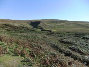 |
| Image 2 ID | 6481 Click image to enlarge |
| Image 2 Description | At first sight the site is a mass of quarried stone. | 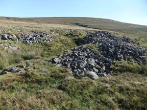 |
| Image 3 ID | 6482 Click image to enlarge |
| Image 3 Description | The existence of structures is indicated by long passage ways leading to sunken circular areas. | 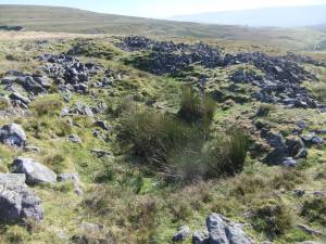 |
| Image 4 ID | 6483 Click image to enlarge |
| Image 4 Description | Curving passage | 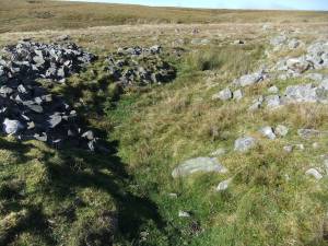 |
| Image 5 ID | 6484 Click image to enlarge |
| Image 5 Description | Possible recessed hut | 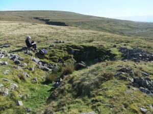 |


