|
| *****SWAAG_ID***** | 917 |
| Date Entered | 24/02/2016 |
| Updated on | 26/02/2016 |
| Recorded by | Tim Laurie |
| Category | Geographical Record |
| Record Type | Geomorphology |
| SWAAG Site Name | |
| Site Type | |
| Site Name | |
| Site Description | |
| Site Access | Public Access Land |
| Record Date | 19/02/2016 |
| Location | Gunnerside Gill, High Scar |
| Civil Parish | Melbecks |
| Brit. National Grid | |
| Altitude | 530m |
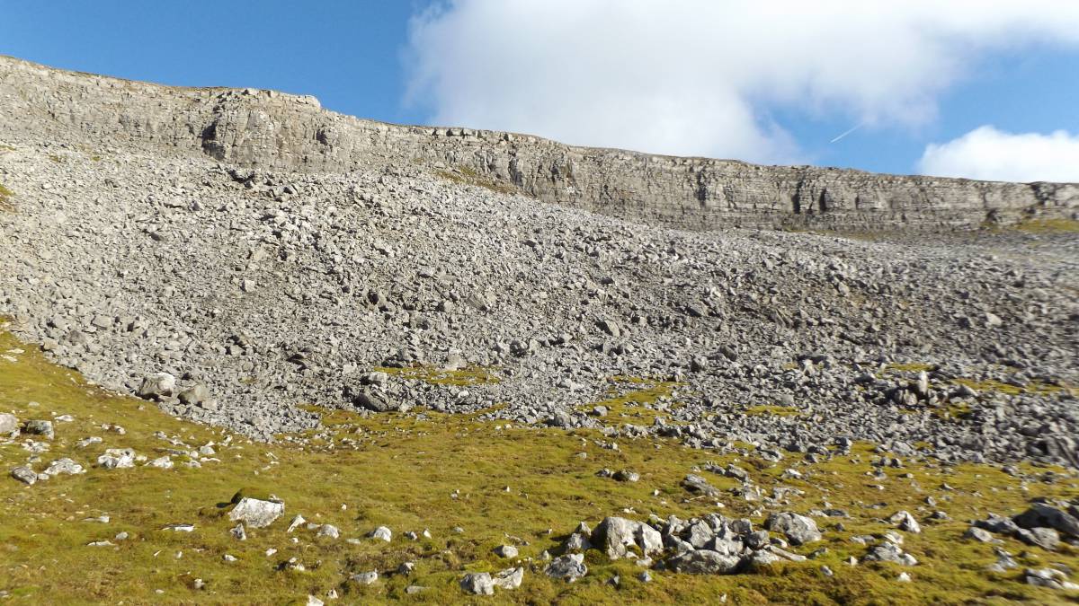
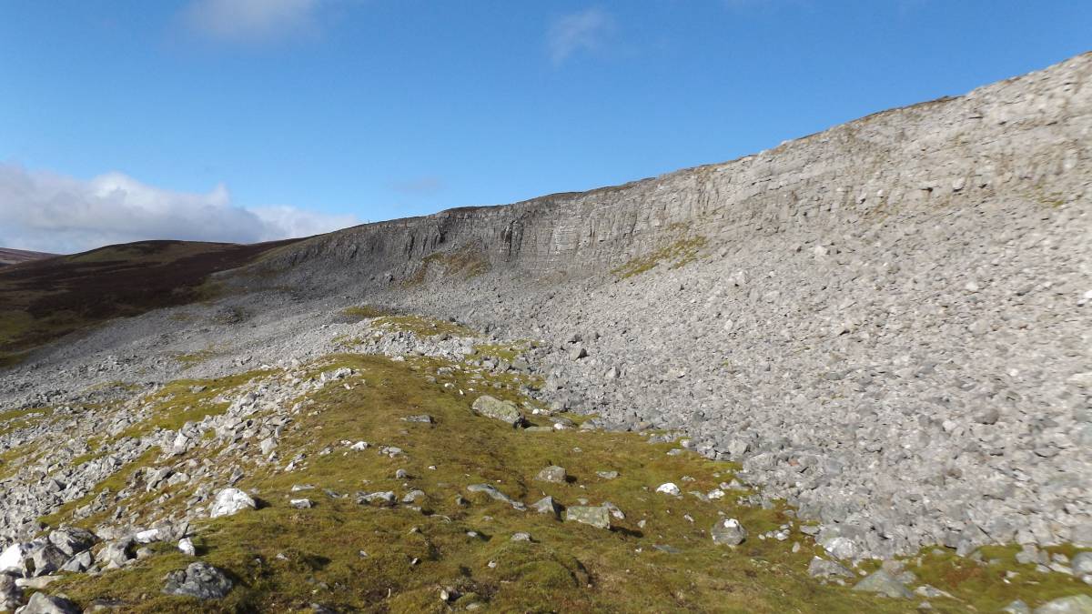
| Geology | Vertical cliff formed from the Main Limestone. Lidar images show that High Scar was the source of a vast landslip which extended all the way down slope to Gunnerside Beck. High Scar was once masked by unstable glacial debris and only revealed following this vast land slip caused by unstable glacial deposits slumping during late glacial conditions of high meltwater.
Subsequent freeze-thaw of the face of the thin- bedded limestone Scar has formed the extensive screes below the cliff. |
| Record Name | Gunnerside Gill. High Scar. One of the finest limestone Scars in the Yorkshire Dales. |
| Record Description | Unlike many other exposed limestone cliffs in Swaledale, for example Whitcliffe Scar, Oxnop Scar, Fell End Scar and Cotterby Scars- no trees grow on the face of this high limestone cliff. The reason may be elevation, aridity and full exposure to the west winds. However trees are able to withstand wind if securely rooted. Unlike the above listed Scars which are massively bedded, the limestone strata of the High Scar above Gunnerside Gill is thin bedded, fractured and cannot support the load of mature trees. |
| Dimensions | See photographs |
| Geographical area | |
| Species | |
| Scientific Name | |
| Common / Notable Species | |
| Tree and / or Stem Girth | |
| Tree: Position / Form / Status | |
| Tree Site ID | 0 |
| Associated Site SWAAG ID | 0 |
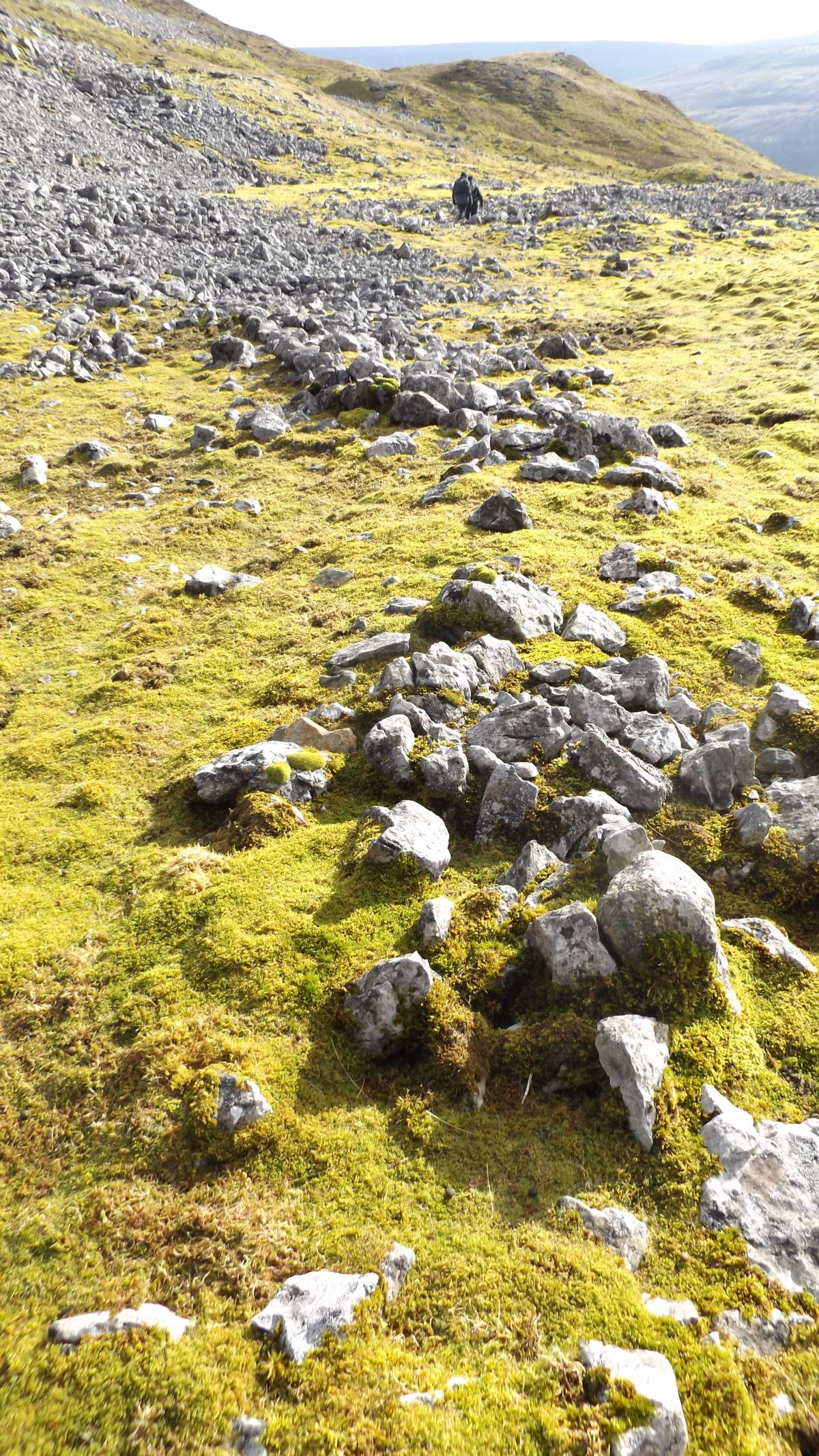
| Additional Notes | Just one small stone banked enclosure with probable hut circles was noted on the bottom edge of the scree slope (See separate Database Record to follow). Fieldhouse and Jennings (1978) in 'A History of Richmond and Swaledale'. (Phillimore, 1978), noted the absence of prehistoric hut circle settlement below High Scar and on the basis that similar locations, albeit not so high, below Scars in Wharfedale or Wensleydale would show hut circle settlement, concluded that early settlement in Swaledale generally was sparse.. |
| Image 1 ID | 6680 Click image to enlarge |
| Image 1 Description | The approach to High Scar | 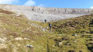 |
| Image 2 ID | 6681 Click image to enlarge |
| Image 2 Description | The High Scar and extensive scree below. |  |
| Image 3 ID | 6682 Click image to enlarge |
| Image 3 Description | Stone banked enclosure at front of scree. |  |
| Image 4 ID | 6683 Click image to enlarge |
| Image 4 Description | Detail of the scree and a small stone banked enclosure. | 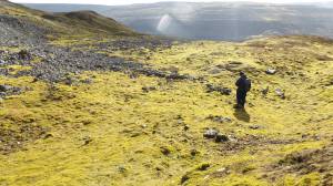 |
| Image 5 ID | 6684 Click image to enlarge |
| Image 5 Description | Detail of the scree and a small stone banked enclosure. |  |
| Image 6 ID | 6685 Click image to enlarge |
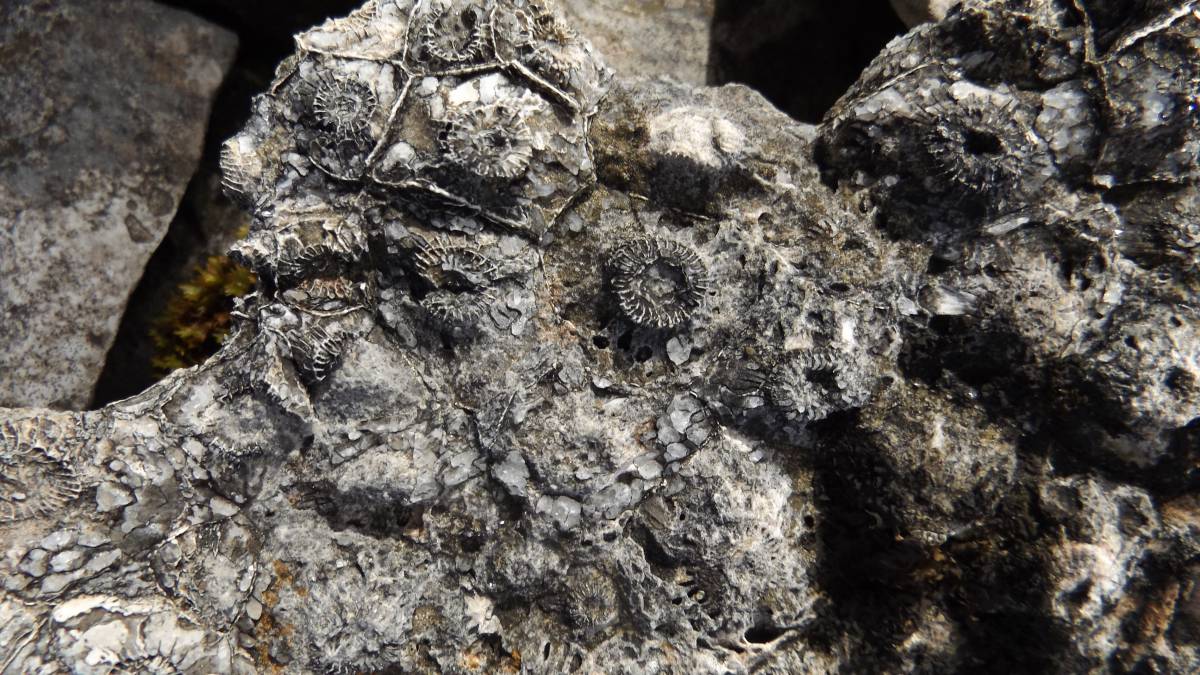
| Image 6 Description | Example of the colonial coral fossils in the scree below the Scar | 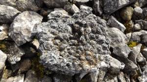 |
| Image 7 ID | 6686 Click image to enlarge |
| Image 7 Description | Example of the colonial coral fossils in the scree below the Scar | 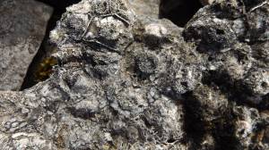 |
| Image 8 ID | 6687 Click image to enlarge |
| Image 8 Description | Example of the colonial coral fossils in the scree below the Scar | 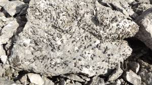 |
| Image 9 ID | 6688 Click image to enlarge |
| Image 9 Description | View of the Scar, kame and pro-talus rampart from the eastern end. | 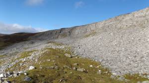 |
| Image 10 ID | 6689 Click image to enlarge |
| Image 10 Description | The approach to the Kining Mine from High Scar | 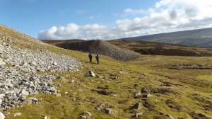 |