|
| *****SWAAG_ID***** | 916 |
| Date Entered | 24/02/2016 |
| Updated on | 24/02/2016 |
| Recorded by | Tim Laurie |
| Category | Geological Record |
| Record Type | Geological HER |
| SWAAG Site Name | |
| Site Type | |
| Site Name | |
| Site Description | |
| Site Access | Public Footpath |
| Record Date | 19/02/2016 |
| Location | Gunnerside Gill |
| Civil Parish | Melbecks |
| Brit. National Grid | |
| Altitude | |
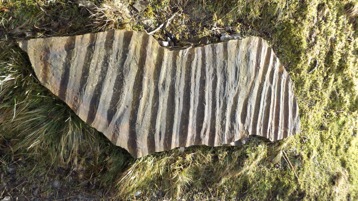
| Geology | Erratic slab of ripple marked sandstone. |
| Record Name | Ripple marked sandstone slab close to footpath into Gunnerside Gill |
| Record Description | This fine ripple marked slab of sandstone shows the shallow water river estuarine origin of the sandstone strata. |
| Dimensions | See photograph |
| Geographical area | |
| Species | |
| Scientific Name | |
| Common / Notable Species | |
| Tree and / or Stem Girth | |
| Tree: Position / Form / Status | |
| Tree Site ID | 0 |
| Associated Site SWAAG ID | 0 |
| Additional Notes | |
| Image 1 ID | 6679 Click image to enlarge |
| Image 1 Description | This fine ripple marked slab of sandstone shows the shallow water river estuarine origin of the sandstone strata. |  |