|
| *****SWAAG_ID***** | 898 |
| Date Entered | 09/10/2015 |
| Updated on | 09/10/2015 |
| Recorded by | Tim Laurie |
| Category | Geological Record |
| Record Type | Geological HER |
| SWAAG Site Name | |
| Site Type | |
| Site Name | |
| Site Description | |
| Site Access | Public Access Land |
| Record Date | 08/10/2015 |
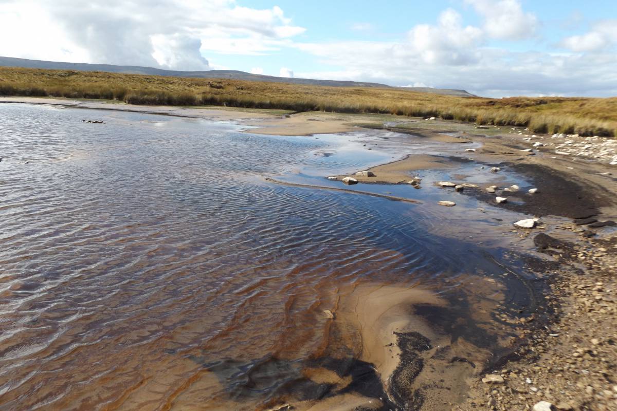
| Location | Birkdale Tarn |
| Civil Parish | Muker |
| Brit. National Grid | NY 852 018 |
| Altitude | 488m |
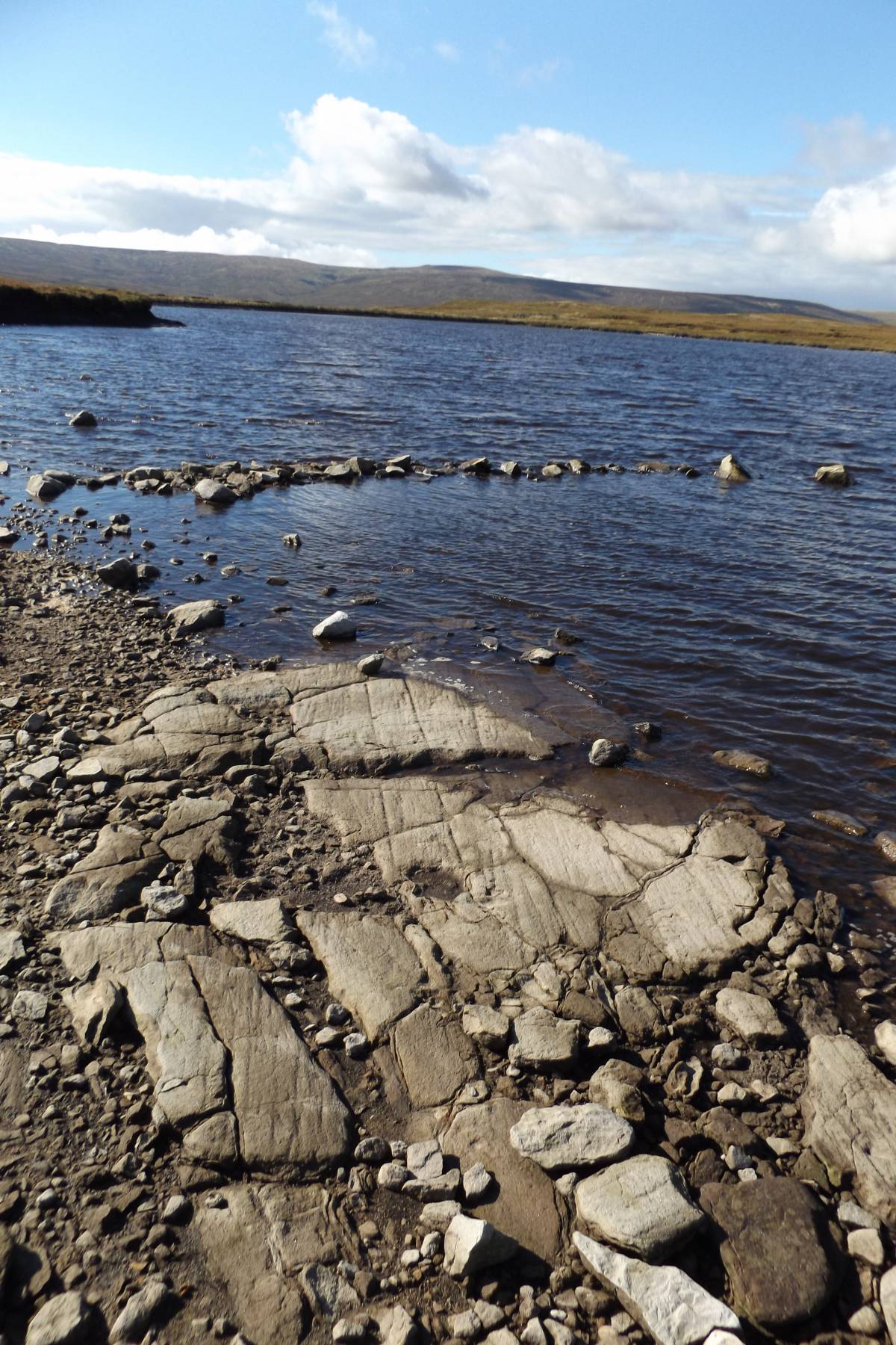
| Geology | Namurian sandstone bedrock with glacial striae and massed tube fossil fragments exposed at low water on the southern side of the 'Tarn'. |
| Record Name | A perambulation of Birkdale Tarn at low water, a mining reservoir with landscape interest. |
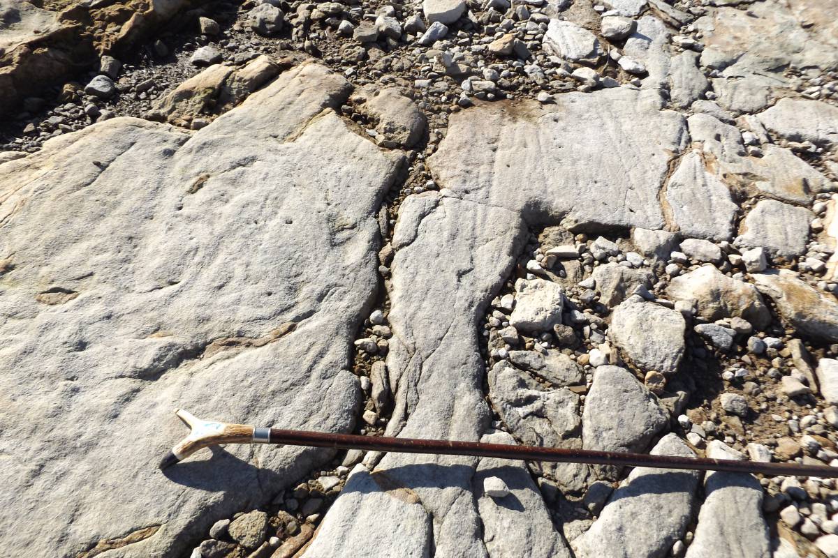
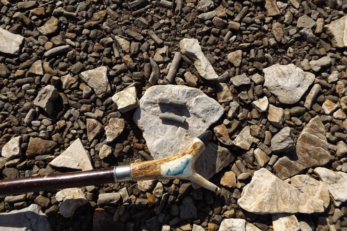
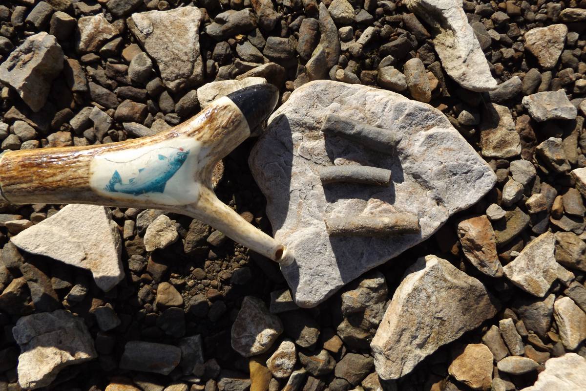
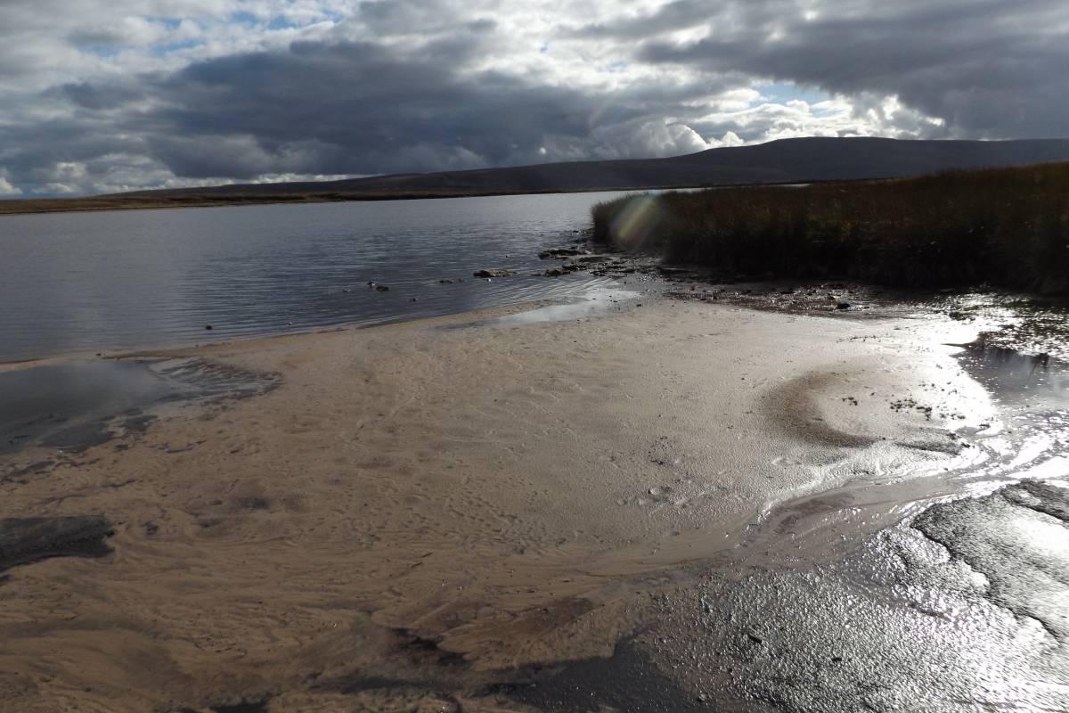
| Record Description | Birkdale 'Tarn' is in fact a small reservoir originally dammed to provide water and probably also to provide hydraulic power to the pumps at the deep mines at the lower end of Great Sleddale above Stone Houses. At low water, the surface of the glacially smoothed and striated bedrock is exposed on the eastern shore of the Tarn. Of some further palaeontological interest are the massed fossil tube fragments which cover a short length of the beach of the Tarn. Since these loose tube fragments are only concentrated on the shore within a length of 25m, the strata from which they originate must have a limited exposure. These solid tubular fragments, which are smooth surfaced and average 15mm diameter, approximately, and not more than 75mm in length, are of silica and clearly harder than the shale or sandstone within which they were deposited. The strata from which they had eroded must now exist below water level, as the rock with these tubes in situ is nowhere visible.
The shrunken waters of the Tarn are retained by a very substantial dam , see photographs. When in use the waters could have been considerably deeper, as the present level of the Water is well below the level of the base of the Tarn.
|
| Dimensions | See photographs |
| Geographical area | |
| Species | |
| Scientific Name | |
| Common / Notable Species | |
| Tree and / or Stem Girth | |
| Tree: Position / Form / Status | |
| Tree Site ID | 0 |
| Associated Site SWAAG ID | 0 |
| Additional Notes | The waters of the Tarn are, today, shallow, windswept and very acid, without any sign of aquatic plants or of the gulls which once nested here. The only birds visible on our visit were a pair of Goosanders. |
| Image 1 ID | 6486 Click image to enlarge |
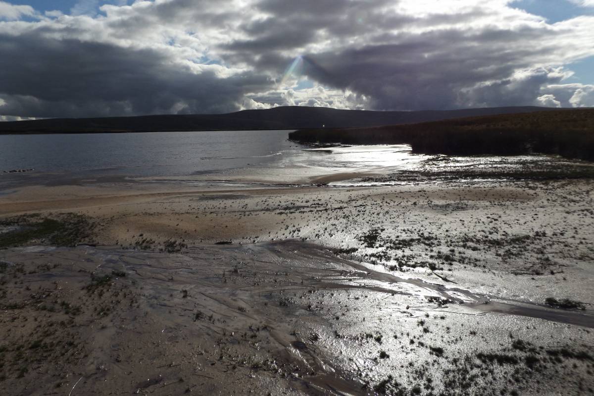
| Image 1 Description | Birkdale tarn at low water | 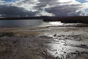 |
| Image 2 ID | 6487 Click image to enlarge |
| Image 2 Description | Birkdale tarn, first sight from the east | 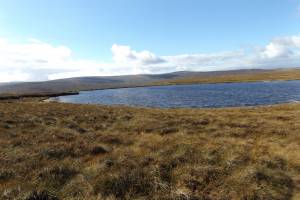 |
| Image 3 ID | 6488 Click image to enlarge |
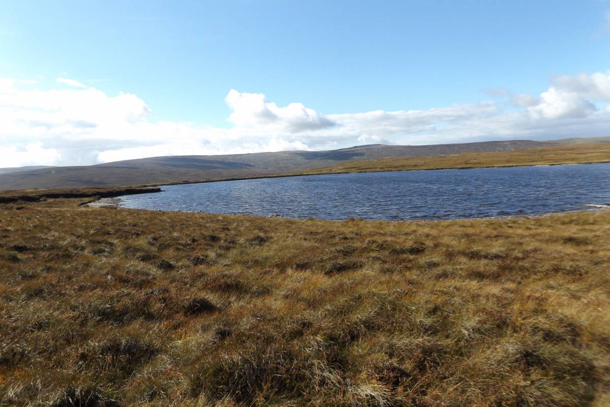
| Image 3 Description | Birkdale tarn, the eastern shore. Mallerstang Edge with High Seat in distance. | 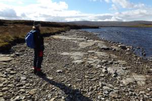 |
| Image 4 ID | 6489 Click image to enlarge |
| Image 4 Description | Glacial striae on exposed bedrock previously under peat, East Shore | 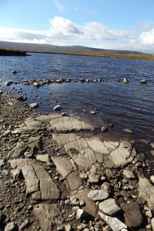 |
| Image 5 ID | 6490 Click image to enlarge |
| Image 5 Description | Glacial striae | 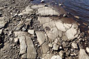 |
| Image 6 ID | 6491 Click image to enlarge |
| Image 6 Description | | 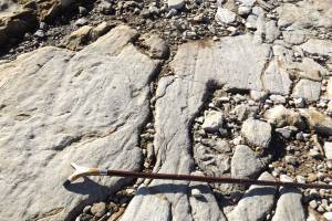 |
| Image 7 ID | 6492 Click image to enlarge |
| Image 7 Description | Fossil tube fragments like these cover a short 25m length of the eastern shore | 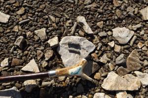 |
| Image 8 ID | 6493 Click image to enlarge |
| Image 8 Description | Detail of the fragments | 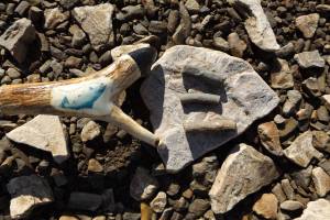 |
| Image 9 ID | 6494 Click image to enlarge |
| Image 9 Description | Eileen at the eastern Shore. Fossil fragments cover the darker areas of the beach. | 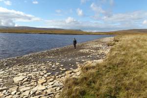 |
| Image 10 ID | 6495 Click image to enlarge |
| Image 10 Description | Two very small streams feed into the northern end of the Tarn. The silver sand was previously used to sharpen scythes. | 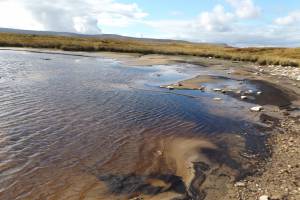 |
| Image 11 ID | 6496 |
| Image 11 Description | Birkdale tarn, the peat embanked western shore. | 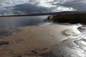 |
| Image 12 ID | 6497 |
| Image 12 Description | Birkdale tarn. The substantial and stone slab surfaced dam. | 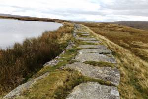 |