|
| *****SWAAG_ID***** | 900 |
| Date Entered | 04/11/2015 |
| Updated on | 06/11/2015 |
| Recorded by | Tim Laurie |
| Category | Photographic Record |
| Record Type | Archaeology |
| SWAAG Site Name | |
| Site Type | |
| Site Name | |
| Site Description | |
| Site Access | Army Range |
| Record Date | 26/10/2015 |
| Location | Feldom Ranges, Gayles Moor |
| Civil Parish | Gayles |
| Brit. National Grid | NZ 110 060 |
| Altitude | 310m |
| Geology | Hummocky drift over sandstones with worked coal seam |
| Record Name | The rock art sites of Gayles Moor revisited |
| Record Description | This record will provide a partial photographic record of a few cup marked and cup and ring marked rocks as they appear today together with photographs of the same rocks taken 30-40 years ago, together with several other features which can be regarded as elements within the same prehistoric landscape. The reduced sheep population and reduction of grazing on moorland across the Pennines generally has allowed the moorland vegetation to recover and become rank, ie to remain un-grazed from year to year. Archaeological features are obscured and much more difficult to recognise than when first recorded, some 40 years ago. furthermore the rock art may be less sharp than when first recorded due possibly to acid rain.
Comparison of these recent images with photo illustrations of the same rocks within Beckensall and Laurie, 1998. 'The Prehistoric Rock Art of Co Durham, Swaledale and Wensleydale.' together with those shown here which were taken some 30- 40 years ago (see also previous SWAAG Record No ) will be useful in assessing any changes taking place. |
| Dimensions | See photos |
| Geographical area | |
| Species | |
| Scientific Name | |
| Common / Notable Species | |
| Tree and / or Stem Girth | |
| Tree: Position / Form / Status | |
| Tree Site ID | 0 |
| Associated Site SWAAG ID | 0 |
| Additional Notes | Rock reference Nos on photo images are to Beckensall and Laurie 1998. |
| Image 1 ID | 6513 Click image to enlarge |
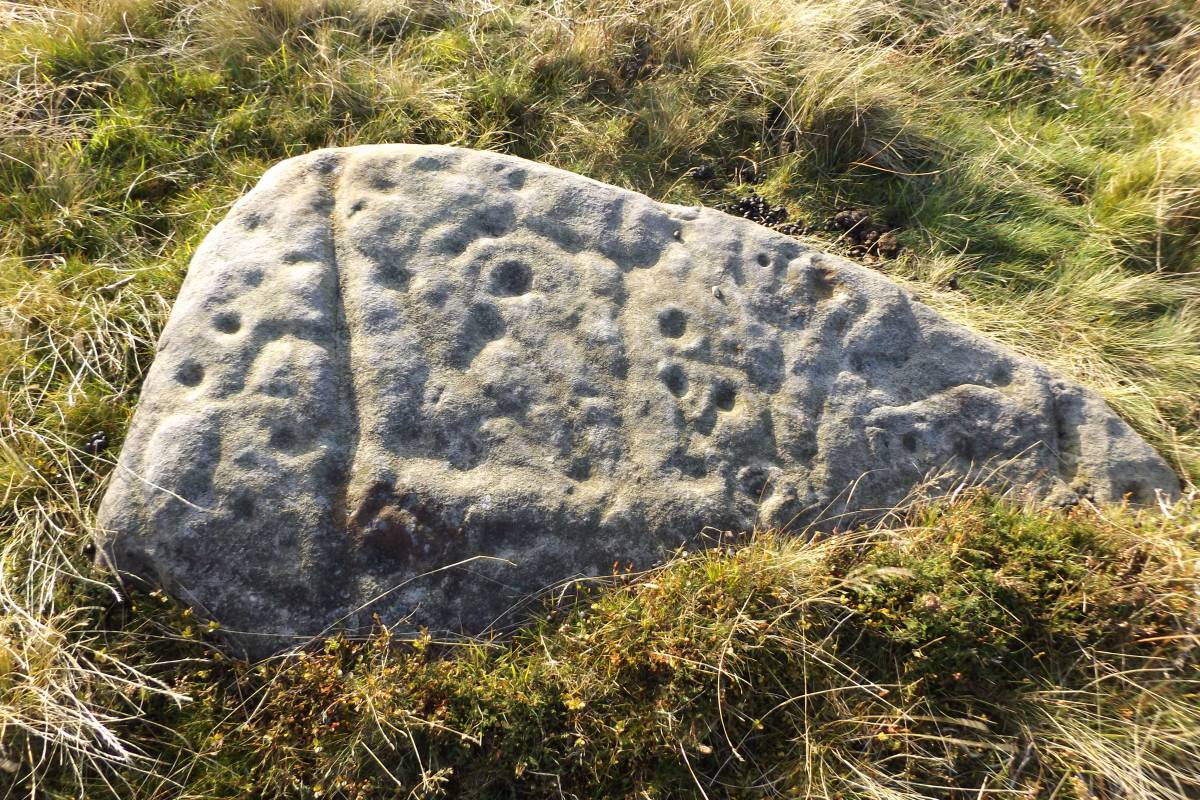
| Image 1 Description | The fine cup and ring marked rock below Hill 99, C11, in Craddocks Plantation as it is today. | 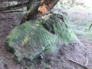 |
| Image 2 ID | 6512 Click image to enlarge |
| Image 2 Description | The same rock photographed some 40 years ago. | 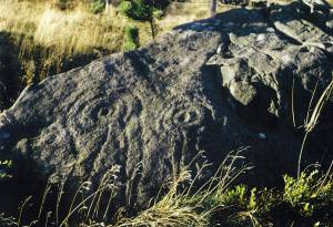 |
| Image 3 ID | 6521 Click image to enlarge |
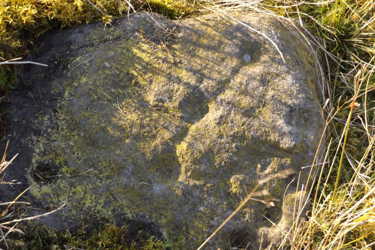
| Image 3 Description | Cup and ring marked rock (D3) as it is today. | 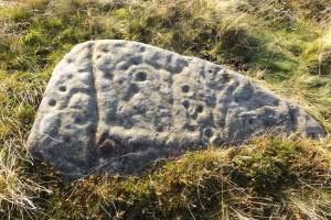 |
| Image 4 ID | 6517 Click image to enlarge |
| Image 4 Description | The same rock photographed some 40 years ago. | 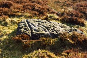 |
| Image 5 ID | 6524 Click image to enlarge |
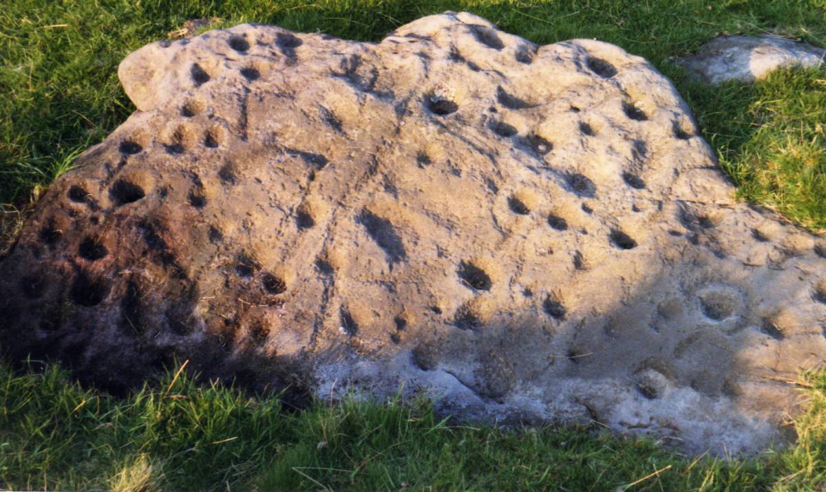
| Image 5 Description | Heavily cup marked slab (D4) as it is seen today. | 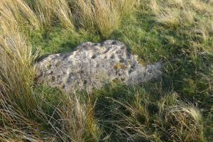 |
| Image 6 ID | 6518 Click image to enlarge |
| Image 6 Description | The same rock photographed some 40 years ago. |  |
| Image 7 ID | 6519 Click image to enlarge |
| Image 7 Description | Detail of this rock show individual pock marks | 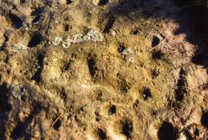 |
| Image 8 ID | 6516 Click image to enlarge |
| Image 8 Description | Small earthfast rock with cup and ring markings (D7) photographed some 30-40 years ago. This rock is now covered with vegetation and could not be located recently. | 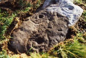 |
| Image 9 ID | 6525 Click image to enlarge |
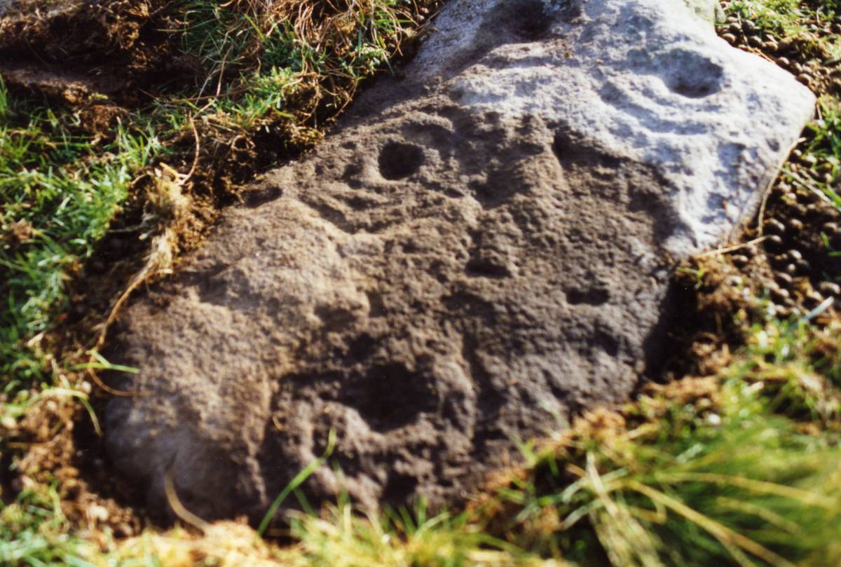
| Image 9 Description | Very small cup and cup and ring marked rock with linking grooves (D13) photographed recently | 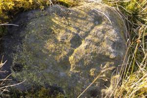 |
| Image 10 ID | 6526 Click image to enlarge |
| Image 10 Description | The same rock. D13, as illustration in Beckensall and Laurie 1998. | 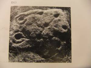 |