|
| *****SWAAG_ID***** | 908 |
| Date Entered | 27/11/2015 |
| Updated on | 28/11/2015 |
| Recorded by | Tim Laurie |
| Category | Burial Mounds and Cairns |
| Record Type | Archaeology |
| SWAAG Site Name | |
| Site Type | |
| Site Name | |
| Site Description | |
| Site Access | Public Access Land |
| Record Date | 11/11/2015 |
| Location | Low Row Pasture, Barf Side |
| Civil Parish | Melbecks |
| Brit. National Grid | SD 96744 98105 |
| Altitude | 367m |
| Geology | Calcareous grassland over the Middle Limestone. |
| Record Name | The Barf Side Round Cairn |
| Record Description | Remnant of a once substantial, 13m diameter round cairn located on a low limestone knoll in pasture above Barf Side Scar and just some 10m south of the track from Blades to Winterings.
The remnant of this once substantial and prominent round cairn was first identified during 1998 when it was noticed that a continuous deposit of fell sandstone rubble circular on plan and 13m diameter had obscured the surface of the limestone bed rock. It was then realised that this deposit of stone cairn material was the basal structure of a substantial round cairn.
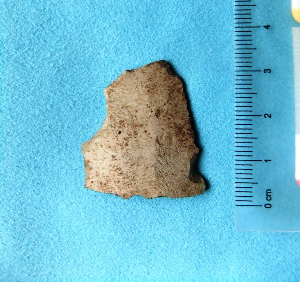
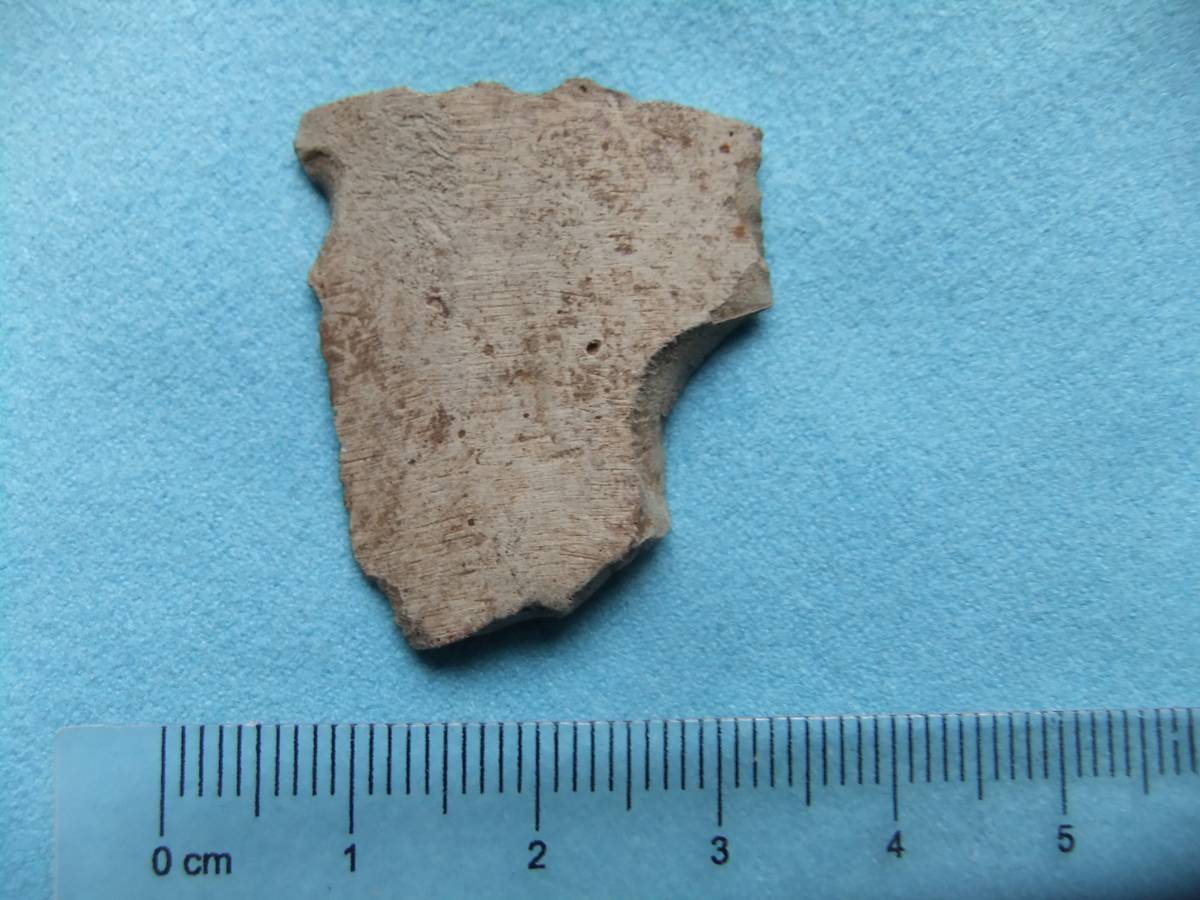
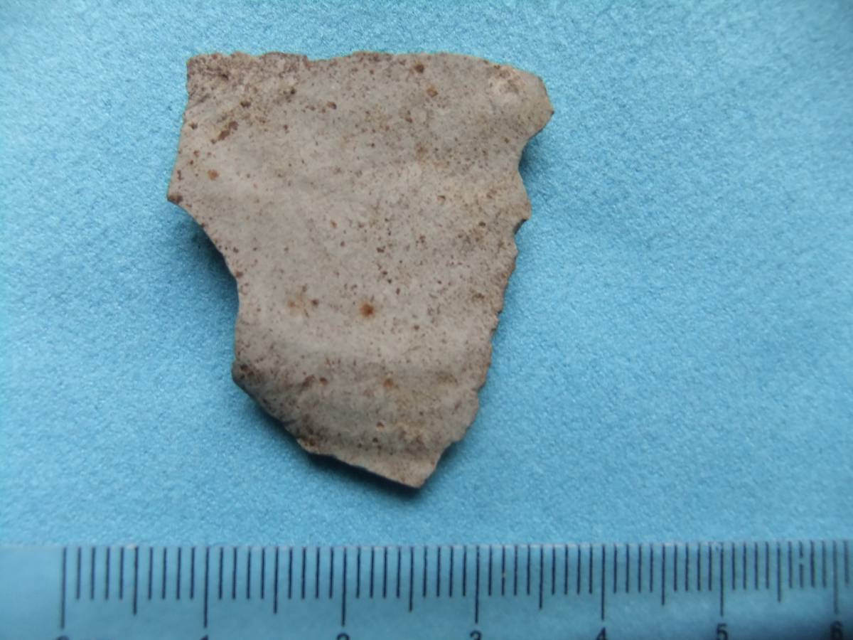
A small struck flake from a Group 6 Langdale Volcanic Tuff Polished Stone Axe was discovered at a rabbit scrape from within the body of this round cairn, see Photo Image Nos 2 -4. A number of other lithic finds, arrow points and scraper forms characteristic of Neolithic/Early Bronze Age activity have been made elsewhere on the limestone pasture in the vicinity of this cairn.
This cairn is located within a coaxial field boundary system which crosses the limestone pasture .
The archaeological landscape of Low Row Pasture is currently under survey.
|
| Dimensions | The remnant of the round cairn measures 13.4m * 12.3m diameter |
| Geographical area | |
| Species | |
| Scientific Name | |
| Common / Notable Species | |
| Tree and / or Stem Girth | |
| Tree: Position / Form / Status | |
| Tree Site ID | 0 |
| Associated Site SWAAG ID | 0 |
| Additional Notes | This substantial round cairn is located at a vantage point where the view eastward down through Swaledale is spectacular. The Barf Side Round Cairn is intervisible with the similar round cairns located on Cringley Pasture and on Fremington Edge. |
| Image 1 ID | 6580 Click image to enlarge |
| Image 1 Description | The outline of the Barf Side Round Cairn is defined by a members of a Pre-Swaag Walking Group, Friends of the Swaledale Museum. | 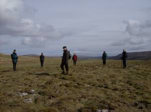 |
| Image 2 ID | 6583 Click image to enlarge |
| Image 2 Description | Struck flake from a Group 6 Langdale Volcanic Tuff polished axe found on a rabbit scrape at the centre of this cairn | 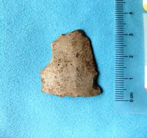 |
| Image 3 ID | 6584 Click image to enlarge |
| Image 3 Description | The same, detail | 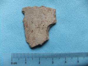 |
| Image 4 ID | 6585 Click image to enlarge |
| Image 4 Description | The same, detail |  |
| Image 5 ID | 6581 Click image to enlarge |
| Image 5 Description | The coaxial field system which crosses the limestone pasture. | 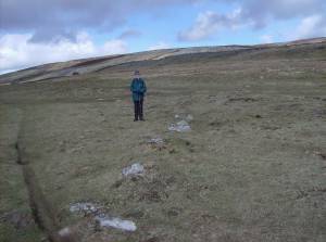 |
| Image 6 ID | 6582 Click image to enlarge |
| Image 6 Description | The coaxial field system under survey by SWAAG, November 2015 | 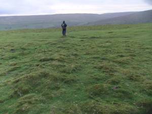 |