|
| *****SWAAG_ID***** | 919 |
| Date Entered | 05/03/2016 |
| Updated on | 05/03/2016 |
| Recorded by | Tim Laurie |
| Category | Earthworks |
| Record Type | Archaeology |
| SWAAG Site Name | |
| Site Type | |
| Site Name | |
| Site Description | |
| Site Access | Public Access Land |
| Record Date | 03/03/2016 |
| Location | Brownsey Moor |
| Civil Parish | Melbecks |
| Brit. National Grid | SD 9770 9895 |
| Altitude | 450m |
| Geology | Main and Richmond Cherts over the Main Limestone |
| Record Name | A small high level cairnfield settlement on Brownsey Moor |
| Record Description | Slight stone field banks, clearance cairns and stone free areas defined by clearance edges on a high terrace mark the site of a high level settlement of Bronze Age Cairnfield character. No timber round house structures have been recognised, however their probable presence can be inferred on an adjacent level terrace.
These very slight but definite traces of human activity at an elevation of 450m AOD are surely among the highest and most exposed remains of cultivation and transient settlement by a small family group during prehistory.
It should be borne in mind that the climatic and woodland environment at all levels of Swaledale was very different during the Second Millenium BC. The climate during the Atlantic Period was warm and dry. Mixed deciduous woodland extended across all areas of what today is open heather moorland.
Very extensive cultivation remains similar to these are present at equivalent elevation on Fremington Edge and at slightly lower elevations on Grinton Moor, Harkerside and on Reeth Low Moor. (Laurie T.C. with N.W. Mahaffy and R.F. White, 2012 in R.D. Martlew, Ed. 'Prehistory in the Yorkshire Dales: recent research and future prospects. pp37-59'. ISBN 978-1-906604-35-6) |
| Dimensions | See photos |
| Geographical area | |
| Species | |
| Scientific Name | |
| Common / Notable Species | |
| Tree and / or Stem Girth | |
| Tree: Position / Form / Status | |
| Tree Site ID | 0 |
| Associated Site SWAAG ID | 0 |
| Additional Notes | These slight remains characteristic of Bronze Age cultivation were first noted during a current programme of archaeological reconnaissance across areas of Swaledale not previously surveyed during the Swaledale Land Boundaries Project (Fleming A.F.and Laurie T.C. 1985-1994.) |
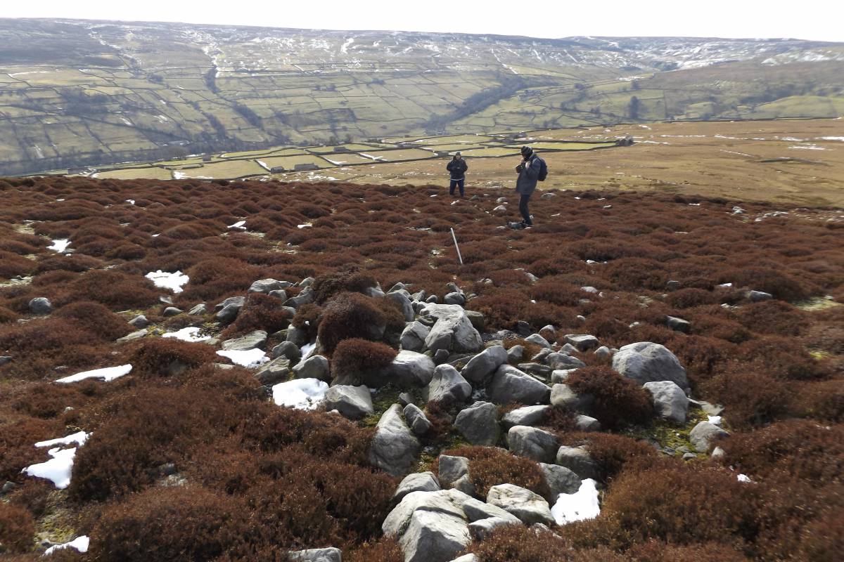
| Image 1 ID | 6703 Click image to enlarge |
| Image 1 Description | Stone cairn, may contain a burial, but possibly just field clearance. Stone free areas between the cairns and field banks were cultivated following initial clearance of woodland. |  |
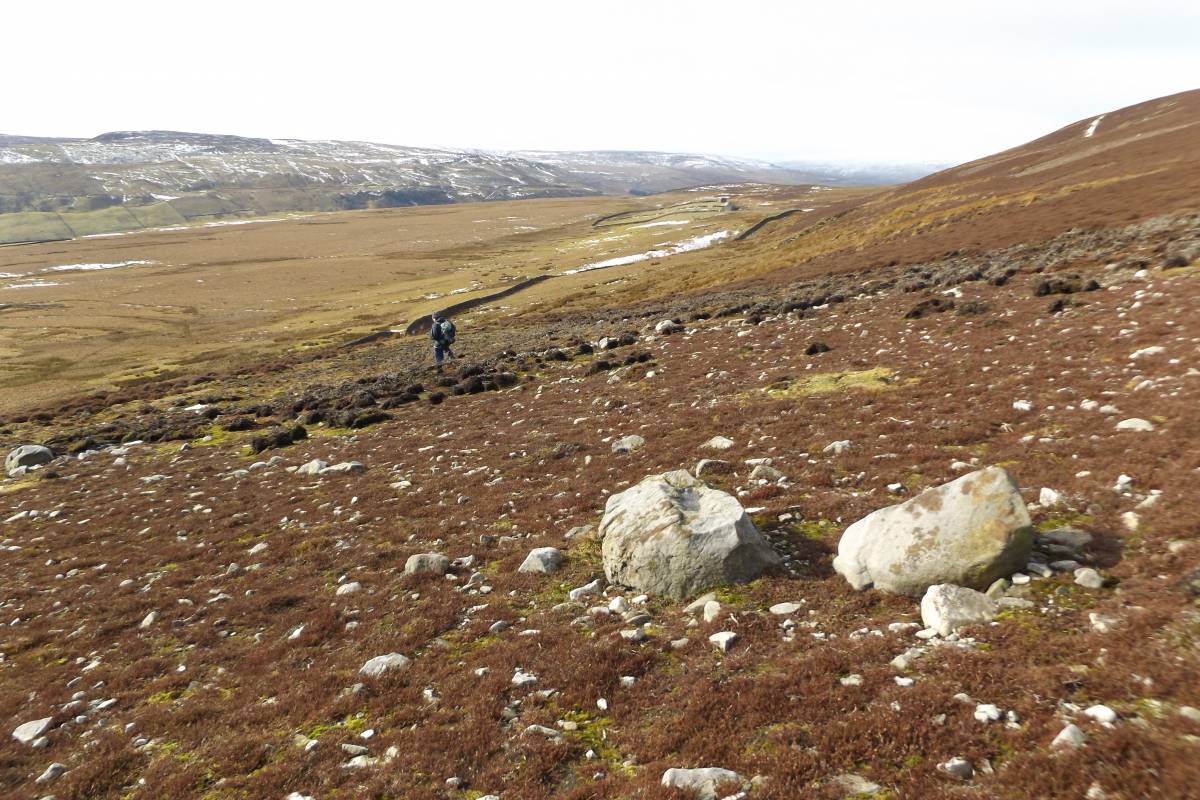
| Image 2 ID | 6705 Click image to enlarge |
| Image 2 Description | Stone dump field bank. | 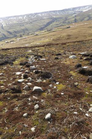 |
| Image 3 ID | 6704 Click image to enlarge |
| Image 3 Description | The slight curve visible on this ver slight field bank may mark the location of a timber round house. | 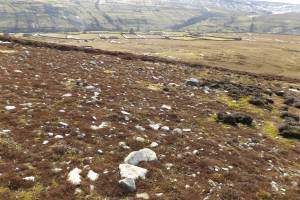 |
| Image 4 ID | 6706 Click image to enlarge |
| Image 4 Description | The two large boulders mark a small circular cairn like feature. |  |
| Image 5 ID | 6707 Click image to enlarge |
| Image 5 Description | View westward from the cairnfield across the fields of Brownsey House | 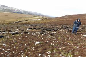 |