|
| *****SWAAG_ID***** | 735 |
| Date Entered | 30/06/2013 |
| Updated on | 06/07/2013 |
| Recorded by | Alan and Judith Mills |
| Category | Mining Related |
| Record Type | Mining |
| SWAAG Site Name | |
| Site Type | |
| Site Name | |
| Site Description | |
| Site Access | Public |
| Record Date | 04/06/2013 |
| Location | Arkengarthdale - Wetshaw |
| Civil Parish | Arkengarthdale |
| Brit. National Grid | NY 979 027 |
| Altitude | |
| Geology | |
| Record Name | Possible inclined planes in the Wetshaw area of Arkengarthdale - maps & notes on other interesting features |
| Record Description | This record contains the maps and aerial photograph of the Wetshaw area used in the investigation into the potential inclined planes covered in record 733 as well as photos of other interesting features noted on the visits there.
All photos copyright Alan Mills. |
| Dimensions | |
| Geographical area | |
| Species | |
| Scientific Name | |
| Common / Notable Species | |
| Tree and / or Stem Girth | |
| Tree: Position / Form / Status | |
| Tree Site ID | 0 |
| Associated Site SWAAG ID | 0 |
| Additional Notes | |
| Image 1 ID | 4527 Click image to enlarge |
| Image 1 Description | Map annotated by Mike Gill showing the line of the three potential trackways, labelled A, B and C - copyright Mike Gill. | 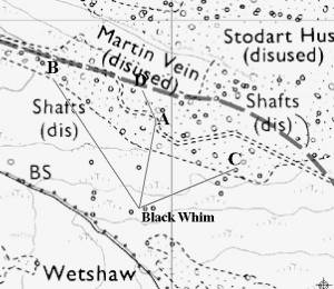 |
| Image 2 ID | 4533 Click image to enlarge |
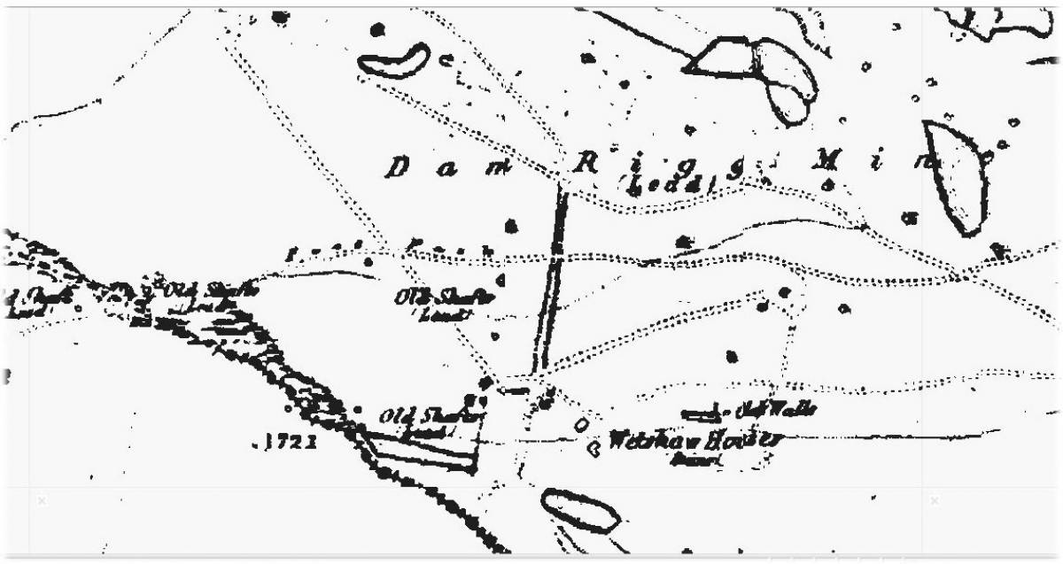
| Image 2 Description | A section from the 1st ed OS of the area showing the three potential trackways. B and C above are shown as tracks; A appears to be a cutting. | 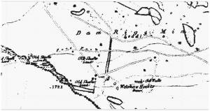 |
| Image 3 ID | 4528 Click image to enlarge |
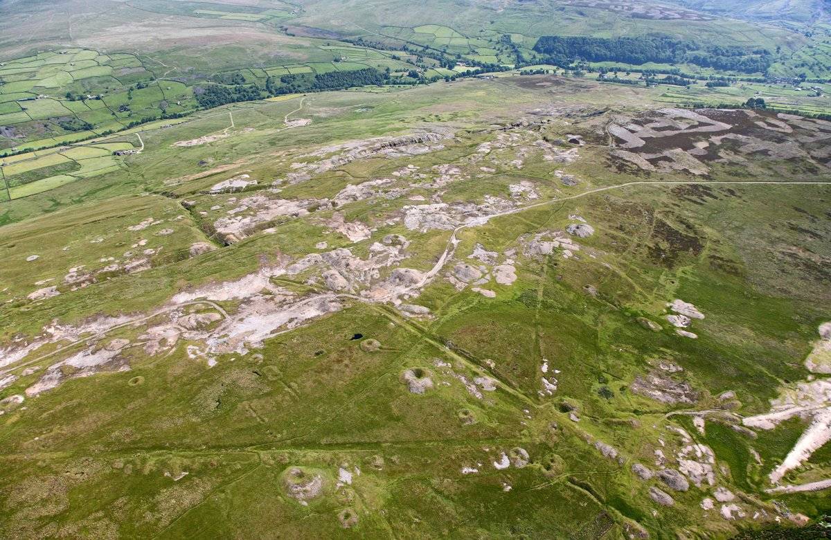
| Image 3 Description | Aerial photograph of the area - copyright Mike Gill |  |
| Image 4 ID | 4489 Click image to enlarge |
| Image 4 Description | Photo 1. Possible bale at NY 98700 02150 | 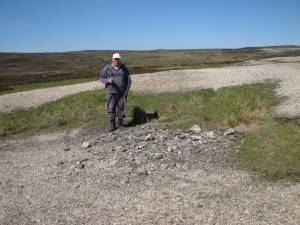 |
| Image 5 ID | 4490 Click image to enlarge |
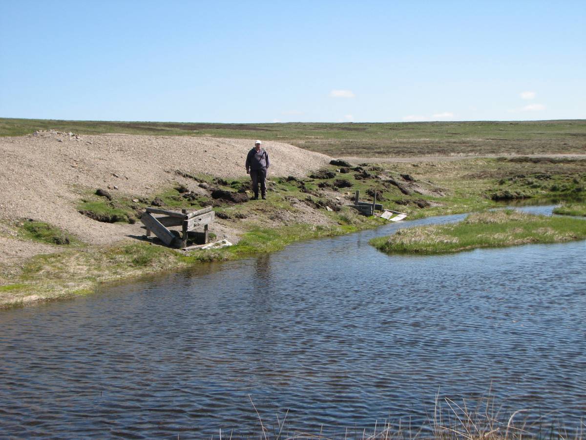
| Image 5 Description | Photo 2. Possible hotching tubs at NY 98173 02365. Could be from the 20th century works. | 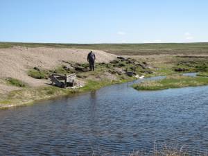 |
| Image 6 ID | 4509 Click image to enlarge |
| Image 6 Description | Photo 17. Remains of a small building at NY 98003 02823, another nearby. Possibly miners' shelters. | 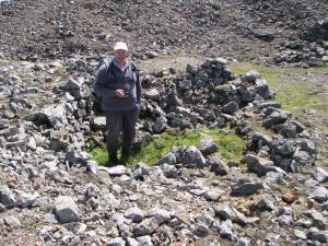 |
| Image 7 ID | 4510 Click image to enlarge |
| Image 7 Description | Photo 18. The other ruined building at NY 98008 02813. | 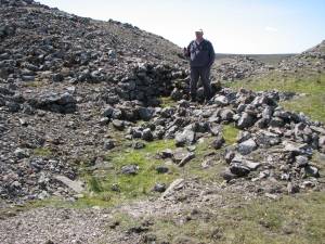 |
| Image 8 ID | 4511 Click image to enlarge |
| Image 8 Description | Photo 21. Bale site at NY 97698 02863 | 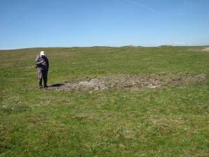 |
| Image 9 ID | 4529 Click image to enlarge |
| Image 9 Description | Photo 20. Rock with lead attached at the bale site, NY 97698 02863 | 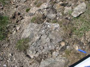 |
| Image 10 ID | 4512 Click image to enlarge |
| Image 10 Description | Photo 22. Stone with lead silicate? attached. At possible bale at NY 97678 02869 | 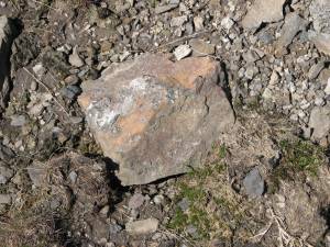 |