|
| *****SWAAG_ID***** | 752 |
| Date Entered | 28/08/2013 |
| Updated on | 28/08/2013 |
| Recorded by | Tim Laurie |
| Category | Burial Mounds and Cairns |
| Record Type | Archaeology |
| SWAAG Site Name | |
| Site Type | |
| Site Name | |
| Site Description | |
| Site Access | |
| Record Date | 30/08/2013 |
| Location | Barningham Moor, High Moor, Frankinshaw How |
| Civil Parish | Newsham |
| Brit. National Grid | NZ 06107 06682 |
| Altitude | 438m |
| Geology | The Main Limestone |
| Record Name | Barningham High Moor. Round cairn at Frankinshaw How. |
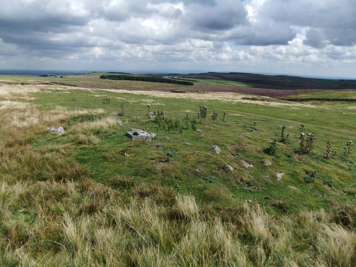
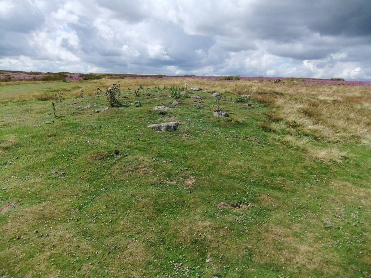
| Record Description | Round cairn, 9m diameter and approximately .8m in height constructed of sandstone boulders which have been taken from the nearby outcrop and or as glacial erratics scattered across the limestone moorland. This round cairn is false crested with wide views across the Vale of Mowbray, see photo. This low round cairn is a Late Neolithic or Early Bronze Age burial mound characteristic of the area. Three of the sandstone boulders within this cairn are cup marked (Reference Beckensall and Laurie, 1998. 'The Prehistoric Rock Art of County Durham, Swaledale and Wensleydale' Durham County Books.Pages 46-67).
This round cairn is very similar in appearance to the low cup and ring marked round cairn located close to the Stone Circle at the head of Osmonds Gill some 1100m to the NW.
These low rock cairns can be expected to contain short stone cists and contracted beaker burials. |
| Dimensions | 9m dia and .8m high. |
| Geographical area | |
| Species | |
| Scientific Name | |
| Common / Notable Species | |
| Tree and / or Stem Girth | |
| Tree: Position / Form / Status | |
| Tree Site ID | 0 |
| Associated Site SWAAG ID | 0 |
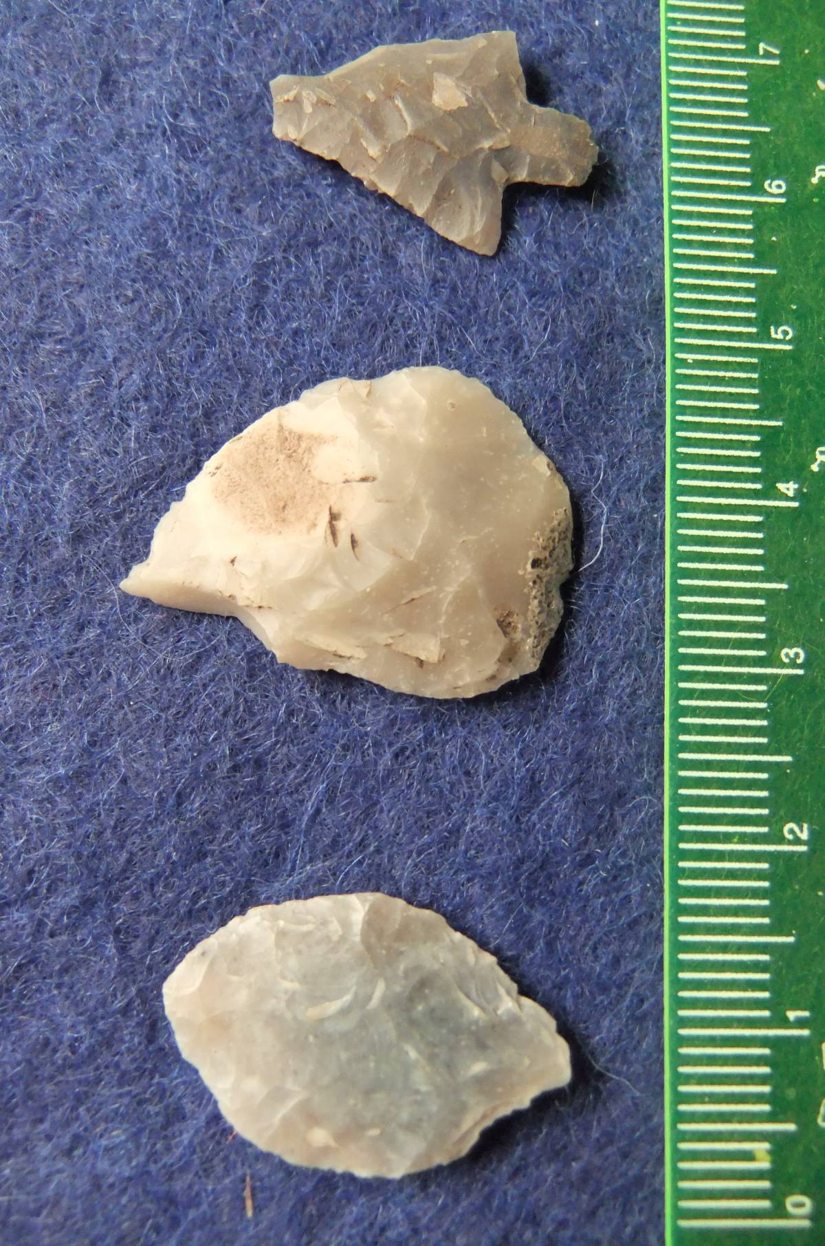
| Additional Notes | The presence of Late Mesolithic Occupation Sites on the Swale-Tees/Greta interfluve and of Late Neolithic Occupation Sites and stray lithic finds of Late Neolithic and Early Bronze Age arrow points and scrapers in the vicinity of this cairn and across the area of both Barningham High Moor and Barningham Low Moor are indicative of activity in this area throughout Prehistory. |
| Image 4 ID | 4679 Click image to enlarge |
| Image 4 Description | | 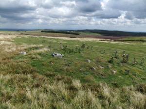 |
| Image 5 ID | 4678 Click image to enlarge |
| Image 5 Description | | 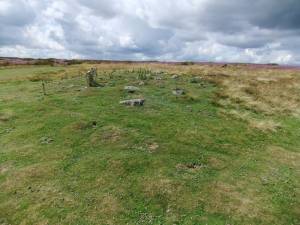 |
| Image 6 ID | 4680 Click image to enlarge |
| Image 6 Description | Stemmed flint arrow point and two small leaf arrow heads from the vicinity of the cairn. The larger of the leaf arrow points shows evidence of an impact fracture. | 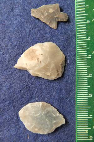 |