|
| *****SWAAG_ID***** | 733 |
| Date Entered | 26/06/2013 |
| Updated on | 06/07/2013 |
| Recorded by | Alan and Judith Mills |
| Category | Mining Related |
| Record Type | Mining |
| SWAAG Site Name | |
| Site Type | |
| Site Name | |
| Site Description | |
| Site Access | Public |
| Record Date | 26/06/2013 |
| Location | Arkengarthdale - Wetshaw |
| Civil Parish | Arkengarthdale |
| Brit. National Grid | NY 979 027 |
| Altitude | |
| Geology | |
| Record Name | Possible inclined planes in the Wetshaw area of Arkengarthdale. |
| Record Description | Report on an investigation into possible inclined planes in the Wetshaw area of Arkengarthdale.
Introduction
This investigation was carried out at the request of Mike Gill of the Northern Mines Research Society.
Mike had noticed some obvious traces of civil engineering associated with the mines in the area. From Google Earth and oblique aerial photographs he identified what look like three inclined tramways converging on the Black Whim area.
It is known that the mining entrepreneur Frederick Hall used inclines at Danby and Dam Rigg Levels to take ore to a central dressing floor. There is a record of a winding engine being sent from Boulton & Watt to Frederick Hall at Arkendale [sic] c1802 but it is not known where this was used. It is possible that it was used for hauling one or more of these inclines.
The purpose of this investigation is to determine if there is any evidence to support the following hypotheses:
1. that one or more of the features identified was a tramway used to carry ore from the mines to a common ore-dressing area
2. If so, is there any evidence to suggest the use of a winding engine; for example traces of masonry, cinders etc, noting that this whole area might have been extensively modified by the 20th century activities of Shevels & Co. while looking for fluorspar/barytes.
Alan & Judith Mills visited the area on 23rd May 2013 and Alan and Stephen Eastmead re-visited on 4th June 2013. This report covers the findings of both visits.
The survey
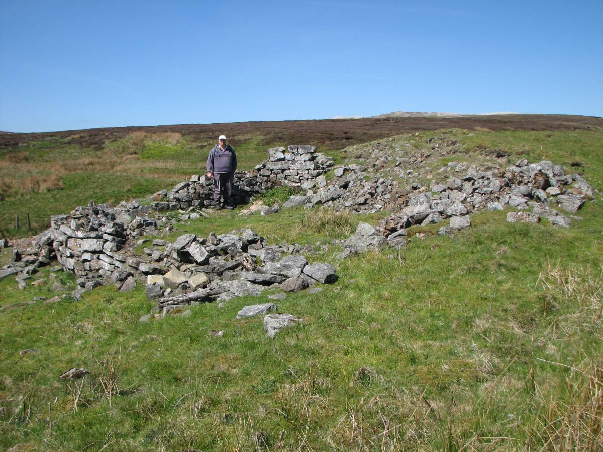
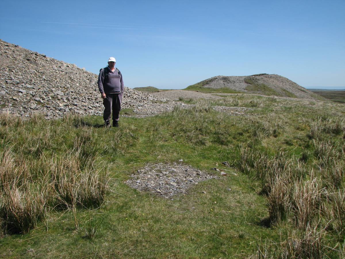
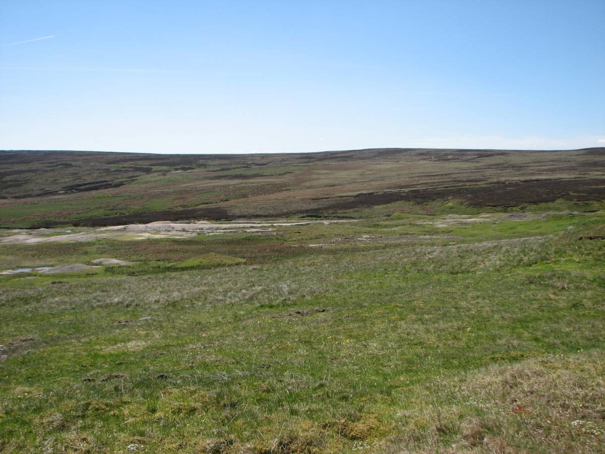
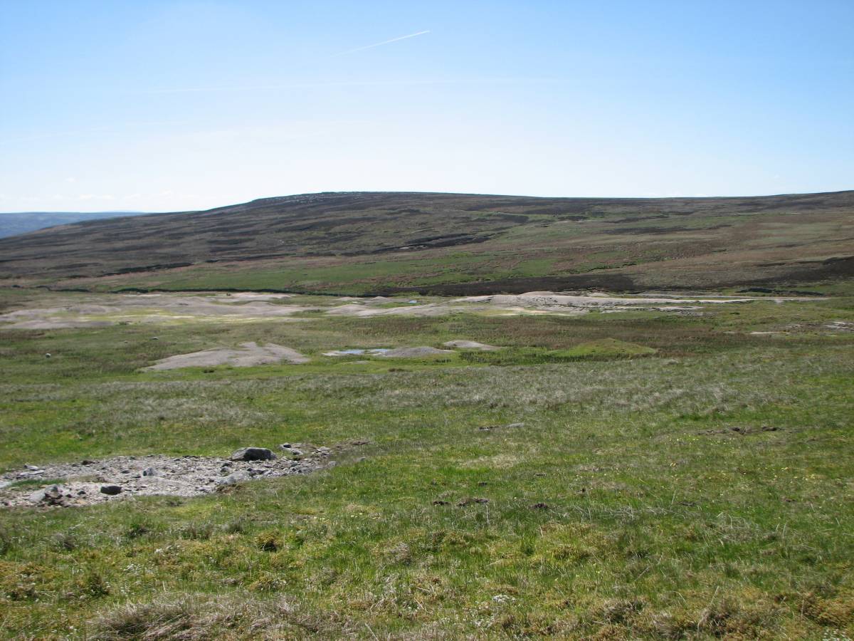
The area was surveyed by walkover, following the line of the inclines, noting, photographing and recording interesting features. The dressing area was looked at first but no detailed investigation was carried out. A ruined building was noted at NY 97957 02438 - photo 3. It is not clear if this was associated with the 19th century mining or the later 20th century workings. The nature of the spoil heaps nearby - photos 4 & 5 - might suggest the latter as the slope of the tops are uphill towards the tipping points, suggesting that some sort of powered vehicle was used.
Lead mining, as evidenced by a number of shafts, took place to the north of the dressing area. The three potential inclined planes seem to converge on a point to the north at NY 97950 02588, we refer to this as point X. For ease of identification of the inclined planes we have adopted the notation used by Mike Gill on Image 1. The central incline running approximately north is referred to as A, that to the west of it as B and that to the east as C.
Photo 6 is from the ruined building referred to above, looking up towards incline A (the noticeable nick on the horizon); photo 7 is from a point just to the north-east of the building also looking up towards A. Together with photos11 and 11b these four photos show the embankment running down from incline A into the dressing floor area and the extent to which it has been slighted by later work, probably in the 20th century.
Moving on towards the potential inclines, photos 9, 10, 11 and 12 all show views from the point X, where the three inclines converge. Photo 11 is looking to the south, looking down to the dressing floor. It shows the embankment running down towards the dressing floor which at first sight looks like a spoil heap from a level but might perhaps be the cut from incline A.
Photo 11 is looking up incline A, showing that it has been cut into the natural and the sides raised. The depth is well illustrated in photo 12a, taken at the point where a leat crosses; the leat is clearly visible on the aerial photograph in record 735
Photo 9 shows a large shaft adjacent to point X to the south-east. This is approximately 25m across and 8m deep. This must be the shaft known as the Black Whim; Dunham & Wilson have it at NY 9795 0257, close to our gps reading of NY97950 02588 for the nearby intersection of the three inclines (point X). In addition, Photo 8 shows what seems to be a spoil heap from a level butting up to the spoil from the Black Whim shaft; as the top of the spoil heap approaches the base of the rime of the shaft it becomes narrower and seem to be walled, although no stone walling is visible. This must be the ‘adit’ to which Dunham and Wilson refer (p137) to as being started about 100ft south of the Black Whim. At point X the direct route for incline A to the dressing floor is blocked by a low bank; this is shown in photo 12, to the right. It can be seen that the route of the incline turns to the east (left), around the top of the Black Whim and becomes much narrower, having the appearance of a leat. This then peters out as it leaves the northern edge of the shaft but possibly carried on into what is undoubtedly a water management system just below and to the east of spoil heap referred to above.
Leaving point X and going up, incline A becomes very wide and uneven as we approach NY 97967 02686 where it is cut by the small leat visible on the aerial photo. The incline peters out at NY 97972 02725 as it approaches an area of shafts - photo 13. It picks up again at NY 97972 02781 - photo 14 - and continues to a large dressing area on the top at NY 97958 02831 - photo 15 is from this point looking back south down the incline, photo 16 is of the dressing area itself. This final section of the incline is narrow and steep in places and heavily slighted by later mining activity. It is far from convincing as a man-made trackway.
Photo 24 shows the top of incline B at NY 97710 02857; this is possibly a loading platform. Photo 25 is looking back up the incline to the top; the upper section of B is quite compelling as an incline, however it soon becomes rough and marshy at NY 97755 02795. Photo 26 is from a little lower down B looking south to the dressing floor and showing the rough broken ground; there appear to be small workings along the way at this point. At NY 97818 02718 a leat forms a U-bend to cross the incline - photo 27. Photo 28 at NY 97919 02584 is looking back up B. At NY 97949 02575 B turns left to avoid small shafts before joining A by the large shaft at NY 97950 02588.
Moving on to incline C, this is very difficult to identify at its foot where it is assumed it meets A and B at point X. Photo 29 shows the incline at NY 98000 02612, looking roughly north-east at the point where it begins to becomes visible although still very indistinct. Further up, the incline is clear and level. At NY 98100 02642 the incline is built-up and revetted - photo 30a. There seems to be a loading platform at NY 98131 02653 adjacent to the nearby mine workings - photo 31. Photos 32-35 show views of the dressing floor from this point in a generally south-west direction.
Conclusions
The first objective (above) was to investigate whether one or more of the features referred to here as inclines A, B and C was indeed a tramway or trackway used to carry ore from the mines above to a common ore-dressing area below.
Incline A is not convincing in this regard. It does not share the characteristics of B and C being more deeply cut and much narrower in places. It looks more like a hush or the result of shallow opencast mining, perhaps a prospecting trench, than a trackway or tramway. This seems to be the interpretation of the surveyors who drew the 1st edition Ordnance Survey map (see image in record 735) who showed B and C as tracks with A as a cutting. The embankment below where A, B and C meet might well be the spoil from the hush / mining. In addition, the line of A supports this interpretation as if projected to the north it aligns well with a hush (or prospecting trench) on the other side of Whaw Edge (see aerial photo). Further, the obvious reworking of the embankment suggests it was viewed as spoil from a vein and the extent of the working suggests that something such as barytes was found. Against this interpretation as hush / opencast is the fact that the main lower section is very straight and not very deep. This suggests a prospecting trench rather than a hush or opencast. On balance the interpretation as a prospecting trench seems more likely although it could of course have been a trench later re-used as a trackway or indeed as a leat or even both!
The extension of A above the area of shafts looks even less like a way than that below, being narrow and steep in places. It does though lead to, or come from, what appears to be a dressing area on the very top of the bank (photo 16). There would have been little if any water at this location and so the partially dressed ore would have had to have been carried elsewhere, presumably to the major dressing area below. Whilst this upper section of A is not wide enough for a horse and cart nor for rails on sleepers, it might have been used to carry ore on sledges. It is of course possible that it started life as a hush / opencast and was then used as a route to transport ore to the floor below.
Incline B is more persuasive. There is a flattish area at the top which might have been a loading platform and the section down from this point is quite compelling as trackway. The ground soon deteriorates however and there are small workings on the line of the trackway; however both the deterioration and the workings might well have occurred after the trackway went out of use. It seems more likely than not that this was a trackway or tramway to bring ore down to the dressing floor.
Incline C is compelling as a trackway. It seems clear that there was a loading platform at the top and the track is built up in places. The lower section is very indistinct but its line if projected would meet with A and B at or near X, their intersection.
Overall, it seems more likely than not that A was not a trackway / tramway whilst B and C were.
The second objective was to see if there is any evidence to suggest the use of a winding engine; for example traces of masonry, cinders etc. As yet none has been found. A further visit will be made to investigate the possibility that inclines B and C did not intersect with A where we currently think but that C crossed A to meet B at the point NY 97949 02575 where B now appears to turn to avoid a small shaft. The initial focus on A might have been a distraction. In addition the ruined building below the embankment, and referred to above, warrants further investigation to explore the remote possibility that it was an engine house.
Other features of interest(see record 735 for photographs)
1. A possible bale site at NY 98700 02150. Photo 1
2. Possible hotching tubs on the side of the small lake / large pond at NY 98173 02365; may from the 20th century re-working of the spoil heaps. Photo 2
3. The surviving remains of a twin log ore washer/separator at NY 981 024. See Tin Laurie’s SWAAG database entry no. 274 for a full description and photos.
4. The remains of two poorly constructed buildings at NY 98003 02823 and NY 98008 02813. Possibly miners’ shelters. Photos 17 and 18.
5. A bale site at NY 97698 02863 . Photos 19 shows a stone with lead splatter; Photo 21 shows the site.
6. A probable bale at NY 97678 02869. Photo 22 shows a stone with possible lead silicate attached. A further possible bale is nearby at NY 97679 02865. No photo.
All photos copyright Alan Mills.
3rd July 2013
|
| Dimensions | |
| Geographical area | |
| Species | |
| Scientific Name | |
| Common / Notable Species | |
| Tree and / or Stem Girth | |
| Tree: Position / Form / Status | |
| Tree Site ID | 0 |
| Associated Site SWAAG ID | 0 |
| Additional Notes | Comment added by Stephen Eastmead:
Trackway/tramways A and B both have well defined leats crossing them. The leats post-date any use as a trackway/tramway. The leat crossing A also respects a large shaft beside A, so the shaft pre-dates the leat. The general appearance of 'trackways' A and B whilst very straight do not appear to be sufficiently level for a tramway, and there are no visible structures indicating a tramway. Having said that, the rough areas of ground tended to be wet with coarse grass tussocks. The current appearance could be associated with the leats falling into disrepair.
In my opinion C is the only 'trackway' that still has evidence supporting a possible tramway, the evidence being stronger at its distal end.
The comprehensive system of leats appeared to me to be taking water to the area to the south (below) where all the 'trackway' are heading and may be associated with the later barytes extraction by the Shevels brothers see record 274 which is very close to this site.
|
| Image 1 ID | 4491 Click image to enlarge |
| Image 1 Description | 3. Ruined building at NY 97957 02438. | 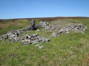 |
| Image 2 ID | 4492 Click image to enlarge |
| Image 2 Description | 4. At ruined building looking SE. |  |
| Image 3 ID | 4493 Click image to enlarge |
| Image 3 Description | 5. At ruined building looking bit more E. | 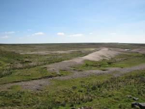 |
| Image 4 ID | 4494 Click image to enlarge |
| Image 4 Description | 6. At ruined building looking N to A. | 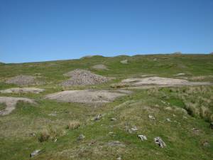 |
| Image 5 ID | 4499 Click image to enlarge |
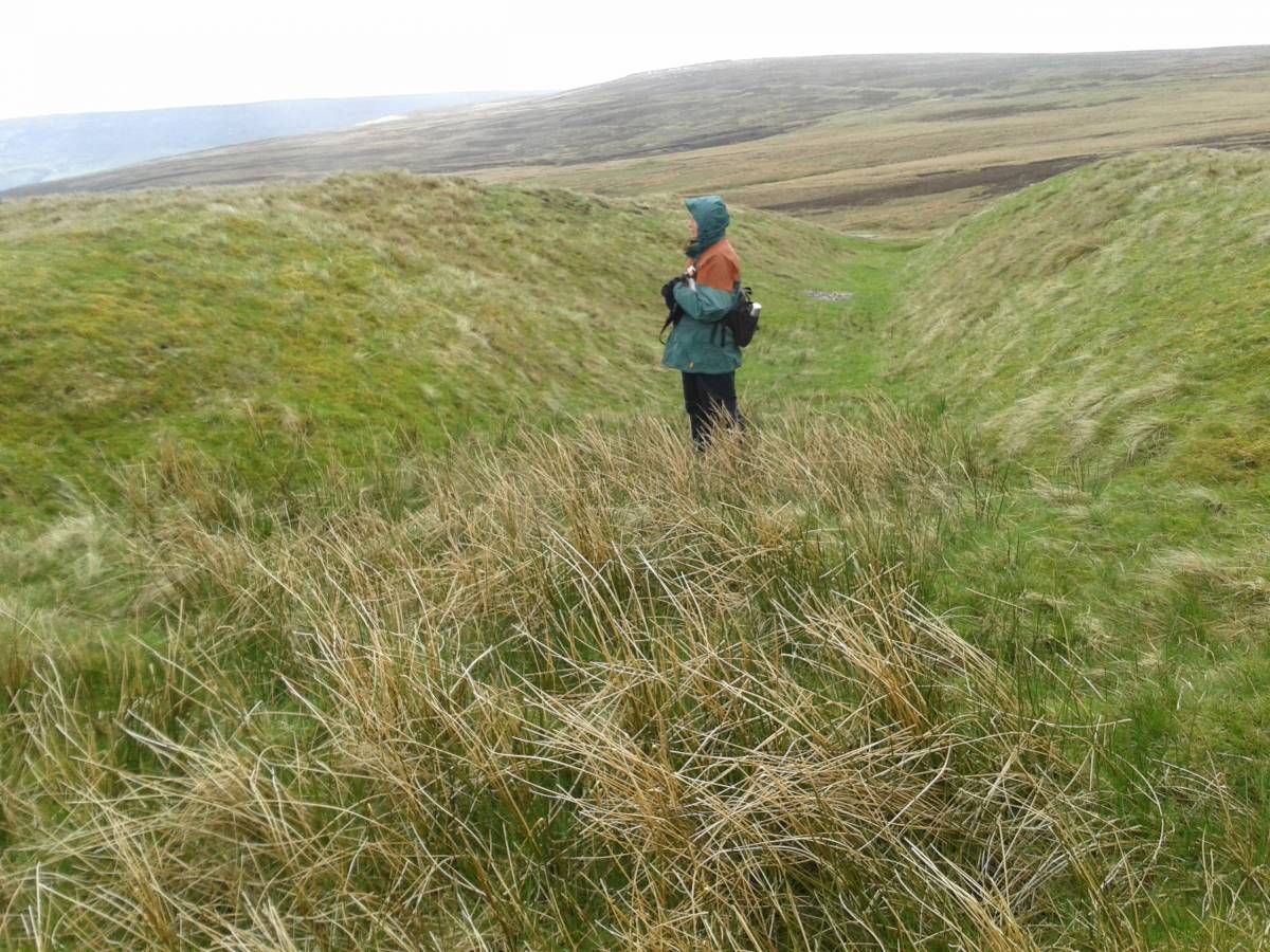
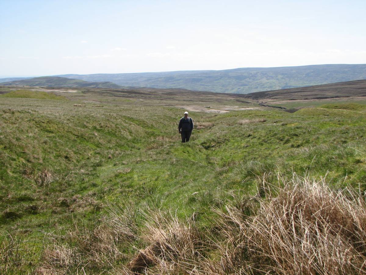
| Image 5 Description | 7. Looking NE up to A from foot of the embankment. Incline A crosses the horizon at the prominent nick roughly in the middle of the photo. | 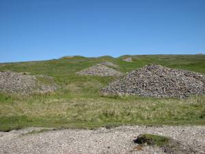 |
| Image 6 ID | 4501 Click image to enlarge |
| Image 6 Description | 11. At NY97950 02588 (point X), where A, B, C appear to meet, looking down to the dressing area. |  |
| Image 7 ID | 4502 Click image to enlarge |
| Image 7 Description | 11b. The embankment, looking S from X. |  |
| Image 8 ID | 4497 Click image to enlarge |
| Image 8 Description | 9. At X looking SE to the nearby large shaft; the Black Whim | 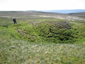 |
| Image 9 ID | 4500 Click image to enlarge |
| Image 9 Description | 10. At X looking N up A | 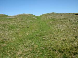 |
| Image 10 ID | 4503 Click image to enlarge |
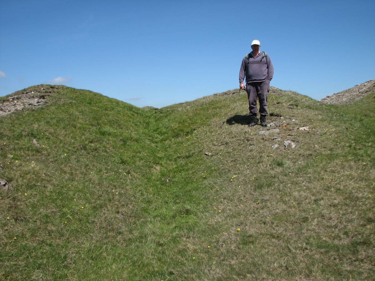
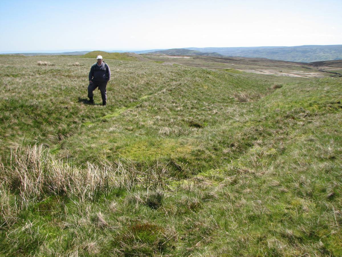
| Image 10 Description | 12. At X. The Black Whim in the background, the low bank which blocks the route of A to the South is in the foreground, right, with Stephen standing on it. At this point it looks like a leat. | 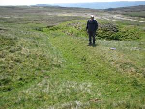 |
| Image 11 ID | 4504 |
| Image 11 Description | 12a. Incline A at NY 97967 02686 where it is cut by a small leat, clearly visible on the aerial photo in record 735. Note the depth of cut of A. It was probably deeper originally. | 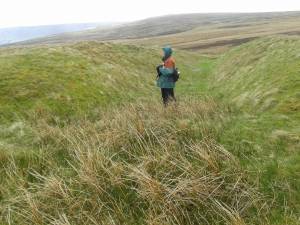 |
| Image 12 ID | 4505 |
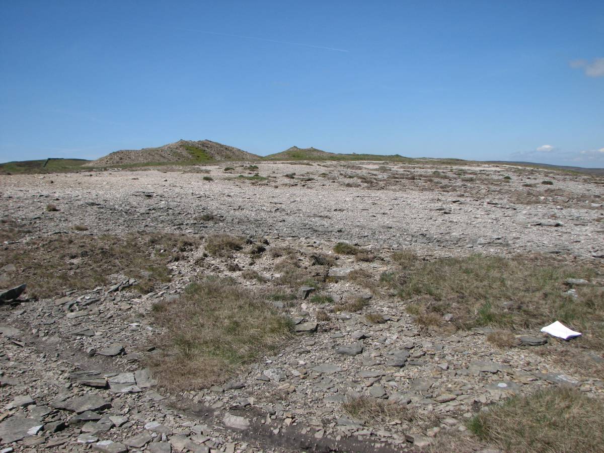
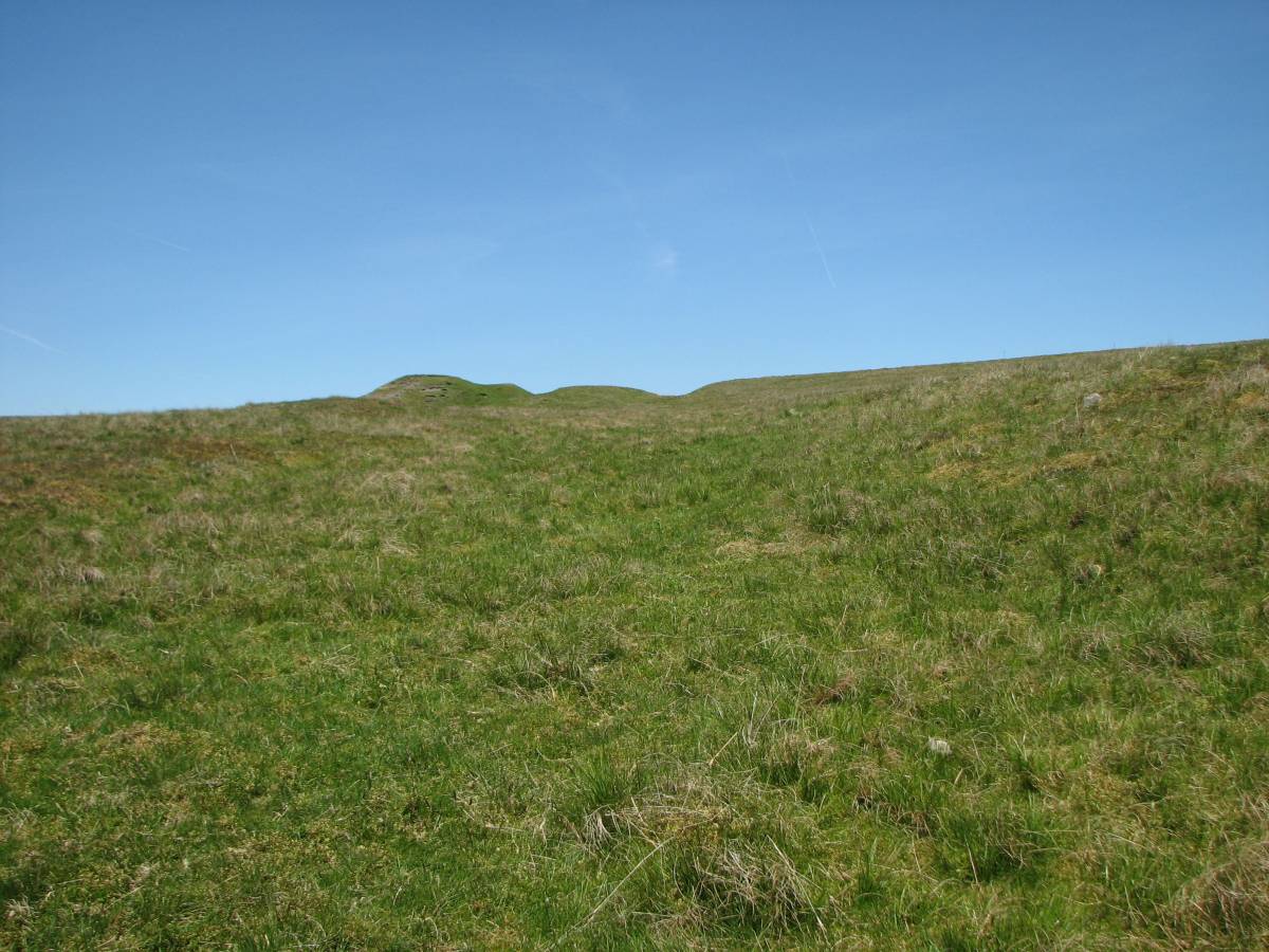
| Image 12 Description | 13. A peters out at NY 07972 02725, looking S. | 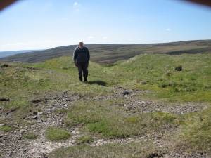 |
| Image 13 ID | 4506 |
| Image 13 Description | 14 A continues at NY 97972 02781, looking NNW. |  |
| Image 14 ID | 4507 |
| Image 14 Description | 15. A ends at NY 97958 02831 looking S. | 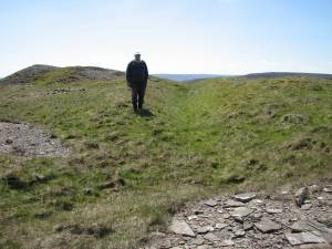 |
| Image 15 ID | 4508 |
| Image 15 Description | 16.The dressing area where A ends. |  |
| Image 16 ID | 4514 |
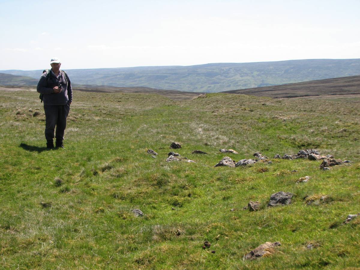
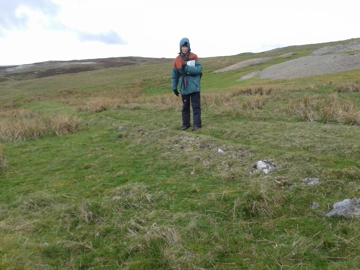
| Image 16 Description | 24. At top of B NY 97710 02857; the slight rise in the ground might indicate a loading platform. However whilst not immediately evident on the ground, the photo suggests that the track continues beyond this point. The 1st Ed OS suggests the same. This will be investigated further. | 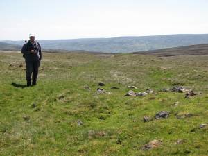 |
| Image 17 ID | 4515 |
| Image 17 Description | 25. Looking back to start of B | 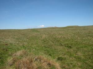 |
| Image 18 ID | 4516 |
| Image 18 Description | 26. B, looking S, where it becomes very rough at NY 97755 02795 | 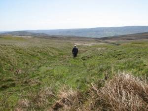 |
| Image 19 ID | 4517 |
| Image 19 Description | 27. A leat loops across B NY 97818 02718; clearly visible on the aerial photo in record 735 | 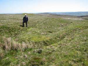 |
| Image 20 ID | 4518 |
| Image 20 Description | 28. At NY 97919 02584 looking up B | 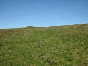 |
| Image 21 ID | 4519 |
| Image 21 Description | 29. First signs of foot of C at NY 98000 02612 |  |
| Image 22 ID | 4532 |
| Image 22 Description | 30a. Revetment on C at NY 98100 02642 | 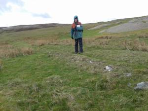 |
| Image 23 ID | 4521 |
| Image 23 Description | 31. Possible loading platform at the top of C; NY 98131 02653 | 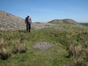 |
| Image 24 ID | 4522 |
| Image 24 Description | 32. View from NY 98131 02653 at the top of C | 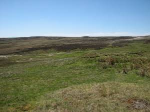 |
| Image 25 ID | 4523 |
| Image 25 Description | 33. View from NY 98131 02653 at the top of C, moving E from photo 32. | 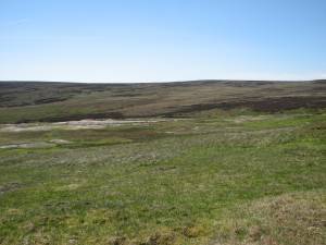 |
| Image 26 ID | 4524 |
| Image 26 Description | 34. View from NY 98131 02653 at the top of C, moving further E from photo 33. |  |
| Image 27 ID | 4525 |
| Image 27 Description | 35. View from NY 98131 02653 at the top of C, moving yet further E from photo 34. | 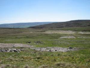 |