|
| *****SWAAG_ID***** | 754 |
| Date Entered | 05/09/2013 |
| Updated on | 05/09/2013 |
| Recorded by | Stephen Eastmead |
| Category | Mining Related |
| Record Type | Industrial Archaeology |
| SWAAG Site Name | |
| Site Type | |
| Site Name | |
| Site Description | |
| Site Access | Public Access Land |
| Record Date | 01/09/2013 |
| Location | Black Mires, Arkengarthdale |
| Civil Parish | Arkengarthdale |
| Brit. National Grid | NY 992 035 |
| Altitude | See Map image |
| Geology | |
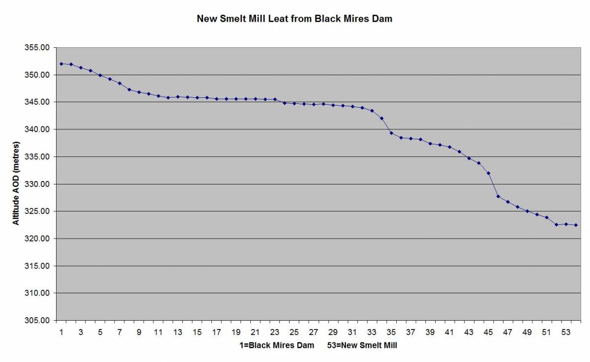
| Record Name | Black Mire Dam Leat to the New Smelt Mill. GPS 3D Survey |
| Record Description | A survey of the Black Mires Dam and its associated leat to the New Smelt Mill was undertaken using a ProMark 120 GPS. Post processing was based on OS-Net RICM CORS (Continuously Operating Reference Station) data downloaded from
here.
The processed data and map can be downloaded here.
|
| Dimensions | |
| Geographical area | |
| Species | |
| Scientific Name | |
| Common / Notable Species | |
| Tree and / or Stem Girth | |
| Tree: Position / Form / Status | |
| Tree Site ID | 0 |
| Associated Site SWAAG ID | 0 |
| Additional Notes | |
| Image 1 ID | 4684 Click image to enlarge |
| Image 1 Description | Black Mire Leat - Altitude profile from Black Mire Dam to just above the New Smelt Mill. |  |
| Image 2 ID | 4685 Click image to enlarge |
| Image 2 Description | Black Mires Leat Map showing its path across the chert tramway and the teo flues from the Octagonal and New Smelt Mills. | 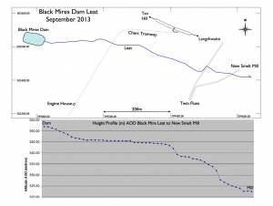 |