|
| *****SWAAG_ID***** | 741 |
| Date Entered | 22/07/2013 |
| Updated on | 23/07/2013 |
| Recorded by | Tim Laurie |
| Category | Settlement |
| Record Type | Archaeology |
| SWAAG Site Name | |
| Site Type | |
| Site Name | |
| Site Description | |
| Site Access | Public Access Land |
| Record Date | 19/07/2013 |
| Location | Walden Head. Walden Moor. Terrace below Crag Brea |
| Civil Parish | Bishopdale |
| Brit. National Grid | SD 990 804 |
| Altitude | 432m |
| Geology | Kame terrace below the Underset Limestone. |
| Record Name | Walden. Round house settlement below Crag Brea with associated enclosures with well preserved wall passage feature. |
| Record Description | Round house settlement on kame terrace below Crag Brea with associated enclosures with well preserved wall passage feature. This settlement is well preserved in spite of the fact that a large modern sheep fold directly overlies the settlement and has been built from stone obtained from the settlement enclosure and wall passage feature walls.
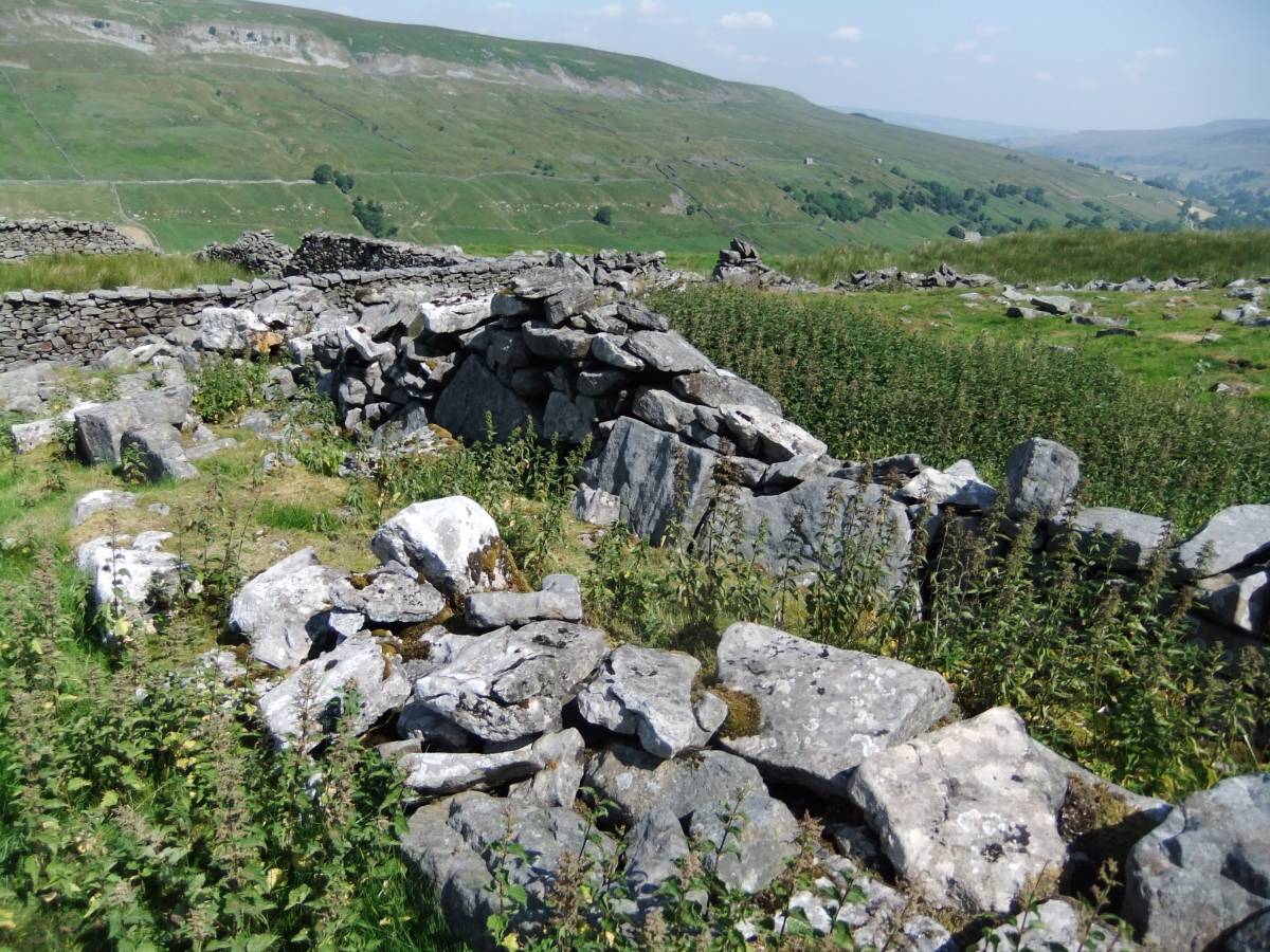
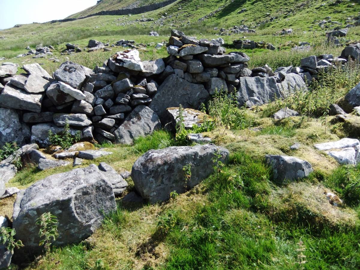
The wall passage feature is attached to the western side of a large stone walled enclosure and has been reduced by stone taken for the later sheepfold, however the two orthostatic wall faces are intact at and below ground level together with some of the dry stone walling. The end walls of the wall passage are masked by tumble.
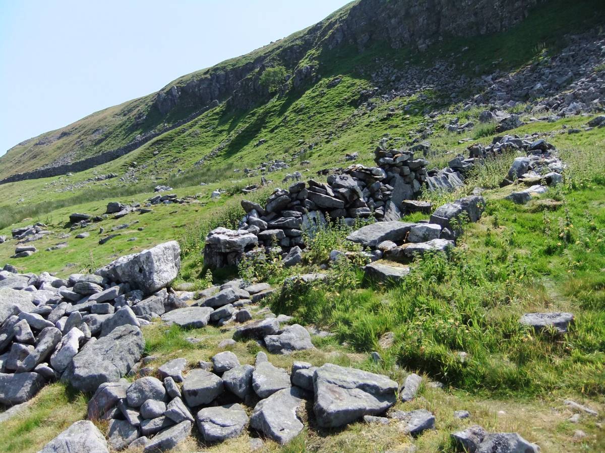
The best of the few hut circles is located at the western limit of the settlement enclosures, at SD9882080292,444m. Several small hut circles and a row of features which may be collapsed beehive structures are incorporated within the substantial stone enclosure walls, at SD9889580340. |
| Dimensions | 160m in length from SD9897980396 to SD9882080292 |
| Geographical area | |
| Species | |
| Scientific Name | |
| Common / Notable Species | |
| Tree and / or Stem Girth | |
| Tree: Position / Form / Status | |
| Tree Site ID | 0 |
| Associated Site SWAAG ID | 0 |
| Additional Notes | This settlement together with the overlying sheep fold suggest that this terrace has been in continuous use for seasonal, transhumant sheep management and foddering for millennia.
Wall passage features are generally 1.2m wide with faced dry stone walls which were most probably roofed with timbers and turf coverings. If so they could have served the purpose of cold storage for cheese or for dried and smoke cured meat products, and for protection from wolves, foxes and inclement weather. Wall passages are associated, in the Pennine Uplands with shieling settlements of late Iron Age,Native Roman and pre-Conquest date, as at Greenber Edge above Bainbridge (Blood and Cater,1996).
This settlement can be seen on Google Earth.
The superficially similar round house settlement also on the southern side of Walden, above Whitrow Farm some 3km to the NE and located at 400m elevation below Dove Scar is associated with an open group of three burnt mounds, see SWAAG Database Site No. The burnt mounds at Whitrow Farm may far predate the enclosures but they do indicate continuity of pastoral activity on the Pennine Fringe from the Late Neolithic onwards.
References:
Keith Blood and Derek Cater 1996.'Settlements at Greenber Edge'. RCHME Archaeological Survey Report on NMR nos:SD98NE1,6,201-4 |
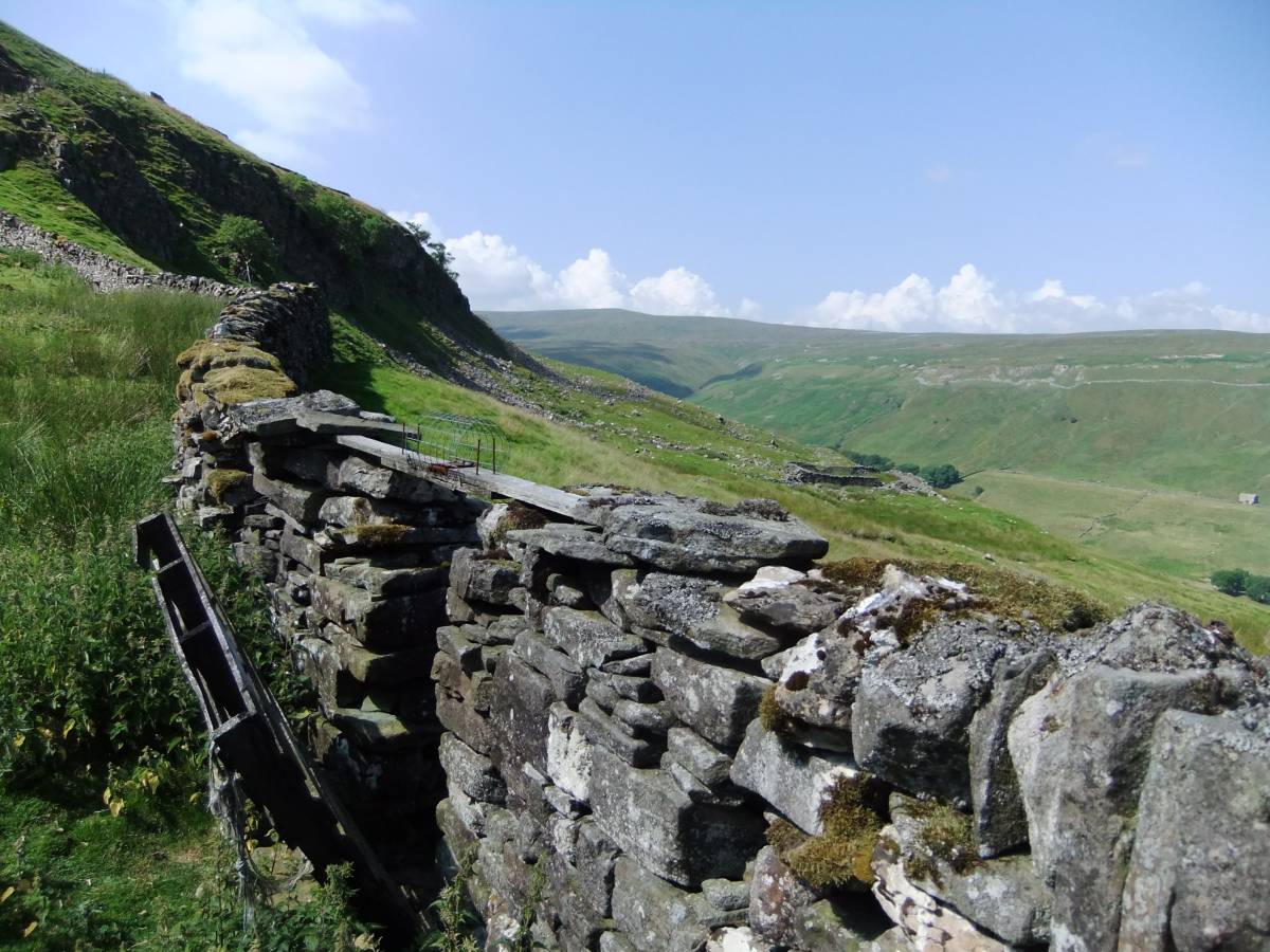
| Image 1 ID | 4573 Click image to enlarge |
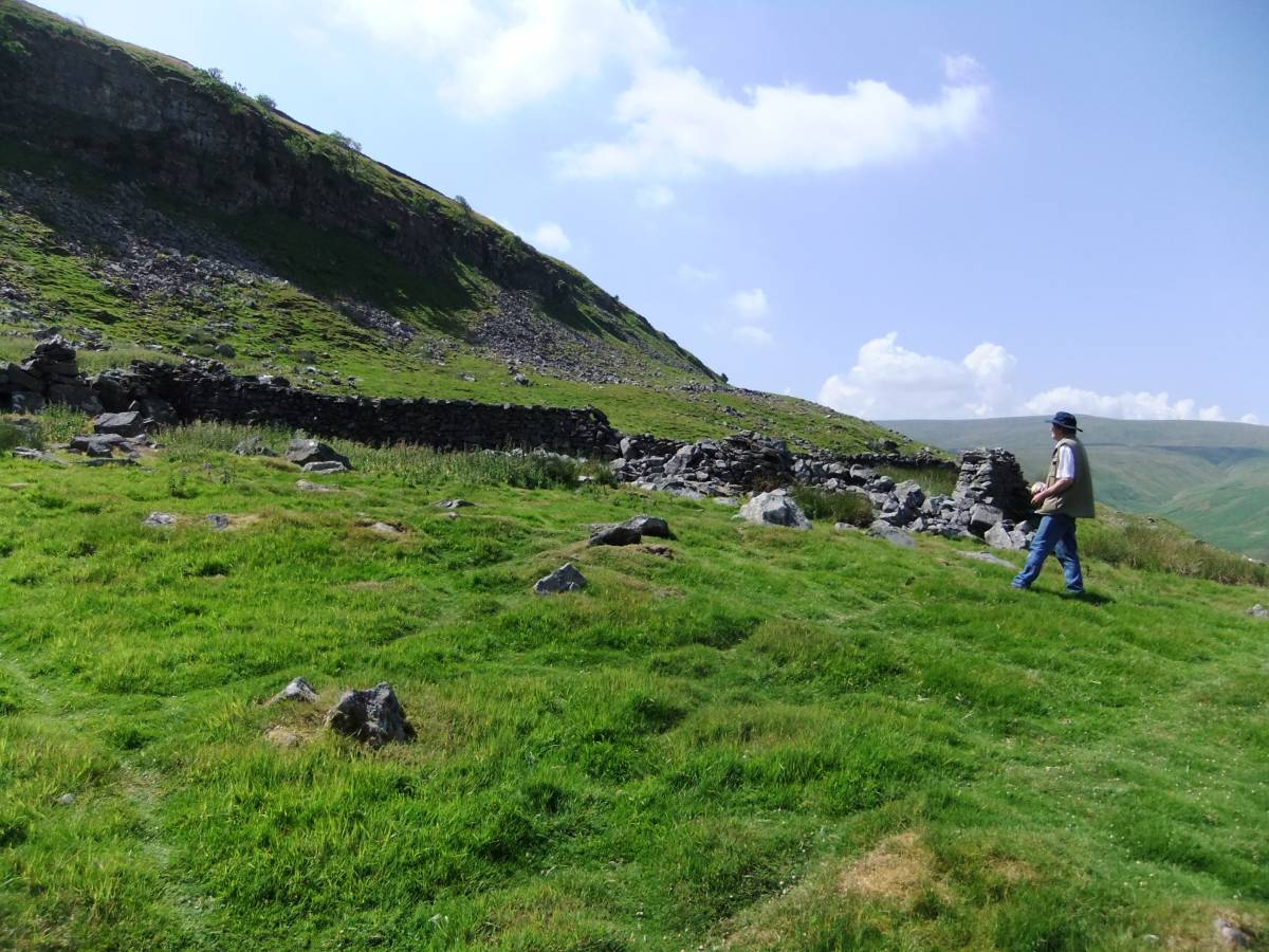
| Image 1 Description | View westward towards the settlement and modern sheepfold below Crag Brea. |  |
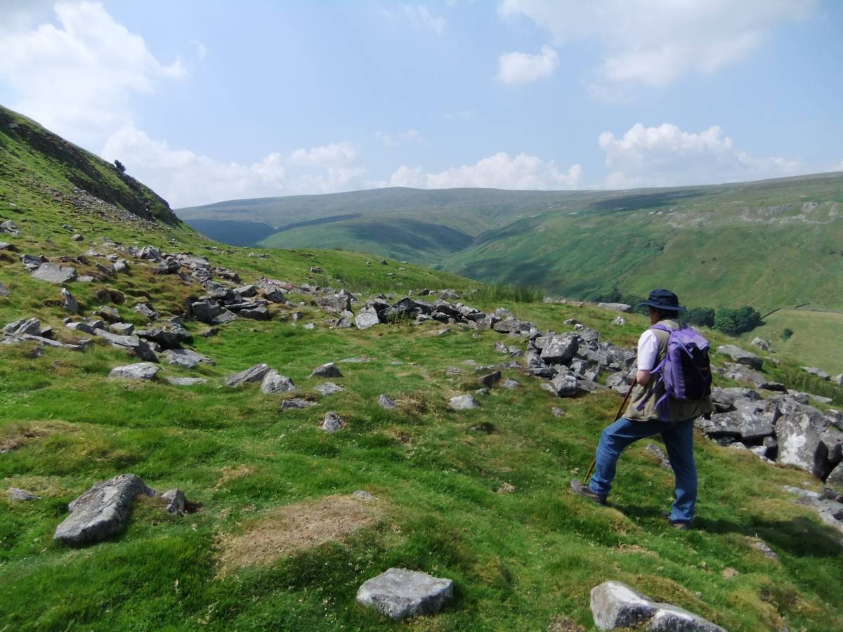
| Image 2 ID | 4574 Click image to enlarge |
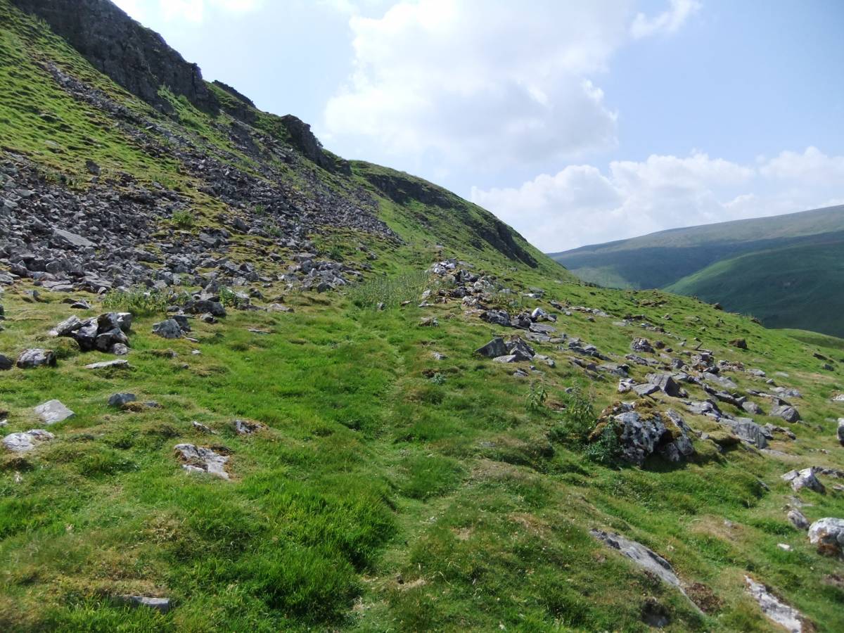
| Image 2 Description | The approach to the settlement |  |
| Image 3 ID | 4575 Click image to enlarge |
| Image 3 Description | Round house at western limit of the settlement enclosures |  |
| Image 4 ID | 4578 Click image to enlarge |
| Image 4 Description | The wall passage feature and stone wall enclosure. | 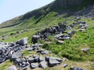 |
| Image 5 ID | 4576 Click image to enlarge |
| Image 5 Description | The wall passage feature | 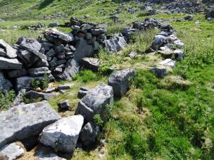 |
| Image 6 ID | 4577 Click image to enlarge |
| Image 6 Description | The wall passage feature | 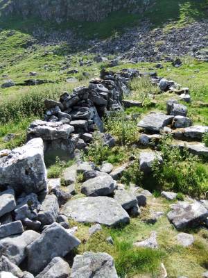 |
| Image 7 ID | 4579 Click image to enlarge |
| Image 7 Description | The wall passage feature | 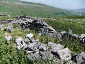 |
| Image 8 ID | 4580 Click image to enlarge |
| Image 8 Description | The wall passage feature |  |
| Image 9 ID | 4581 Click image to enlarge |
| Image 9 Description | Round house. | 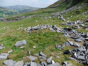 |
| Image 10 ID | 4582 Click image to enlarge |
| Image 10 Description | The enclosure walls are hevily quarried close to the modern sheepfold, but can be discerned. |  |
| Image 11 ID | 4583 |
| Image 11 Description | The settlement terrace below Crag Brea from the SE. | 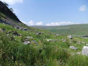 |
| Image 12 ID | 4584 |
| Image 12 Description | A small trackway and hollow way leads upto the one and only gap in Crag Brea which provides access from the western limit of the settlement up to the moorland plateau above. | 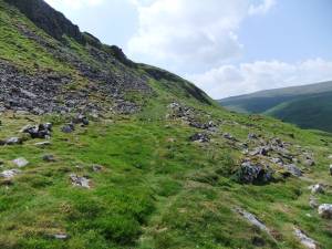 |