|
| *****SWAAG_ID***** | 746 |
| Date Entered | 20/08/2013 |
| Updated on | 20/08/2013 |
| Recorded by | Tim Laurie |
| Category | Mining Related |
| Record Type | Mining |
| SWAAG Site Name | |
| Site Type | |
| Site Name | |
| Site Description | |
| Site Access | Public Access Land |
| Record Date | 18/08/2013 |
| Location | High Dukerdale, Winton Parish. Westmoreland |
| Civil Parish | Not known |
| Brit. National Grid | NY 81346 05332 |
| Altitude | 518m |
| Geology | Open cast lead workings with shaft mounds on the outcrop of faulted Main Limestone. |
| Record Name | High Dukerdale Scars, eastern side..Open cast lead working, shaft mounds and associated lead bale. |
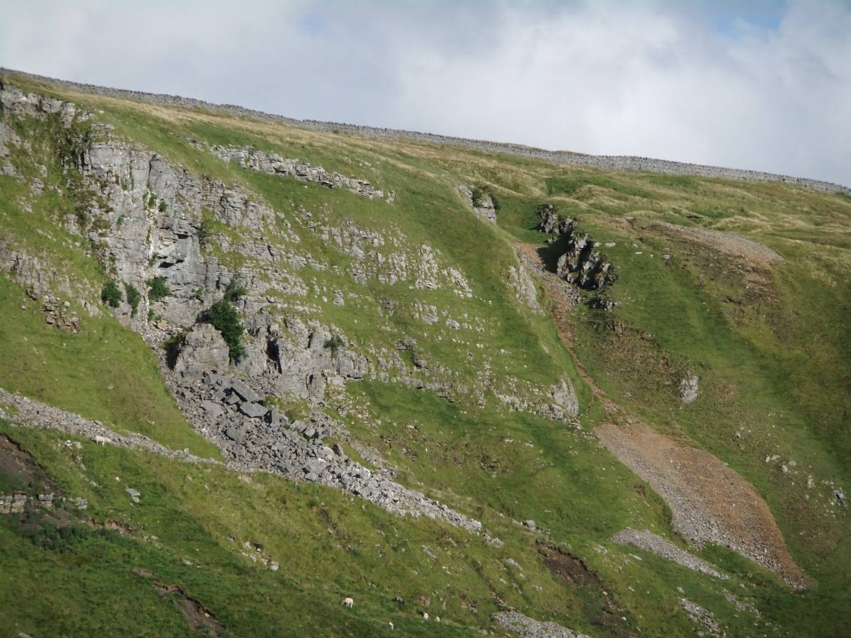
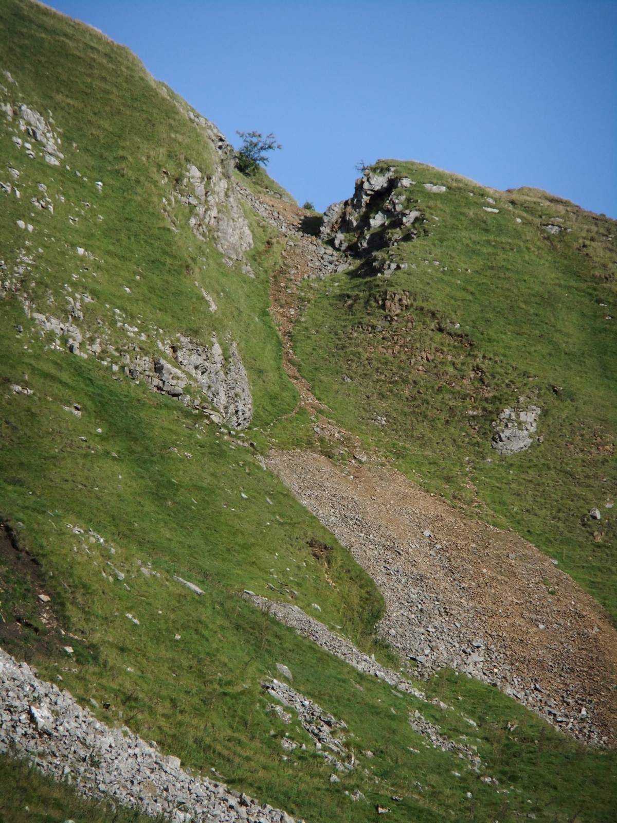
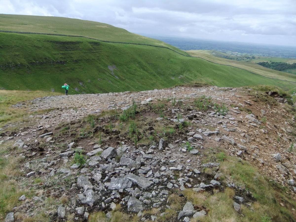
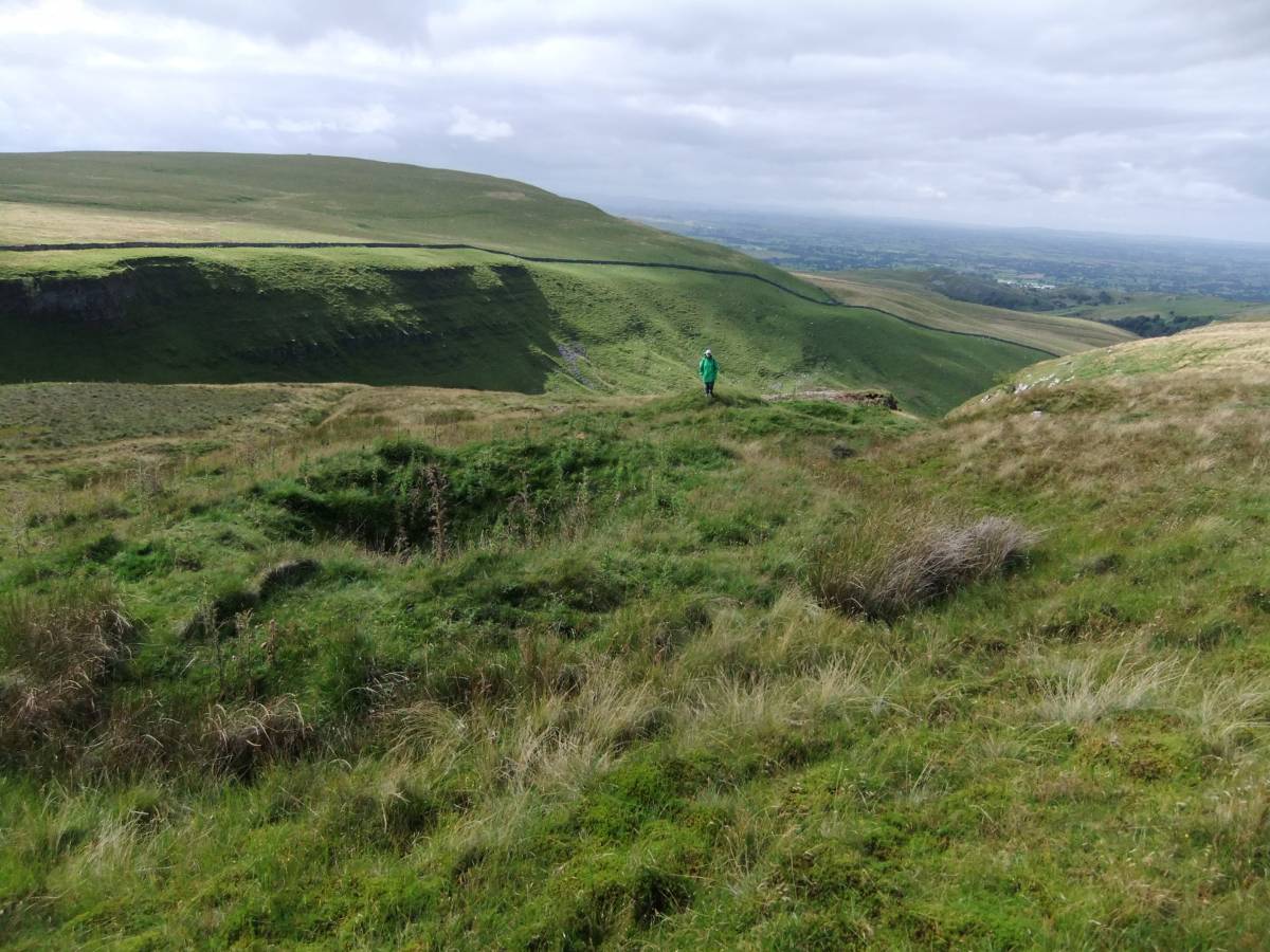
| Record Description | This lead mine is not identified on 1:25000 OS Map Sheet OL18. The open cast lead mine is visible as a prominent 'hush' or rock cut trench at the upper edge of the sheer limestone cliff or scar which forms the eastern side of High Dukerdale. At the top of the open cast hush are three shaft mounds. Various strings leading from the hush have been worked from the surface.
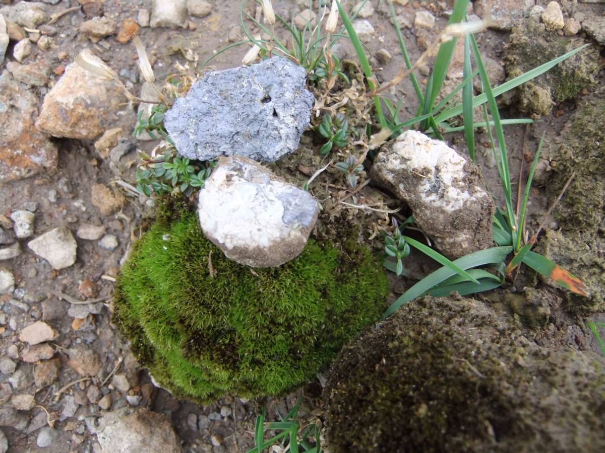
Most significantly, a circular erosion patch on the southern edge of the 'hush' has fragments of galena lead ore and a small amount of yellow lead slag usually detected as 'splashes' on small fragments of limestone (see photo **). The presence of the slag denotes smelting and the existence of a bale directly associated with the lead mine here.
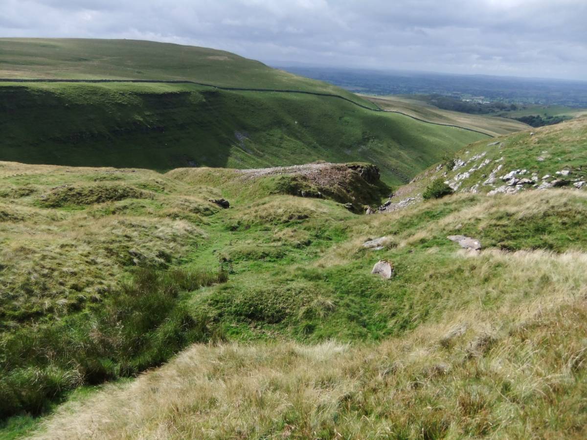
A careful search revealed the existence of a level driven into the side of the gill directly below the open cast hush. The spoil heap below the hush can be seen on the attached photos.
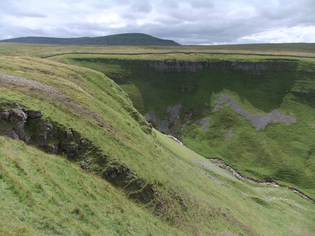
The lead vein is just one of a series of faults, all of which except this 'hush' are not mineralised, visible in the the face of the Main Limestone Scar at the top edge of High Dukerdale. |
| Dimensions | See photofile |
| Geographical area | |
| Species | |
| Scientific Name | |
| Common / Notable Species | |
| Tree and / or Stem Girth | |
| Tree: Position / Form / Status | |
| Tree Site ID | 0 |
| Associated Site SWAAG ID | 0 |
| Additional Notes | |
| Image 1 ID | 4641 Click image to enlarge |
| Image 1 Description | The High Dukerdale Lead Mine from the South West. Hush and bale visible. | 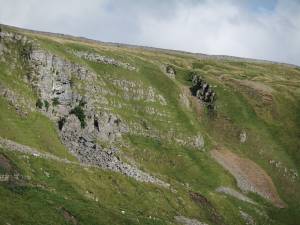 |
| Image 2 ID | 4642 Click image to enlarge |
| Image 2 Description | The High Dukerdale Lead Mine from the South West. Open cast hush in face of the cliff. | 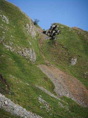 |
| Image 3 ID | 4652 Click image to enlarge |
| Image 3 Description | Open cast hush. |  |
| Image 4 ID | 4653 Click image to enlarge |
| Image 4 Description | The uppermost of three shaft mounds | 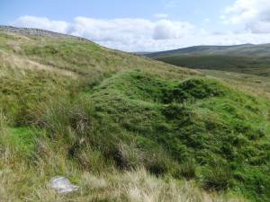 |
| Image 5 ID | 4645 Click image to enlarge |
| Image 5 Description | High Dukerdale Head from the open cast Hush. |  |
| Image 6 ID | 4646 Click image to enlarge |
| Image 6 Description | Lead Bale | 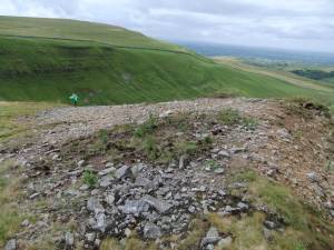 |
| Image 7 ID | 4647 Click image to enlarge |
| Image 7 Description | Galena. | 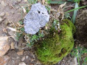 |
| Image 8 ID | 4648 Click image to enlarge |
| Image 8 Description | Galena and slag | 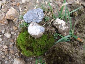 |
| Image 9 ID | 4649 Click image to enlarge |
| Image 9 Description | Shaft mounds above the open cast hush. | 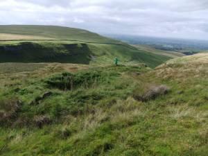 |