|
| *****SWAAG_ID***** | 774 |
| Date Entered | 24/01/2014 |
| Updated on | 25/01/2014 |
| Recorded by | Tim Laurie |
| Category | Standing Stones / Circles |
| Record Type | Archaeology |
| SWAAG Site Name | |
| Site Type | |
| Site Name | |
| Site Description | |
| Site Access | Public Footpath |
| Record Date | 21/01/2014 |
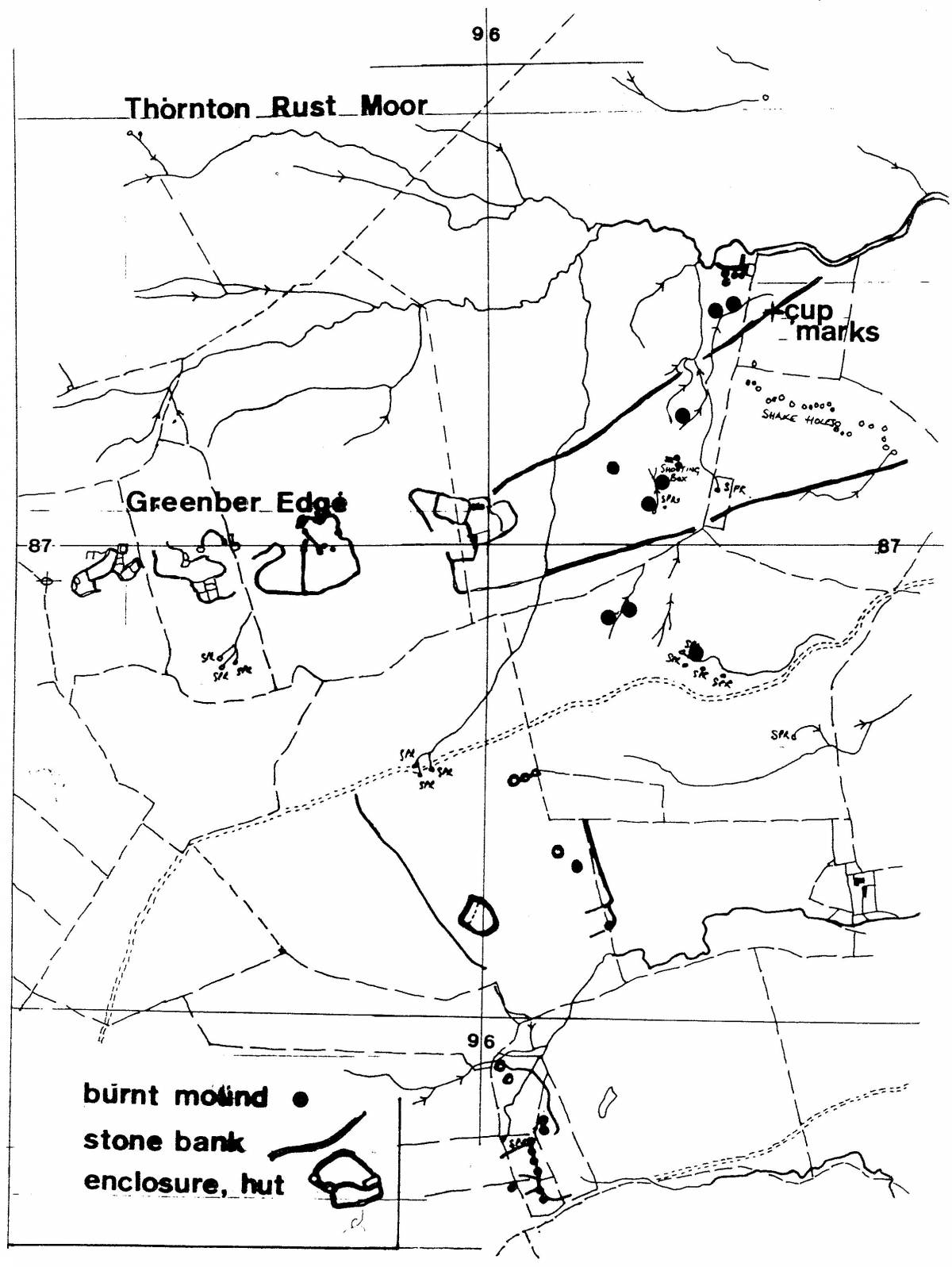
| Location | Wensleydale, Aysgarth, from Flout Moor Lane to Thornton Rust Springs and then to Stake Fell. |
| Civil Parish | Aysgarth |
| Brit. National Grid | SD 976 870 |
| Altitude | |
| Geology | Carboniferous Limestones of the Wensleydale Series overlain by Glacial moraines. Flout Moor Springs rise below the Middle Limestone. Thornton Moor Springs rise below strata of the Underset Limestone Series. |
| Record Name | SWAAG Walk to Castle Dikes Henge and to Stake Fell via Flout Moor Lane and Thornton Rust Springs |
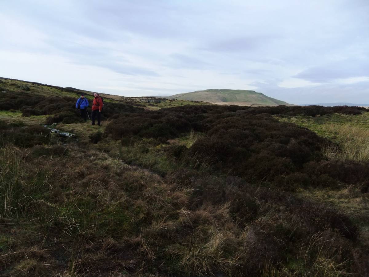
| Record Description | This record is of the historic landscapes of Flout Moor, Thornton Rust Springs and of the eastern slopes of Stake Fell seen by a strong group of SWAAG members during a walk on a fine day in January.
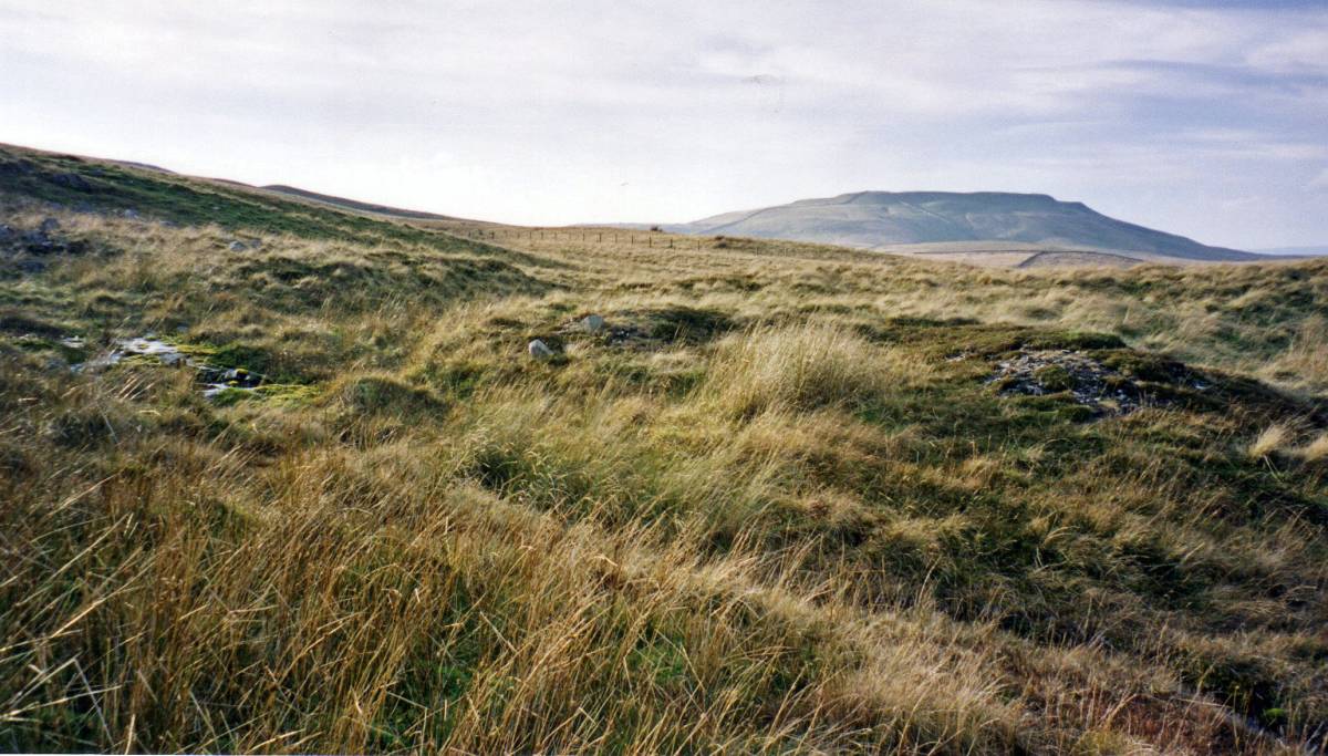
Features visited include the very fine and undisturbed Aysgarth Castle Dikes henge monument, the two very large burnt mounds at Flout Moor Springs, the prehistoric undated unenclosed platform settlement and associated field system on Flout Moor, the open cluster of nine burnt mounds on Black Pasture and in the vicinity of the Shooting Hut at Thornton Rust Springs. The Group then walked to visit the smaller of the two unenclosed high level prehistoric round house settlements above Gayle Ing and at Side Well on Stake fell. An, as yet, unrecorded small shieling type settlement of Pre-Conquest or Medieval Character was visited on the way back to the cars.
For Location Maps see Image Nos 6, and brief details of the sites and area visited, see captions to the attached photographic images. |
| Dimensions | Round trip of approximately six miles. |
| Geographical area | |
| Species | |
| Scientific Name | |
| Common / Notable Species | |
| Tree and / or Stem Girth | |
| Tree: Position / Form / Status | |
| Tree Site ID | 0 |
| Associated Site SWAAG ID | 0 |
| Additional Notes | The linear morainic ridges and other glacial land forms which contribute to the very fine Upland Wensleydale landscape to the east of the Stake, with Addlebrough Hill and Carperby Moor across the Dale were explained to the Group by John Russell. Lithic scatter sites located and recorded previously, see Laurie 1993 and 2003 (selected lithic finds from the area are on display at the Dales Countryside Museum) together with the two stray lithic finds made during the walk added direct evidence for human activity in this interesting area.
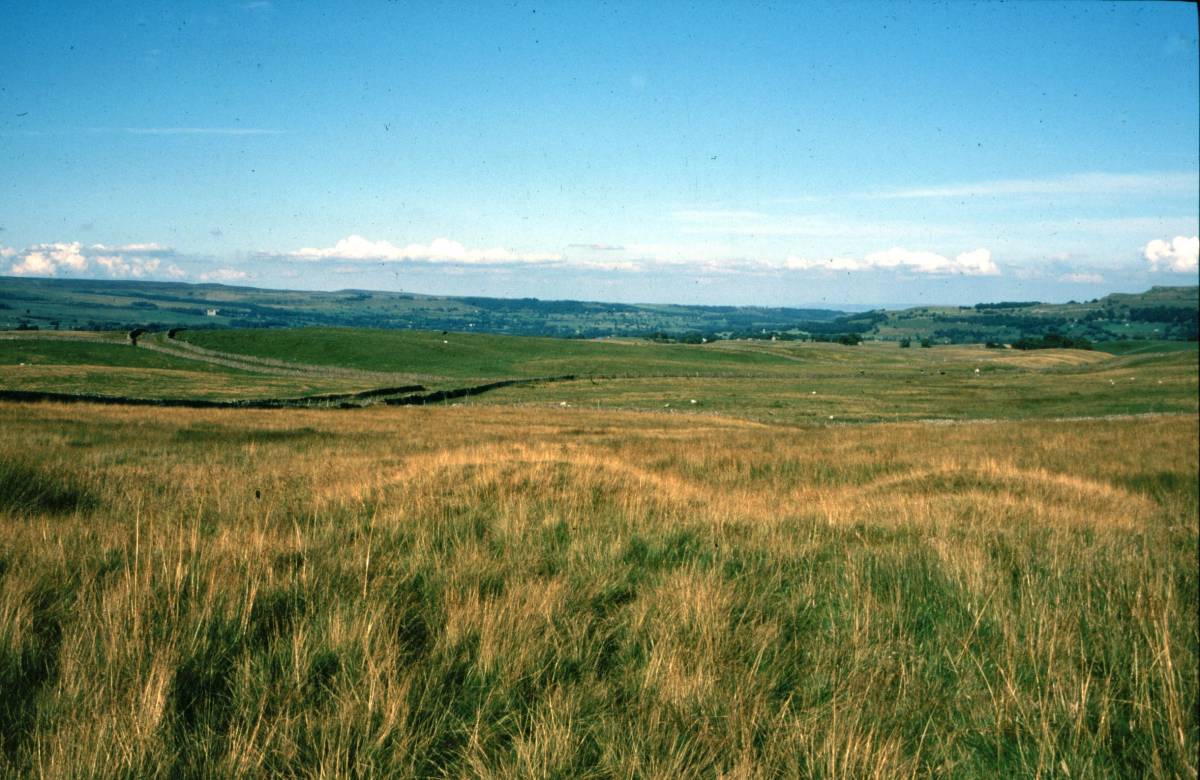
The images include firstly photographs taken during the walk including several contributed by Doug Waugh together with, secondly, a number of photographs taken many years ago to illustrate the great increase in the moorland vegetation following enclosure of the Thornton Rust SSSI and reduction in grazing pressure.
The unpublished Location Maps are copyright Tim Laurie.
References:
Laurie, T.C. 2003 in: T.G. Manby et al. Eds. 'The Archaeology of Yorkshire'.
Yorkshire Archaeological Society. Occ.Paper No 3 pp223-253.
Laurie, T.C. 2004 'Burnt mounds in the Yorkshire Dales' in: R.F. White and P.F. Wilson, Eds.'Archaeological Landscapes of the Yorkshire Dales.' Yorkshire Archaeological Society. Occ.Paper No 2 pp79-88 and Figure 8.3. |
| Image 1 ID | 4998 Click image to enlarge |
| Image 1 Description | Castle Dikes Henge. Photo: Doug Waugh | 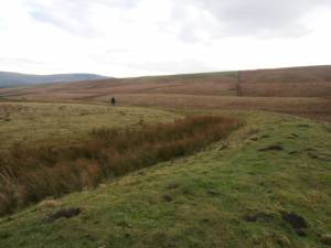 |
| Image 2 ID | 4996 Click image to enlarge |
| Image 2 Description | Castle Dikes Henge in winter, TCL previous photograph | 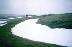 |
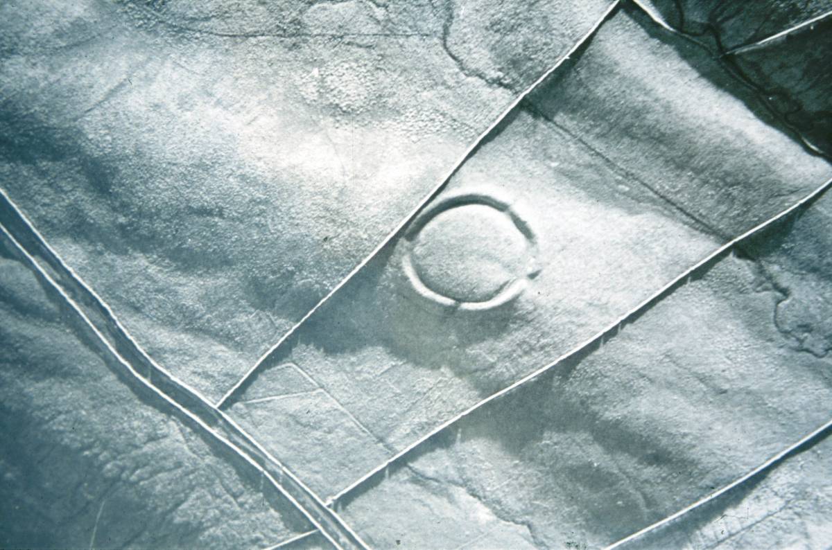
| Image 3 ID | 4997 Click image to enlarge |
| Image 3 Description | Castle Dikes Henge. A.P. by St Joseph |  |
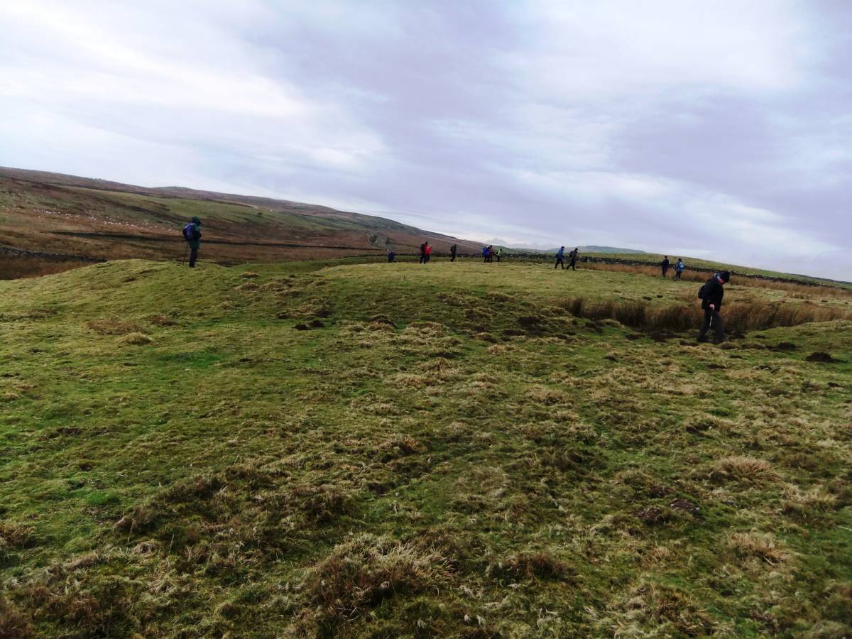
| Image 4 ID | 4993 Click image to enlarge |
| Image 4 Description | Castle Dikes Henge with SWAAG members. | 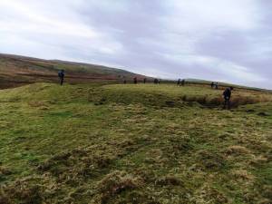 |
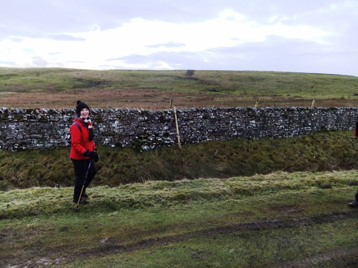
| Image 5 ID | 4994 Click image to enlarge |
| Image 5 Description | Flout Moor Lane. Ann brings up the rear party. | 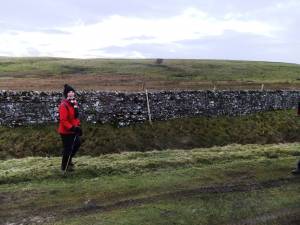 |
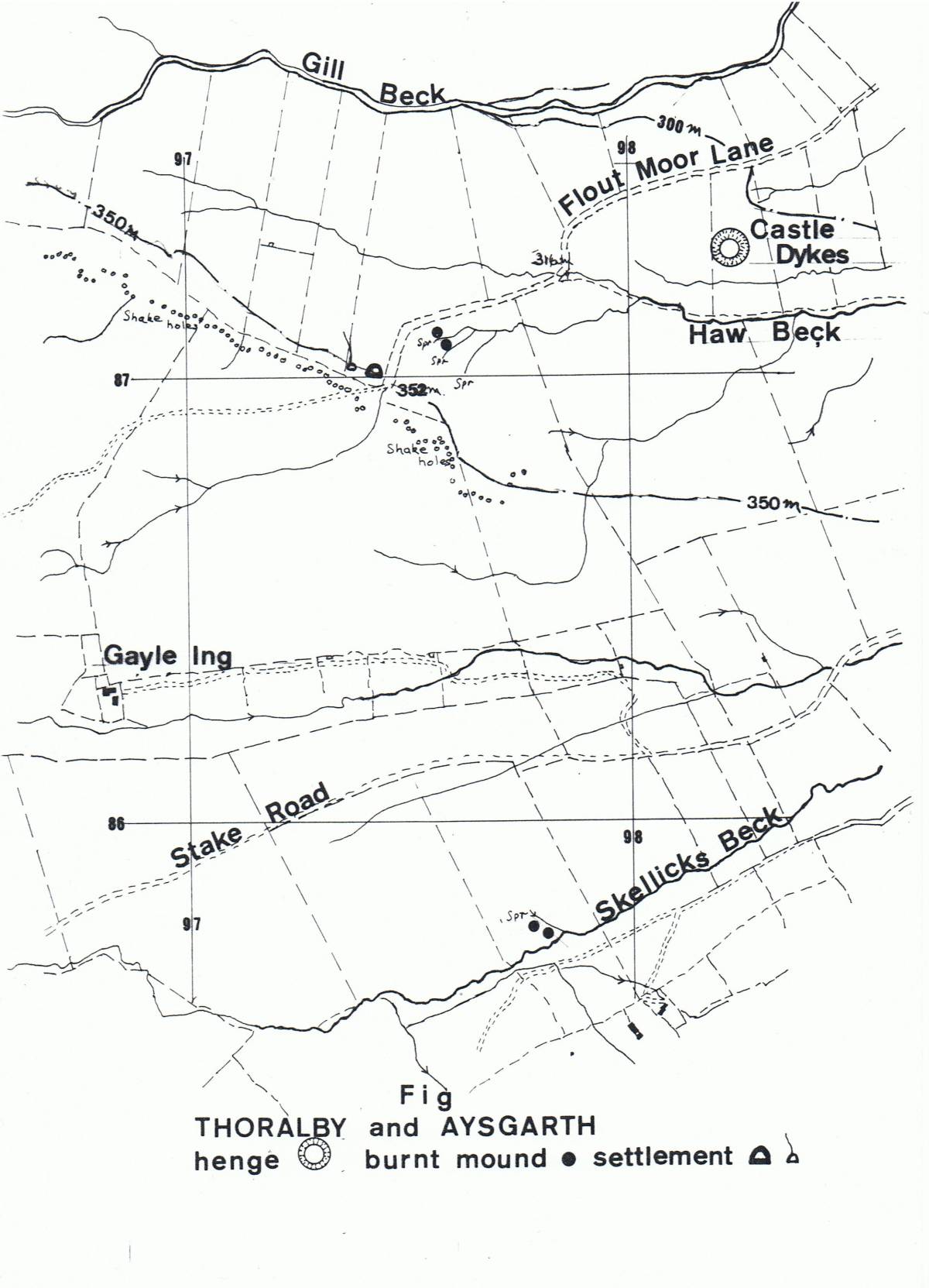
| Image 6 ID | 5017 Click image to enlarge |
| Image 6 Description | Location Map. Prehistoric sites close to Flout Moor lane. | 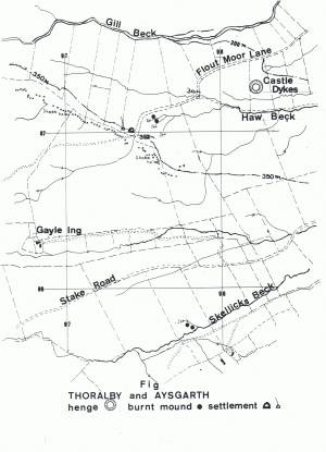 |
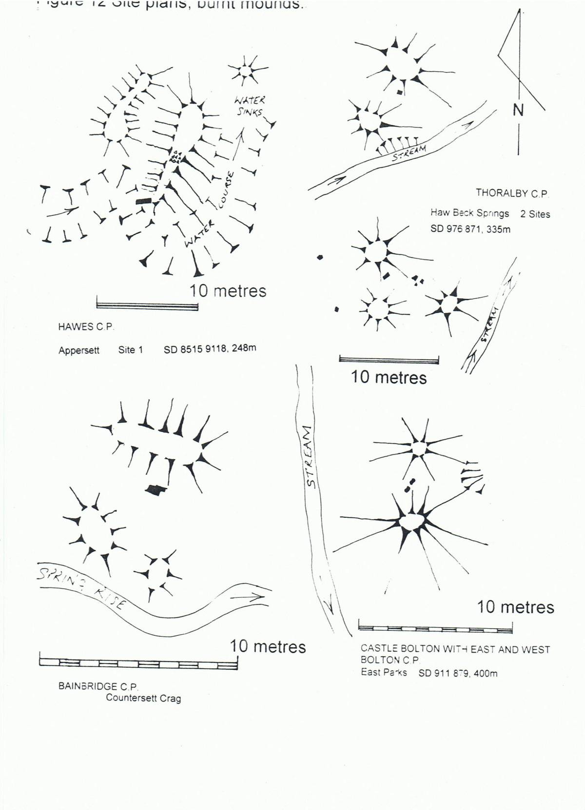
| Image 7 ID | 5035 Click image to enlarge |
| Image 7 Description | Burnt Mounds. Comparative site plans. BMs at Appersett, Thoralby-Flout Moor,Counterset Crag and Castle Bolton: East Parks. | 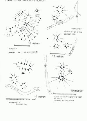 |
| Image 8 ID | 5000 Click image to enlarge |
| Image 8 Description | Flout Moor Springs. Burnt Mound Site 1, of two burnt mound sites here. | 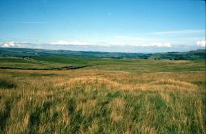 |
| Image 9 ID | 5007 Click image to enlarge |
| Image 9 Description | Thornton Rust Moor. Burnt Mound concealed under thick heather following enclosure of this SSSI Area and reduction in grazing pressure. See below image nos 18-20 for views of this burnt mound before enclosure and rampant growth of heather. | 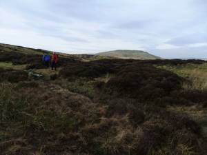 |
| Image 10 ID | 5004 Click image to enlarge |
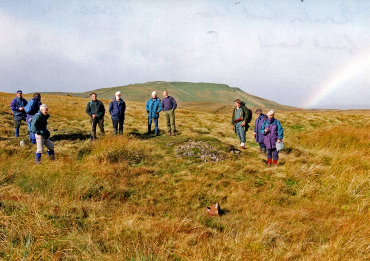
| Image 10 Description | SWAAG search for evidence that there really is a burnt mound below this heather. | 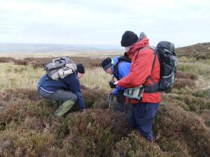 |
| Image 11 ID | 5015 |
| Image 11 Description | Yes there is, here is the evidence! The burnt stone core of the mound, photo Doug Waugh. | 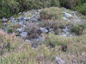 |
| Image 12 ID | 5008 |
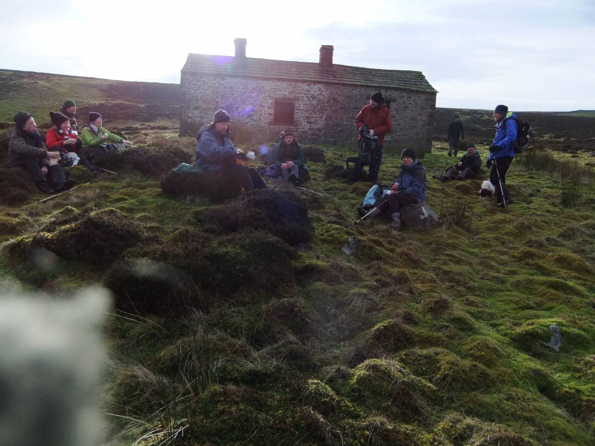
| Image 12 Description | Lunch hut, Thornton Rust Moor. | 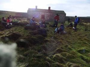 |
| Image 13 ID | 5014 |
| Image 13 Description | Hut circle, marked by vegetation change from sedge to ling, one of several similar hut circles in the vicinity of the burnt mounds here. Photo Doug Waugh. | 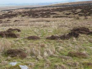 |
| Image 14 ID | 5009 |
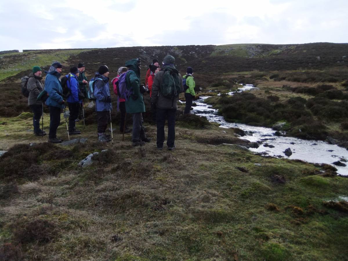
| Image 14 Description | SWAAG at Thornton Rust Spring Rise. See below image no 21 for a view of this spring rise with the two burnt mounds clearly visible before enclosure and rampant growth of heather. |  |
| Image 15 ID | 5013 |
| Image 15 Description | Hugh at burnt mound under thick heather at Thornton Rust Spring Rise.See below image no 20 for a view of this spring rise with the two burnt mounds clearly visible before enclosure and rampant growth of heather. | 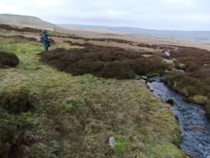 |
| Image 16 ID | 5032 |
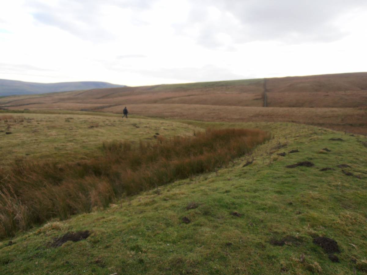
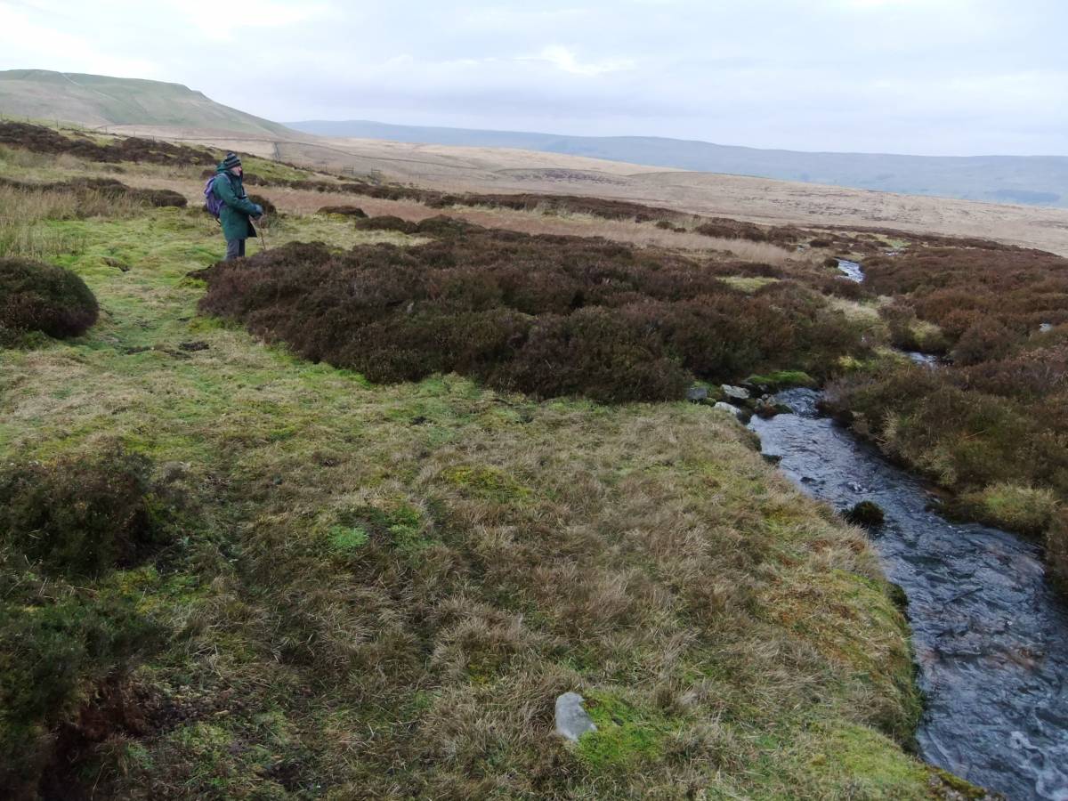
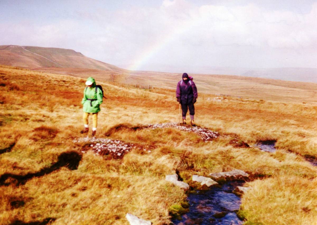
| Image 16 Description | Spring stream crossing Black pasture with two burnt mounds. |  |
| Image 17 ID | 5018 |
| Image 17 Description | Location Map Thornton Rust Moor. Nine burnt Mounds at Thornton Rust Springs. Two unenclosed Settlements at Side Well and Gayle Ing Springs. | 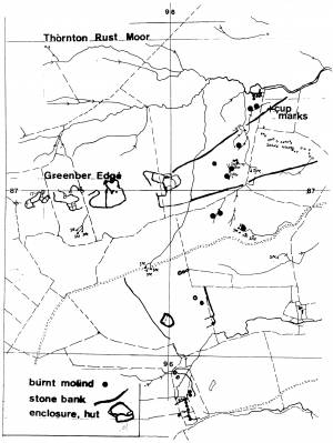 |
| Image 18 ID | 5020 |
| Image 18 Description | Burnt mound at Thornton Rust Springs. Photographed before recent enclosure and consequent growth of heather. Compare with Image Nos 9 and 10 above. | 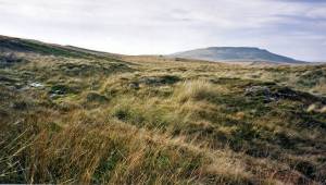 |
| Image 19 ID | 5019 |
| Image 19 Description | As last, earlier field visit. | 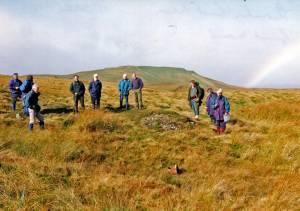 |
| Image 20 ID | 5021 |
| Image 20 Description | A second of the nine burnt mounds hat Thornton Rust Moor. | 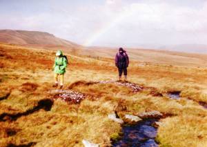 |
| Image 21 ID | 5022 |
| Image 21 Description | The spring rise above the Shooting hut. Compare with photos 5009 and 5013. | 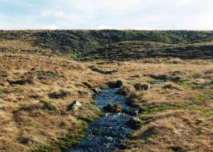 |
| Image 22 ID | 5023 |
| Image 22 Description | Late Neolithic/early bronze age finds from eroded slope above the Shooting Hut (Musgrove Collection). |  |
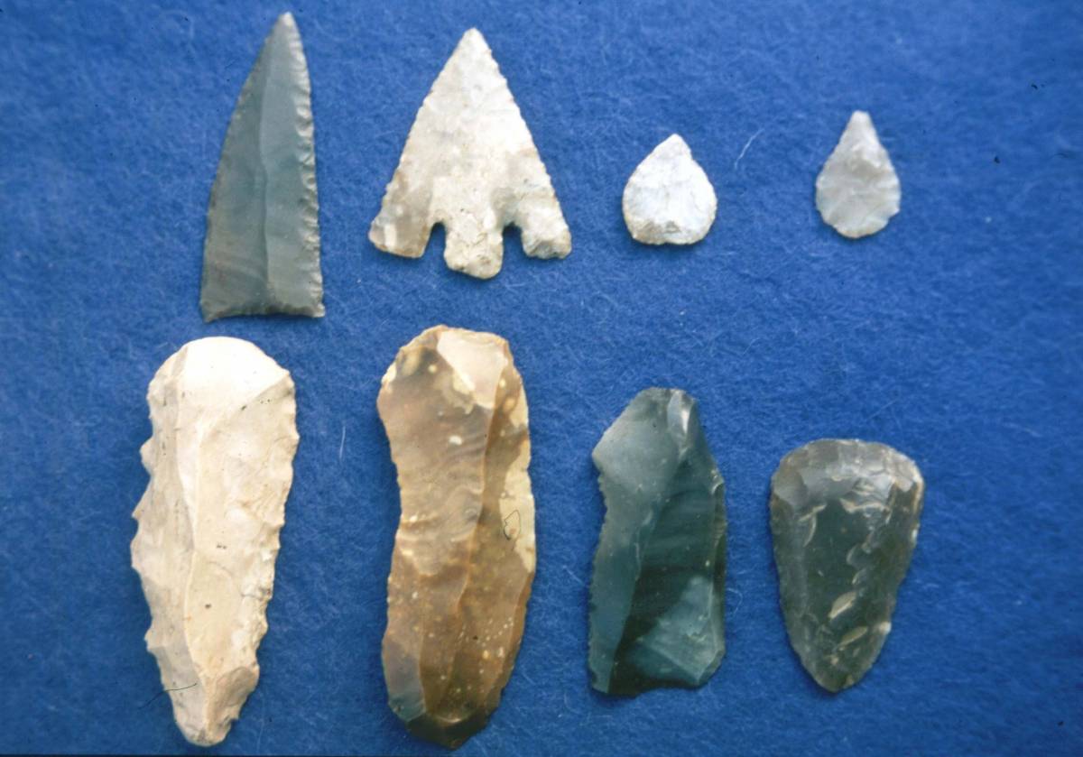
| Image 23 ID | 5024 |
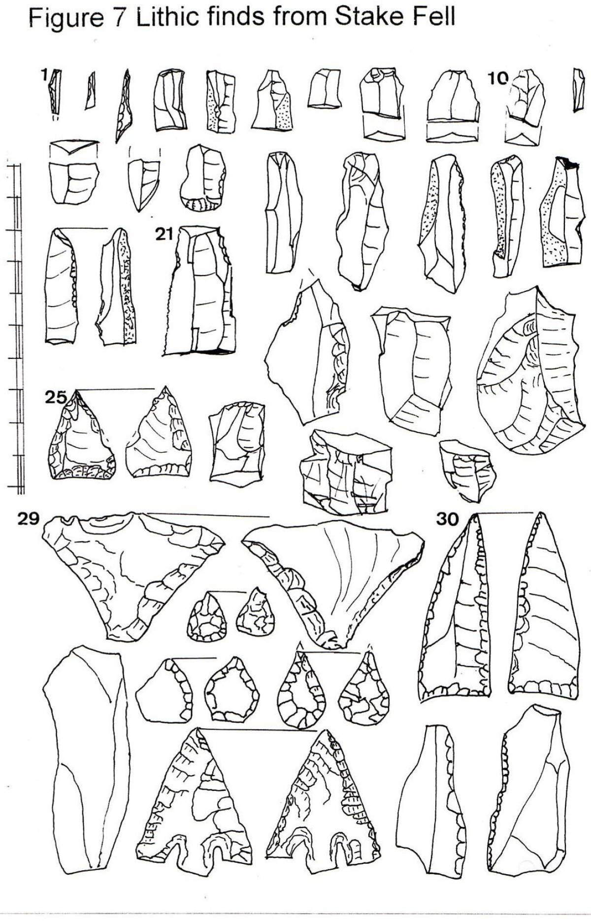
| Image 23 Description | Selected finds. Stake Fell Area, for details of the multi period lithic finds from this area see Laurie 2003 figure 65. | 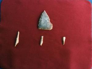 |
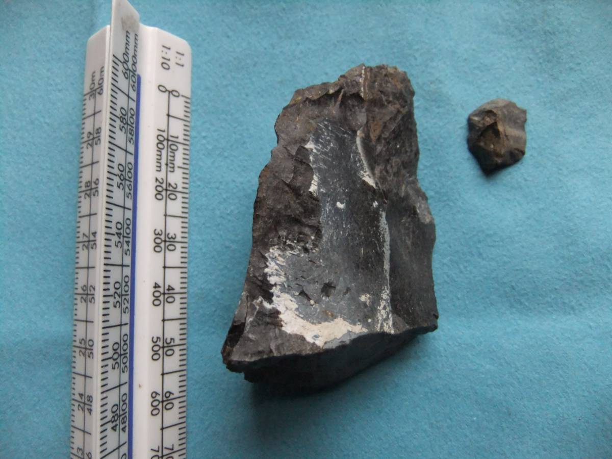
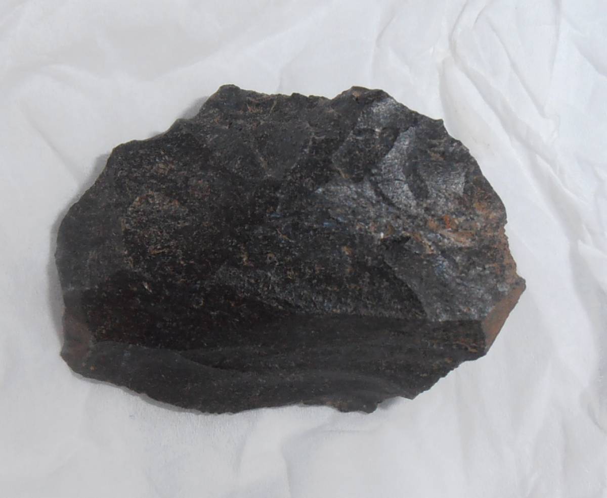
| Image 24 ID | 5025 |
| Image 24 Description | Chert core fragment and chert rhomboidal microlith of Later Mesolithic character from area of smaller unenclosed settlement above Gayle Ing. The heavy core fragment shows several flake removal scars, bulb of percussion and extensive pressure retouch to form flake knife. This is of later prehistoric date. |  |
| Image 25 ID | 5026 |
| Image 25 Description | Chert rhomboidal microlith backed on three sides. From the smaller settlement. | 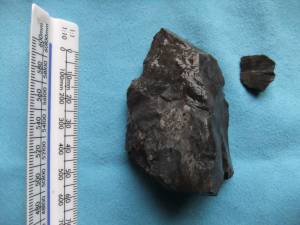 |
| Image 26 ID | 5027 |
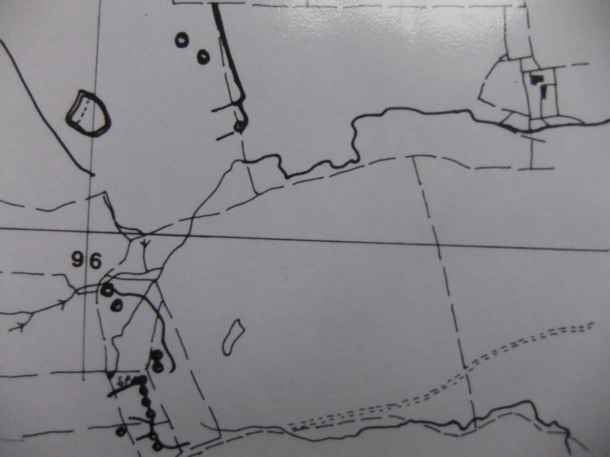
| Image 26 Description | Detail from Location Map, see above image 17, to show detail of the smaller settlement visited by the Group. | 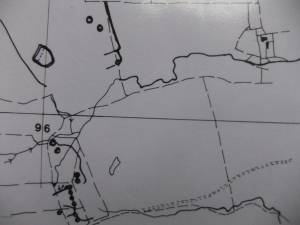 |
| Image 27 ID | 5030 |
| Image 27 Description | Chert core.From the smaller settlement. Photo Doug Waugh. | 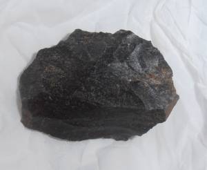 |
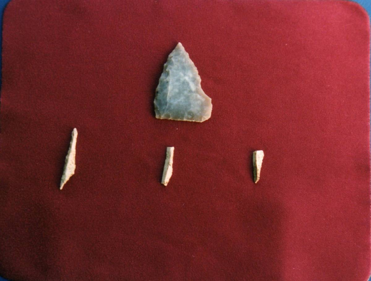
| Image 28 ID | 5031 |
| Image 28 Description | Lithic finds from Stake Fell Area. For details of the multi period lithic finds from this area see Laurie 2003 figure 65. | 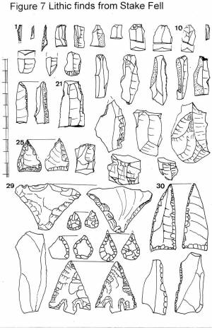 |
| Image 29 ID | 5034 |
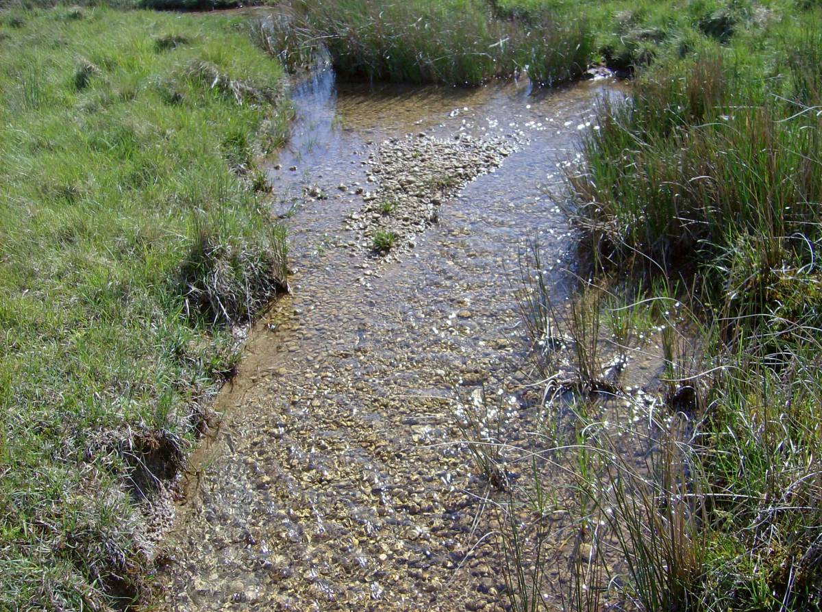
| Image 29 Description | Thornton Rust springs. Oncolite rich spring stream. | 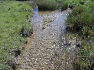 |
| Image 30 ID | 5033 |
| Image 30 Description | Primula farinosa. Thornton Rust Springs. | 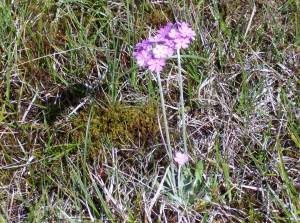 |