|
| *****SWAAG_ID***** | 799 |
| Date Entered | 10/04/2014 |
| Updated on | 10/04/2014 |
| Recorded by | Tim Laurie |
| Category | Geological Record |
| Record Type | Geomorphology |
| SWAAG Site Name | |
| Site Type | |
| Site Name | |
| Site Description | |
| Site Access | Public Access Land |
| Record Date | 08/04/2014 |
| Location | Fremington Edge, Solifluction Lobes below The Copperthwaite Lead Mine Scar. |
| Civil Parish | Reeth |
| Brit. National Grid | SE 050 998 |
| Altitude | 400m-300m |
| Geology | Complex landslips originating 400m AOD at kame terrace below a head wall on the Main Limestone Scar at Fremington Edge. |
| Record Name | Images of Fremington 1: Fremington Edge, Solifluction Lobes below the Copperthwaite lead Vein. |
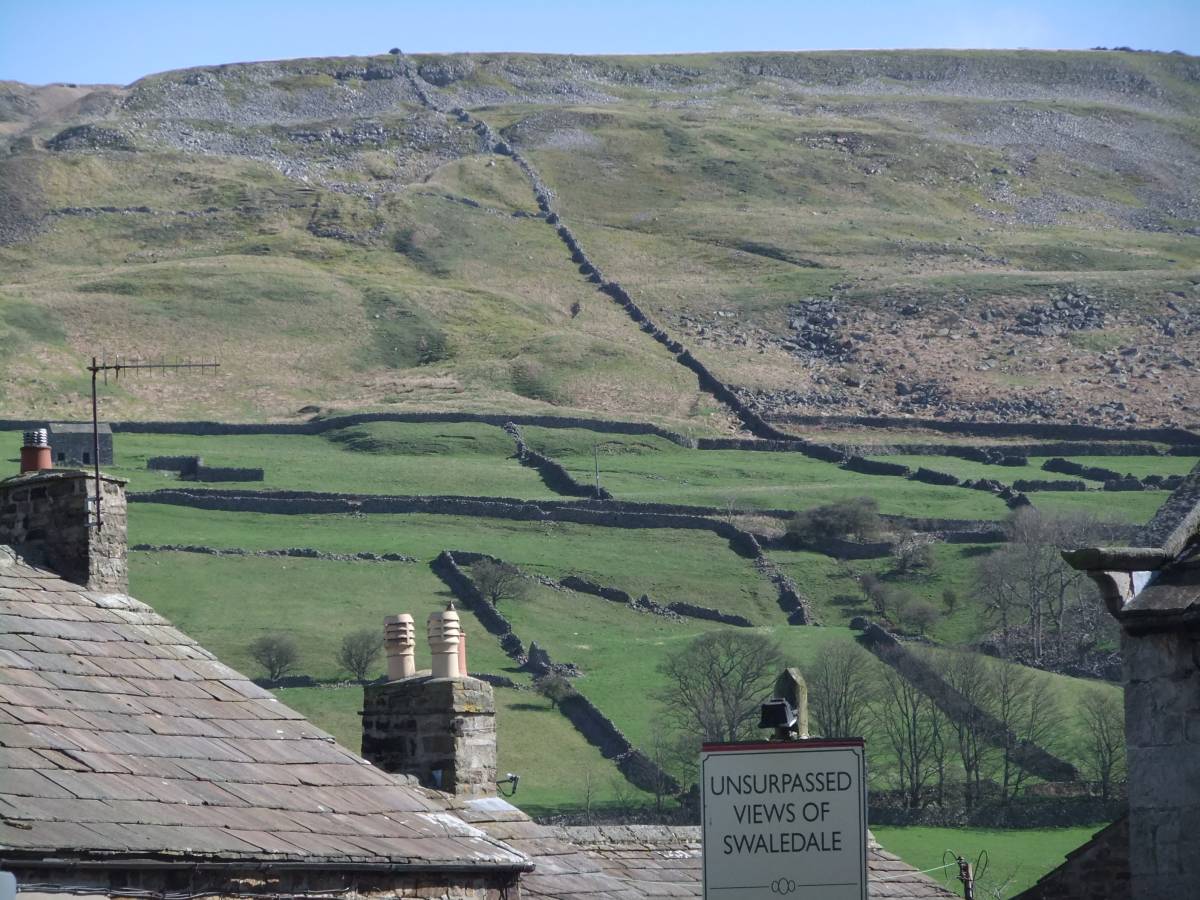
| Record Description | This record shows two periglacial landslips or solifluction lobes, one more recent and prominent than the other which both originate from the unconsolidated glacial debris and kame terrace which once concealed the vertical limestone cliff face of the highest scar at Fremington Edge on the south eastern side of the workings on the Copperthwaite Vein above High Banks House.
The more recent of the two landslips is readily visible on the photograph, Image No 1 taken at *10 from Reeth. Careful inspection of the photograph will show that this landslip cuts through an earlier landslip, the lower front edge of which survives at the the north west edge of the more recent slip. |
| Dimensions | See photographs |
| Geographical area | |
| Species | |
| Scientific Name | |
| Common / Notable Species | |
| Tree and / or Stem Girth | |
| Tree: Position / Form / Status | |
| Tree Site ID | 0 |
| Associated Site SWAAG ID | 0 |
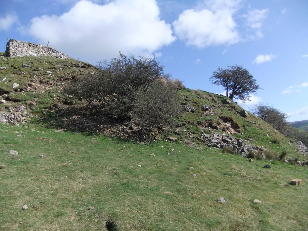
| Additional Notes | The front of the more recent of the two landslips can be seen on photo image 1 below the dry stone wall which marks the upper limit of the improved pastures just to the left of the long wall rising to Fremington Edge. The front edge of the landslip is very prominent at close hand and is shown on images 2 and 3.
From visual inspection these landslips were single events and resulted from super-saturated glacial debris flowing as a liquid mass of rock debris and clay.
The two landslips recorded here are large but by no means the largest of these spectacular landslip features to be seen on the slopes elsewwhere below Fremington Edge.
An opportunity may exist to examine early organic deposits which survive below these landslips. |
| Image 1 ID | 5359 Click image to enlarge |
| Image 1 Description | Landslip or solifluction lobe below Fremington Edge, below the north western end of Jabz Cave Scar, seen from Reeth |  |
| Image 2 ID | 5360 Click image to enlarge |
| Image 2 Description | Front of the landslip at close quarters |  |
| Image 3 ID | 5361 Click image to enlarge |
| Image 3 Description | Front of the landslip at close quarters |  |
| Image 4 ID | 5362 Click image to enlarge |
| Image 4 Description | Fremington Edge, with the chert quarries and the lead workings on Copperthwaite from Reeth. Landslips originate from glacial debris below the highest limestone Scar. | 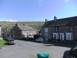 |