|
| *****SWAAG_ID***** | 807 |
| Date Entered | 08/05/2014 |
| Updated on | 08/05/2014 |
| Recorded by | Tim Laurie |
| Category | Geological Record |
| Record Type | Geomorphology |
| SWAAG Site Name | |
| Site Type | |
| Site Name | |
| Site Description | |
| Site Access | Public Access Land |
| Record Date | 04/05/2014 |
| Location | Gammersgill Moor |
| Civil Parish | Carlton Town |
| Brit. National Grid | SE 022 828 |
| Altitude | 445m |
| Geology | Glacial till over Richmond Chert strata. |
| Record Name | Harland Hill a glaciated landform with isolated drumlins well above 400m elevation. |
| Record Description | North and South Tarn Hills below Harland Hill are isolated drumlins at an elevation of 440m. Harland Hill itself has a very elegant glacial profile when viewed from the south. See photographs. |
| Dimensions | See photos |
| Geographical area | |
| Species | |
| Scientific Name | |
| Common / Notable Species | |
| Tree and / or Stem Girth | |
| Tree: Position / Form / Status | |
| Tree Site ID | 0 |
| Associated Site SWAAG ID | 0 |
| Additional Notes | This record supports the fact that glacial drumlins are present on the uppermost Dale Sides and on the High Pennine Plateau above 400m. When relatively small and isolated, these glacial mounds can readily be readily mistaken for round barrows |
| Image 1 ID | 5398 Click image to enlarge |
| Image 1 Description | An isolated mound of glacial origin, one of several similar drumlin mounds at 440m elevation at South Tarn Hills. | 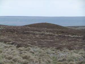 |
| Image 2 ID | 5399 Click image to enlarge |
| Image 2 Description | Harland Hill viewed from North Tarn Hills, this hill is formed by glacial ice flow from Namurian sandstones, with an extremely elegant glaciated profile. | 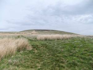 |
| Image 3 ID | 5400 Click image to enlarge |
| Image 3 Description | A drumlin surmounted by a drystone wall at North Tarn Hills | 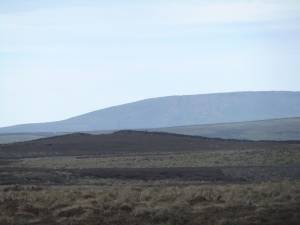 |
| Image 4 ID | 5401 Click image to enlarge |
| Image 4 Description | A second drumlin surmounted by a drystone wall at North Tarn Hills | 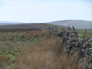 |
| Image 5 ID | 5402 Click image to enlarge |
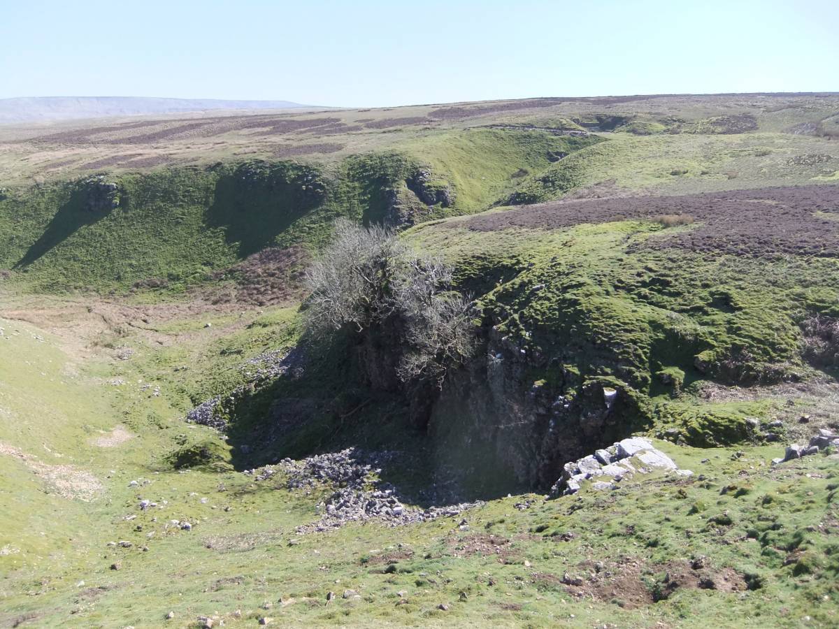
| Image 5 Description | Cumma Gill, an enlarged meltwater channel. Viewed from the lead mine workings at the western end. | 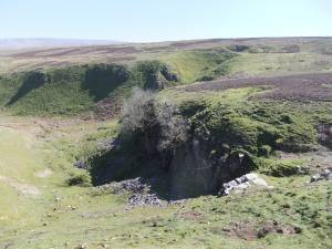 |
| Image 6 ID | 5403 Click image to enlarge |
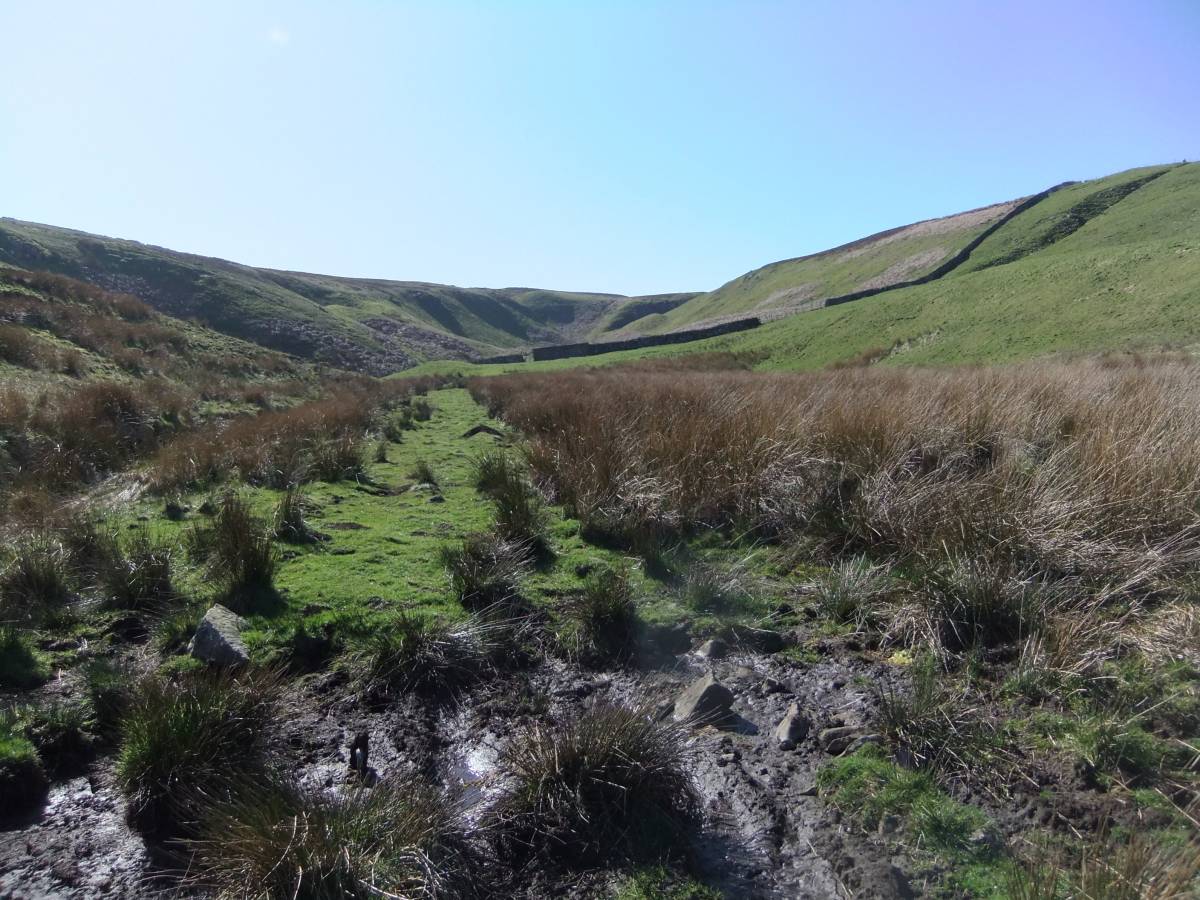
| Image 6 Description | Cumma Gill with its insignificant stream, once a raging torrent of seasonal meltwater. |  |