|
| *****SWAAG_ID***** | 806 |
| Date Entered | 04/05/2014 |
| Updated on | 04/05/2014 |
| Recorded by | Tim Laurie |
| Category | Burial Mounds and Cairns |
| Record Type | Archaeology |
| SWAAG Site Name | |
| Site Type | |
| Site Name | |
| Site Description | |
| Site Access | Private |
| Record Date | 02/05/2014 |
| Location | West Burton. Pasture below Morpeth Wood south of Mountstritch Springs. |
| Civil Parish | Burton cum Walden |
| Brit. National Grid | SE 0270 8805 |
| Altitude | 190m |
| Geology | Terrace formed by the Hardraw Scar Limestone. |
| Record Name | Pasture below Morpeth Wood. Mountstritch Springs. Round barrow below modern field wall |
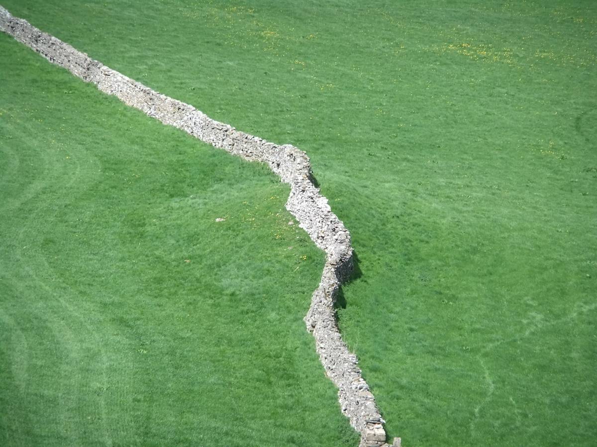
| Record Description | Round barrow preserved below modern dry stone field wall crossing the terrace formed from the Hardraw Scar Limestone at Mountstritch below Morpeth Wood.
This round barrow was first recognised and photographed from the public footpath to the Knights Templars Preceptory from Morpeth Gate during the recording of two burnt mounds located at springs below Morpeth Wood.
This round barrow is not elongated as characteristic of glacial drumlins, is turf covered and appears to be of stone cobble composition. The original circumference of the barrow has been substantially reduced in size by ploughing but this mound is otherwise intact. |
| Dimensions | See photograph. |
| Geographical area | |
| Species | |
| Scientific Name | |
| Common / Notable Species | |
| Tree and / or Stem Girth | |
| Tree: Position / Form / Status | |
| Tree Site ID | 0 |
| Associated Site SWAAG ID | 0 |
| Additional Notes | The juxtaposition of this round barrow with the lowest two of a linear group of nine burnt mounds on the line of springs which rise intermittently below the highest springs at SE08164 86317, 444m AOD just 300m east of the prehistoric round house settlement on Burton Moor, is of considerable interest. For details of these burnt mounds, See separate SWAAG Records. |
| Image 1 ID | 5392 Click image to enlarge |
| Image 1 Description | The round barrow is clearly visible where overlain by the dry stone field wall |  |
| Image 2 ID | 5393 Click image to enlarge |
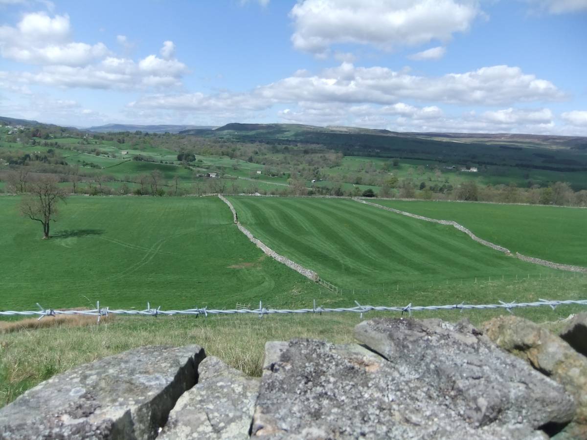
| Image 2 Description | View of the Mountstritch Pastures from the footpath below Morpeth Wood. |  |
| Image 3 ID | 5394 Click image to enlarge |
| Image 3 Description | Burnt mound at Spring rise below Morpeth Wood. The presence of slag indicates smelting activity here and that this burnt mound may have been reused as an iron bloomery site. |  |
| Image 4 ID | 5395 Click image to enlarge |
| Image 4 Description | Burnt mound below Morpeth Wood at SE0289 8814 | 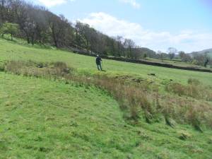 |
| Image 5 ID | 5396 Click image to enlarge |
| Image 5 Description | Slag from smelting on the burnt mound. | 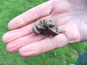 |
| Image 6 ID | 5397 Click image to enlarge |
| Image 6 Description | The second burnt mound a below a spring rise at SE0289 8813 | 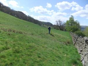 |