|
| *****SWAAG_ID***** | 815 |
| Date Entered | 15/07/2014 |
| Updated on | 16/07/2014 |
| Recorded by | Tim Laurie |
| Category | Geological Record |
| Record Type | Geological HER |
| SWAAG Site Name | |
| Site Type | |
| Site Name | |
| Site Description | |
| Site Access | Public Access Land |
| Record Date | 30/06/2014 |
| Location | Forest of Stainmore, Below Burnt Hill. Plat. |
| Civil Parish | Not known |
| Brit. National Grid | NY 880 101 |
| Altitude | 470m |
| Geology | Limestone pavement, formed from a wide surface exposure of The Little Limestone. Reference: British Geological Survey, Sheet 31: 'Brough-under Stainmore.' |
| Record Name | Stainmore Forest. Plat. An area of Limestone Pavement between Plat Sike and Little Plat Sikes |
| Record Description | Limestone pavements are always of exceptional geological, geomorphological and botanical interest especially when located at the heart of Stainmore within an area of Namurian Grits which give rise to unrelieved acidic moorland vegetation. The wide expanse of limestone pavement which exists at Plat is no exception being an island of calcareous grassland vegetation. The limestone pavement has until recently been concealed below 2-3m deep blanket peat, however during recent centuries the deep blanket peat has been removed from a substantial area by erosion .
The Little Limestone, one of the two thin limestones stratagraphically above the Main Limestone, is usually concealed below glacial drift and is seen only in section or in the bed of streams. |
| Dimensions | 400m * 400m overall, approx |
| Geographical area | |
| Species | |
| Scientific Name | |
| Common / Notable Species | |
| Tree and / or Stem Girth | |
| Tree: Position / Form / Status | |
| Tree Site ID | 0 |
| Associated Site SWAAG ID | 0 |
| Additional Notes | This is a preliminary record following initial recognition of the exposed limestone and and the record and photo images will be updated following a further visit to determine the extent and special features of the Pavement. |
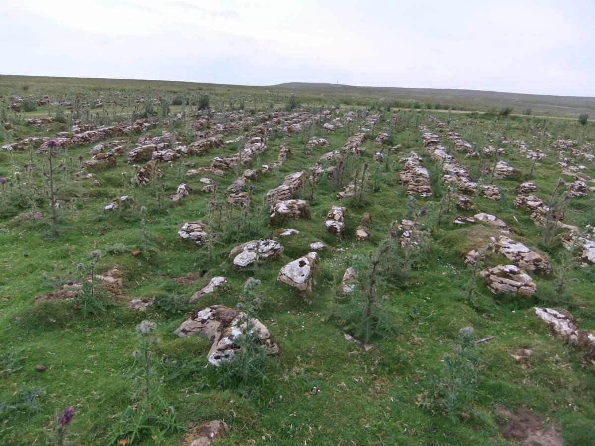
| Image 1 ID | 5556 Click image to enlarge |
| Image 1 Description | Plat, an area of limestone pavement at the heart of Stainmore. | 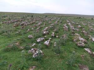 |
| Image 2 ID | 5557 Click image to enlarge |
| Image 2 Description | View of the Namurian Grits of Brown Hill from Plat Sike | 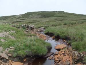 |
| Image 3 ID | 5558 Click image to enlarge |
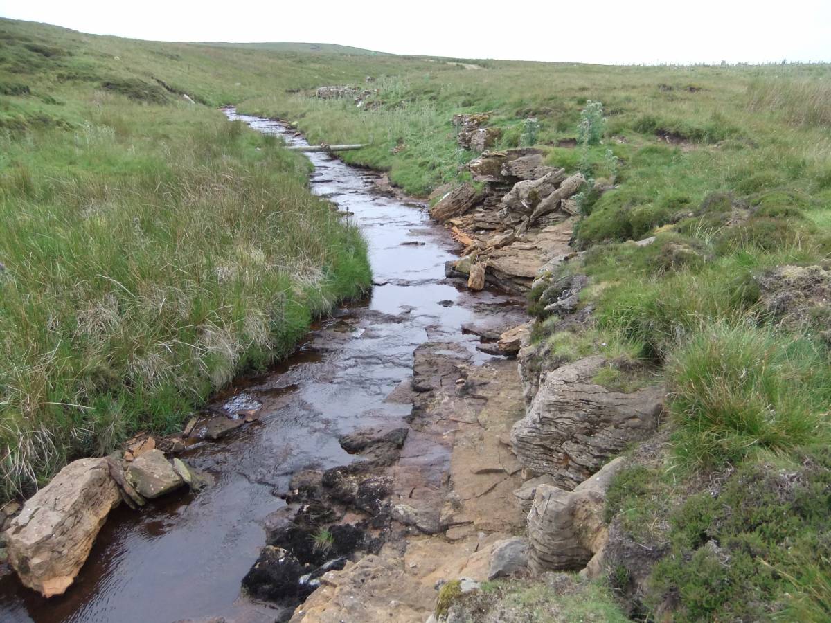
| Image 3 Description | The Little Limestone forms the northern bank of Plat Sike. |  |
| Image 4 ID | 5559 Click image to enlarge |
| Image 4 Description | The Little Limestone forms the northern bank of Plat Sike. | 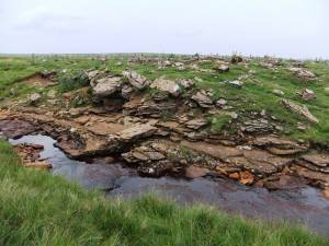 |
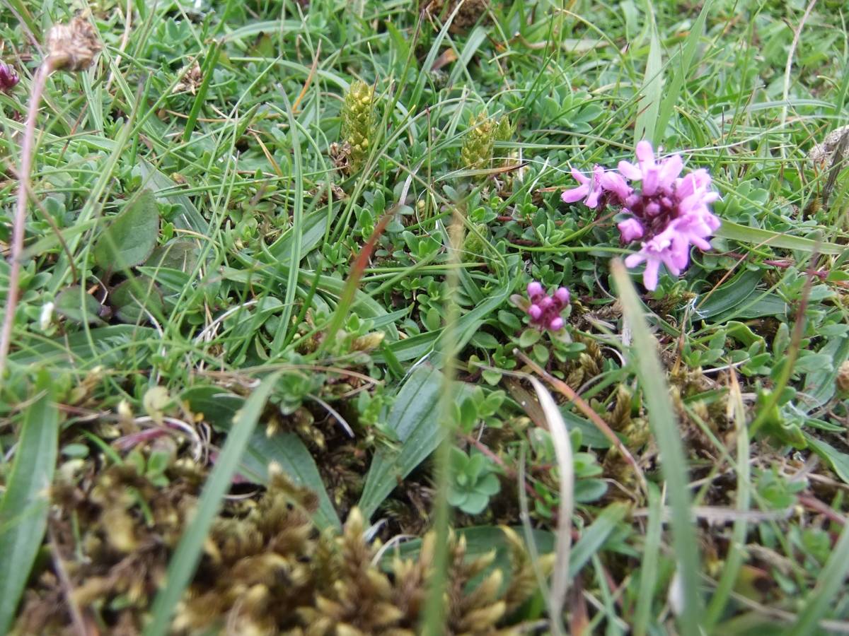
| Image 5 ID | 5560 Click image to enlarge |
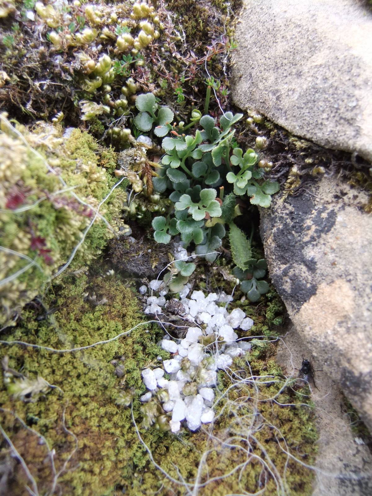
| Image 5 Description | Detail of the species rich limestone vegetation at Plat including Thyme and the diminutive Least Clubmoss. | 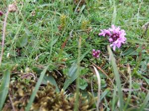 |
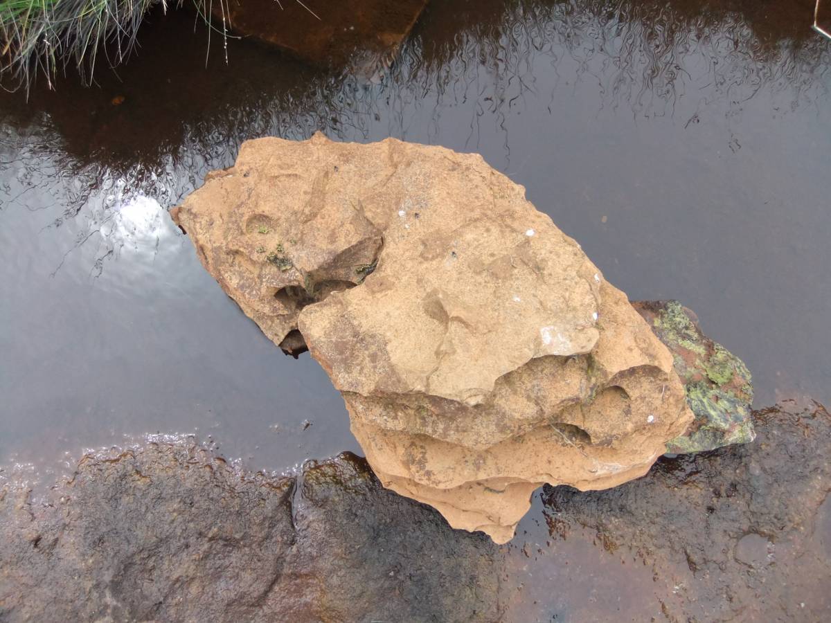
| Image 6 ID | 5561 Click image to enlarge |
| Image 6 Description | Water worn limestone in Plat Sike |  |
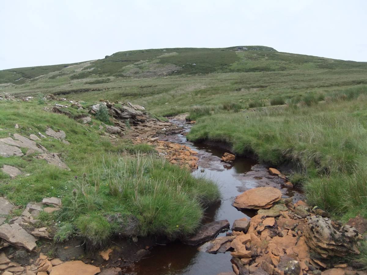
| Image 7 ID | 5562 Click image to enlarge |
| Image 7 Description | Plat Sike, view upstream. The Little Limestone forms the northern bank. | 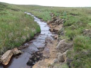 |
| Image 8 ID | 5565 Click image to enlarge |
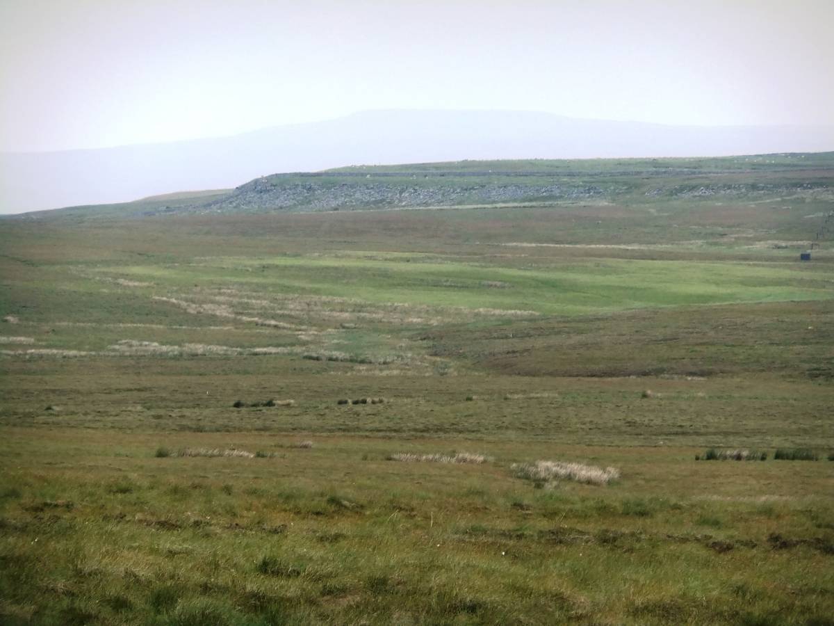
| Image 8 Description | View north westward across Plat towards Risp Howe. | 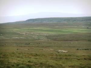 |
| Image 9 ID | 5566 Click image to enlarge |
| Image 9 Description | Detail of the Little Limestone with Green Spleenwort and Wall-rue ferns in crevices | 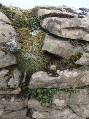 |
| Image 10 ID | 5567 Click image to enlarge |
| Image 10 Description | Wall rue fern. |  |