|
| *****SWAAG_ID***** | 394 |
| Date Entered | 10/12/2011 |
| Updated on | 10/12/2011 |
| Recorded by | Tim Laurie |
| Category | Settlement |
| Record Type | Archaeology |
| SWAAG Site Name | |
| Site Type | |
| Site Name | |
| Site Description | |
| Site Access | Army Range |
| Record Date | 01/01/2005 |
| Location | Ellerton Moor. Spur above and to the west of Juniper Gill |
| Civil Parish | Ellerton Abbey |
| Brit. National Grid | SE 073 960 |
| Altitude | 365m |
| Geology | Strata above the Main Limestone. |
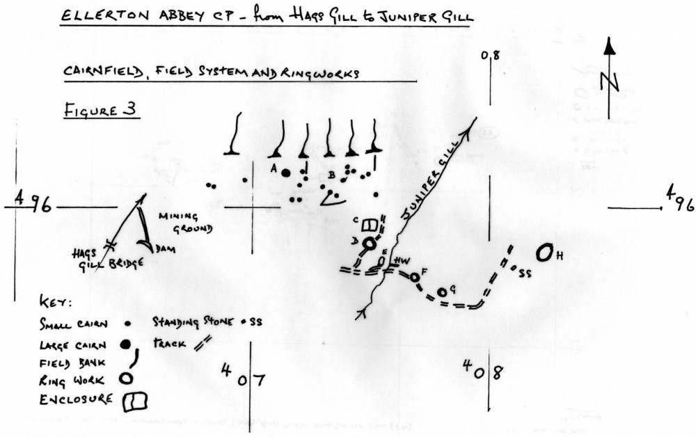
| Record Name | ELL05 Ellerton Moor. Bronze Age Cairnfield Settlement and Field System above Juniper Gill |
| Record Description | See Figure 1 and cairns at B on Figure 3
Coaxial field system with scattered cairns (20 recorded to date) averaging 4m diameter in area of thick heather on upper slope of the spur west of Juniper Gill.
The field banks are difficult to see in thick heather and have not been fully recorded on Figure 3.
NOTE! ARMY RANGE DANGER AREA!
This site is on an active Army Firing Range.
Access is NOT ALLOWED without express written permission from the Army Range Authorities.
(SE 073 960 centre) |
| Dimensions | See Location Plan, Figure 4 |
| Geographical area | |
| Species | |
| Scientific Name | |
| Common / Notable Species | |
| Tree and / or Stem Girth | |
| Tree: Position / Form / Status | |
| Tree Site ID | 0 |
| Associated Site SWAAG ID | 0 |
| Additional Notes | This cairnfield occupies the high elevation valley spur location so characteristic of these enigmatic Bronze Age settlements. See the separate texts in my Introduction to ‘Cairnfields’ and ‘Coaxial Field Systems’ for the chronology and characteristics of these complex sites.
The cairnfield and coaxial field system should be considered integral to the Ring Cairn and Unenclosed Settlement at the head of Juniper Gill, ELL06, 07.
|
| Image 1 ID | 1650 Click image to enlarge |
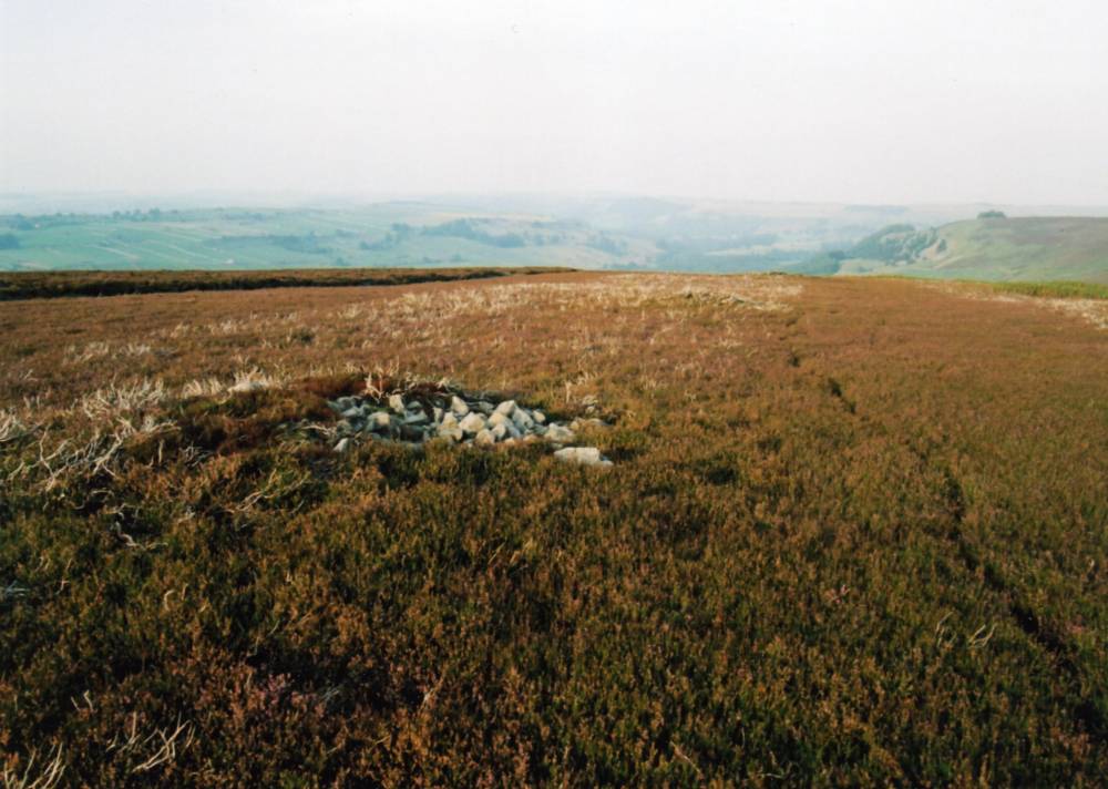
| Image 1 Description | Three aligned cairns above Juniper Rig. |  |
| Image 2 ID | 1651 Click image to enlarge |
| Image 2 Description | Field boundary visible after heather burning. | 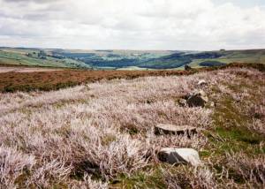 |
| Image 3 ID | 1645 Click image to enlarge |
| Image 3 Description | Location Plan and preliminary survey. Cairnfield and field system at Juniper Gill. |  |