|
| *****SWAAG_ID***** | 755 |
| Date Entered | 15/09/2013 |
| Updated on | 15/09/2013 |
| Recorded by | Tim Laurie |
| Category | Earthworks |
| Record Type | Archaeology |
| SWAAG Site Name | |
| Site Type | |
| Site Name | |
| Site Description | |
| Site Access | Public Access Land |
| Record Date | 13/09/2013 |
| Location | Tor Dike, Coverhead. Eastern section from the unfenced road above Kettlewell to the Black Dike. |
| Civil Parish | Carlton Highdale |
| Brit. National Grid | SD 98901 75591 |
| Altitude | 500m |
| Geology | South facing escarpment formed by the outcrop of the Main Limestone. |
| Record Name | The Tor Dike. Eastern section from the unfenced road above Kettlewell to the junction with The Black Dike. |
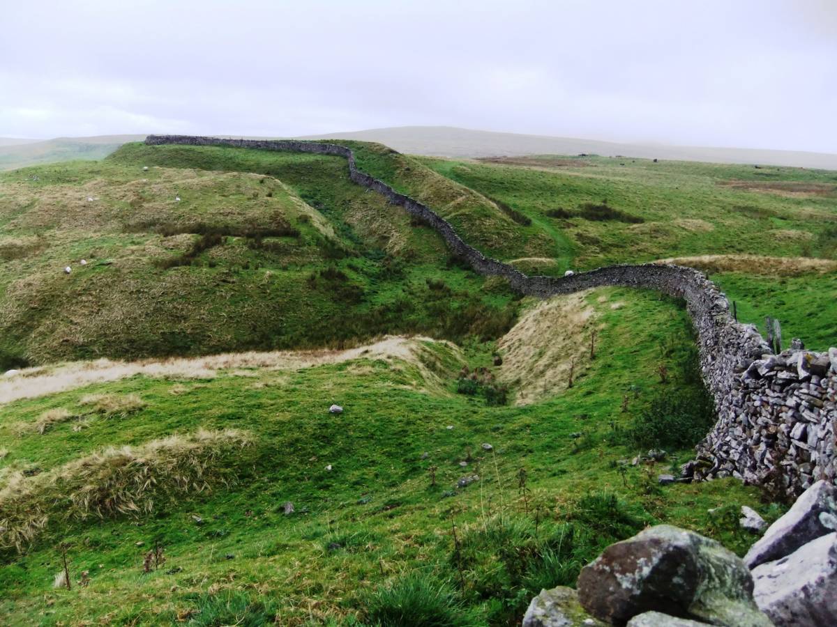
| Record Description | This is Part Two* of a photographic record of several visits made to the as yet undated impressive linear earthwork known as the Tor Dike. Tor Dike bears visual comparison of scale and appearance with the linear earthwork on High Harker Hill recently excavated by SWAAG and now dated to (to follow)..... The Tor Dike comprises a rock cut ditch, berm and a very substantial earthen or rock rubble bank (the rampart) which has now been extensively quarried for material when building the dry stone wall which closely follows Tor Dike at the top edge of the natural limestone escarpment.
Tor Dike can be characterised by stating that the earthwork takes maximum advantage of the natural barrier provided by the sheer scars of the limestone escarpment. However the sheer limestone scars are not continuous and in several places the cliff face is masked by glacial till and easy access is possible up a steep grass slope to the high moorland above. In other places the 'wall' of limestone cliff are breached at several places by spring streamlets.
However, the linear earthwork is especially strong at these weak points, the ditch is very deep and the bank is heightened and especially substantial.
Tor Dike once thought to have been constructed as a final Iron Age or Brigantian defence against Roman advance, is now considered to have formed the North Eastern Boundary of the kingdom of Craven. (Reference: Robert White, 1997. 'English Heritage Book of the Yorkshire Dales' Chapter 4). |
| Dimensions | Approximately 2km in length from Top Mere Gate on the Starbotton Road to the junction with the Black Dike. |
| Geographical area | |
| Species | |
| Scientific Name | |
| Common / Notable Species | |
| Tree and / or Stem Girth | |
| Tree: Position / Form / Status | |
| Tree Site ID | 0 |
| Associated Site SWAAG ID | 0 |
| Additional Notes | * See also SWAAG Database Record Nos
It is intended to provide a comprehensive photographic record of the 2km length of Tor Dike taken during several visits made at different years and times of year under different weather conditions. |
| Image 1 ID | 4696 Click image to enlarge |
| Image 1 Description | Moonrise over Whernside with Scots Dike. | 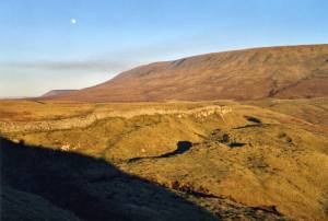 |
| Image 2 ID | 4686 Click image to enlarge |
| Image 2 Description | Guardian of the Dike. | 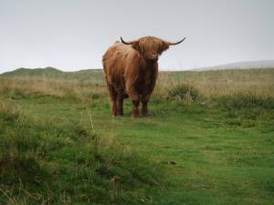 |
| Image 3 ID | 4688 Click image to enlarge |
| Image 3 Description | Tor Dike at SD98901 75591 with entrance causeway through the Dike. | 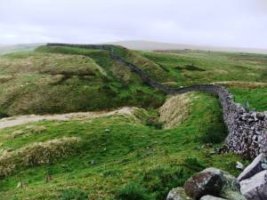 |
| Image 4 ID | 4687 Click image to enlarge |
| Image 4 Description | | 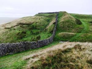 |
| Image 5 ID | 4690 Click image to enlarge |
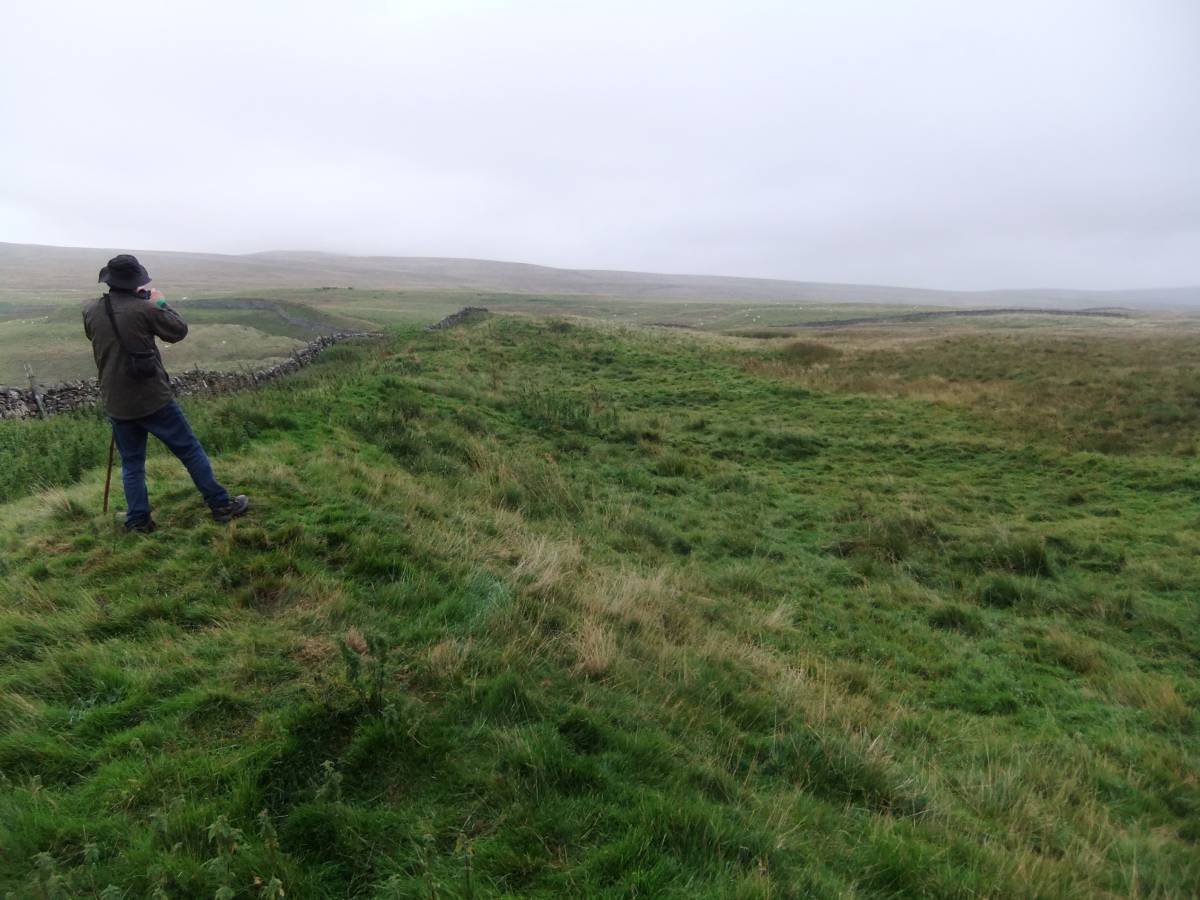
| Image 5 Description | View westward from above the eastern extremity of the Tor Dike and junction with The Black Dike | 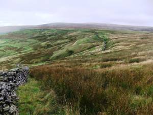 |
| Image 6 ID | 4691 Click image to enlarge |
| Image 6 Description | The Black Dike, infilled and not clearly visible here, is assumed to follow the line of this modern dry stone wall to rise to the summit ridge of Great Whernside at around 699m Elevation. | 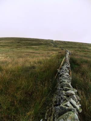 |
| Image 7 ID | 4692 Click image to enlarge |
| Image 7 Description | The Black Dike is visible where it rises to cross the skyline and run beyond to the summit ridge of Great Whernside. Black Dike formed Township, Parish, Deanery, Wapentake and until 1974, the County Boundary (R.F.White 1974). | 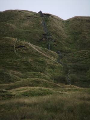 |
| Image 8 ID | 4699 Click image to enlarge |
| Image 8 Description | Terrace like features below the dike and the complex of small enclosures and huts which abut the tbank above the Dike are probable shieling type settlements, seasonal meetings and markets for the communities of Wharfedale and Coverdale at either side of the Boundary. |  |
| Image 9 ID | 4701 Click image to enlarge |
| Image 9 Description | The complex of small enclosures and huts which abut the bank above the Dike are probable shieling type settlements | 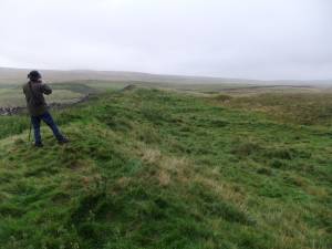 |