|
| *****SWAAG_ID***** | 756 |
| Date Entered | 16/09/2013 |
| Updated on | 16/09/2013 |
| Recorded by | Tim Laurie |
| Category | Earthworks |
| Record Type | Archaeology |
| SWAAG Site Name | |
| Site Type | |
| Site Name | |
| Site Description | |
| Site Access | Public Access Land |
| Record Date | 13/09/2013 |
| Location | Tor Dike, Coverhead. Western section from the unfenced road above Kettlewell to the western terminus at SD9765 7561 close to the Starbotton Road |
| Civil Parish | Carlton Highdale |
| Brit. National Grid | SD 9809 7545 |
| Altitude | 500m |
| Geology | South facing escarpment formed by the outcrop of the Main Limestone. |
| Record Name | The Tor Dike. Western section from the unfenced road above Kettlewell to the terminus at SD9765 7561 the terminus near the Starbotton Road |
| Record Description | This is Part Three* of a photographic record of several visits made to the as yet undated impressive linear earthwork known as the Tor Dike. Tor Dike bears visual comparison of scale and appearance with the linear earthwork on High Harker Hill recently excavated by SWAAG and now dated to (to follow)..... The Tor Dike comprises a rock cut ditch, berm and a very substantial earthen or rock rubble bank (the rampart) which has now been extensively quarried for material when building the dry stone wall which closely follows Tor Dike at the top edge of the natural limestone escarpment.
Tor Dike can be characterised by stating that the 2km long earthwork takes maximum advantage of the natural barrier provided by the sheer scars of the limestone escarpment. However the sheer limestone scars are not continuous and in several places the cliff face is masked by glacial till and easy access is possible up a steep grass slope to the high moorland above. In other places the 'wall' of limestone cliff are breached at several places by spring streamlets.
However, the linear earthwork is especially strong at these weak points, the ditch is very deep and the bank is heightened and especially substantial.
Tor Dike once thought to have been constructed as a final Iron Age or Brigantian defence against Roman advance, is now considered to have formed the North Eastern Boundary of the kingdom of Craven. (Reference: Robert White, 1997. 'English Heritage Book of the Yorkshire Dales' Chapter 4). |
| Dimensions | Approximately 2km in total length from the presumed junction with the Black Dike at SD9914752 4 |
| Geographical area | |
| Species | |
| Scientific Name | |
| Common / Notable Species | |
| Tree and / or Stem Girth | |
| Tree: Position / Form / Status | |
| Tree Site ID | 0 |
| Associated Site SWAAG ID | 0 |
| Additional Notes | The total length of The Tor Dike is approximately 2km from the eastern terminus at the presumed junction with the Black Dike at SD9914752 westward to the unfenced road From Carlton in Coverdale to Kettlewell in Wharfedale and beyond to the western terminus at SD9765756. The Dike to the west of the road is at first a rock cut ditch below a sheer cliff with no visible bank. However for the larger part the Dike comprises rock cut ditch and a substantial limestone rubble unfaced bank which has been extensively quarried for stone in the construction of the dry stone wall which follows close above the limestone scar and the earthwork.
The most notable feature of this western section is the wide causewayed entrance through the earthwork which is protected by a linear bank or 'Titulus' located some 20 m below the ditch and directly below the causeway across the ditch. It may be fortuitous that this 'Titulus' like bank resembles the characteristic defensive mounds in front of the entrances to Roman Forts.
A second hollow way trackway penetrates the earthwork but no special defences here indicate that it is a later trackway.
As noted in the previous record for the eastern section of the Dike, there are small stone banked enclosures above and below the Dike which indicate the activity of pasturalists on either side of this boundary. |
| Image 1 ID | 4702 Click image to enlarge |
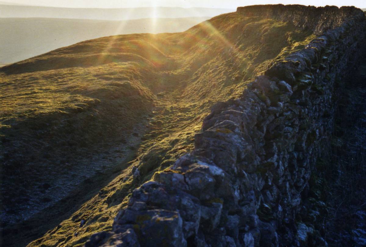
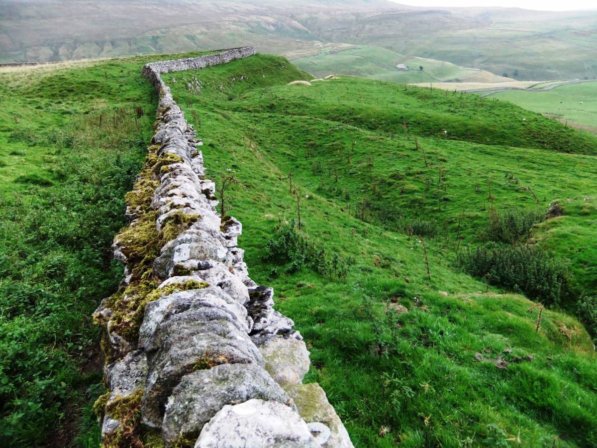
| Image 1 Description | Tor Dike west of the road, view eastward to Whernside | 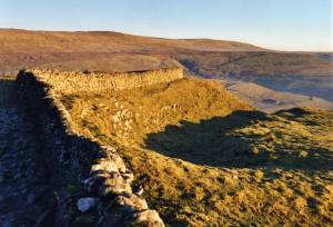 |
| Image 2 ID | 4703 Click image to enlarge |
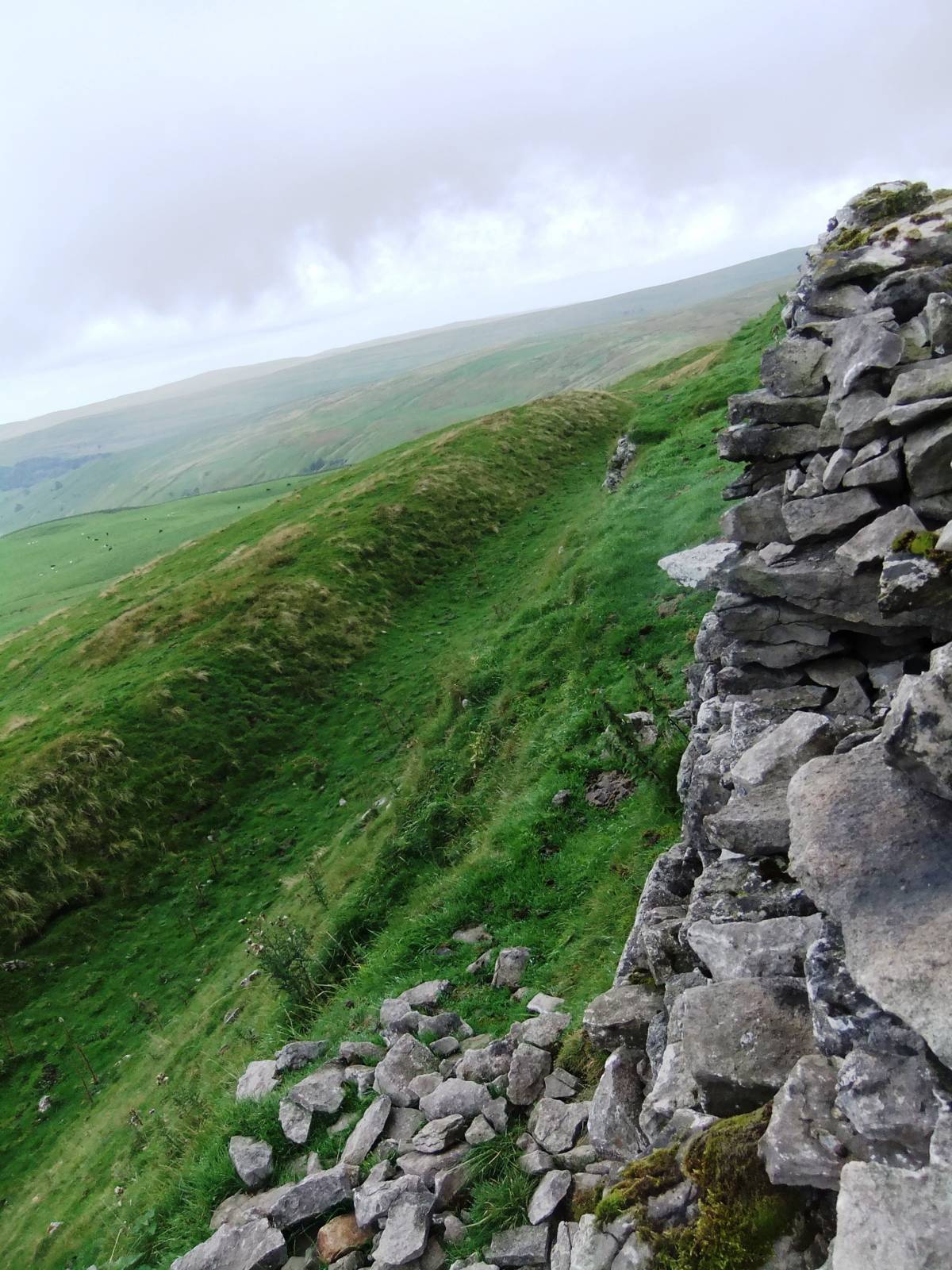
| Image 2 Description | Tor Dike west of the road |  |
| Image 3 ID | 4704 Click image to enlarge |
| Image 3 Description | Beware bull ahead. Chance being gored or breaking your neck on the other side of the wall. He proved to be friendly. | 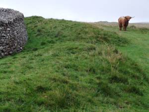 |
| Image 4 ID | 4705 Click image to enlarge |
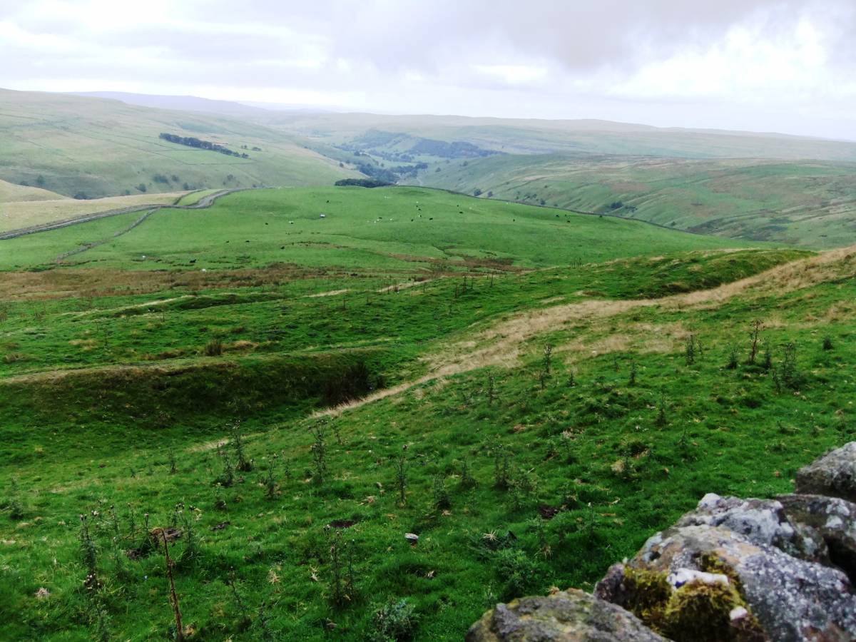
| Image 4 Description | Rock cut ditch below the Scar, east of the main casewayed entrance. |  |
| Image 5 ID | 4706 Click image to enlarge |
| Image 5 Description | Rock cut ditch below the Scar, east of the main casewayed entrance. |  |
| Image 6 ID | 4707 Click image to enlarge |
| Image 6 Description | The main causewayed entrance with titulus like bank 20m downslope and directly below the causeway. |  |
| Image 7 ID | 4708 Click image to enlarge |
| Image 7 Description | Hollow Way track cutting the Dike. |  |
| Image 8 ID | 4709 Click image to enlarge |
| Image 8 Description | The rock cut ditch and limestone scar close to the western terminus. | 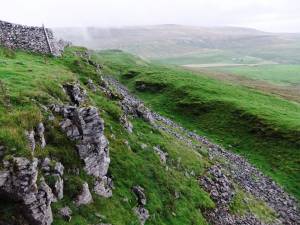 |