|
| *****SWAAG_ID***** | 773 |
| Date Entered | 15/01/2014 |
| Updated on | 17/01/2014 |
| Recorded by | Tim Laurie |
| Category | Coaxial Field Systems |
| Record Type | Archaeology |
| SWAAG Site Name | |
| Site Type | |
| Site Name | |
| Site Description | |
| Site Access | Public Access Land |
| Record Date | 14/01/2014 |
| Location | Grinton Moor, from Grinton Lodge to How and Ridley Hushes via Grinton Smelt Mill returning across How Hill |
| Civil Parish | Grinton |
| Brit. National Grid | SE 040 964 |
| Altitude | 250-420m |
| Geology | Strata above and below The Main Limestone. Strata below the Underset Limestone concealed below glacial drift. |
| Record Name | Images of historic landscapes on Grinton Moor from Grinton Lodge to How and Ridley Hushes |
| Record Description | This record comprises photographic images of the historic and prehistoric landscapes of Grinton Moor taken during a walk from Grinton Lodge to and from the mining grounds at How and Ridley Hushes on How Hill attended by a strong party of SWAAG Members in January 2014. These images are of a landscape which has constantly changed through time in consequence of human economic activity, both pastoral and industrial, and of climate change. Archaeological remains of an ancient field system which extended far above the upper limit of the present stone walled pastures across what is now heather moorland to reach the moorland plateau at an elevation of 410m at Ridley Hush on How Hill SE040964. Pollen evidence indicates that around 2400BC at the arrival of the first pastoral farmers, the south facing slopes of Swaledale were entirely covered with mixed deciduous woodland from river to the highest limestone scars. Birch and stunted oak woodland covered the high plateau with light hazel scrub over limestone outcrop. Alder groves were present at spring flushed slopes. In response to increasing grazing pressures, the whole of the upper dale slopes were enclosed by a planned and managed landscape of parallel or co-axial field boundaries now visible as substantial banks of rock and rubble bleached white where exposed by removal of overlying peat and heather. These ancient field boundaries can be interpreted as originating as fence lines which soon developed into hedgerows with hedgerow trees probably much as the Swaledale farms of pre-war days being self supporting with one or two milk cows, and goats but centred on sheep for intensive production of wool, cheese and meat. Copses of ash, elm, oak and lime trees and thickets of hazel and blackthorn were present on steep declivities of hard rock to complete, at least to my eyes, a park like idyllic prehistoric dales landscape of tree lined fields fields rich in hay meadow flowers and of scattered woodlands teeming with aurochsen - the wild cattle, red and roe deer, hare and squirrel but no rabbits! The presence of wolf, bear, lynx, fox and marten imposed the necessity for constant shepherding and protection of stock within enclosure at night . This Bronze Age Swaledale Eden supported the first seasonal, transhumant pioneering farmstead settlements of substantial timber round houses with attached paddock like fields located close to the most constant springs where the numerous burnt mounds of fire cracked sandstone survive today interpreted as sweat house-saunas. In due course, following clearance of the more dense woodland of the lower slopes, the first permanent settlements were established on the lower dale slopes. The present open heather moorland landscape developed only at the end of the Iron Age with heather becoming dominant during the Roman period following over grazing, leaching of the soils, acidification and podsolization of the original soils. Subsequently these original fields having been abandoned, the upper slopes of Grinton Moor were incorporated within the preserves of the stag hunts of the medieval lord with subsistence deer management for venison. Finally all the open moorland was the objective of the prospections and labours of lead miner. For comparative purposes, selected images of the same landscapes taken some years ago are included to illustrate the constant changes to the moorland vegetation. |
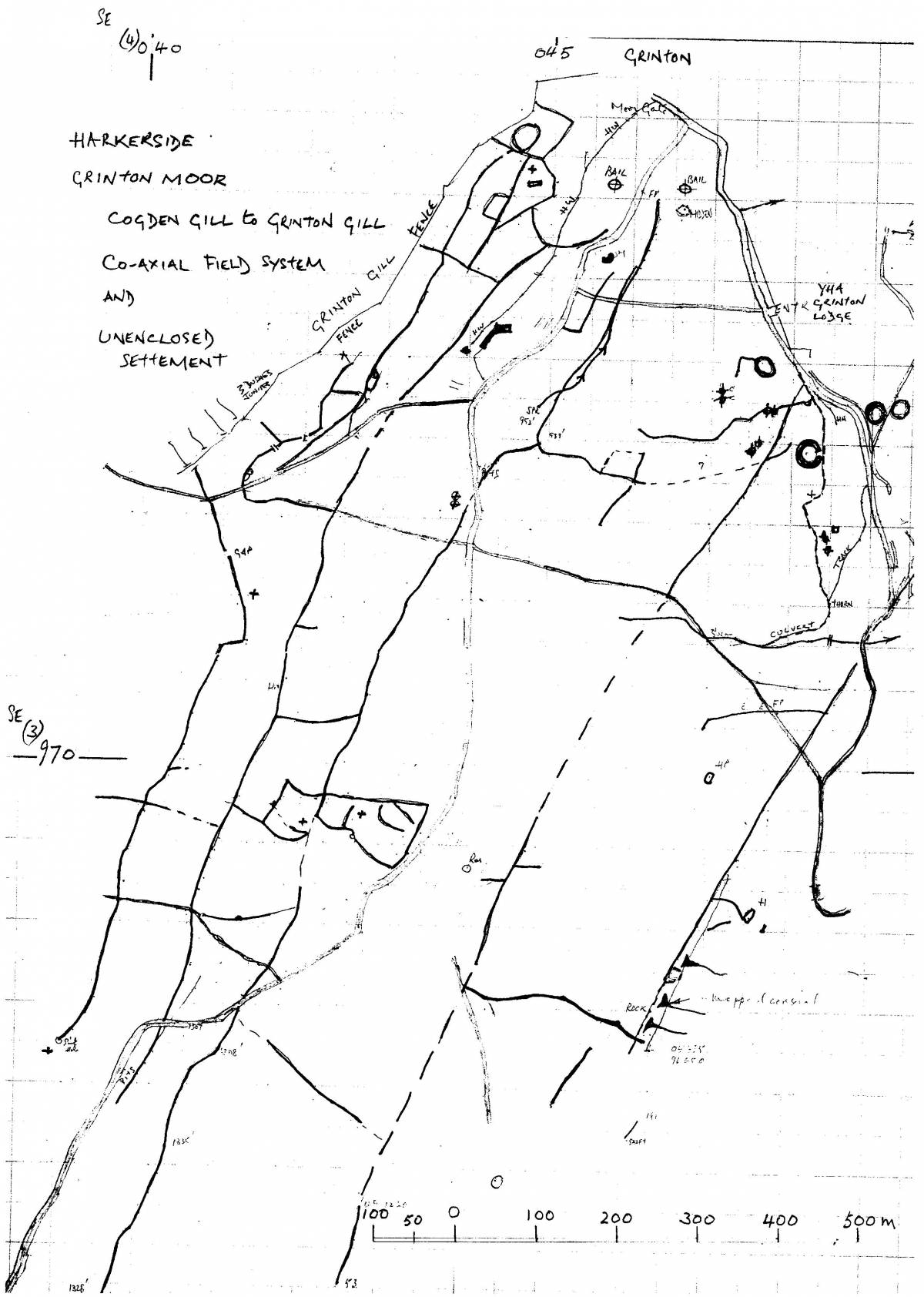
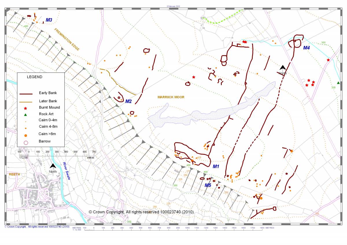
| Dimensions | See figure 01. |
| Geographical area | |
| Species | |
| Scientific Name | |
| Common / Notable Species | |
| Tree and / or Stem Girth | |
| Tree: Position / Form / Status | |
| Tree Site ID | 0 |
| Associated Site SWAAG ID | 0 |
| Additional Notes | The coaxial field systems south of the Swale, on Grinton Moor and on Harkerside Moor share the same NNE/SSW axis and high elevation as those on the northern side of Swaledale on Copperthwaite Allotment, on Marrick Moor and on Skelton Moor above Marske . These field systems are very extensive, those on Marrick Moor and on Skelton Moor cover an area of 9km2. The field systems reach an elevation of 420m on Copperthwaite Allotment and 415m on How Hill, Grinton Moor. This shared axis implies the contemporary prehistoric (ie Bronze Age) existence of a communal or tribal hierarchy with the authority and ability to plan and impose the construction of these systems of land division.
For comparison with those on Grinton Moor, a number of images of the high level coaxial field boundaries at 400m elevation across the Dale above Fremington Edge on Copperthwaite Allotment, Marrick Moor are included in this record.
NOTE!
The Maps have been extracted from: 'T.C. Laurie with N.W. Mahaffy and R.F.White. 2011. 'Co-axial Field Systems in Swaledale: a reassessment following recent fieldwork.' in R.D. Martlew, ED. 'Prehistory in the Yorkshire Dales, pp37- 59.' Published by Place/Yorkshire Dales Landscape Research Trust. All the other hand drawn survey maps are my own The maps and photographs within the Place Publication 2011 Paper are both Crown Copyright and Copyright Individual Authors. |
| Image 1 ID | 4964 Click image to enlarge |
| Image 1 Description | Grinton How Hush. Ann leads the way! | 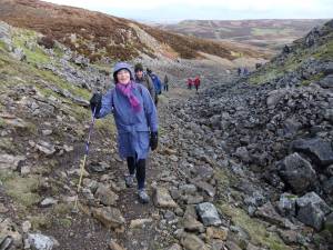 |
| Image 2 ID | 4978 Click image to enlarge |
| Image 2 Description | SWAAG at Ridley Hush. One for the album. | 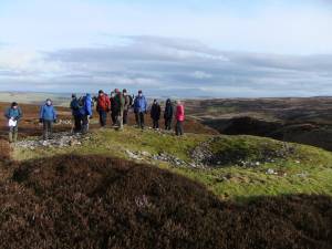 |
| Image 3 ID | 4947 Click image to enlarge |
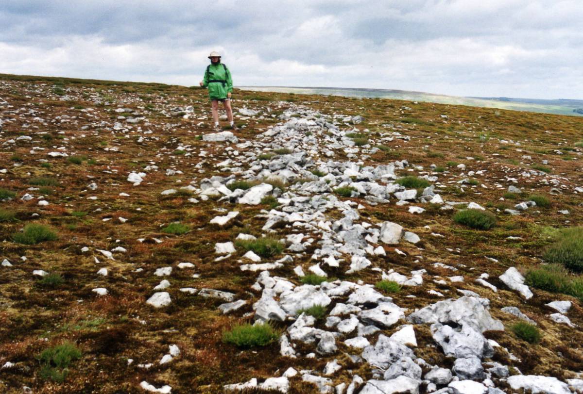
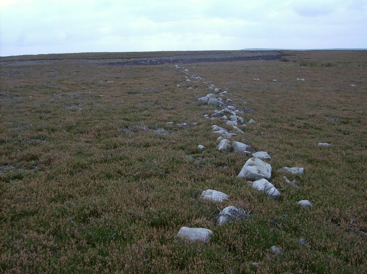
| Image 3 Description | Coaxial field boundary at Ridley Hush. This substantial prehistoric field boundary bank of white weathered chert rocks was revealed after an intense moorland fire burnt off all peat and vegetation from a large area, photographed some 20 years ago. | 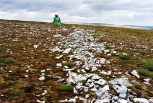 |
| Image 4 ID | 4976 Click image to enlarge |
| Image 4 Description | Twenty years after the fire, heather has reseeded in clumps leaving open areas colonised by brightly coloured soil forming mosses and lichens. | 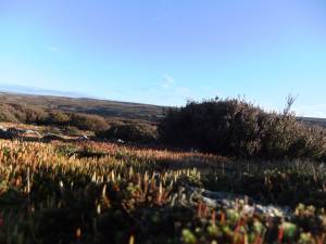 |
| Image 5 ID | 4977 Click image to enlarge |
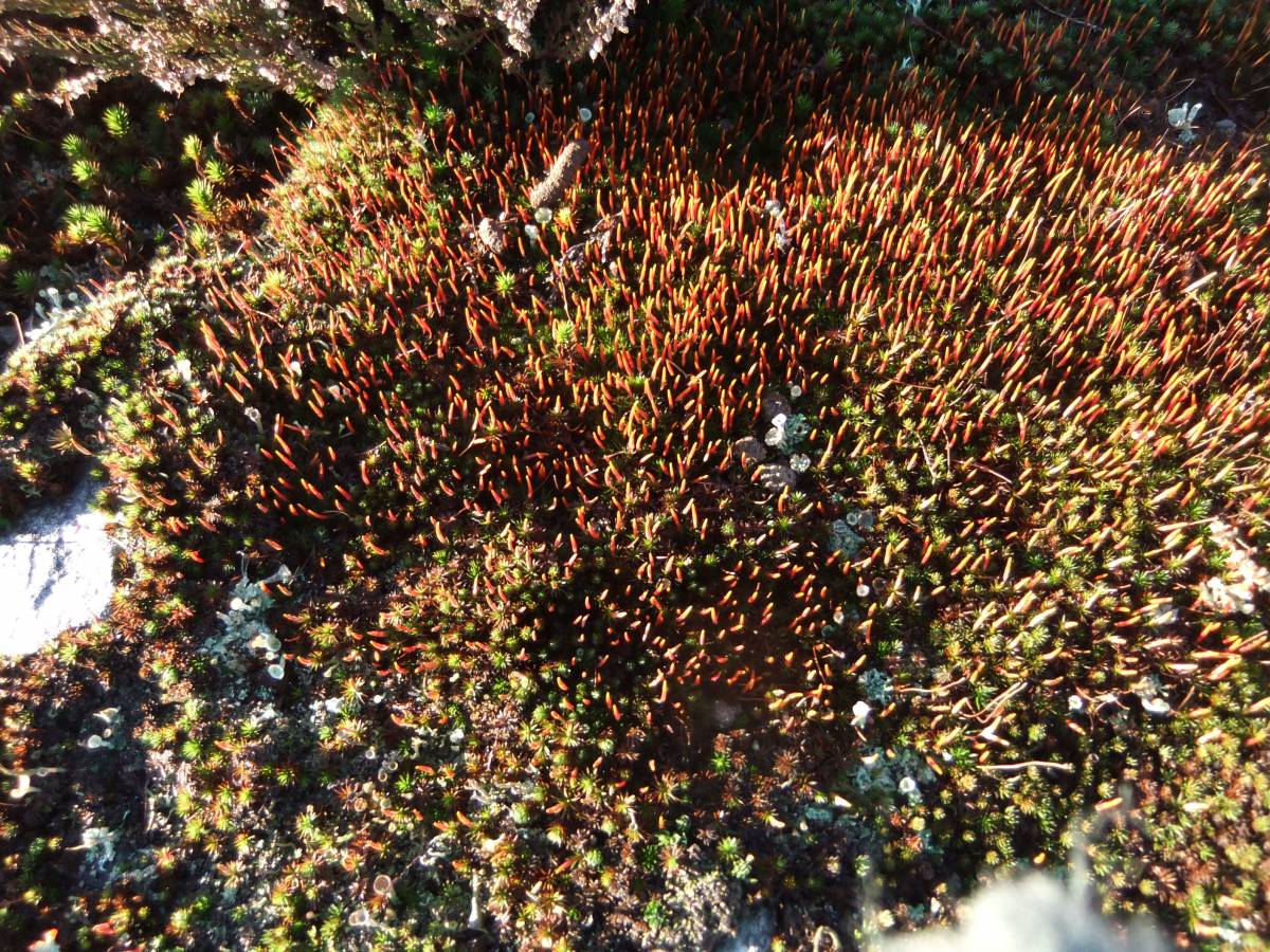
| Image 5 Description | The colonising and soil forming moss carpet formed by Polytrichum juniperinum with the lichen Cladonia spp and other species. | 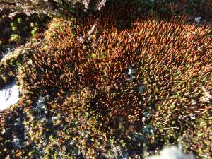 |
| Image 6 ID | 4988 Click image to enlarge |
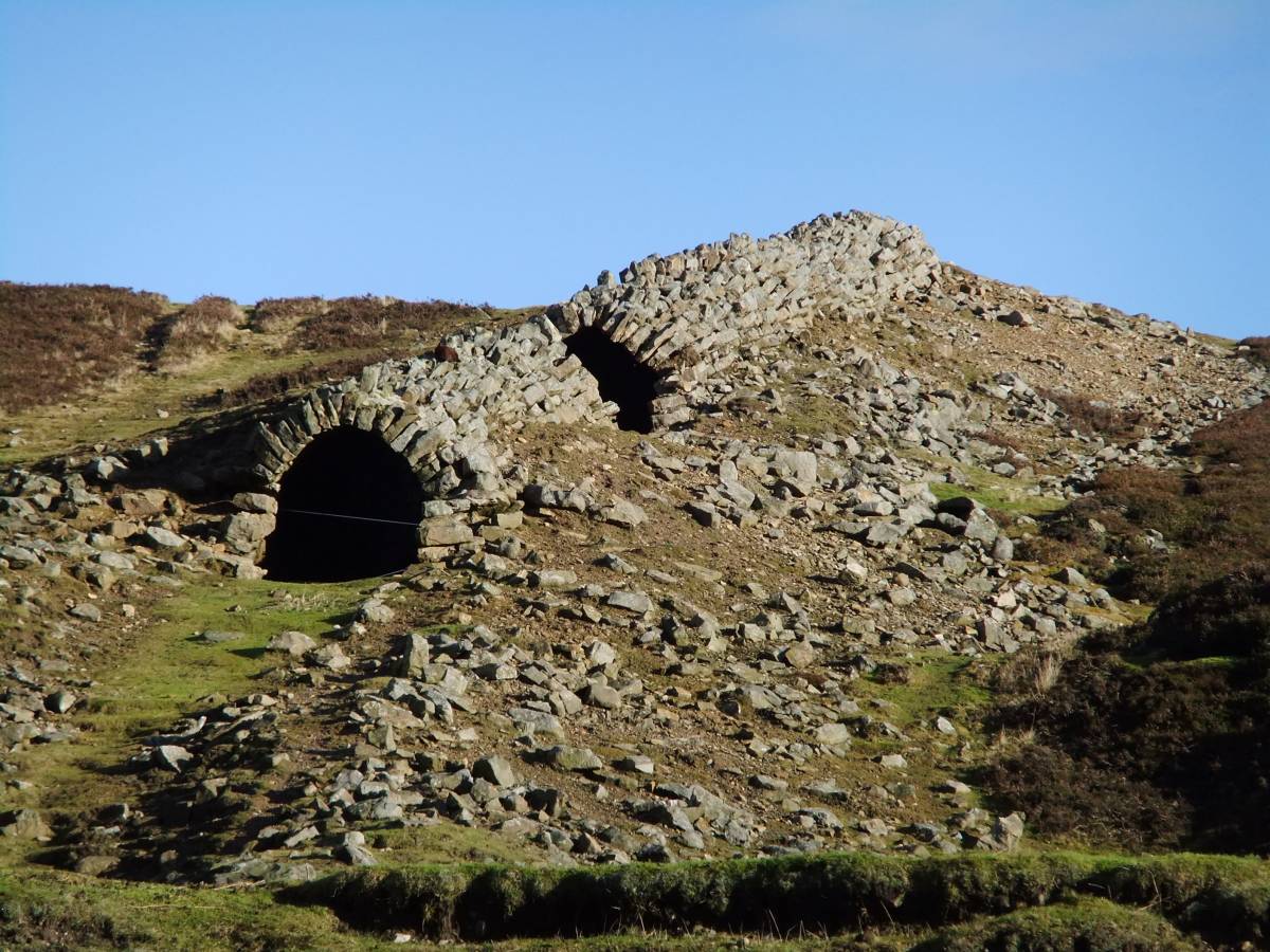
| Image 6 Description | Entrance to the Grinton How Level and the hidden world of the Lead Miner | 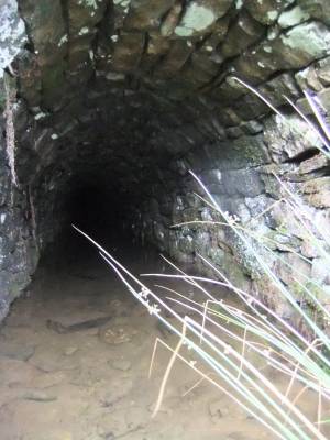 |
| Image 7 ID | 4966 Click image to enlarge |
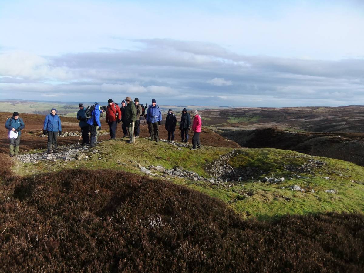
| Image 7 Description | Pay attention! Swaag members wait to be informed by Peter of a differing interpretations of this characteristic burnt mound as either a Bronze Age Sweat house/sauna or a smoker for venison steaks. | 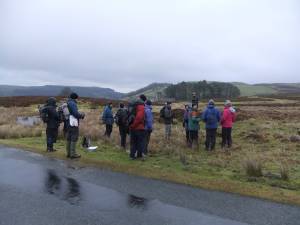 |
| Image 8 ID | 4967 Click image to enlarge |
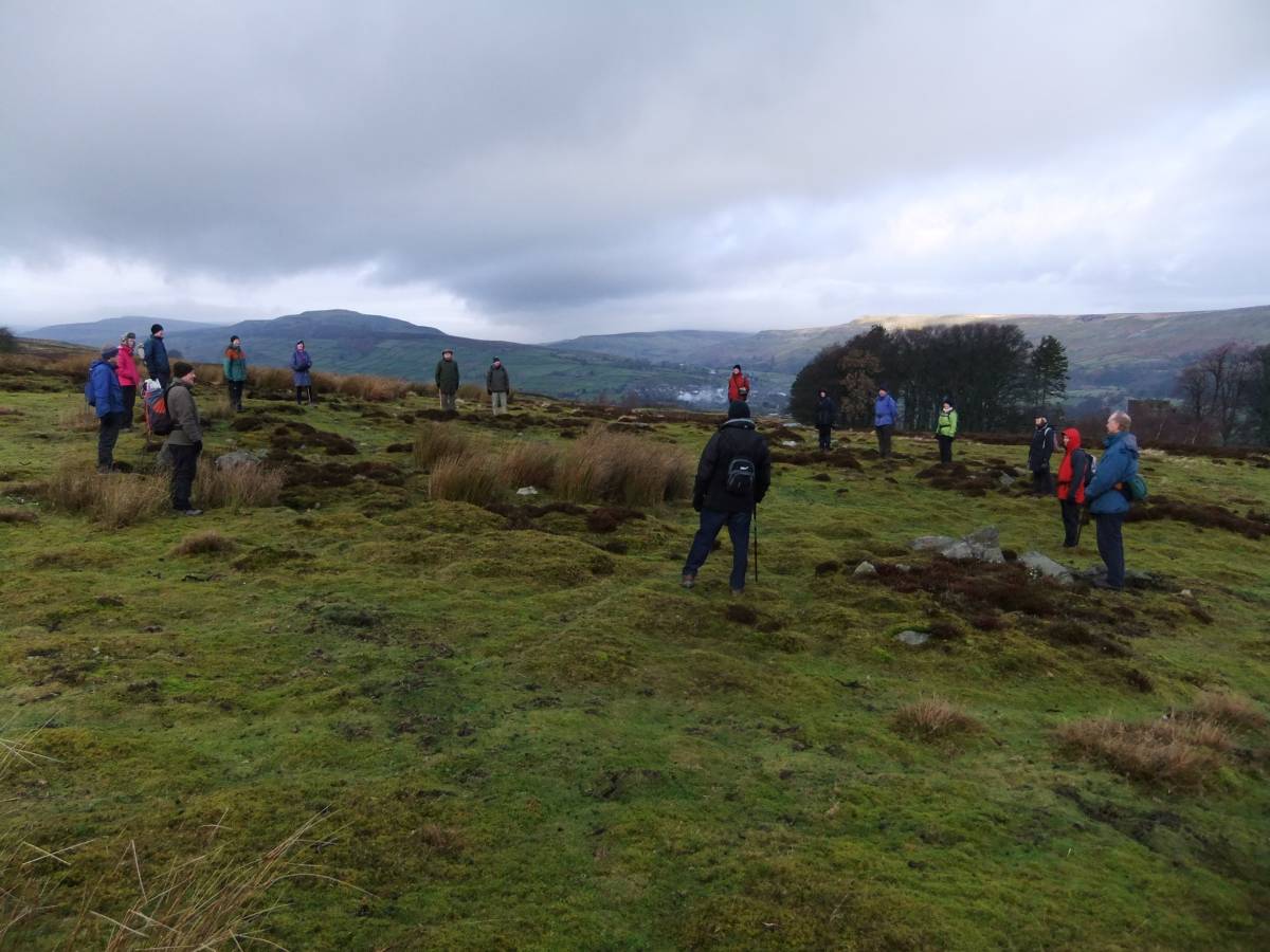
| Image 8 Description | Swaag members act as substitute timber posts to mark the perimeter of one of four large prehistoric round houses which form an open settlement with associated small cairns and trackways close to the road south of Grinton Lodge. H1 on survey plan. | 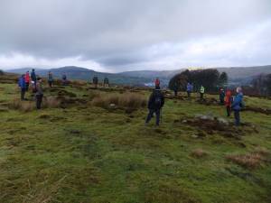 |
| Image 9 ID | 4958 Click image to enlarge |
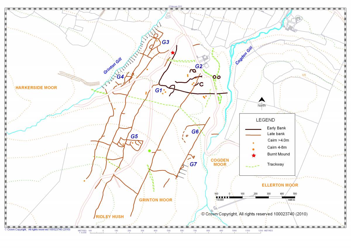
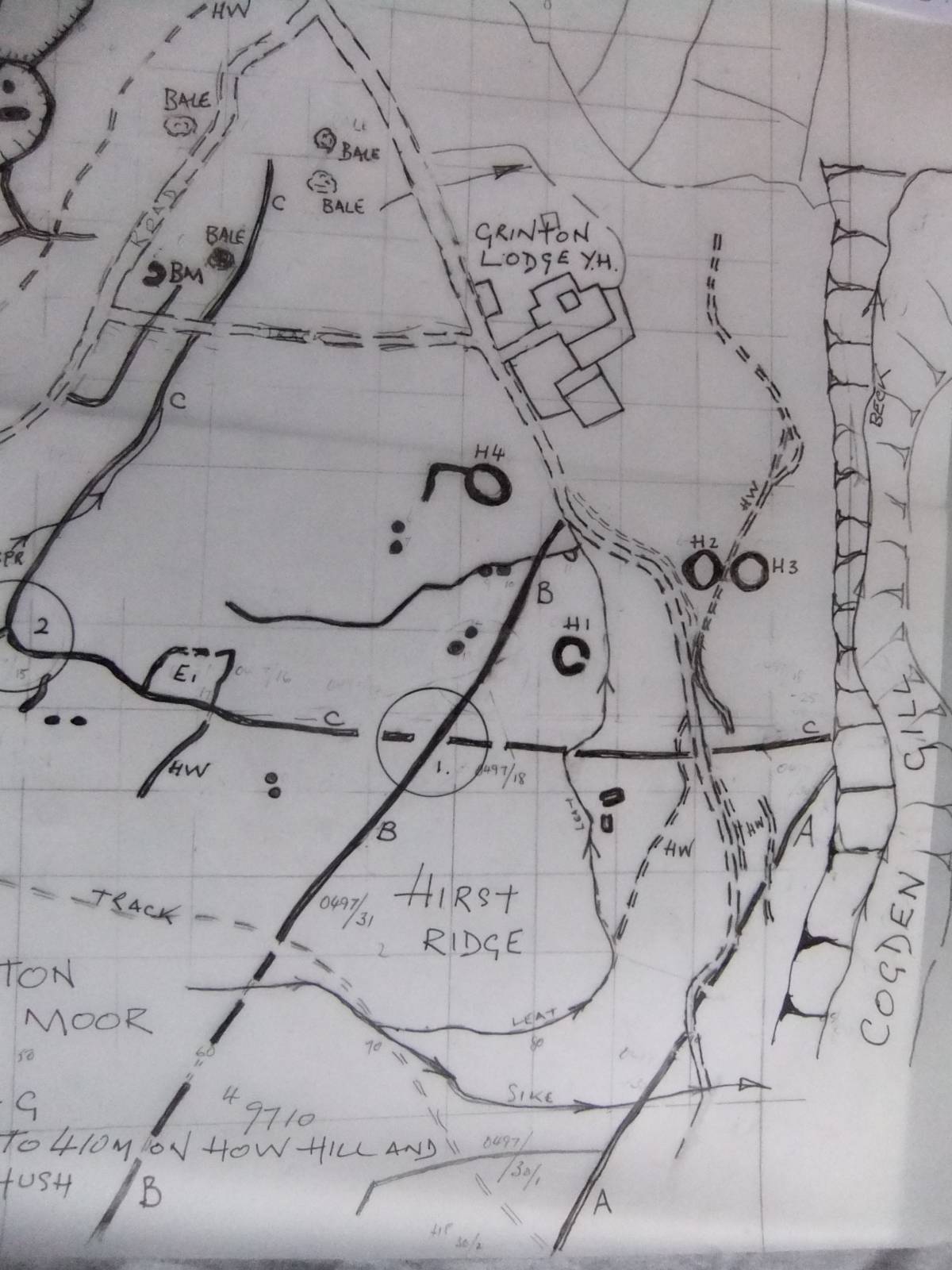
| Image 9 Description | Survey drawing of Grinton Moor. Based on an unpublished EDM survey by the Swaledale Ancient Land Boundaries Project with later revision and additions. Copyright Tim Laurie. |  |
| Image 10 ID | 4970 Click image to enlarge |
| Image 10 Description | Stone banked settlement enclosure with one round house and hut platform terrace attached to coaxial field boundary (not visible on this photo) which ascends the hill slope west of Cogden Bridge. |  |
| Image 11 ID | 4971 |
| Image 11 Description | This stone enclosure bank is attached to the downslope side of a coaxial field boundary higher upslope. | 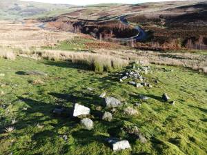 |
| Image 12 ID | 4968 |
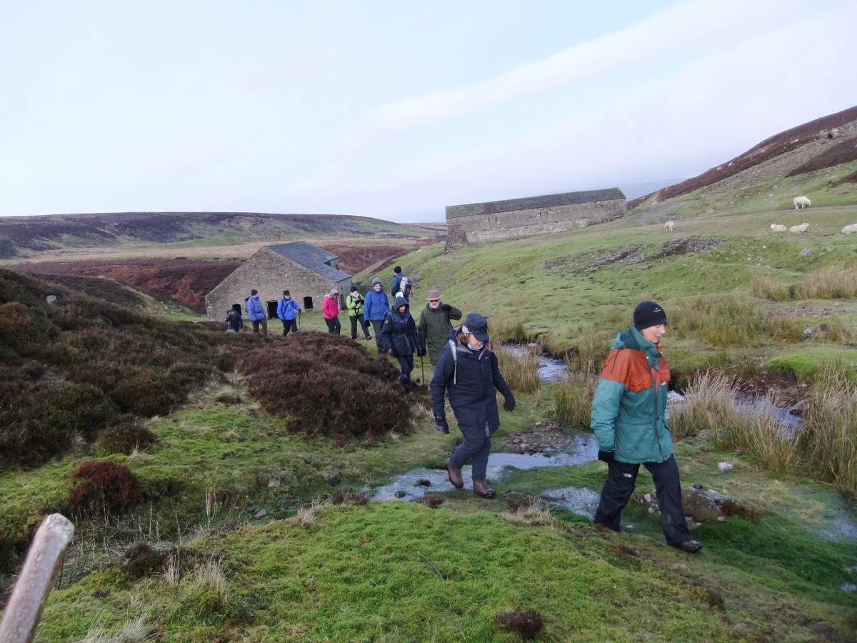
| Image 12 Description | Coffee taken standing up at Grinton Smelt Mill. | 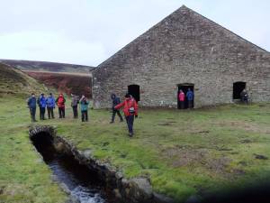 |
| Image 13 ID | 4969 |
| Image 13 Description | Swaag leaving the mill |  |
| Image 14 ID | 4972 |
| Image 14 Description | The Grinton melt mill flue. |  |
| Image 16 ID | 4974 |
| Image 16 Description | Grinton Smelt Mill and flue rising to the demolished chimney on Sharrow Hill. | 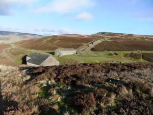 |
| Image 17 ID | 4975 |
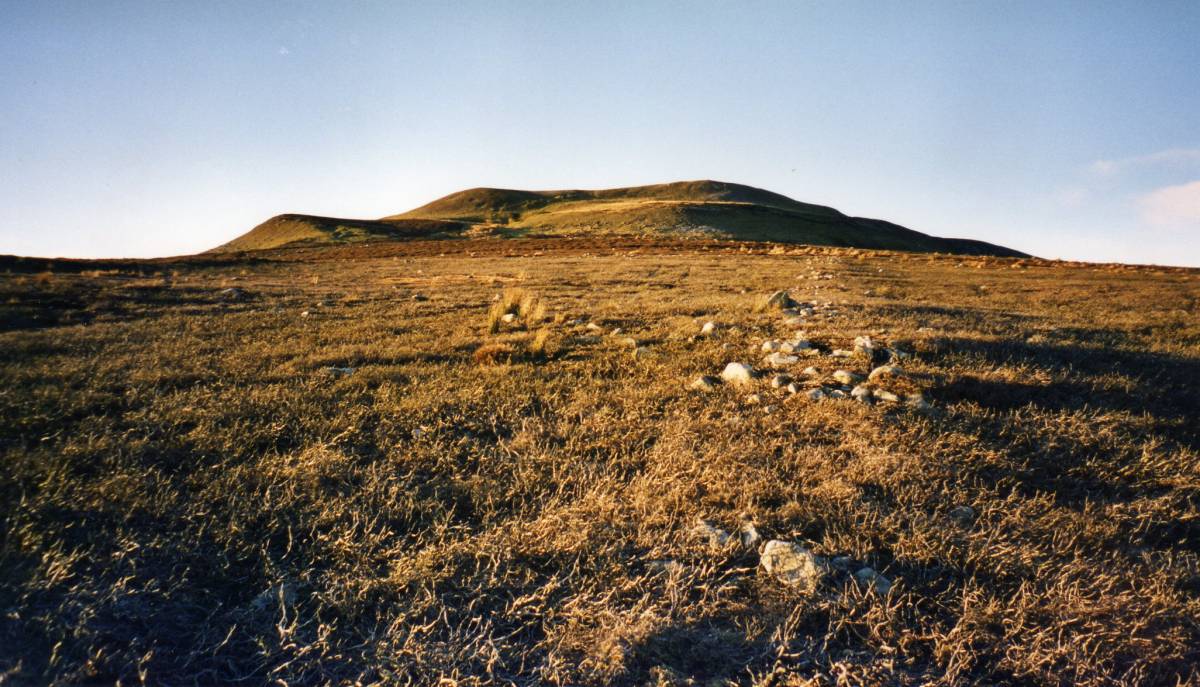
| Image 17 Description | Grinton How Lead Mine and hushes. | 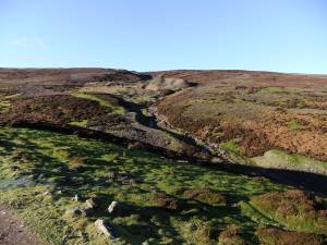 |
| Image 18 ID | 4960 |
| Image 18 Description | Grinton Moor. Final Survey. Extract from: 'T.C. Laurie with N.W. Mahaffy and R.F.White. 2011. 'Co-axial Field Systems in Swaledale: a reassessment following recent fieldwork.' in R.D. Martlew, ED. 'Prehistory in the Yorkshire Dales, pp37- 59, Figure 6.3.' Published by Place/Yorkshire Dales Landscape Research Trust. This Crown Copyright map shows the relationship between two of the coaxial boundaries with an earlier unenclosed settlement and key locations, for interpretation see Laurie, White and Mahaffey, 2003. | 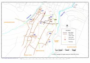 |
| Image 19 ID | 4959 |
| Image 19 Description | Swaledale. Early settlement and Land Division. Laurie et al 2003 Figure 6.1 | 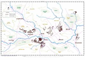 |
| Image 20 ID | 4961 |
| Image 20 Description | Marrick Moor and Skelton Moor.Early settlement and Land Division. Laurie et al 2003 Figure 6.16 | 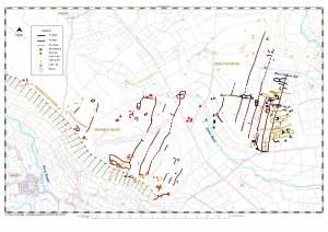 |
| Image 21 ID | 4962 |
| Image 21 Description | Fremington Edge and Marrick Moor.Early settlement and Land Division. Laurie et al 2003 Figure 6.17 |  |
| Image 22 ID | 4954 |
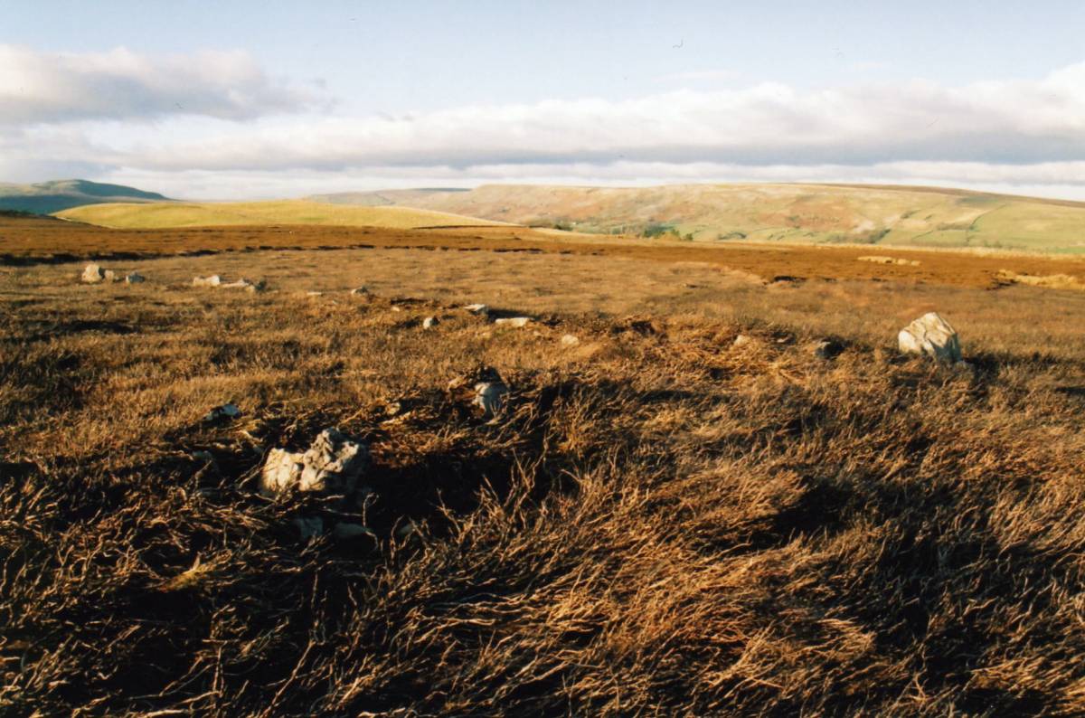
| Image 22 Description | Coaxial field boundary NW of Trig Point 430m on Copperthwaite Allotment. This boundary is on the same NNE-SSW alignment as those on Grinton Moor on the southern side of Swaledale. | 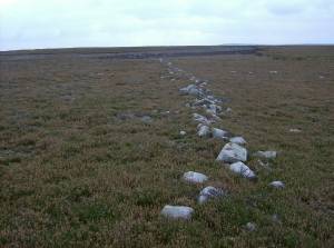 |
| Image 23 ID | 4953 |
| Image 23 Description | Coaxial field boundary at Fremington Edge This boundary is on the same NNE-SSW alignment as those on Grinton Moor on the southern side of Swaledale. | 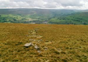 |
| Image 24 ID | 4952 |
| Image 24 Description | Substantial field boundary on Riddings Rig, Reeth Low Moor. | 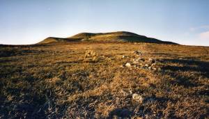 |
| Image 25 ID | 4951 |
| Image 25 Description | Unsurveyed field system on Ellerton Moor. Swaag will visit this area soon. |  |
| Image 26 ID | 4983 |
| Image 26 Description | Grinton Moor. Swinston Brow. Transverse field boundary revealed after heather burn. | 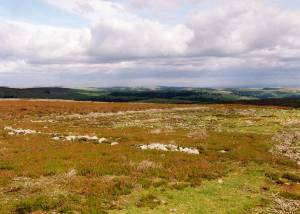 |
| Image 27 ID | 4985 |
| Image 27 Description | Grinton Lodge, Unenclosed settlement west of Cogden Gill. Extract from original SWALB EDM Survey with additions by TCL | 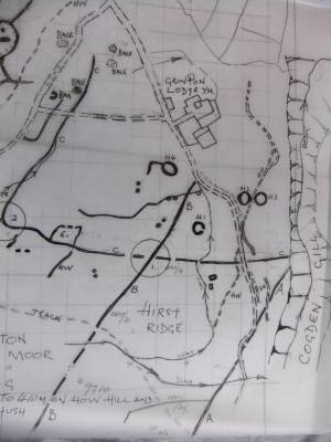 |
| Image 28 ID | 4982 |
| Image 28 Description | Grinton Moor. South of Grinton lodge. Unenclosed round house H1 on plan. | 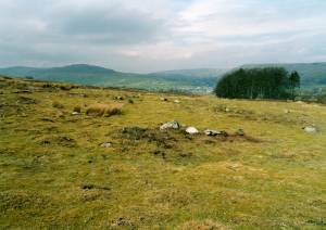 |
| Image 29 ID | 4980 |
| Image 29 Description | Grinton Moor. South of Grinton lodge. Unenclosed round house H2 on plan. | 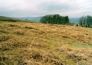 |
| Image 30 ID | 4989 |
| Image 30 Description | Detail of the moorland moss carpet at Ridley Hush | 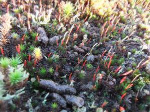 |