|
| *****SWAAG_ID***** | 760 |
| Date Entered | 12/10/2013 |
| Updated on | 13/10/2013 |
| Recorded by | Tim Laurie |
| Category | Standing Stones / Circles |
| Record Type | Archaeology |
| SWAAG Site Name | |
| Site Type | |
| Site Name | |
| Site Description | |
| Site Access | Public Access Land |
| Record Date | 28/09/2013 |
| Location | Galloway. Kirkudbrightshire. Glenquicken. NX509582, 150mOD |
| Civil Parish | Not known |
| Brit. National Grid | |
| Altitude | 150m |
| Geology | Silrian sandstones, shales and grits. |
| Record Name | Some Galloway Stone Circles 2. Cambret Moor West. Kirkudbright. |
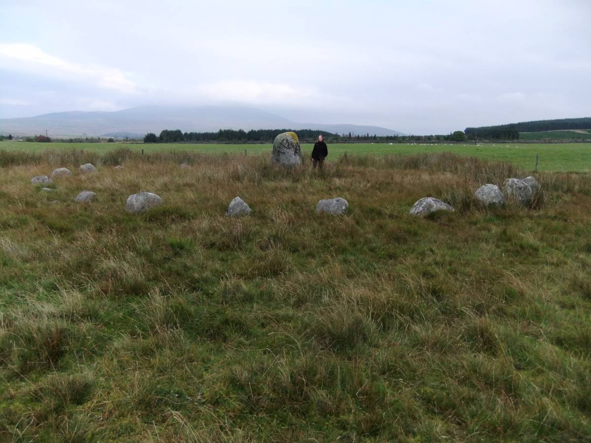
| Record Description | This fine stone ring with centre stone is has been surveyed by A. and A.A.Thom and interpreted as a flattened circle with a diameter of 16.6m. All the stones are glacial erratics of granite and other volcanic rock. The granite centre standing stone is 1.9m high. |
| Dimensions | |
| Geographical area | |
| Species | |
| Scientific Name | |
| Common / Notable Species | |
| Tree and / or Stem Girth | |
| Tree: Position / Form / Status | |
| Tree Site ID | 0 |
| Associated Site SWAAG ID | 0 |
| Additional Notes | It may be mentioned that the only instance of a flattened circle in nature is the one day old moon.
The frequent occurance within the comprehensive and very large body of accurately surveyed stone circle plans published by A. and A.A. Thom of this flattened circle plan within the numerous stone circles of the British Isles may indicate that these structures acknowledged a Mood Deity or The White Goddess (Robert Graves, 1948).
A comparative Note.
By comparison with the megalithic rings of Galloway and elsewhere, the few small free-standing stone rings of the eastern Pennine fringe are very poor relations, but this is not to say that the small Pennine rings are insignificant. These small rings may mark cremation internments at significant places on prehistoric routeways from lowland to upland, as on Carperby Moor and at the head of Lunedale in Upper Teesdale or on the watershed between Dales as at Barningham Moor and at Mudbeck in Arkengarthdale (see previous SWAAG Records).
The ritual and mortuary enclosure characteristic of the Pennine Area is the stone dump ring cairn, some 30 of these slight stone rings being recorded in the Tees/Swale/Ure Uplands. These slight stone dump embanked enclosures are also and most accurately referred to as enclosed cremation cemetaries. as the characteristic burial within these rings are cremations contained within collared or plain urns. |
| Image 1 ID | 4748 Click image to enlarge |
| Image 1 Description | The Cambret Hill Stone Ring and centre stone | 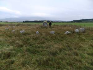 |
| Image 2 ID | 4749 Click image to enlarge |
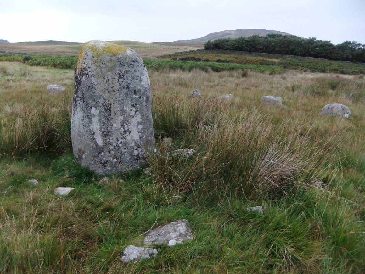
| Image 2 Description | | 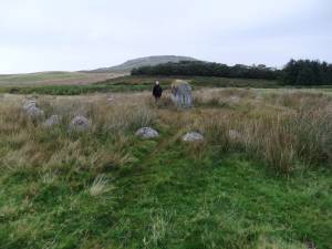 |
| Image 3 ID | 4750 Click image to enlarge |
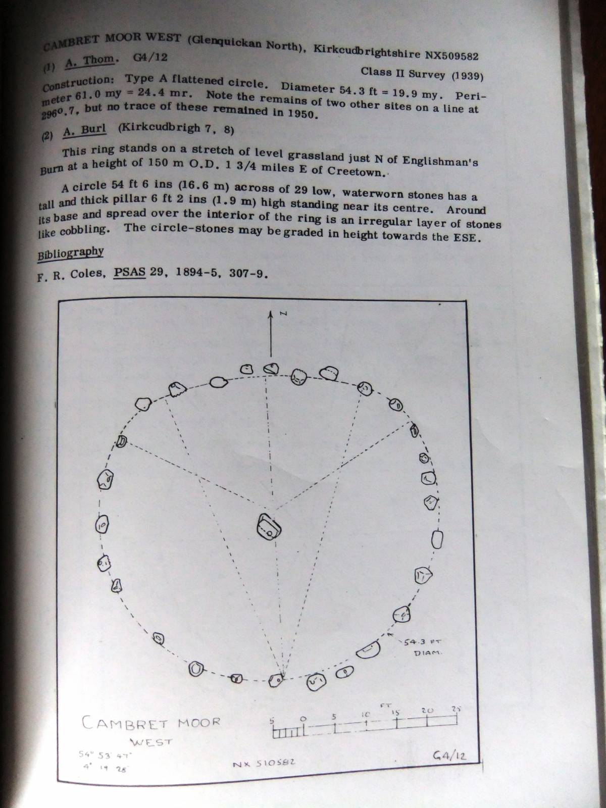
| Image 3 Description | The centre stone and remnant of the internal cairn. |  |
| Image 4 ID | 4754 Click image to enlarge |
| Image 4 Description | Plan of the Cambret Moor Stone ring showing geometric construction as an edge-flattened circle. Thom A. and Thom A.A. 'Megalithic Rings'. British Archaeological Reports 81, 1980. pp284,285. | 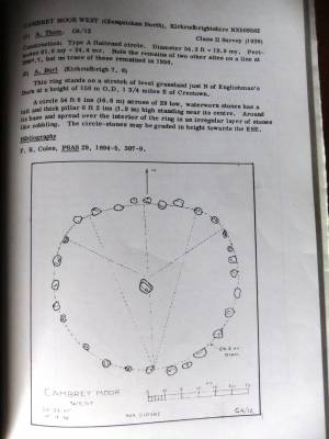 |