|
| *****SWAAG_ID***** | 759 |
| Date Entered | 12/10/2013 |
| Updated on | 13/10/2013 |
| Recorded by | Tim Laurie |
| Category | Standing Stones / Circles |
| Record Type | Archaeology |
| SWAAG Site Name | |
| Site Type | |
| Site Name | |
| Site Description | |
| Site Access | Public Access Land |
| Record Date | 29/09/2013 |
| Location | Galloway, Wigtownshire,Torhouse NX383565, 30m OD. |
| Civil Parish | Not known |
| Brit. National Grid | |
| Altitude | 30m |
| Geology | All the stones of the Torhouskie Stone Circle are of local granite erratic boulders brought to the site which is approximately 1km east of and within sight of the River Bladnoch . The landscape of the valley of the River Bladnoch is characterised by many beautiful drumlins. |
| Record Name | Some Galloway Stone Circles 1. The Torhouskie Stone Circle. |
| Record Description | This fine stone ring (in State Care, by the roadside within a protective fence)is well worth a visit and has been surveyed by Alexander and Archie Thom who interpret it as a flattened circle and they conclude that the three stone outliers located about 140m to the ENE are probably solstitial.
The stone ring surrounds a ring cairn and central three megalithic stone setting. A similar stone setting and probable cairn is located in a pasture at the other side of the road, 140m to the ENE.
Reference:
A & A.S. Thom, 1980. 'Megalithic Rings'. BAR British Series 81 |
| Dimensions | |
| Geographical area | |
| Species | |
| Scientific Name | |
| Common / Notable Species | |
| Tree and / or Stem Girth | |
| Tree: Position / Form / Status | |
| Tree Site ID | 0 |
| Associated Site SWAAG ID | 0 |
| Additional Notes | It may be mentioned that the only instance of a flattened circle in nature is the one day old moon.
The frequent occurance within the comprehensive and very large body of accurately surveyed stone circle plans published by A. and A.A. Thom of this flattened circle plan within the numerous stone circles of the British Isles may indicate that these structures acknowledged a Moon Deity or The White Goddess (Robert Graves, 1948).
A comparative Note.
By comparison with the megalithic rings of Galloway and elsewhere, the few small free-standing stone rings of the eastern Pennine fringe are very poor relations, but this is not to say that the small Pennine rings are insignificant. These small rings may mark cremation internments at significant places on prehistoric routeways from lowland to upland, as on Carperby Moor and at the head of Lunedale in Upper Teesdale or on the watershed between Dales as at Barningham Moor and at Mudbeck in Arkengarthdale (see previous SWAAG Records).
The ritual and mortuary enclosure characteristic of the Pennine Area is the stone dump ring cairn, some 30 of these slight stone rings being recorded in the Tees/Swale/Ure Uplands. These slight stone dump embanked enclosures are also and most accurately referred to as enclosed cremation cemetaries. as the characteristic burial within these rings are cremations contained within collared or plain urns. |
| Image 1 ID | 4741 Click image to enlarge |
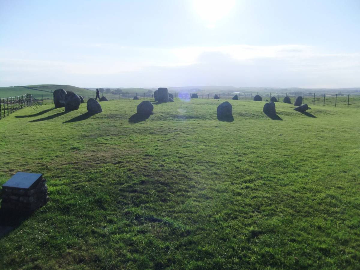
| Image 1 Description | The Torhouskie Stone Ring and valley of the River Bladnoch. | 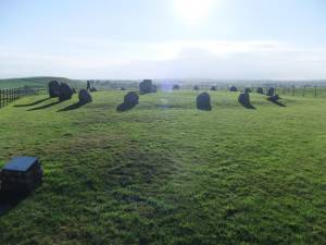 |
| Image 2 ID | 4742 Click image to enlarge |
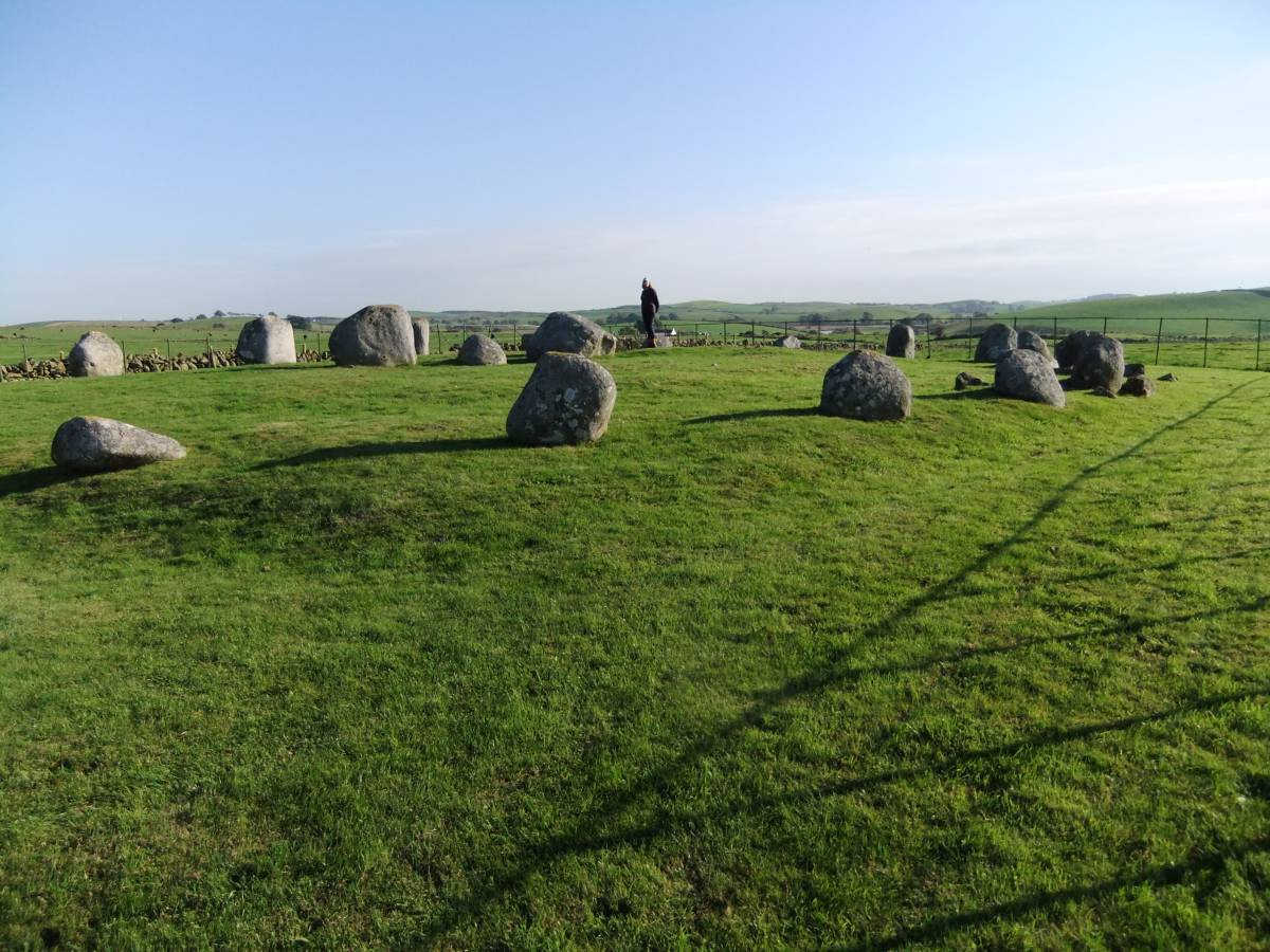
| Image 2 Description | The western perimeter. All the stones are glacial erratic rounded boulders of local grey granite. | 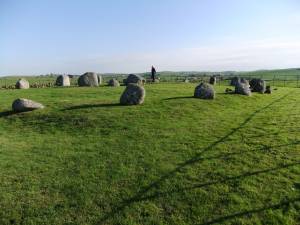 |
| Image 3 ID | 4745 Click image to enlarge |
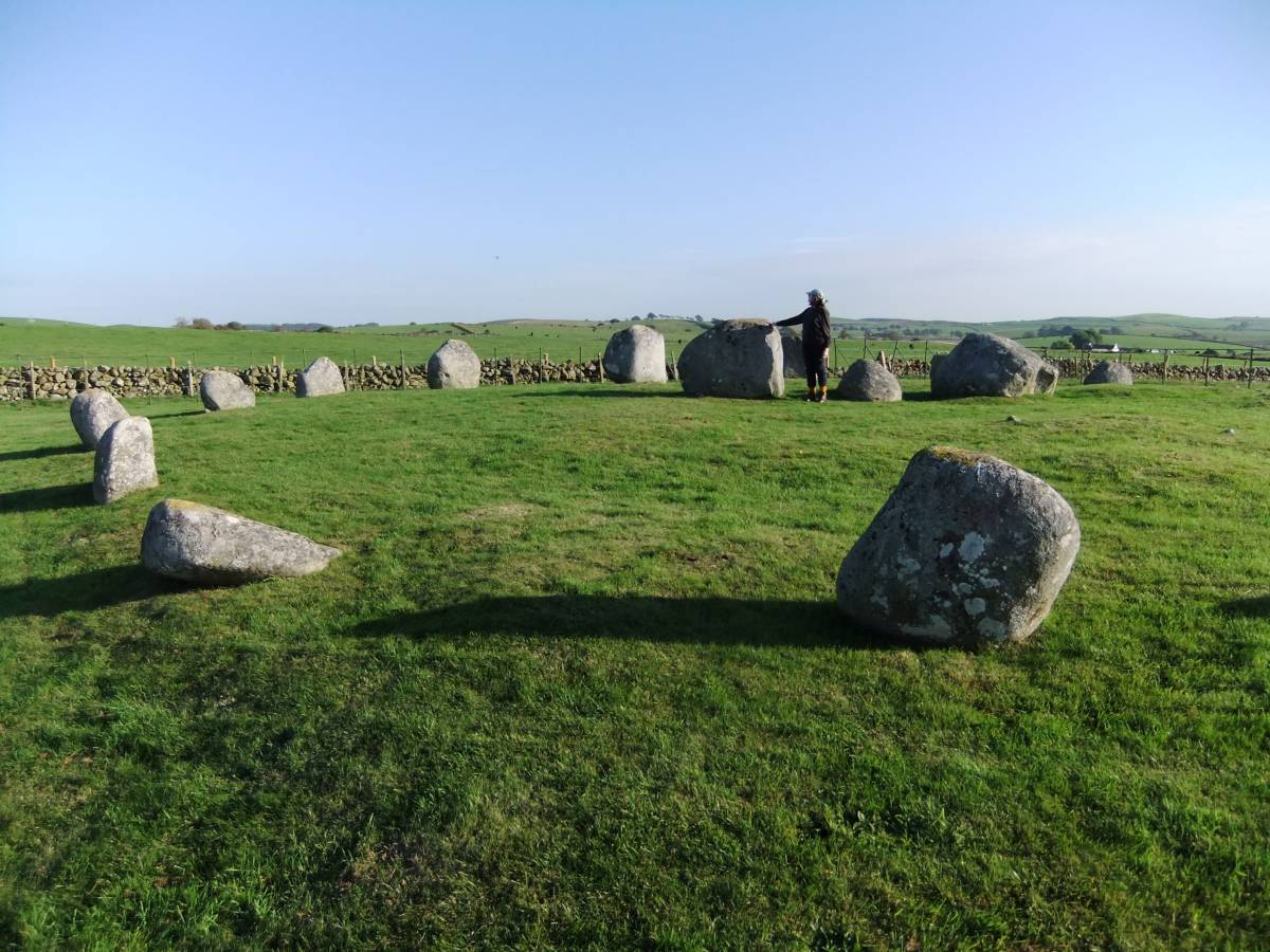
| Image 3 Description | The eastern perimeter. |  |
| Image 4 ID | 4744 Click image to enlarge |
| Image 4 Description | The central three stone setting. | 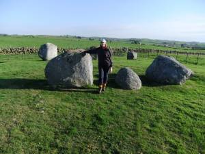 |
| Image 5 ID | 4746 Click image to enlarge |
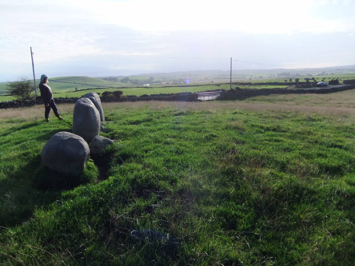
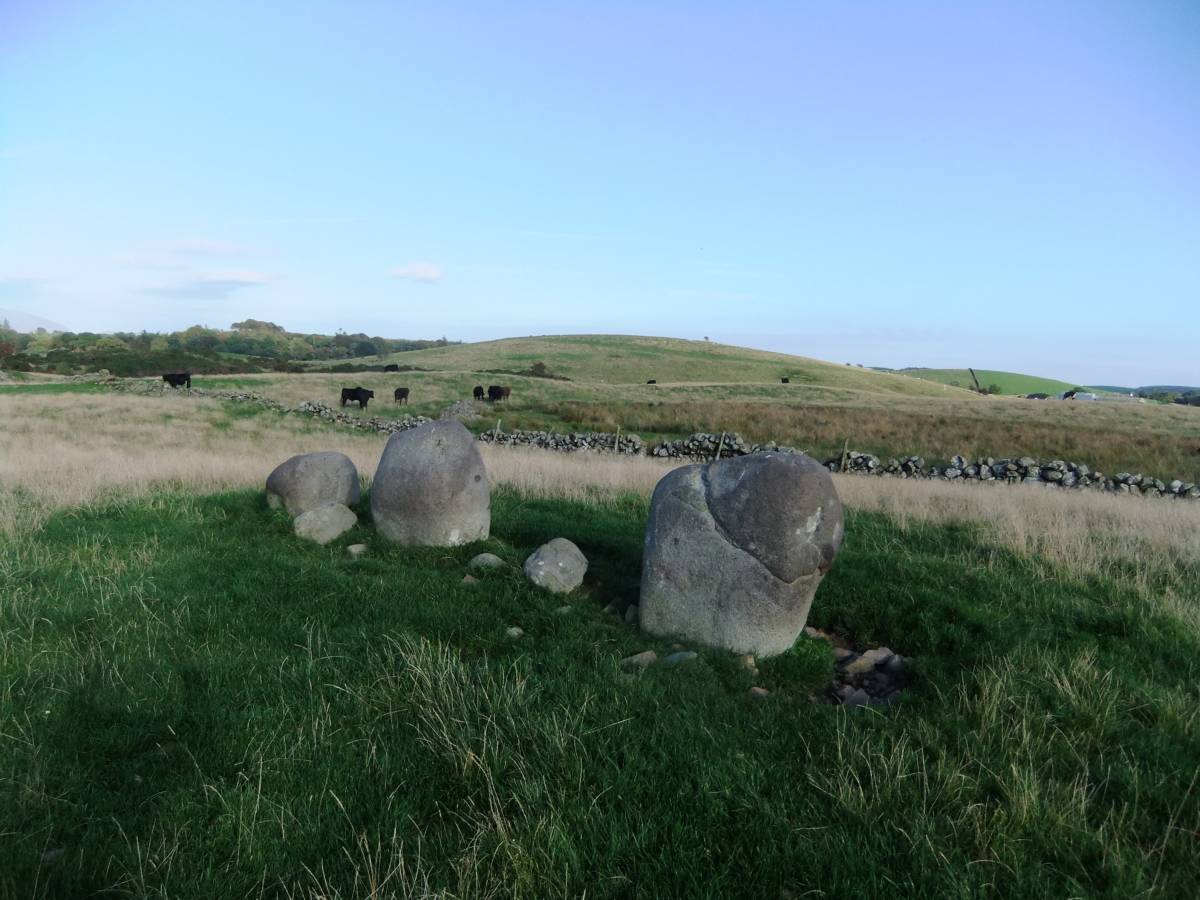
| Image 5 Description | The outlier three stone setting and possible denuded cairn. | 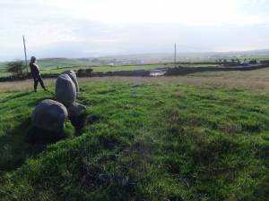 |
| Image 6 ID | 4747 Click image to enlarge |
| Image 6 Description | The outlier three stone setting and glacial drumlin landscape. | 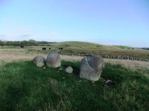 |
| Image 7 ID | 4753 Click image to enlarge |
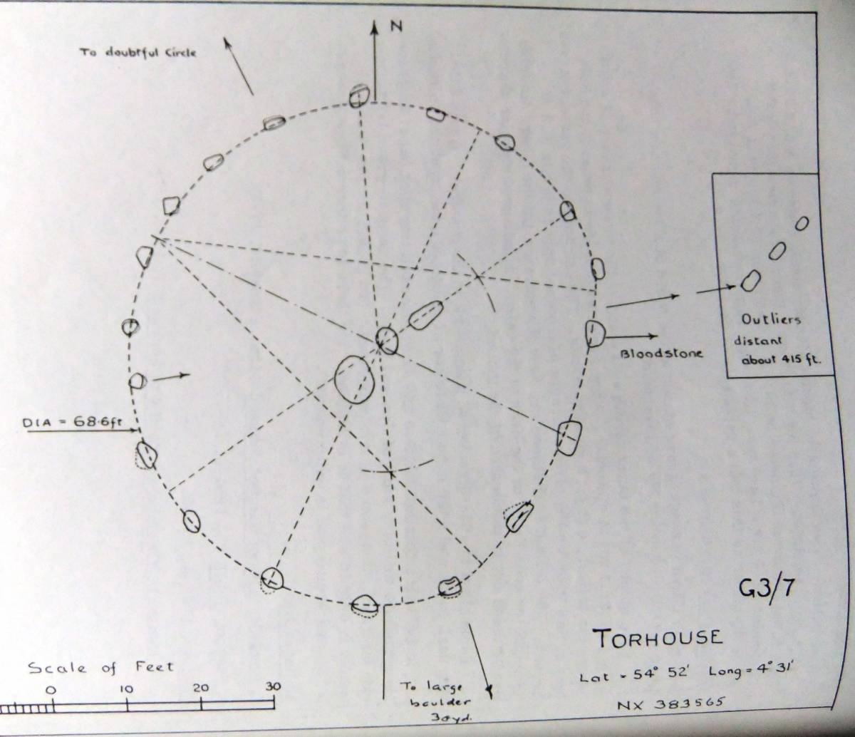
| Image 7 Description | Torhouskie Stone Circle. Survey Plan showing geometric construction as an edge flattened circle. Thom A. and Thom A.A.1980 'Megalithic Rings' B.A.R. British Series 81. pp274,275. | 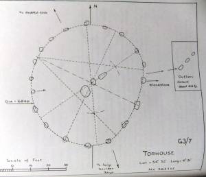 |