|
| *****SWAAG_ID***** | 758 |
| Date Entered | 05/10/2013 |
| Updated on | 07/10/2013 |
| Recorded by | Tim Laurie |
| Category | Rock Art |
| Record Type | Archaeology |
| SWAAG Site Name | |
| Site Type | |
| Site Name | |
| Site Description | |
| Site Access | |
| Record Date | 28/09/2013 |
| Location | High Banks Farm, Kirkudbright at NX709 489, and other locations in Galloway |
| Civil Parish | Not known |
| Brit. National Grid | |
| Altitude | 100m-200m |
| Geology | Outcropping Silurian shales, grits and greywackes, overlaid generally by glacial deposits. A feature of the landscape of Galloway are the many fine drumlins and occasional large granite and other erratic boulders. |
| Record Name | Some examples of Prehistoric Rock Art in Galloway and the widespread affinity of cup and ring marks with Food Vessel Burials. |
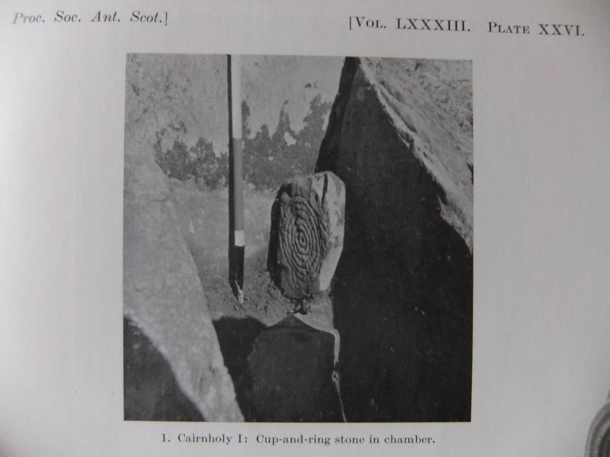
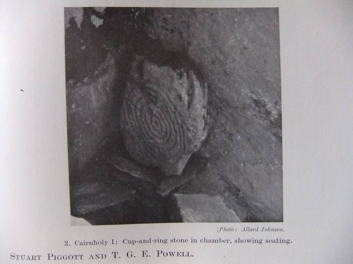
| Record Description | This record is intended to introduce the interested general reader to the wealth of prehistoric rock art sites in Galloway with a brief comparison with the rock art of the NE Pennine Fringe. Finally, this record will provide a note on the association of the cup and ring motif with Early/Mid Bronze Age burials noted by Professor Stuart Piggott in context with the discovery of a fine portable, ie free-standing, cup and multiple concentric ring marked stone slab during excavation between the 22 June and 2nd July in 1949 of two chambered cairns which overlook the estuary of the River Cree in Galloway, namely Cairnholy 1 and 2 and a third cairn, the White Cairn, at Bargrennan located on high ground above the upper reaches of the River Cree. The cup and ring marked slab was found propped against the side wall of the inner chamber of Cairnholy 1, one of two adjacent Neolithic Chambered Tombs located on elevated ground overlooking Wigtown Bay and the Cree Estuary. The cup and ring marked slab was found in the cist-like inner chamber of this tomb together with sherds of Early Bronze Age 'Food Vessel' pottery associated with a later burial inserted through the side wall of the Chamber which had previously been closed. For a full account of this excavation, I refer the reader to Stuart Piggott, 1949. 'The Excavation of Three Neolithic Chambered Tombs in Galloway.' Proceedings of the Society of Antiquaries of Scotland 1948-1949.
This cup and ring marked slab was the first such carved stone to be located in situ within a cist like chamber in association with Food Vessel pottery of early-mid Bronze Age Date and thus demonstrating that the cup and ring motif was associated with ideas of life and death at that time.
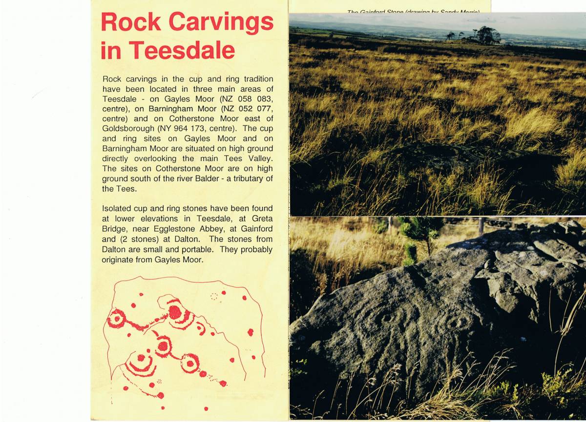
For comparative purposes,I have included several images of cup and ring rock art from Gayles Moor and from elsewhere in Teesdale,from Skelton Moor in Swaledale and from the reduced round cairn on the summit of Addlebrough above Bainbridge in Wensleydale. |
| Dimensions | |
| Geographical area | |
| Species | |
| Scientific Name | |
| Common / Notable Species | |
| Tree and / or Stem Girth | |
| Tree: Position / Form / Status | |
| Tree Site ID | 0 |
| Associated Site SWAAG ID | 0 |
| Additional Notes | For a comprehensive survey and account of the Rock Art of Galloway, see Ronald W.B. Morris, 1979. 'The Prehistoric Rock Art of Galloway and the Isle of Man.' Batsford.
I have very pleasant memories of several days in the late 1970's field walking in Teesdale visiting the cup and ring sites and other prehistoric sites on Barningham Moor and on the Feldom Army Ranges (Gayles Moor) in company with Ronald Morris, Archie Thom and Stan Beckensall. All three were not professional archaeologists and were each driven by an intense interest in the prehistoric record.
Ronald Morris, a successful and well known Glasgow Solicitor, Archie Thom was Professor of Engineering at the University of Glascow. Archie Thom actively continued the life work of his famous father Alexander Thom in accurately surveying all the Stone Circles of the British Isles in pursuit of their astronomical meanings. Stan Beckensall was at this time a retired Head School Master and actively engaged in the recognition, survey and recording of the rock art of Northumberland and elsewhere across northern England. |
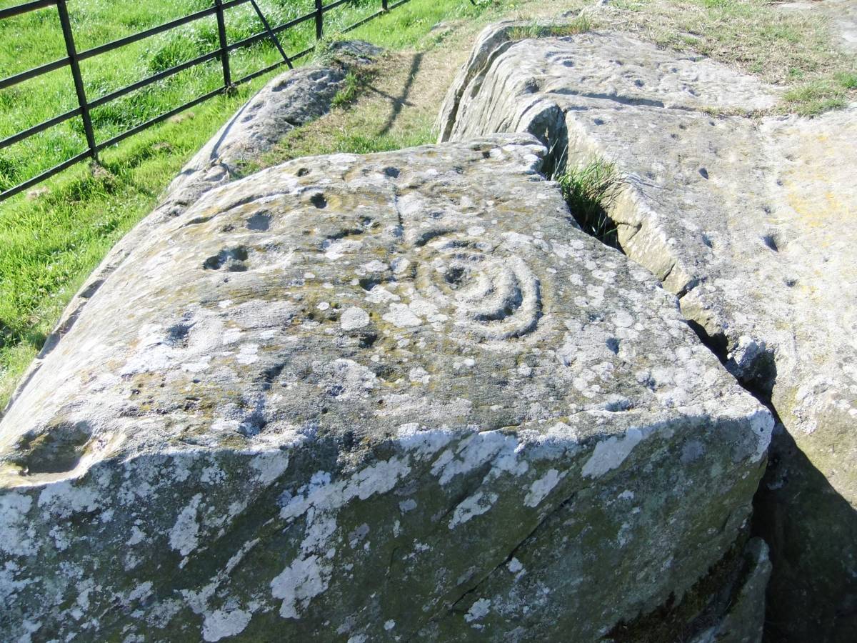
| Image 1 ID | 4711 Click image to enlarge |
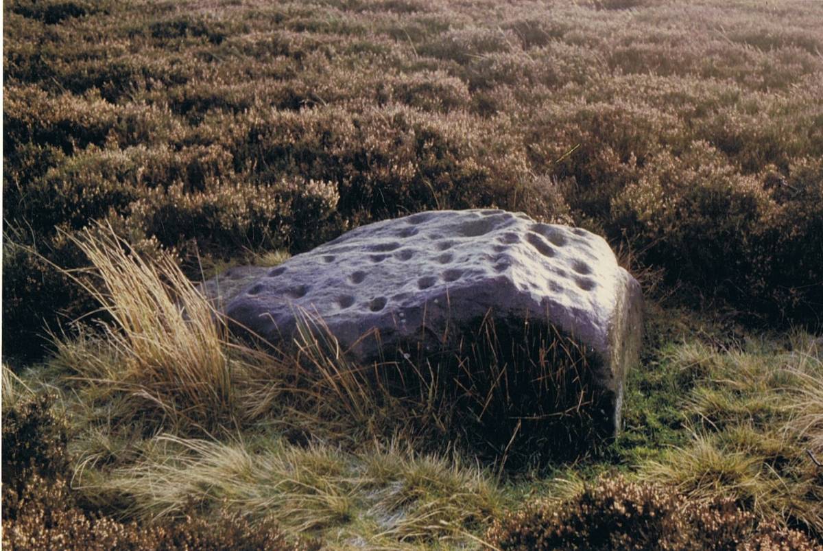
| Image 1 Description | High Banks Farm. A large cup and multiple ring figure. Multiple ring figures of up to six rings and an isolated spiral of nine turns are a characteristic feature of the cup and ring tradition of Galloway. In contrast the maximum number of rings in Teesdale and Swaledale does not exceed 3 rings. | 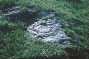 |
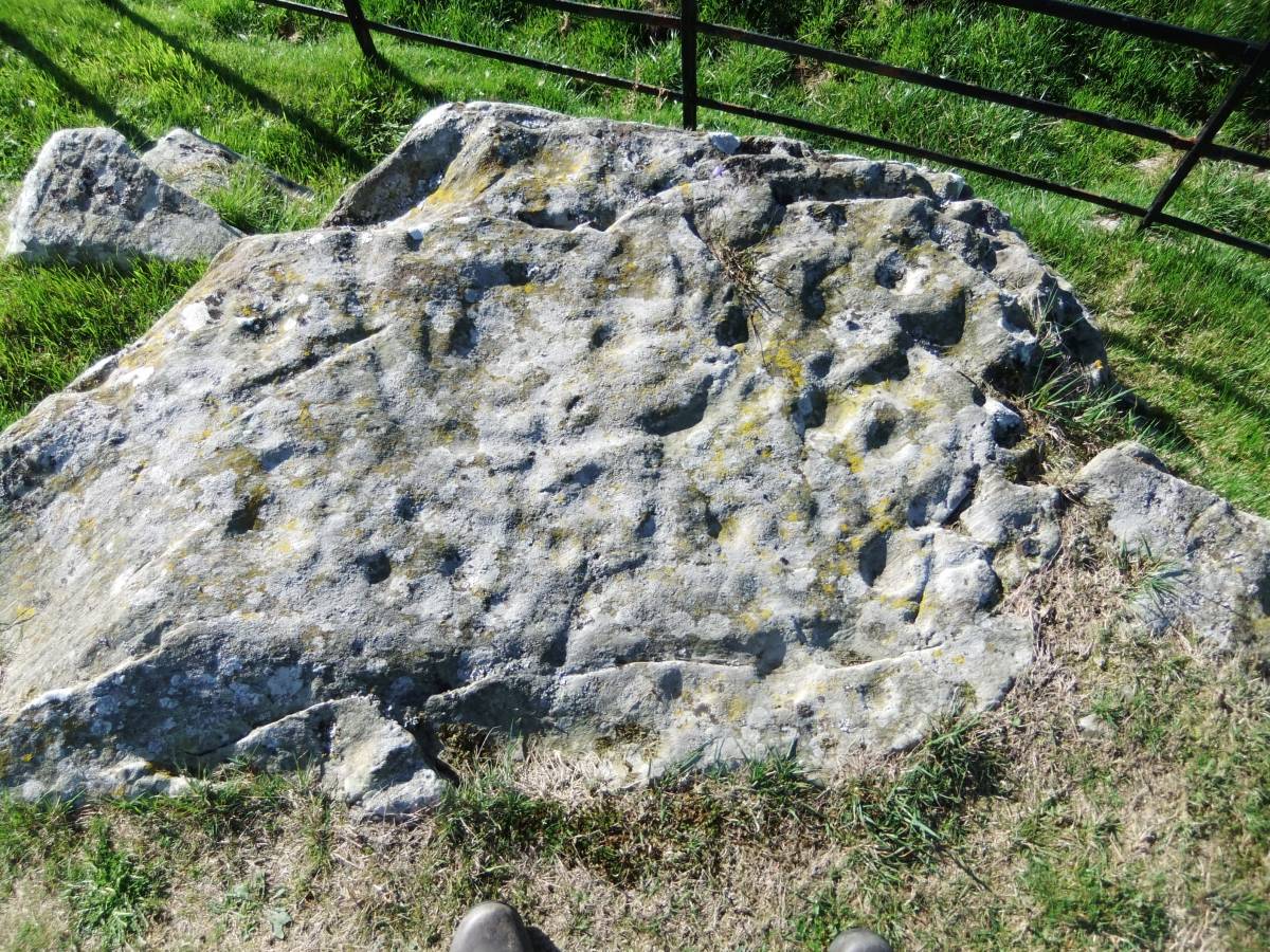
| Image 2 ID | 4712 Click image to enlarge |
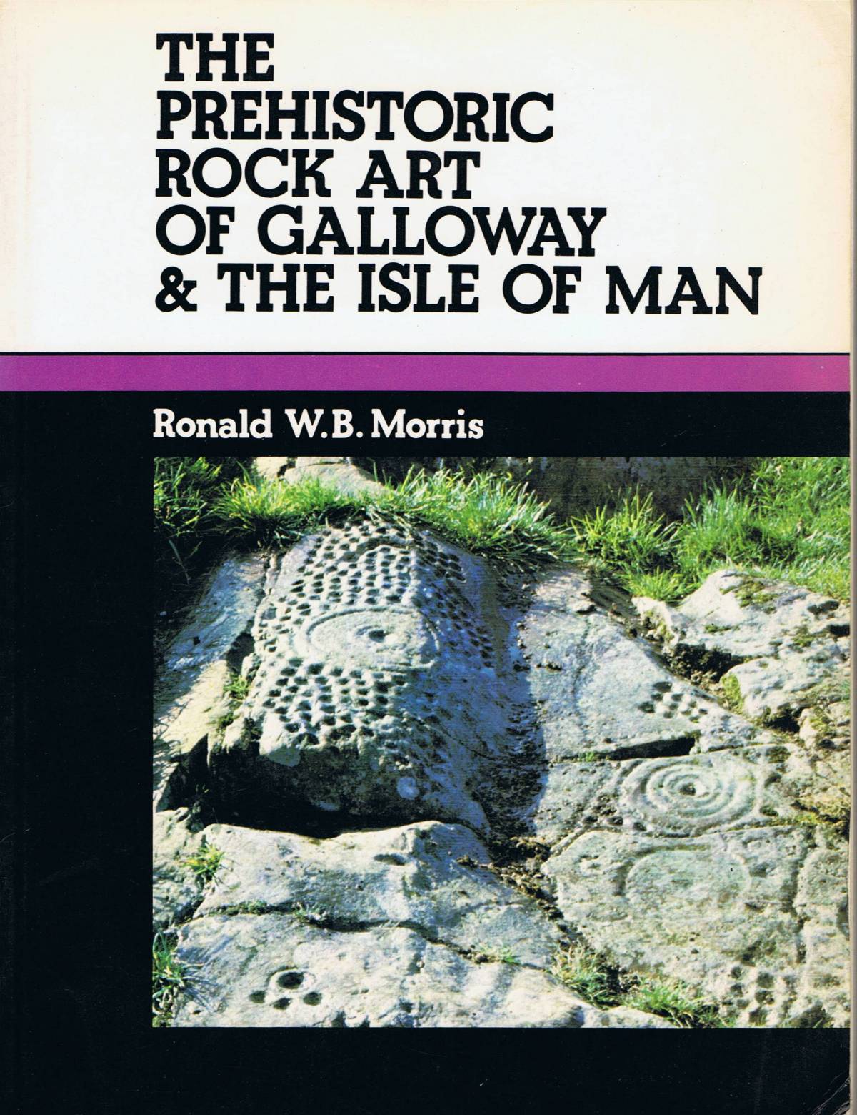
| Image 2 Description | Ronald W.B. Morris, 1979. Front Cover: High Banks Farm Site 1. | 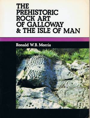 |
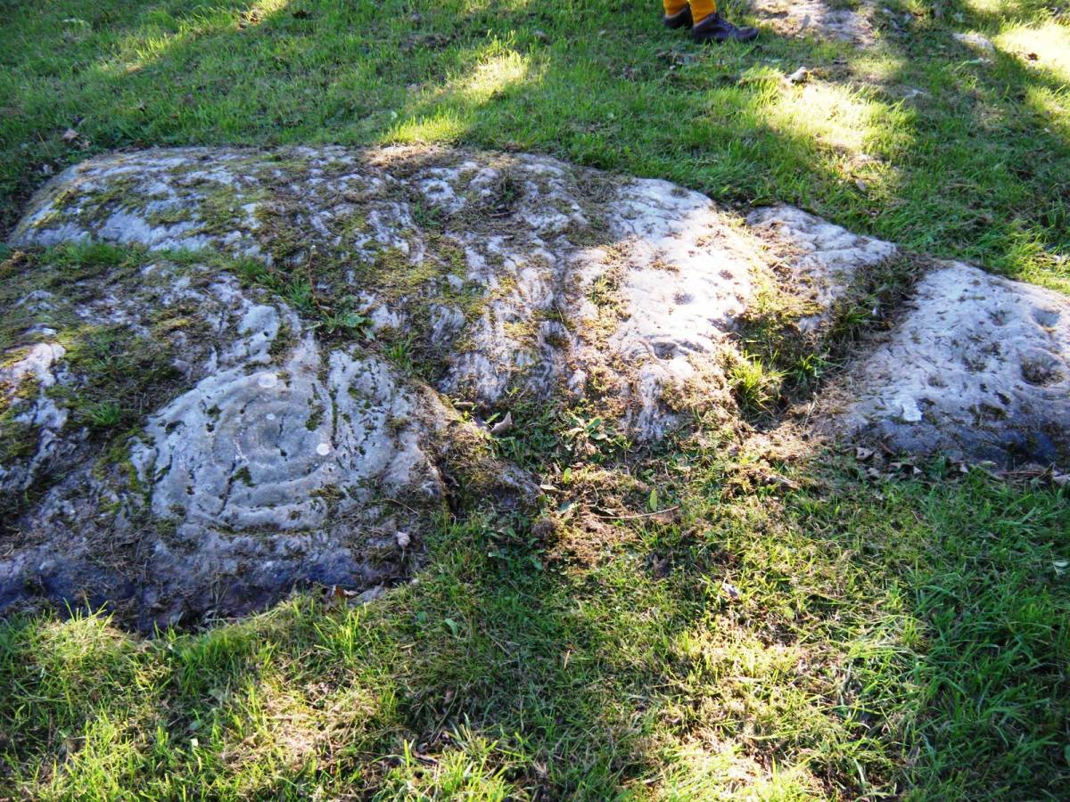
| Image 3 ID | 4713 Click image to enlarge |
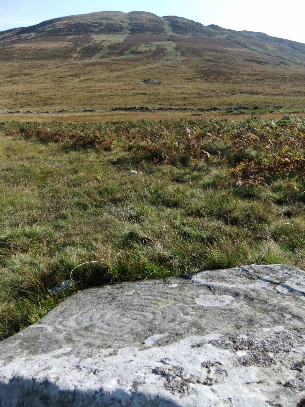
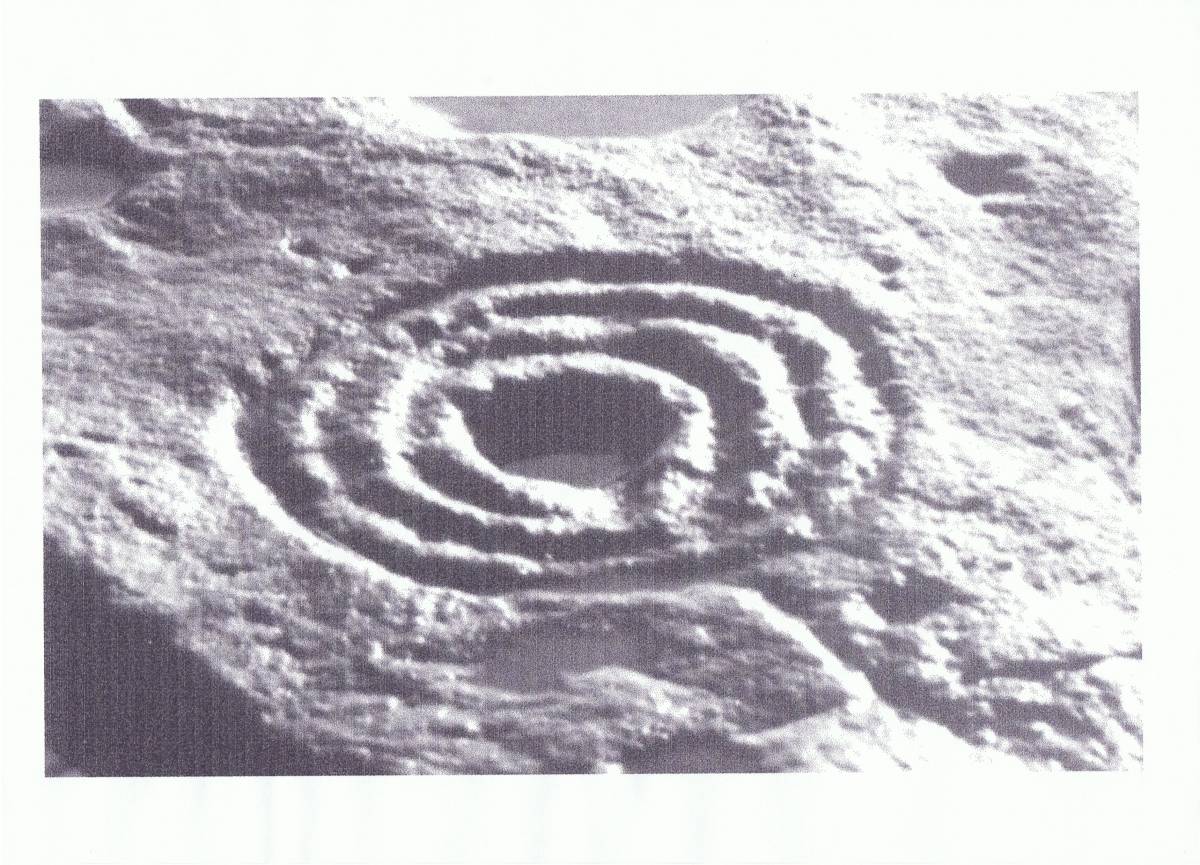
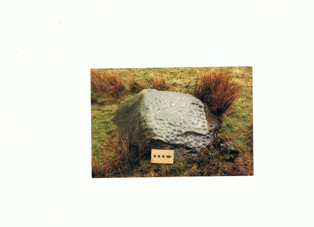
| Image 3 Description | The Cauldside Burn Spiral. This six turn spiral marking is located on the lower slope of Cambret Hill on the northern side of Cauldside Burn and some 400m north of the Cauldside Burn Monument complex comprising a large 18m dia round cairn with an adjacent stone circle and ring cairn |  |
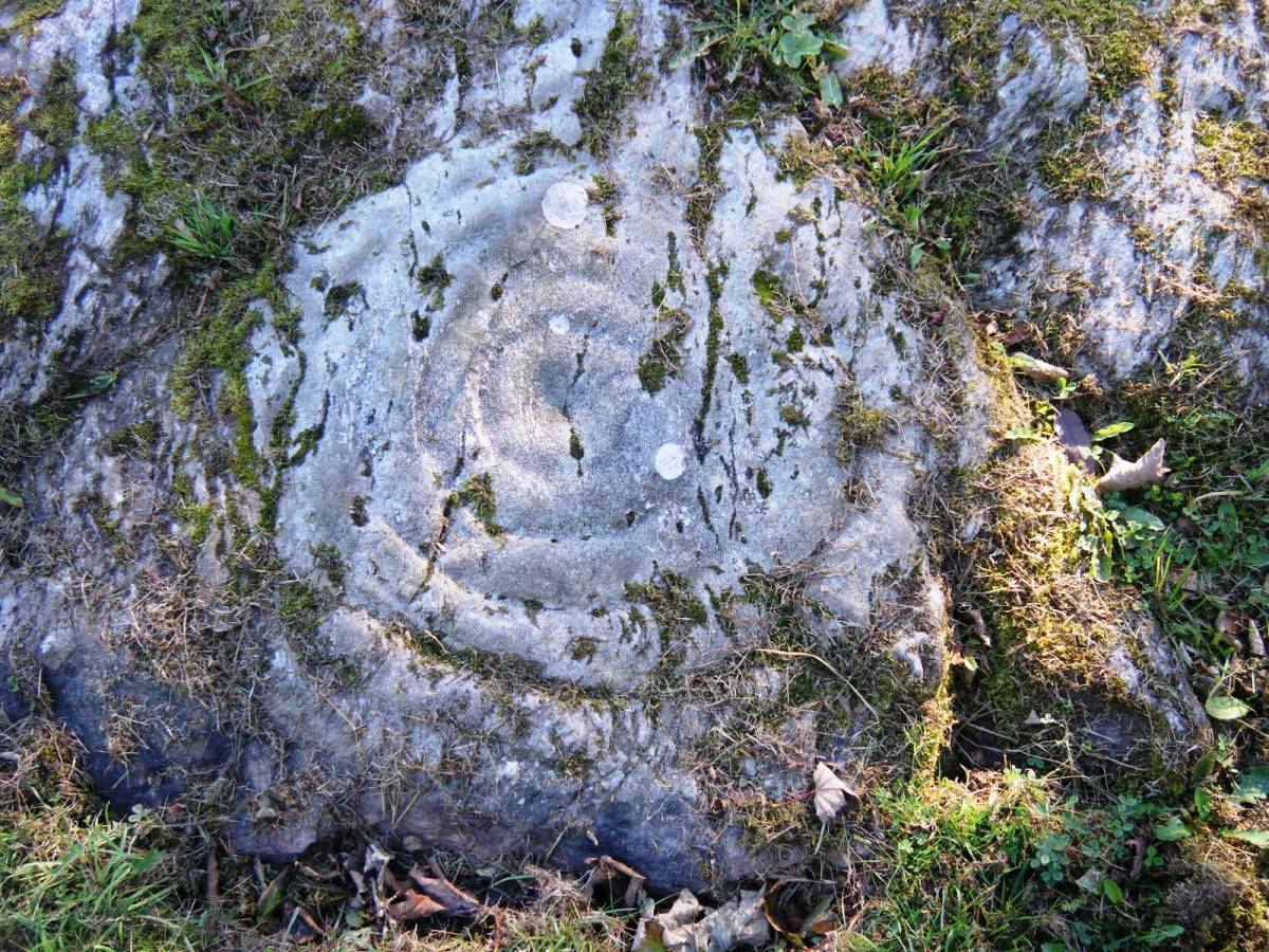
| Image 4 ID | 4714 Click image to enlarge |
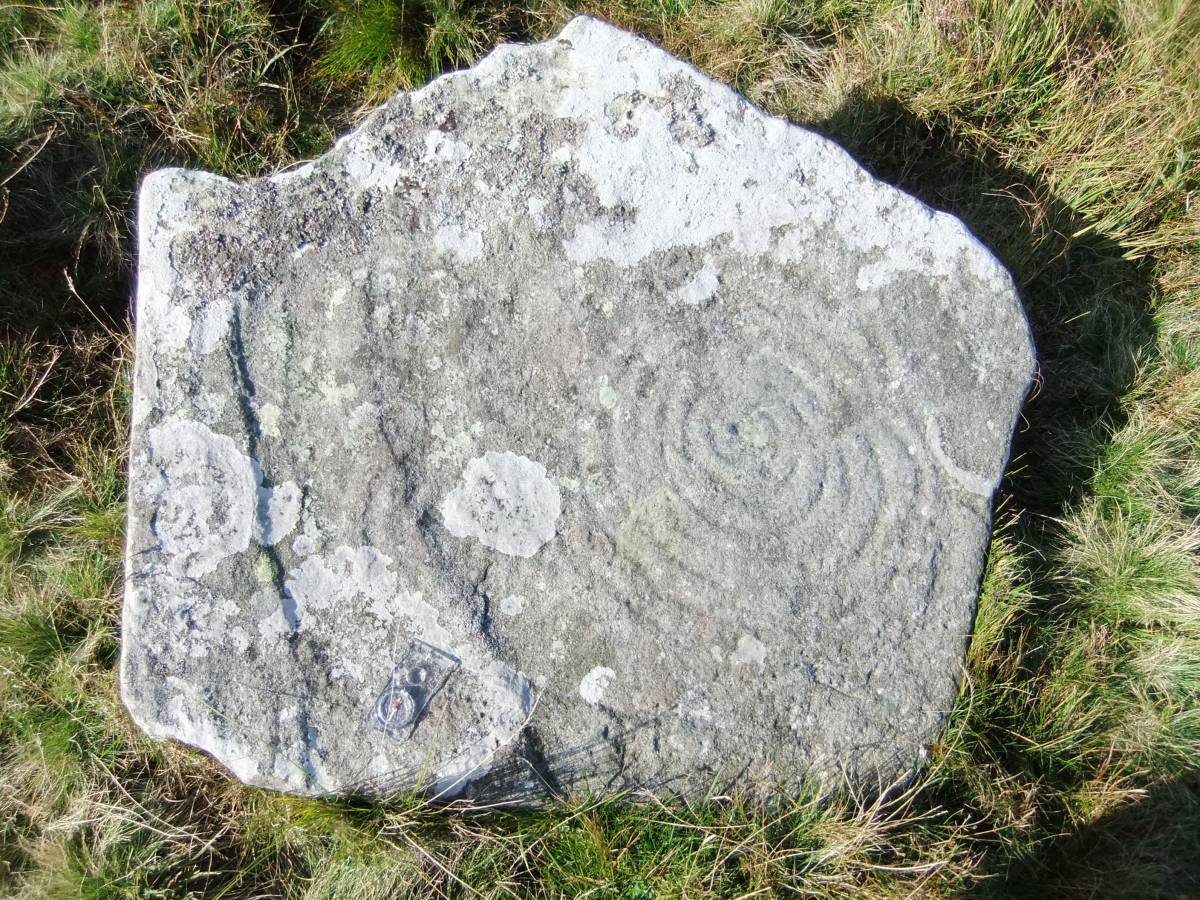
| Image 4 Description | Detail of last. | 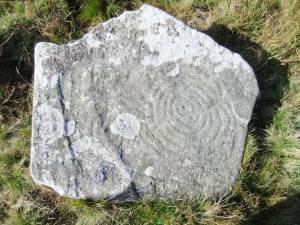 |
| Image 5 ID | 4715 Click image to enlarge |
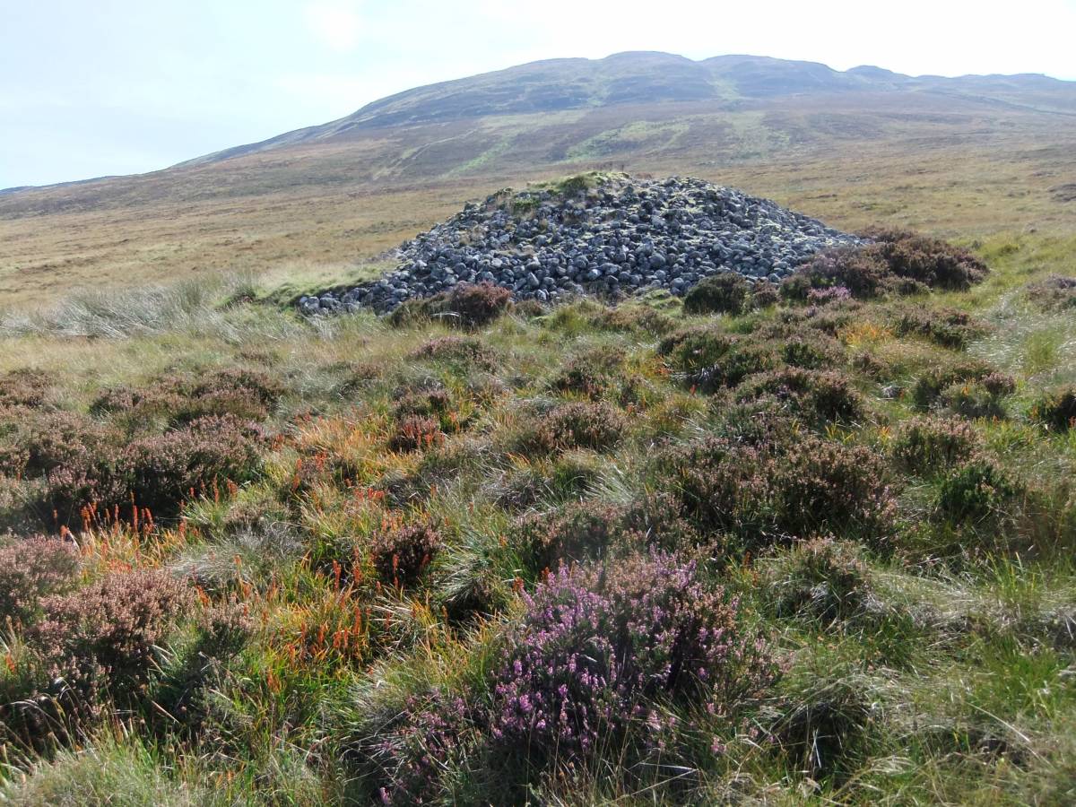
| Image 5 Description | The round cairn and adjacent stone circle south of the Cauldside Burn. | 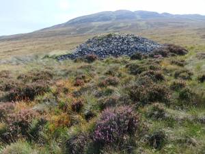 |
| Image 6 ID | 4716 Click image to enlarge |
| Image 6 Description | Drumtroddan Farm Site 2. | 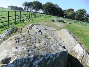 |
| Image 7 ID | 4717 Click image to enlarge |
| Image 7 Description | Drumtroddan Farm Site 2. | 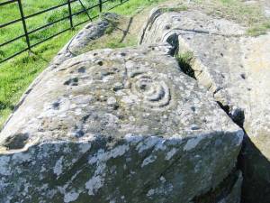 |
| Image 8 ID | 4718 Click image to enlarge |
| Image 8 Description | Drumtroddan Farm Site 2. | 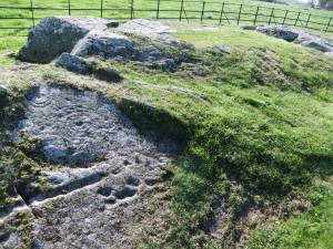 |
| Image 9 ID | 4719 Click image to enlarge |
| Image 9 Description | Drumtroddan Farm Site 2. | 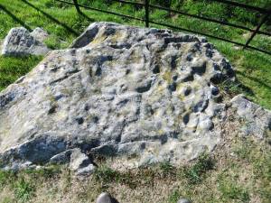 |
| Image 10 ID | 4720 Click image to enlarge |
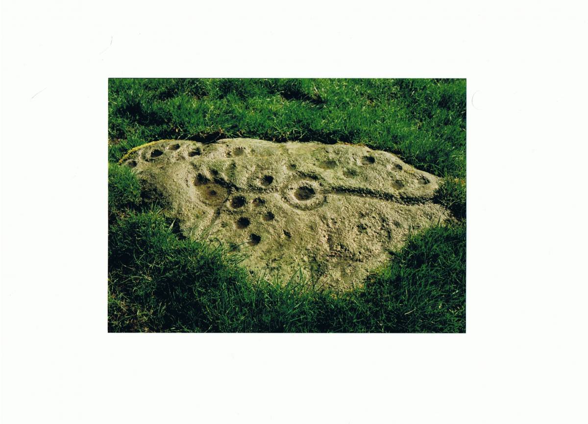
| Image 10 Description | Drumtroddan Farm Site 3, the large figure. |  |
| Image 11 ID | 4721 |
| Image 11 Description | Drumtroddan Farm Site 3. The largest figure. Central cup and five complete rings, 71cm diameter |  |
| Image 12 ID | 4722 |
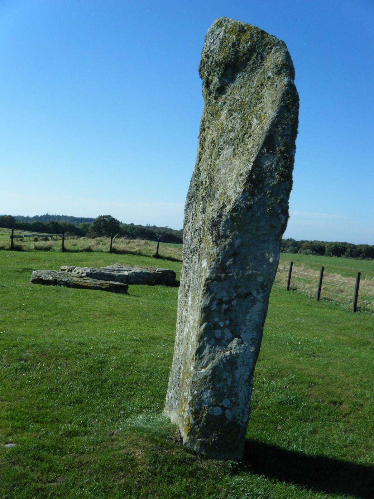
| Image 12 Description | Dromtroddan Farm. Standing stone, the only stone sremaining of an alignment, Fallen stones visible within the fenced enclosure. |  |
| Image 13 ID | 4723 |
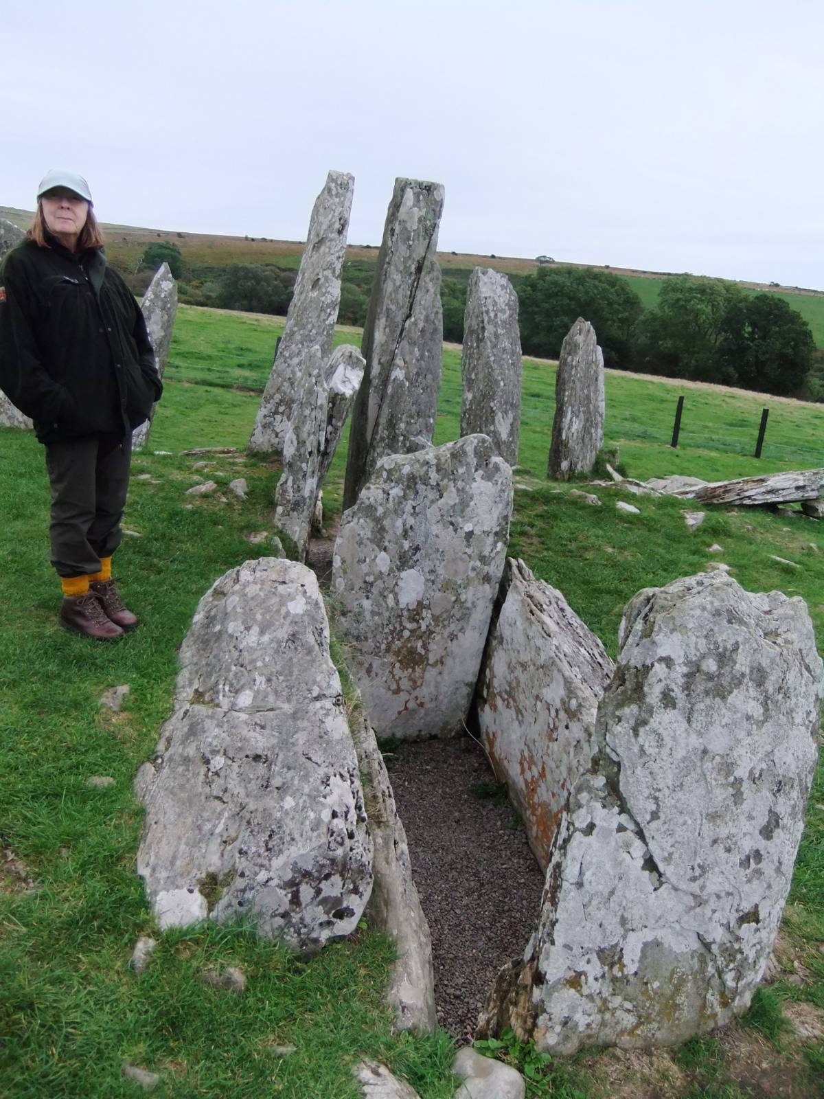
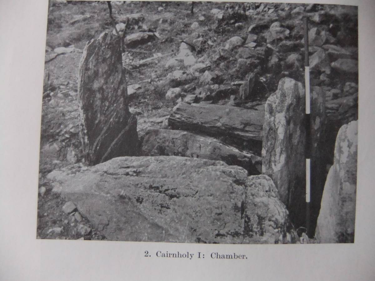
| Image 13 Description | Cairnholy 1 Chambered Cairn. The façade and central passage between two portal stones as it is seen today. Before excavation the forecourt and entrance to the façade was blocked by massive stone cairn material. The cup and ring stone was inserted into the chamber by removing stonework from the side of the chamber | 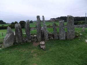 |
| Image 14 ID | 4724 |
| Image 14 Description | The main body of the cairn was measured to be 140ft in length. The retaining stones and the base of the cairn survive. The remainder of the cairn has been quarried away. | 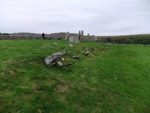 |
| Image 15 ID | 4725 |
| Image 15 Description | The chamber, passage and façade. | 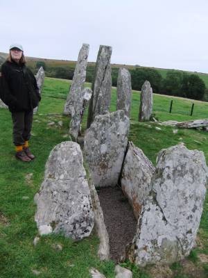 |
| Image 16 ID | 4726 |
| Image 16 Description | The cup and six concentric ring marked slab photographed as discovered within the Chamber. Stuart Piggott and T.G.E. Powell 1949, Plate XXVIII |  |
| Image 17 ID | 4727 |
| Image 17 Description | The cup and ring marked slab may have been made specifically for the later food vessel burial or alternately it may have been quarried from an existing cup and ring marked outcrop and carried to the chamber. | 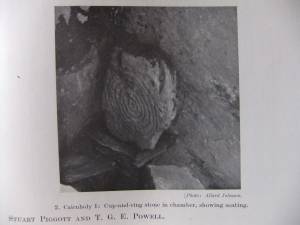 |
| Image 18 ID | 4728 |
| Image 18 Description | The chamber during excavation. | 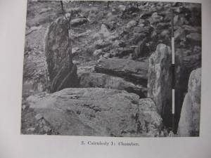 |
| Image 19 ID | 4729 |
| Image 19 Description | Distribution of Rock Art Sites on the NE Pennine Frings showing cup marked round cairns of Food Vessel Character. | 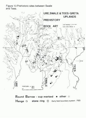 |
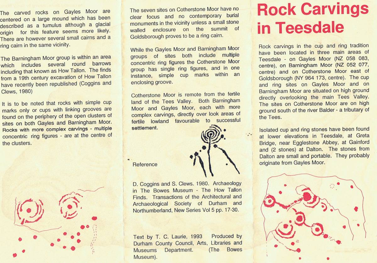
| Image 20 ID | 4730 |
| Image 20 Description | Rock art in Teesdale Leaflet for the Exhibition held at the Bowes Museum 1993.Front. | 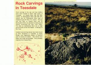 |
| Image 21 ID | 4731 |
| Image 21 Description | Rock art in Teesdale Leaflet for the Exhibition held at the Bowes Museum 1993.Rear. | 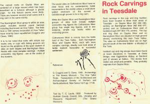 |
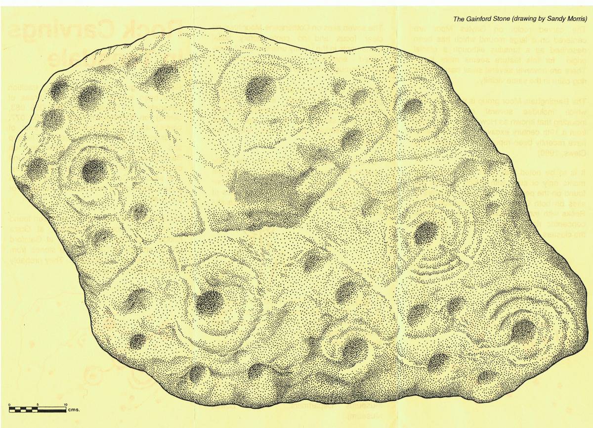
| Image 22 ID | 4735 |
| Image 22 Description | The Gainford Cist Cover, drawing by Sandy Morris for the Bowes Museum.. This is how cup and ring marked rocks should be drawn. Drawings based on rubbings cannot do justice to anything described as 'Art'. | 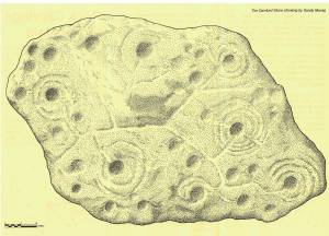 |
| Image 23 ID | 4732 |
| Image 23 Description | Gayles Moor. Detail of CR marked rock Surface. | 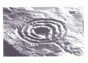 |
| Image 24 ID | 4733 |
| Image 24 Description | Gayles Moor. CR Rock Site | 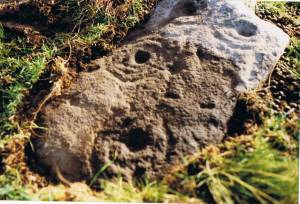 |
| Image 25 ID | 4734 |
| Image 25 Description | Gayles Moor Cup marked rock at eastern periphery of the area of rock carvings. | 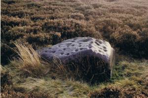 |
| Image 26 ID | 4736 |
| Image 26 Description | Teesdale. Cup and ring marked rock at | 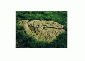 |
| Image 27 ID | 4737 |
| Image 27 Description | Swaledale. Cock How. Boulder with cups and groove only. |  |
| Image 28 ID | 4738 |
| Image 28 Description | Wensleydale, Addlebrough. Three cup and ring marked rocks are incorporated within the body of the summit cairn. | 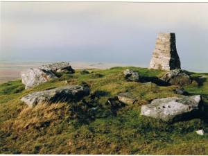 |
| Image 29 ID | 4739 |
| Image 29 Description | Wensleydale, Addlebrough. Three cup and ring marked rocks are incorporated within the body of the summit cairn. | 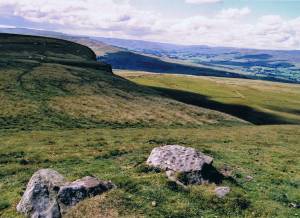 |
| Image 30 ID | 4740 |
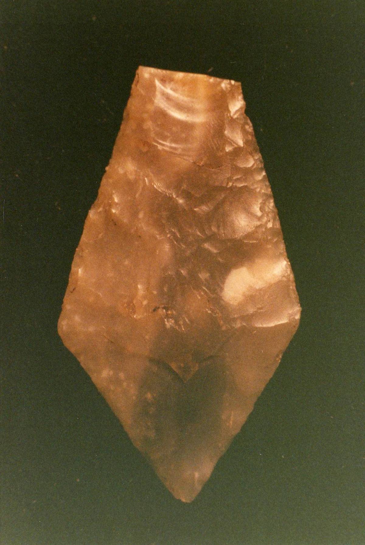
| Image 30 Description | Barningham High Moor. Kite shaped arrow point found at Eel Hill within the area of cup and ring marked rocks. | 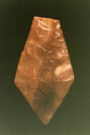 |