|
| *****SWAAG_ID***** | 765 |
| Date Entered | 31/10/2013 |
| Updated on | 31/10/2013 |
| Recorded by | Tim Laurie |
| Category | Earthworks |
| Record Type | Archaeology |
| SWAAG Site Name | |
| Site Type | |
| Site Name | |
| Site Description | |
| Site Access | Public Access Land |
| Record Date | 01/10/2013 |
| Location | Dumfriesshire.The Lowther Hills. Durisdeer Pass. NS902049 OS 1:50000 Sheet 68 |
| Civil Parish | Not known |
| Brit. National Grid | |
| Altitude | |
| Geology | Glacially rounded hills and steep sided stream valleys cut through Silurian Grits and shales. |
| Record Name | The Durisdeer Roman Fortlet controlling a remote pass through the Lowther Hills.. |
| Record Description | Small but impressive fortlet located so as to control the principal pass through the Lowther Hills from Dumfries to Biggar and so to Edinburgh. For the context of this fortlet, see Peter Dennison-Edson's Note below.
The earthwork defences of this fortlet enclose a very small area and have surely born witness to some extremely interesting events. This extremely well preserved fortlet is located directly on the line of a visible roman road which here passes through a steep sided defile through the Lowther Hills.
The locality of the fort is lonely and very atmospheric, the Lowther Hills are of Silurian grits and shales, which support very attractive heather and sedge softly coloured moorland vegetation rather similar to the Howgill Fells around Sedbergh.
This fortlet has a close parallel in the small fortlet which commands the western approaches from the Vale of Eden to the summit of the Stainmore Pass just 1km west of the Marching Camp at Rey Cross.
This area of the Valley of the River Nith is attractive, well wooded and full of interest and so, well worth a visit. |
| Dimensions | See photos |
| Geographical area | |
| Species | |
| Scientific Name | |
| Common / Notable Species | |
| Tree and / or Stem Girth | |
| Tree: Position / Form / Status | |
| Tree Site ID | 0 |
| Associated Site SWAAG ID | 0 |
| Additional Notes | Notes on the historical and stategic context of the Durisdeer Roman Fortlet prepared by Peter Dennison-Edson:
The Romans in South West Scotland
Records of Roman presence in Scotland focus around the campaigns of Agricola in the 80s AD (recorded by Tacitus) culminating in the battle against the Caledonians at Mons Graupius in AD84, the building of the Antonine Wall between the Clyde and the Forth from AD140, and the campaigns of the Emperor Septimius Severus in AD208-11.
All have left traces in the archaeological record but it is also clear that the Roman were active north of the line of Hadrian’s Wall from well before the Wall was built until at least the third century, consistent with the Roman policy of developing border zones rather than fixed linear frontiers, to protect areas under direct Roman rule through alliances and tribute-relationships as well as the threat or use of force.
The Romans knew the people of Dumfries and Galloway as the Novantae and would have wished to have strategic influence both as forward defence of the area south of the Solway and to prevent threats from the island of Ireland.
Ivan Margary in his great gazetteer of Roman roads in Britain, identifies a Roman road network in Scotland begun under Agricola whose completed sections include Road 7 running from Carlisle towards Edinburgh, from which Road 77 ran south-west from Crawford towards Durisdeer and Nithsdale, probably continuing to the known fort at Drumlanrig and down the valley of the Nith towards the large fort at Dalswinton near modern Dumfries. Agricola is said to have planned to invade Ireland at the time his governorship of Britain ended in AD84, and a northern invasion route through Galloway, as well as the more obvious route from Wales, might well have featured in his plans.
Durisdeer has a fortlet of a size to house up to two centuries, probably built to monitor the road and its surrounds, and two marching camps, the larger of legionary size of around 50 acres dated to the Flavian period of the time of Agricola and indicative of his general campaigning throughout Scotland over six annual campaigning seasons.
|
| Image 1 ID | 4802 Click image to enlarge |
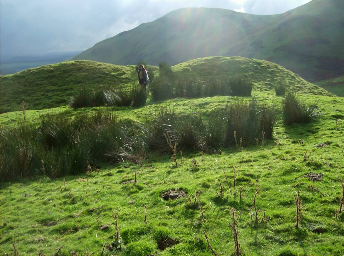
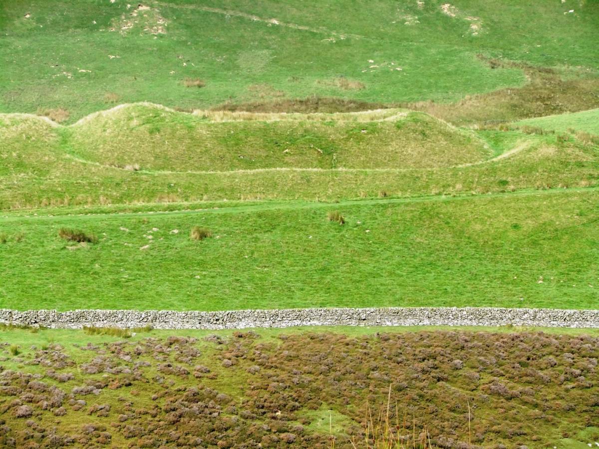
| Image 1 Description | The Durisdeer Roman Fortlet. | 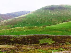 |
| Image 2 ID | 4808 Click image to enlarge |
| Image 2 Description | The northern defensive ditches and entrance to the fortlet | 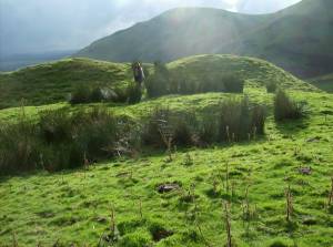 |
| Image 3 ID | 4804 Click image to enlarge |
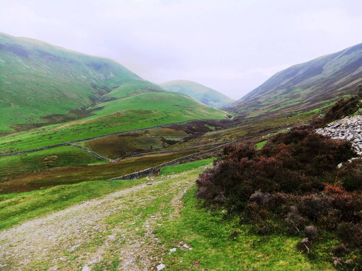
| Image 3 Description | The Durideer pass and the Lowther Hills. The fortlet is located in the mid distance on a glacial morainic hill at the centre of the photograph. | 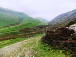 |
| Image 4 ID | 4805 Click image to enlarge |
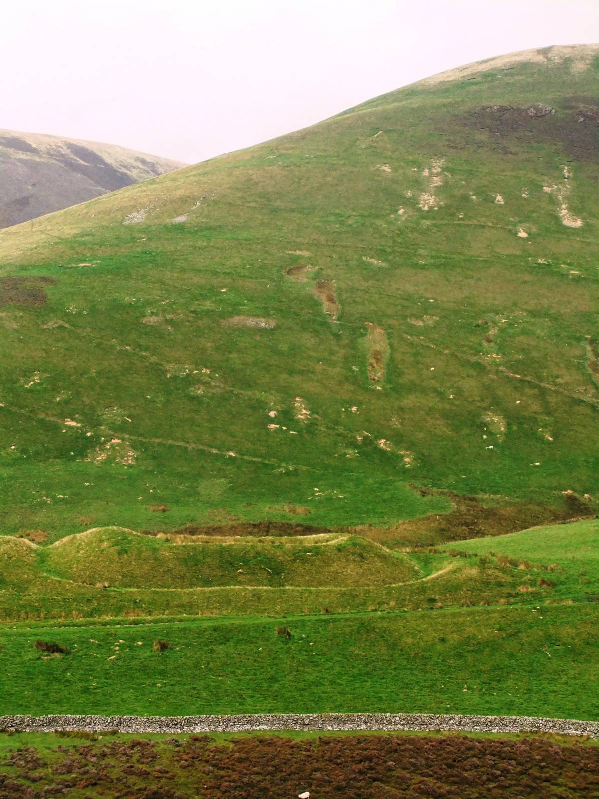
| Image 4 Description | Detail of the fortlet from the roman road which passes close to the fort. | 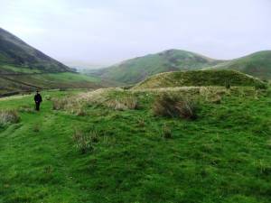 |
| Image 5 ID | 4806 Click image to enlarge |
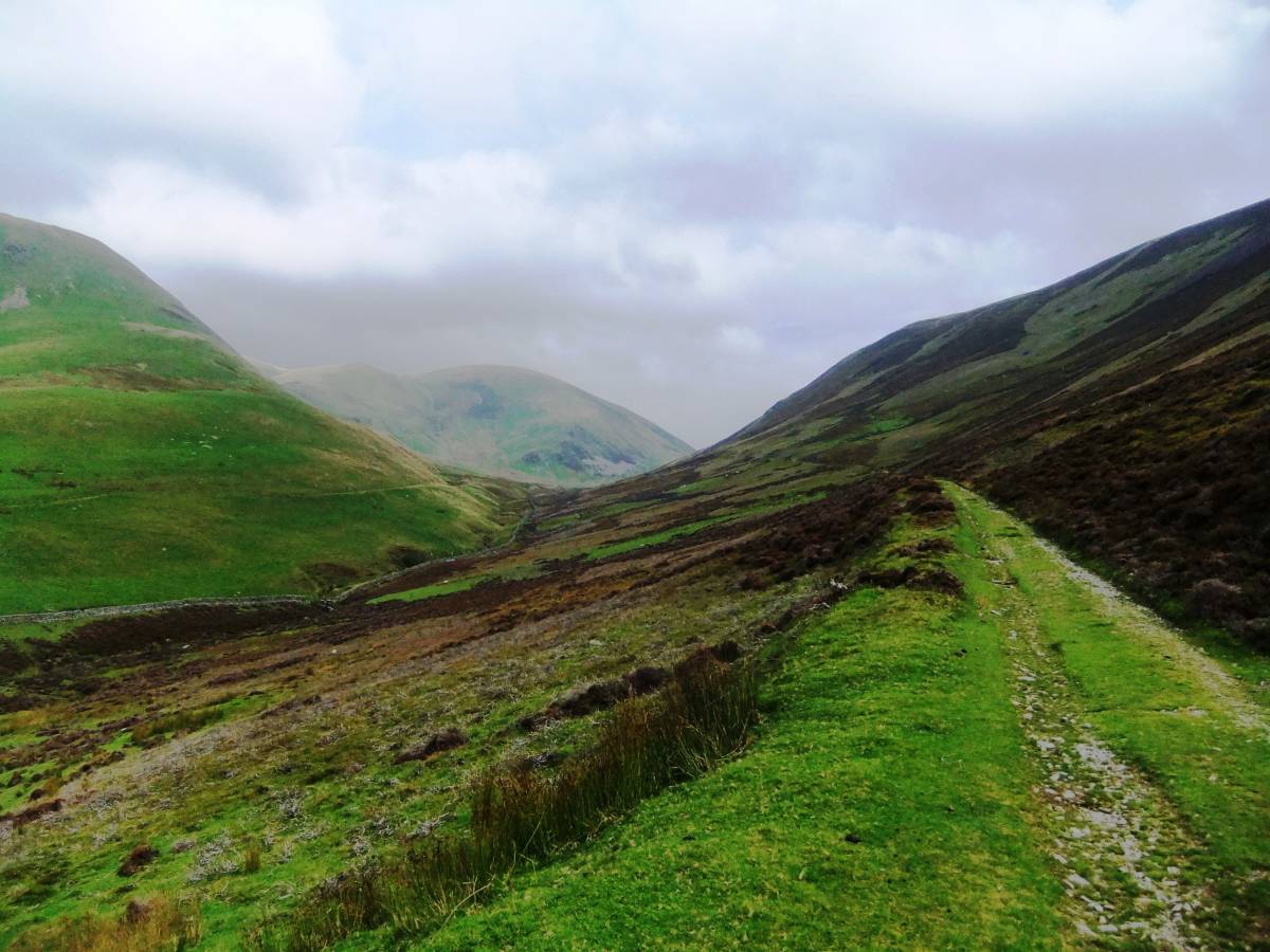
| Image 5 Description | The line of the roman road can just be seen on the hillside across the valley from the modern farm road. | 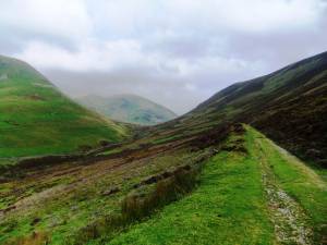 |
| Image 6 ID | 4807 Click image to enlarge |
| Image 6 Description | The small interior of the fortlet is strongly defended. | 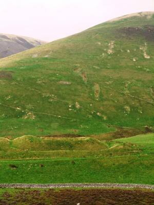 |
| Image 7 ID | 4803 Click image to enlarge |
| Image 7 Description | The Durisdeer Roman Fortlet seen from the modern farm road on the opposite side of the valley. | 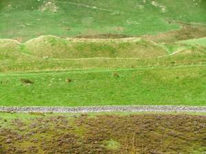 |
| Image 8 ID | 4809 Click image to enlarge |
| Image 8 Description | Detail of the fortlet. | 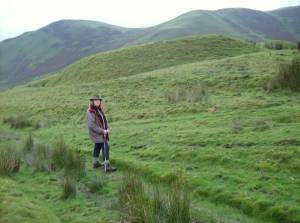 |
| Image 9 ID | 4810 Click image to enlarge |
| Image 9 Description | The approaches to the fort and modern farm road from Durisdeer. | 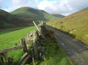 |