|
| *****SWAAG_ID***** | 447 |
| Date Entered | 01/02/2012 |
| Updated on | 21/01/2014 |
| Recorded by | Gill Savage |
| Category | Settlement |
| Record Type | Archaeology |
| SWAAG Site Name | |
| Site Type | |
| Site Name | |
| Site Description | |
| Site Access | Army Range |
| Record Date | 30/01/2012 |
| Location | Low Feldom Farm |
| Civil Parish | Marske |
| Brit. National Grid | NZ 05150 11250 |
| Altitude | 323m |
| Geology | |
| Record Name | Low Feldom DMV |
| Record Description | This site was first recognised and described by T.C.Laurie, 1990. Catterick & Feldom Conservation Group Monograph, 1990. pp7-12 "West Feldom-The Archaeological Background". The details ae recorded in this database at record number:227.
Click here to view record 227.
This survey was done by Gill Savage during the period Nov 2011 to Jan 2012. |
| Dimensions | |
| Geographical area | |
| Species | |
| Scientific Name | |
| Common / Notable Species | |
| Tree and / or Stem Girth | |
| Tree: Position / Form / Status | |
| Tree Site ID | 0 |
| Associated Site SWAAG ID | 0 |
| Additional Notes | |
| Image 1 ID | 2219 Click image to enlarge |
| Image 1 Description | Low Feldom DMV site - best view on Google Earth. | 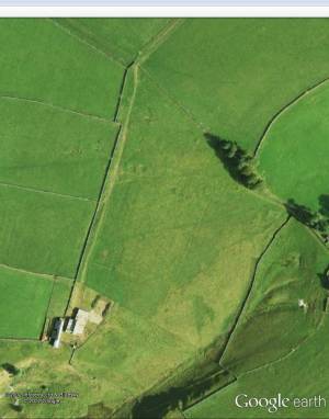 |
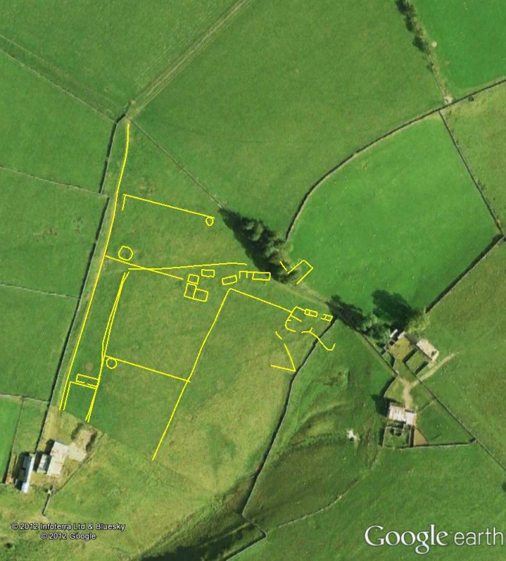
| Image 2 ID | 2216 Click image to enlarge |
| Image 2 Description | Low Feldom DMV site - best view on Google Earth with new 2012 survey superimposed. |  |
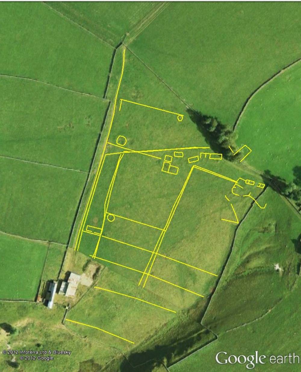
| Image 3 ID | 2217 Click image to enlarge |
| Image 3 Description | Low Feldom DMV site - best view on Google Earth with new survey 2012 superimposed and additional features seen on Google Earth. |  |
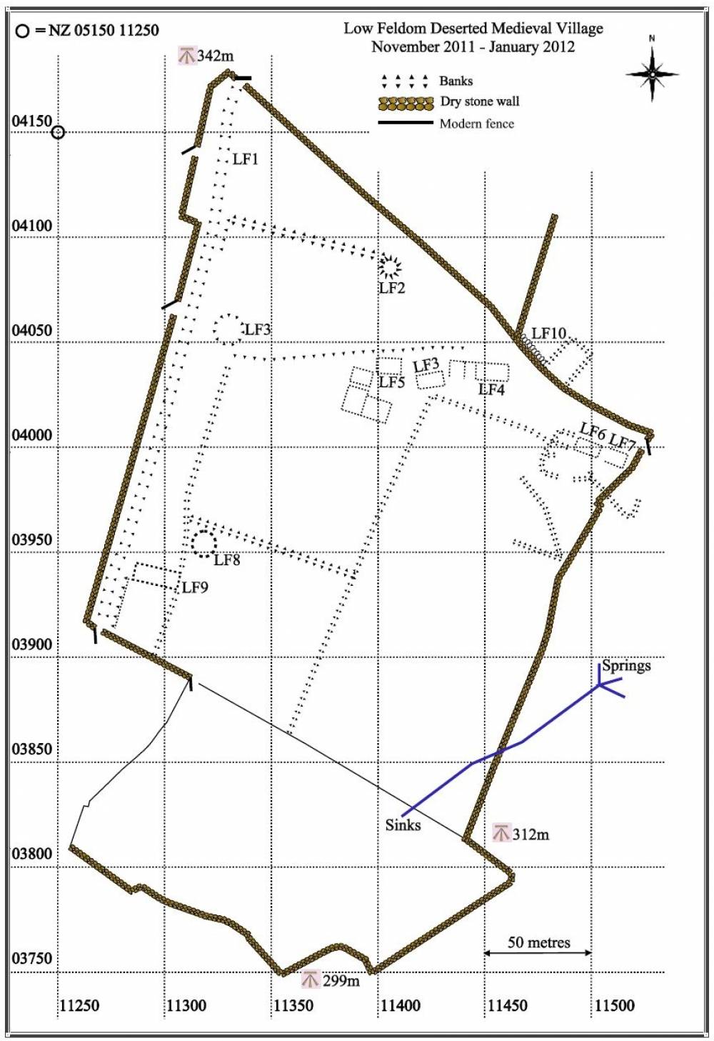
| Image 4 ID | 2224 Click image to enlarge |
| Image 4 Description | Low Feldom DMV site 2012 GPS survey | 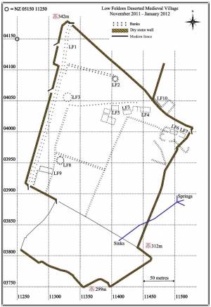 |
| Image 5 ID | 2220 Click image to enlarge |
| Image 5 Description | Low Feldom DMV site with Google Earth features | 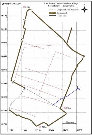 |
| Image 6 ID | 2222 Click image to enlarge |
| Image 6 Description | Low Feldom DMV site 2012 GPS survey + GE features | 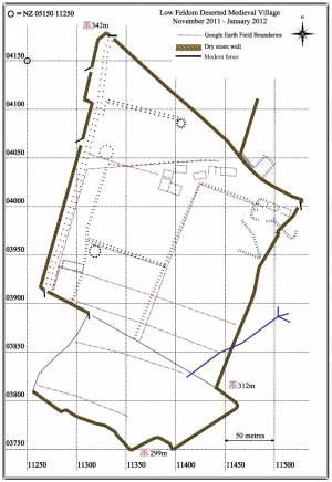 |
| Image 7 ID | 2223 Click image to enlarge |
| Image 7 Description | Low Feldom DMV site 2012 GPS survey on the 1:10,000 OS Map. © Crown copyright and database rights 2011 Ordnance Survey 100023740, kindly supplied by the North Yorkshire Dales National Park Authority. |  |
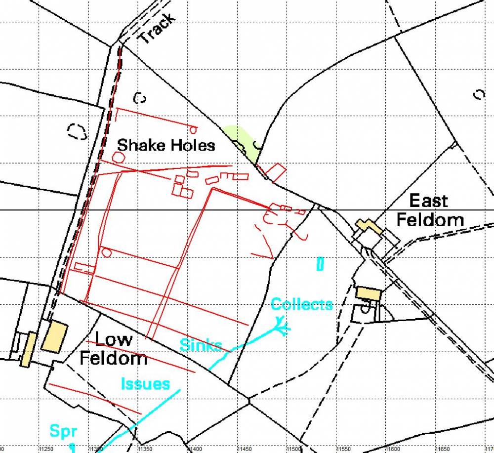
| Image 8 ID | 2221 Click image to enlarge |
| Image 8 Description | Low Feldom DMV site 2012 GPS survey+ GE features on the 1:10,000 OS Map. © Crown copyright and database rights 2011 Ordnance Survey 100023740, kindly supplied by the North Yorkshire Dales National Park Authority. |  |
| Image 9 ID | 2226 Click image to enlarge |
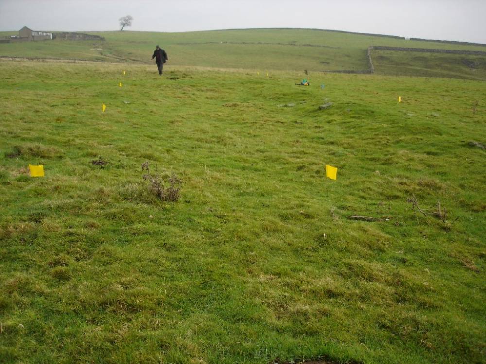
| Image 9 Description | Line of edging stones near rectangular platform | 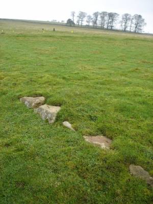 |
| Image 10 ID | 2227 Click image to enlarge |
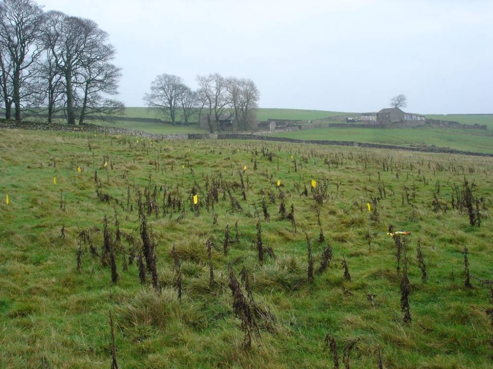
| Image 10 Description | Rectangular building near edging stones |  |
| Image 11 ID | 2228 |
| Image 11 Description | Range of rectangular buildings and enclosures | 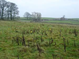 |
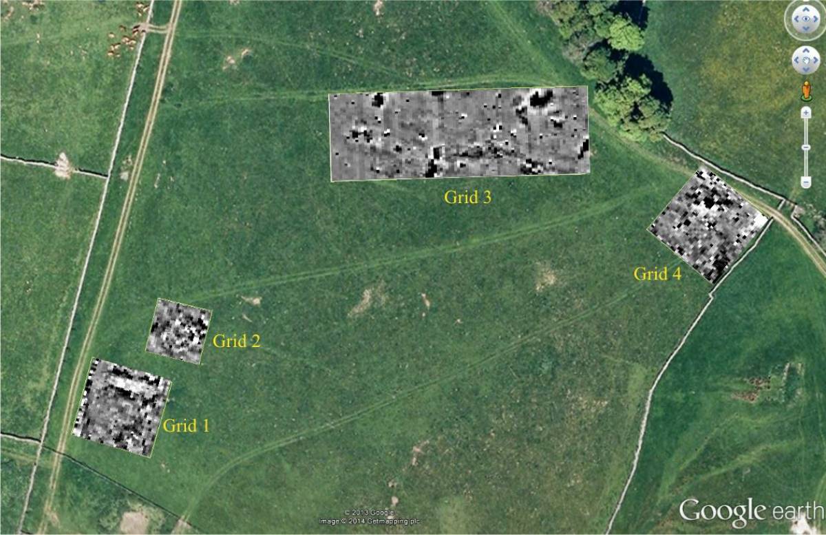
| Image 12 ID | 4990 |
| Image 12 Description | 20/01/2014 Gradiometer Survey using a Bartington 601-2 with minimal post processing | 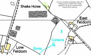 |
| Image 13 ID | 4991 |
| Image 13 Description | 20/01/2014 Gradiometer Survey using a Bartington 601-2 with minimal post processing |  |
| Image 14 ID | 4992 |
| Image 14 Description | 20/01/2014 Gradiometer Survey using a Bartington 601-2 with minimal post processing.
The earlier GPS survey which overlies the geophysics data was from a handheld device, which only had a map accuracy of 5-7 metres. This accounts for the apparent off-set of the circular feature in Grid 2 towards the bottom left of the image. | 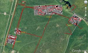 |