|
| *****SWAAG_ID***** | 457 |
| Date Entered | 14/02/2012 |
| Updated on | 17/02/2012 |
| Recorded by | Mike Walton |
| Category | Tree Site Record |
| Record Type | Botanical HER |
| SWAAG Site Name | |
| Site Type | |
| Site Name | |
| Site Description | |
| Site Access | Public Footpath |
| Record Date | 12/02/2012 |
| Location | Between Ivelet and Rampsholme |
| Civil Parish | Muker |
| Brit. National Grid | SD 928 979 |
| Altitude | 822ft |
| Geology | Glacial drift over Middle Limestone |
| Record Name | Relict hedgerows between Ivelet and Rampsholme. |
| Record Description | Relict hedgerows on the line of later drystone enclosure walls evidenced by fair numbers of ancient layered (laid) hedgerow trees. To date the majority of these ancient layered trees are ash, but occasional wych elm and bird cherry. Fair numbers of ancient hedgerow hawthorns are also present.
Without exception,the late 18th/Early 19thC dry stone field walls abut the relict hedgerow trees shown on the photographs below. This evidence clearly indicates that the relict hedgerows predate the present day walled landscapes of Upper Swaledale.
TCL Note! Andrew Fleming first noticed that the walled landscapes of Swaledale were preceded by a hedgerow landscape, however the evidence has only now beeen presented in photographic detail. |
| Dimensions | Widespread and scattered among walled pastures below the unfenced road from Gunnerside. |
| Geographical area | Upper Swaledale |
| Species | |
| Scientific Name | |
| Common / Notable Species | |
| Tree and / or Stem Girth | |
| Tree: Position / Form / Status | |
| Tree Site ID | 0 |
| Associated Site SWAAG ID | 0 |
| Additional Notes | The purpose of this record is to provide a photo record of examples of these relict hedges as seen from the public footpaths which traverse these pastures. |
| Image 1 ID | 2266 Click image to enlarge |
| Image 1 Description | Ash in wall above Shore Gill, Ivelet, SD9371793003. | 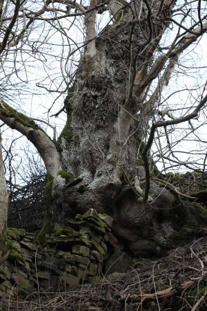 |
| Image 2 ID | 2267 Click image to enlarge |
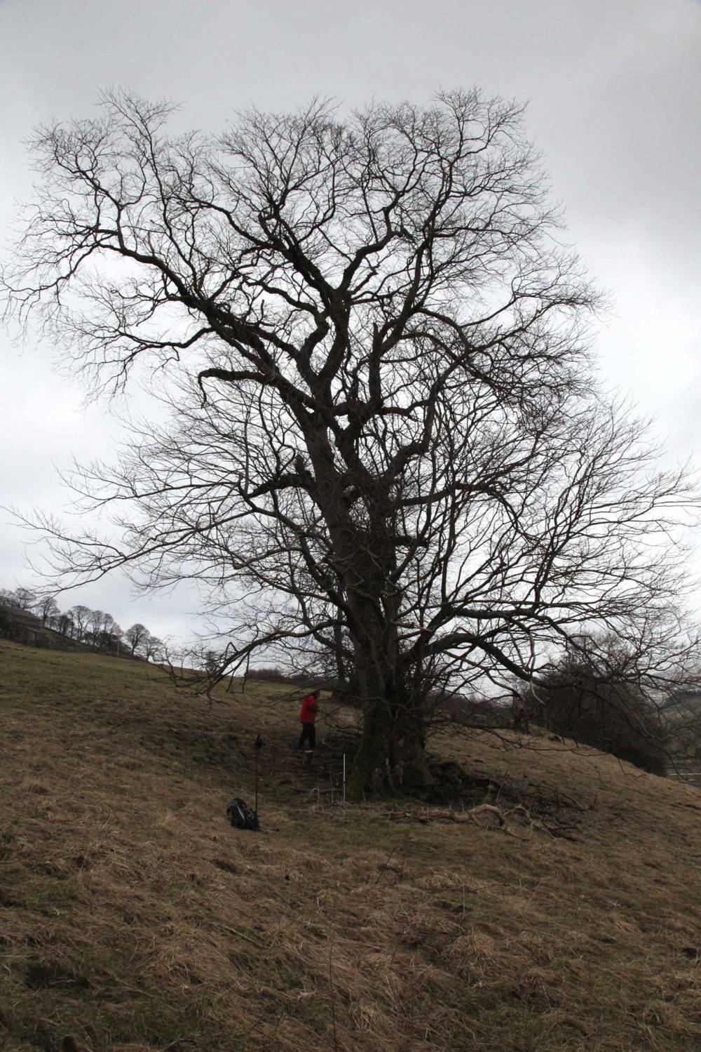
| Image 2 Description | Very large ash in wall near Ivelet Bridge, SD9327 9788. |  |
| Image 3 ID | 2268 Click image to enlarge |
| Image 3 Description | Another view of ash in 2267. | 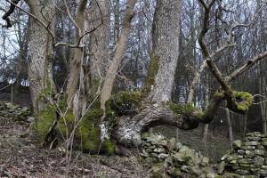 |
| Image 4 ID | 2269 Click image to enlarge |
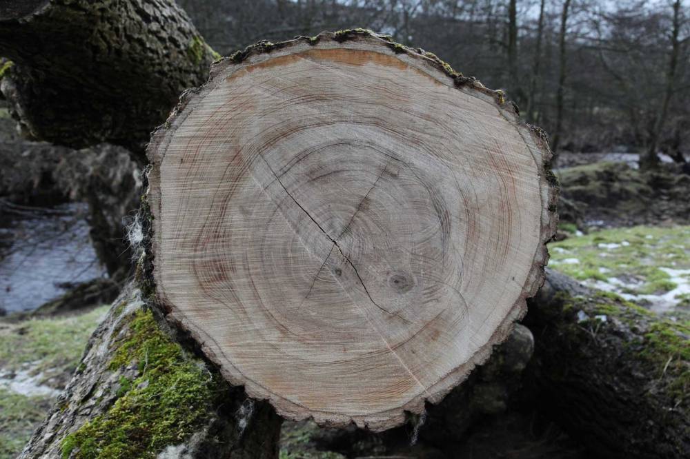
| Image 4 Description | Cut section through branch of a fallen ash by the River Swale, showing growth rings. Approx SD9323 9780. |  |
| Image 5 ID | 2270 Click image to enlarge |
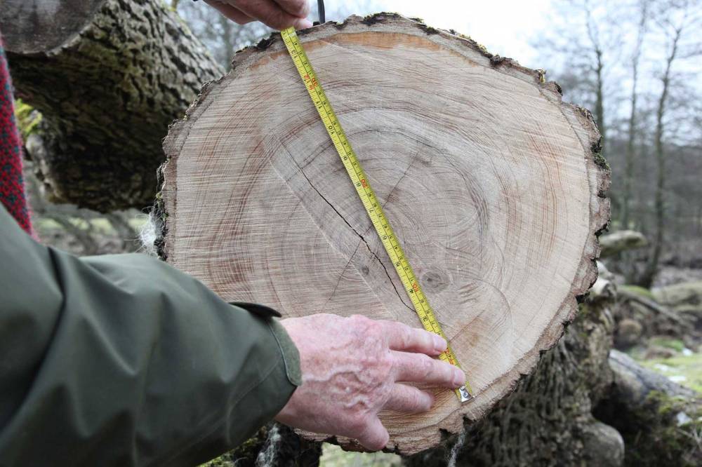
| Image 5 Description | Cut section with tape measure for scale. Diameter 344mm, ring count indicates this is about 176 years old, i.e the average growth rate was about 0.98mm per year. |  |
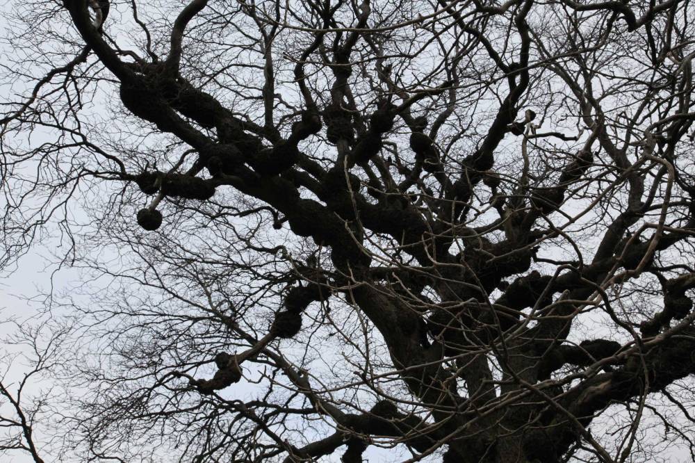
| Image 6 ID | 2273 Click image to enlarge |
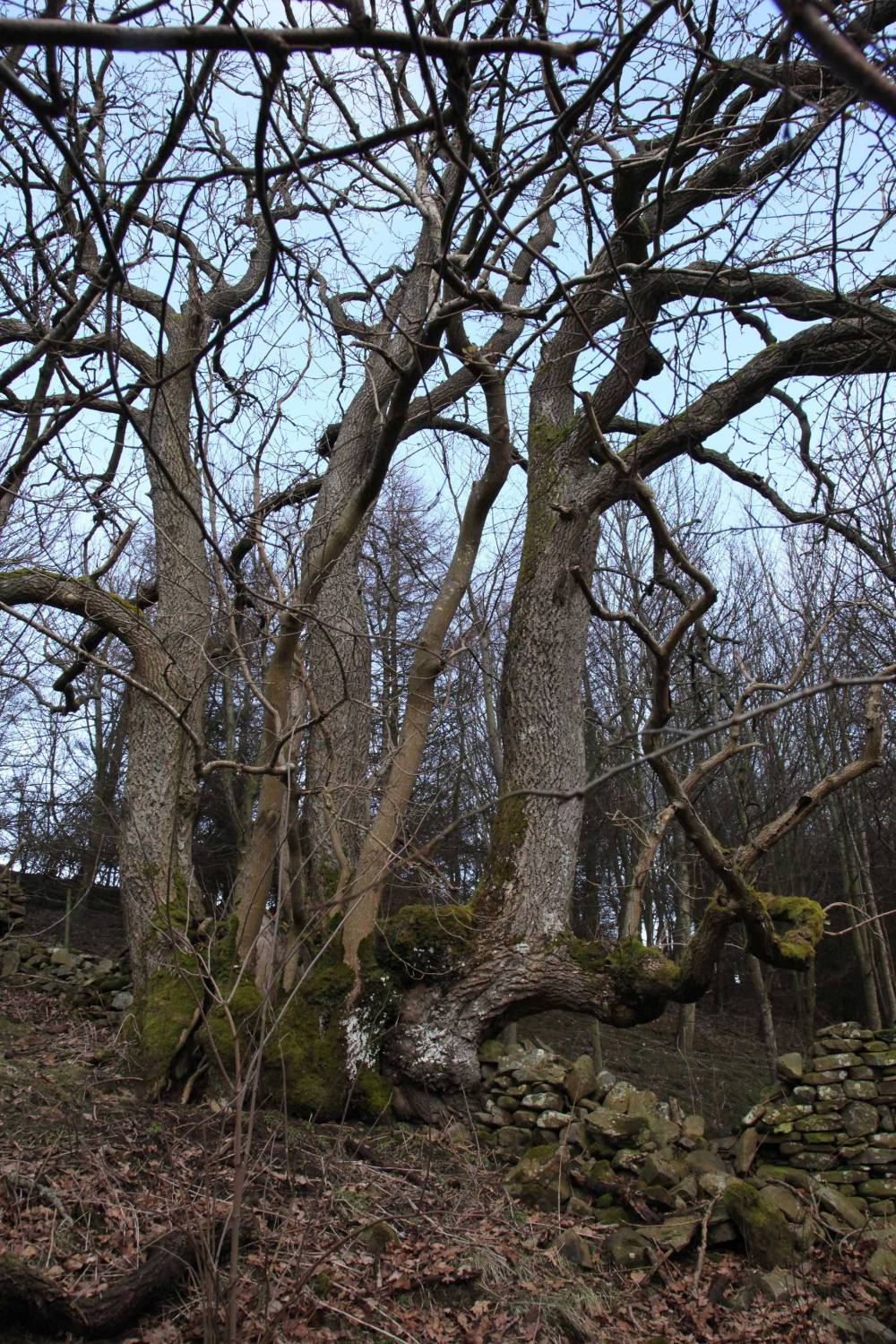
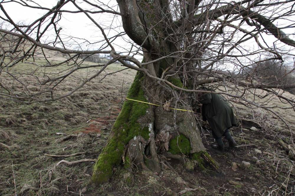
| Image 6 Description | Ancient short pollard wych elm at SD91950 97887, altitude 806ft. |  |
| Image 7 ID | 2272 Click image to enlarge |
| Image 7 Description | Wych elm (as 2273) girth measurement (4.56m at 0.8m). |  |
| Image 8 ID | 2274 Click image to enlarge |
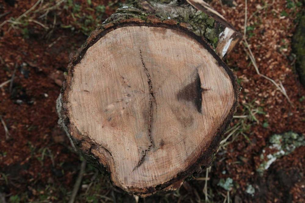
| Image 8 Description | Cut section through a branch fallen from Wych Elm ( as 2273), showing growth rings. |  |
| Image 9 ID | 2275 Click image to enlarge |
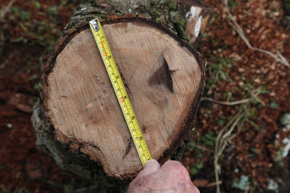
| Image 9 Description | Cut section with measuring tape for scale. Diameter 183mm, ring count indicates this branch was about 110 years old, i.e the average growth rate was about 0.83mm per year. | 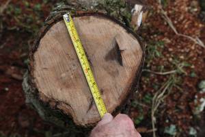 |
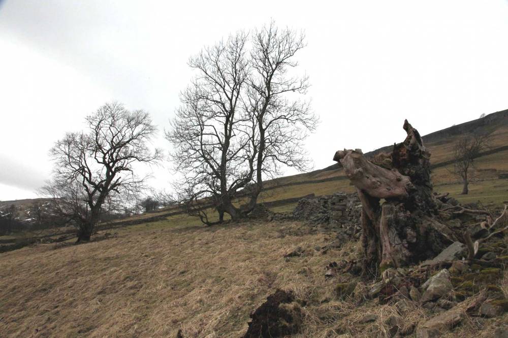
| Image 10 ID | 2276 Click image to enlarge |
| Image 10 Description | Dead pollarded wych elm at SD91993 97868, altitude 822ft. (Girth 3.65m at 1.0m) | 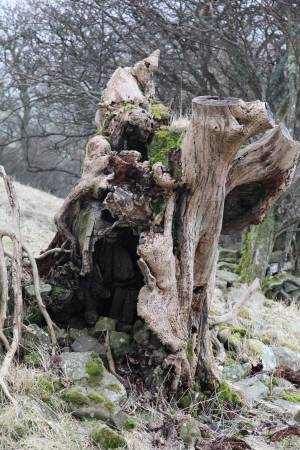 |
| Image 11 ID | 2277 |
| Image 11 Description | Laid ash tree between the two previous elms | 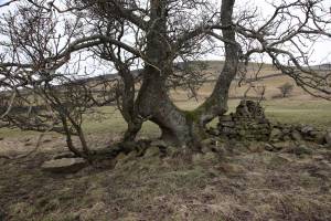 |
| Image 12 ID | 2278 |
| Image 12 Description | View showing the two previous wych elms and the ash tree together. |  |
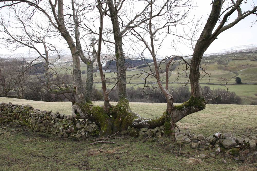
| Image 13 ID | 2279 |
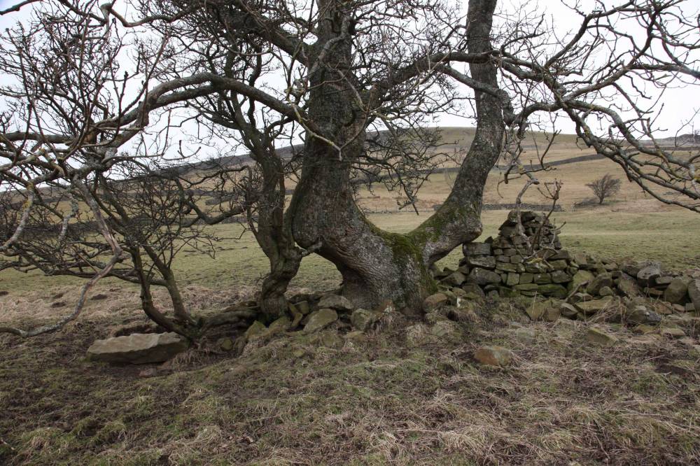
| Image 13 Description | Laid ash tree in wall at SD92822 97908, altitude 906ft. Viewed from south. Estimated girth 4.5m. | 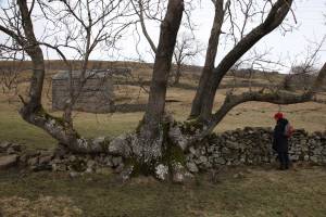 |
| Image 14 ID | 2280 |
| Image 14 Description | Laid ash tree in wall at SD92822 97908, viewed from north. |  |
| Image 15 ID | 2281 |
| Image 15 Description | Wych elm at SD93071 97921, altitude 848ft. Very stunted with dead wood and many bulbous growths. Otherwise appears to be healthy. | 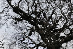 |