|
| *****SWAAG_ID***** | 455 |
| Date Entered | 06/02/2012 |
| Updated on | 07/02/2012 |
| Recorded by | Stephen Eastmead |
| Category | Mining Related |
| Record Type | Mining |
| SWAAG Site Name | |
| Site Type | |
| Site Name | |
| Site Description | |
| Site Access | Army Range |
| Record Date | 06/02/2012 |
| Location | Park Gill Lead mine |
| Civil Parish | Bellerby |
| Brit. National Grid | SE 09349 93051 |
| Altitude | 287m |
| Geology | This mine was part of the Herontree Allotment Strings. The workings were in the Richmond cherts and did not extend down to the 10 Fathom Grit or the Main Limestones. Pg 180 Geology of the Northern Pennine Orefield, Dunham and Wilson.
|
| Record Name | Park Gill Mine Workings |
| Record Description | There is little information about these workings and what there is gives the impression that they were not very productive. On the ground there is no evidence of lead contamination of the soil. There is one major spoil heap of gang rock and no evidence of ore being dressed.
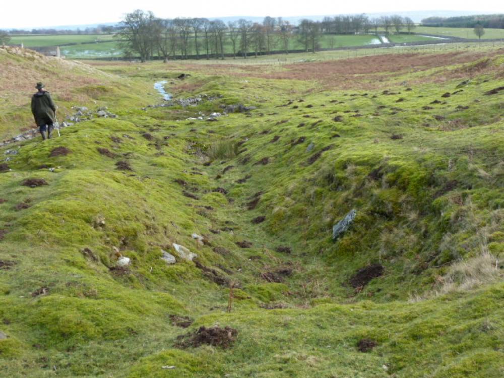
The major feature appears to be a possible level entrance, the main spoil heap, a continuous cut and the diverted gill. See images and their descriptions. There are also a number of platforms and small shafts. |
| Dimensions | |
| Geographical area | |
| Species | |
| Scientific Name | |
| Common / Notable Species | |
| Tree and / or Stem Girth | |
| Tree: Position / Form / Status | |
| Tree Site ID | 0 |
| Associated Site SWAAG ID | 0 |
| Additional Notes | |
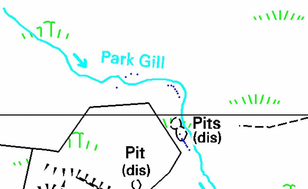
| Image 1 ID | 2247 Click image to enlarge |
| Image 1 Description | Park Gill Map | 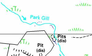 |
| Image 2 ID | 2248 Click image to enlarge |
| Image 2 Description | Google Earth Image of main areas. 1 = level 2= spoil heap 3 = Cut | 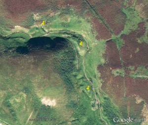 |
| Image 3 ID | 2249 Click image to enlarge |
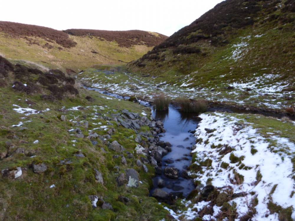
| Image 3 Description | Looking towards where there may have been a level entrance. |  |
| Image 4 ID | 2250 Click image to enlarge |
| Image 4 Description | Lookin down from above where the level entrance may have been. |  |
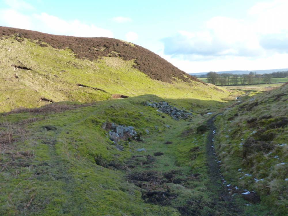
| Image 5 ID | 2251 Click image to enlarge |
| Image 5 Description | Spoil heap looking down Park Gill |  |
| Image 6 ID | 2253 Click image to enlarge |
| Image 6 Description | Spoil heap | 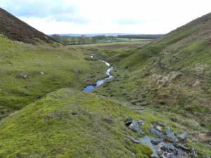 |
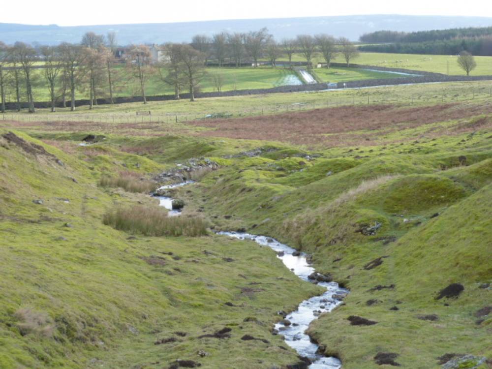
| Image 7 ID | 2254 Click image to enlarge |
| Image 7 Description | Lower Park Gill and the lower mine workings |  |
| Image 8 ID | 2255 Click image to enlarge |
| Image 8 Description | 'Open Cut' mine workings |  |
| Image 9 ID | 2256 Click image to enlarge |
| Image 9 Description | Diversion of the gill. Right goes to the sink hole | 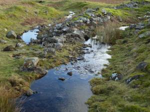 |
| Image 10 ID | 2257 Click image to enlarge |
| Image 10 Description | Diverted watercourse ends in a sink hole |  |