|
| *****SWAAG_ID***** | 450 |
| Date Entered | 05/02/2012 |
| Updated on | 05/02/2012 |
| Recorded by | Tim Laurie |
| Category | Geological Record |
| Record Type | Geological HER |
| SWAAG Site Name | |
| Site Type | |
| Site Name | |
| Site Description | |
| Site Access | Public Access Land |
| Record Date | 03/01/2012 |
| Location | Melbecks. Barf Side. |
| Civil Parish | Melbecks |
| Brit. National Grid | SD 9672 9804 |
| Altitude | 380m |
| Geology | Dale side Scar or low cliff with extensive turf covered pavement above and vegetated talus slope and ?kame terrace below formed by an exposure of the Middle Limestone. |
| Record Name | Melbecks. Barf Side. Limestone Scar and pavement formed by the Midle Limestone. |
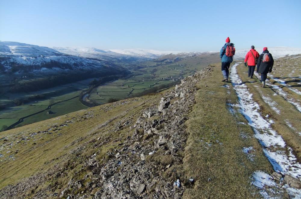
| Record Description | This prominent limestone scar forms the southern edge of Low Row Pasture and provides one of the best high terrace viewpoints in Swaledale. A good track follows the edge of the Scar from which excellent views of the middle reaches of Swaledale and of Shunner Fell in the distance are obtained. The Middle Limestone is the fifth of the cyclotherms below the top of the Main Limestone and underlies the Underset,Three Yard and Five Yard Limestone Cyclotherms. The Middle Limestone Cyclotherm includes the Scar Limestone, the Cockle Shell Limestone and the Single Post Limestone.
The upper surface of the Middle Limestone forms an extensive pavement on the southern edge of Low Row Pasture which is characterised by limestone turf which in May and June is bright with the small flowers of Mountain Pansies (Viola tricolor) ( predominanly yellow in Swaledale, blue in Teesdale).
To the north, the Main Limestone is overlain by thin peat and by a quarried strata of sandstone which has provided the material for buildings and drystone walls of the area. |
| Dimensions | The Limestone Scar is approximately 1km in length |
| Geographical area | |
| Species | |
| Scientific Name | |
| Common / Notable Species | |
| Tree and / or Stem Girth | |
| Tree: Position / Form / Status | |
| Tree Site ID | 0 |
| Associated Site SWAAG ID | 0 |
| Additional Notes | The excellent grazing provided by the calcareous soils over the Main Limestone pavement here has always been attractive th pastoral settlement and hunting activity. A well defined coaxial field system with scattered cairns extends across Low Row Pasture (to be recorded seperately, see HER to follow) |
| Image 1 ID | 2230 Click image to enlarge |
| Image 1 Description | The Edge or Scar formed by the Middle Limestone forms one of the best viewpoints in Swaledale. | 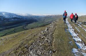 |
| Image 2 ID | 2229 Click image to enlarge |
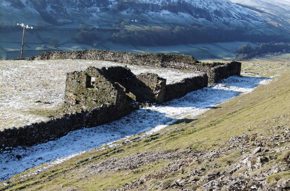
| Image 2 Description | Middle Limestone exposed above Barf Side, with ruined barn. | 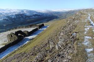 |
| Image 3 ID | 2231 Click image to enlarge |
| Image 3 Description | Barf Side, ruined barn. Detail. | 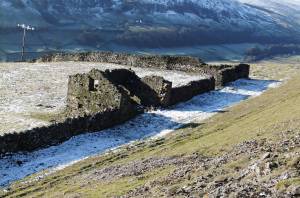 |
| Image 4 ID | 1244 Click image to enlarge |
| Image 4 Description | Barb and tanged arrowpoint found on Low Row Pasture. | 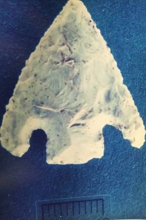 |