|
| *****SWAAG_ID***** | 487 |
| Date Entered | 02/04/2012 |
| Updated on | 04/09/2012 |
| Recorded by | Alan and Judith Mills |
| Category | Mining Related |
| Record Type | Mining |
| SWAAG Site Name | |
| Site Type | |
| Site Name | |
| Site Description | |
| Site Access | Public Access Land |
| Record Date | 01/04/2012 |
| Location | Marrick Moor |
| Civil Parish | Marrick |
| Brit. National Grid | NZ 055 001 |
| Altitude | 1400ft |
| Geology | Yoredale series |
| Record Name | Copperthwaite Vein |
| Record Description | The Copperthwaite Vein is one of the major veins in Swaledale. Workings on the vein extend from NZ 0487 0003 on Fremington Edge in the West to NZ 0632 0048 in the East; approximately one mile in length. The workings include a hush at the Western end, shafts and opencast. The number and density of these workings along its length are testimony to the length of time for which it has been worked and to the quality of the vein. Mike Gill ( Swaledale its mines & smelt mills; p138) notes that it had been worked "from time out of mind". A map of 1592 shows the workings to have been extensive by that time and these continued well into the 19th century. More information is to be found in Les Tyson's monograph 'A history of the manor and lead mines of Marrick' (British Mining no. 38, 1989). |
| Dimensions | |
| Geographical area | |
| Species | |
| Scientific Name | |
| Common / Notable Species | |
| Tree and / or Stem Girth | |
| Tree: Position / Form / Status | |
| Tree Site ID | 0 |
| Associated Site SWAAG ID | 0 |
| Additional Notes | |
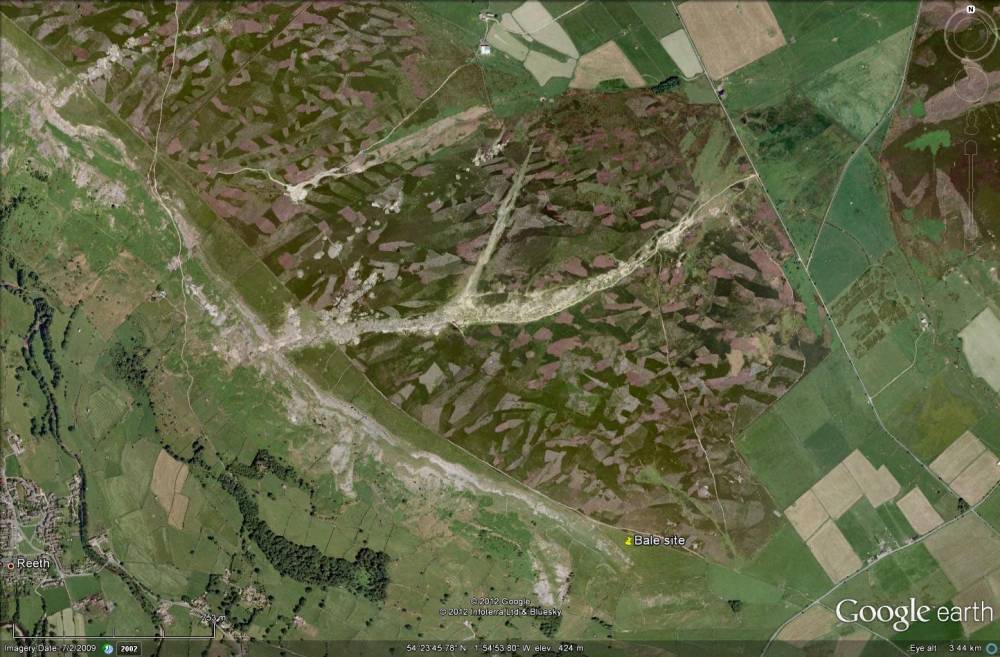
| Image 1 ID | 2556 Click image to enlarge |
| Image 1 Description | The Copperthwaite Vein is shown in the centre, trending approximately E - W. | 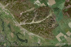 |
| Image 2 ID | 2557 Click image to enlarge |
| Image 2 Description | The Western end of the vein, just below Fremington Edge. This looks like a spoil heap from a level driven onto the vein; there is some possible evidence of a level entrance but inconclusive. | 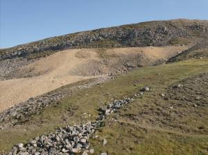 |
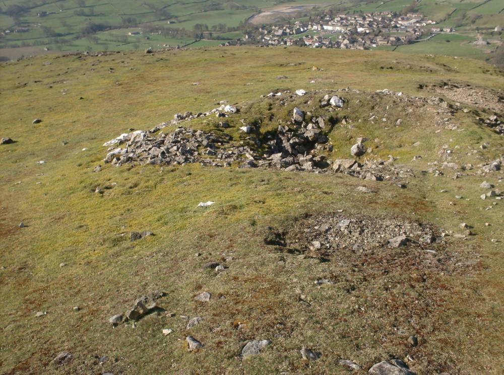
| Image 3 ID | 2558 Click image to enlarge |
| Image 3 Description | A possible bale in the foreground with small shaft behind and Reeth down below. | 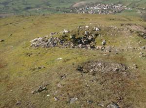 |
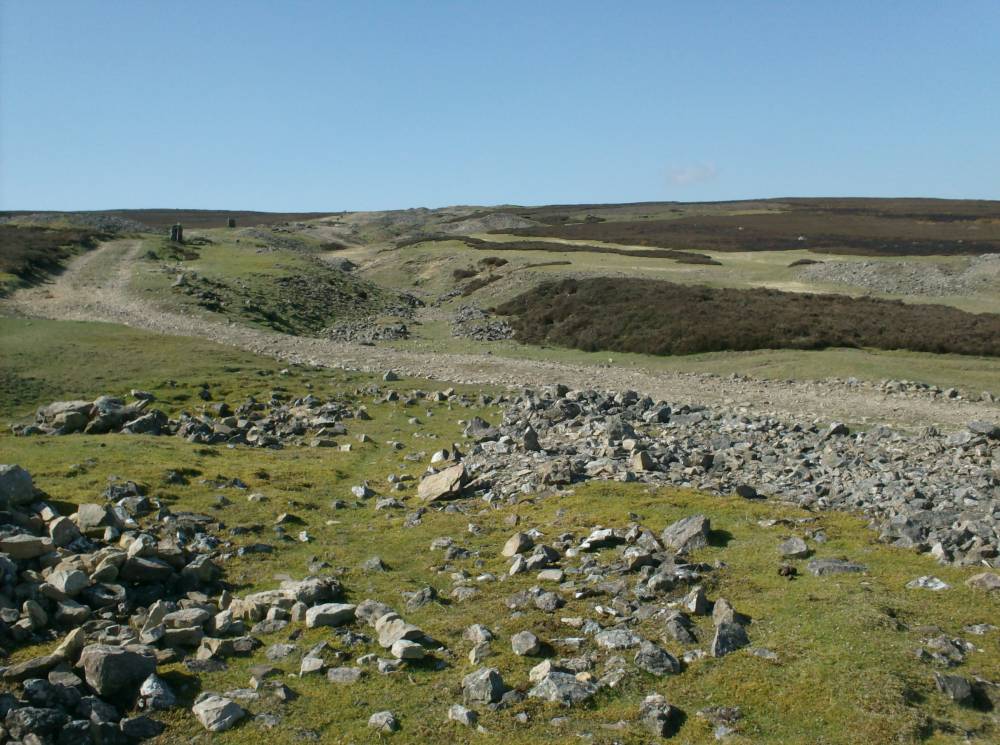
| Image 4 ID | 2559 Click image to enlarge |
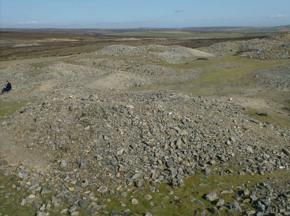
| Image 4 Description | Workings on the vein. | 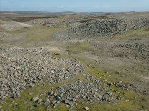 |
| Image 5 ID | 2560 Click image to enlarge |
| Image 5 Description | Looking East along the vein. |  |
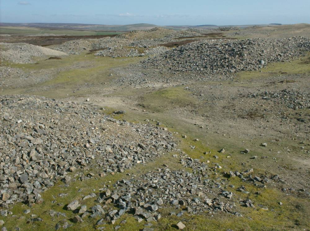
| Image 6 ID | 2561 Click image to enlarge |
| Image 6 Description | Shafts on the vein. |  |
| Image 7 ID | 2562 Click image to enlarge |
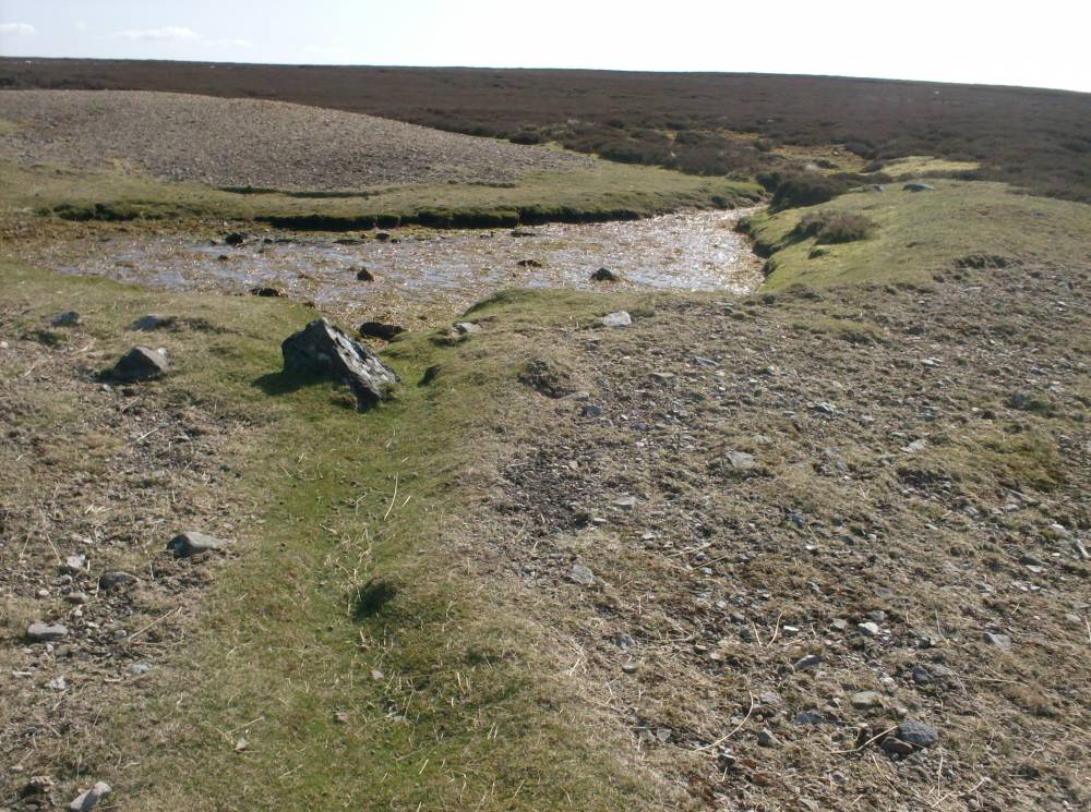
| Image 7 Description | A small dam at NZ 05099 00024, 1432ft, with leat. Probably to supply water for dressing the ore. | 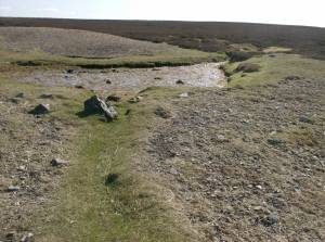 |
| Image 8 ID | 2563 Click image to enlarge |
| Image 8 Description | A much larger dam at NZ 06320 99543, 1288ft; probably for the same purpose. | 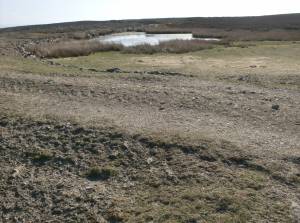 |
| Image 9 ID | 2564 Click image to enlarge |
| Image 9 Description | A map of the Owlands area of 1592. The Copperthwaite 'Gang' (Vein) is bottom left showing the already large extent of the workings. The four small circles at the extreme bottom left represent the bales on Fremington Edge - see record 282 - with the 'Priores bale' (SE 06320 99543 1288ft) to the East. | 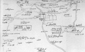 |