|
| *****SWAAG_ID***** | 663 |
| Date Entered | 22/12/2012 |
| Updated on | 23/12/2012 |
| Recorded by | Tim Laurie |
| Category | Geological Record |
| Record Type | Geological HER |
| SWAAG Site Name | |
| Site Type | |
| Site Name | |
| Site Description | |
| Site Access | Public Footpath |
| Record Date | 16/12/2012 |
| Location | Cotherstone Moor. East side of Crawlaw Gill. |
| Civil Parish | Cotherstone |
| Brit. National Grid | NY 9347 1653 |
| Altitude | 400m |
| Geology | Glacial erratic weathered gritstone earthfast boulder. |
| Record Name | Cotherstone Moor. The Crawlaw Stone - a glacial erratic (and non-anthropogenic archaeological site perhaps) |
| Record Description | The Crawlaw Stone is a large (for the area) and prominent earthfast glacial erratic gritstone boulder which is heavily fluted following millenia of natural weathering processes. This boulder, a landmark sufficiently distinctive to have a local name and to be named on the 1:25000 OS Map, Sheet OL31,is located midway between the two distinctive rocky 'nunatak-like' hillocks, Goldsborough 2.3km to the east and Shacklesborough 2.7km to the west. Both of these two hillocks have Early Bronze Age funary monuments on their summits, a ring cairn on Goldsborough Hill (See Swaag Record No ) and a large but low round cairnn on Shacklesborough. In addition, Goldsborough is the focus of several rock art sites, (See Beckensall and Laurie 1998 and Swaag Record .
The Crawlaw Stone is such a distinctive and prominent Rock within an area of known Early Bronze Age ritual activity, that it is not unreasonable to suppose that it may have been the subject of the unknown ritual activities associated with similar rocks decorated in the cup and ring tradition. That is to say, that it is a non anthropological archaeological site. |
| Dimensions | See photographs. |
| Geographical area | |
| Species | |
| Scientific Name | |
| Common / Notable Species | |
| Tree and / or Stem Girth | |
| Tree: Position / Form / Status | |
| Tree Site ID | 0 |
| Associated Site SWAAG ID | 0 |
| Additional Notes | This distinctive rock is a landmark within one of the most distinctive of all Pennine Landscapes. The Pennine Way, the section between Clova Lodge and Gods Bridge- a section usually described as one of the more tedious moorland trudges, crosses Cotherstone Moor some 600m to the east. |
| Image 1 ID | 3866 Click image to enlarge |
| Image 1 Description | The Crawlaw Stone. Shacklesborough in the far distance, as usually seen. | 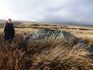 |
| Image 2 ID | 3867 Click image to enlarge |
| Image 2 Description | | 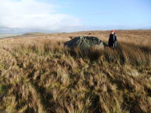 |
| Image 3 ID | 3868 Click image to enlarge |
| Image 3 Description | | 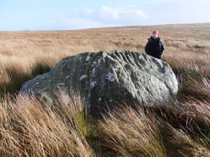 |
| Image 4 ID | 3869 Click image to enlarge |
| Image 4 Description | | 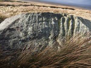 |
| Image 5 ID | 3870 Click image to enlarge |
| Image 5 Description | | 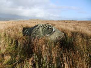 |
| Image 6 ID | 3871 Click image to enlarge |
| Image 6 Description | Shacklesborough from Slateshill Gill, *10 lens magnification. | 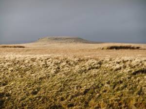 |


