|
| *****SWAAG_ID***** | 647 |
| Date Entered | 25/11/2012 |
| Updated on | 26/11/2012 |
| Recorded by | Tim Laurie |
| Category | Rock Art |
| Record Type | Archaeology |
| SWAAG Site Name | |
| Site Type | |
| Site Name | |
| Site Description | |
| Site Access | Public Access Land |
| Record Date | 23/11/2012 |
| Location | Cotherstone Moor, Pennine Way Bowes Diversion and Goldsbotough Rigg. |
| Civil Parish | Cotherstone |
| Brit. National Grid | NY 957 177 |
| Altitude | 360m |
| Geology | Drift over Namurian Strata. |
| Record Name | Rock art on Goldsborough Rigg and close to the Pennine Way Bowes Diversion. |
| Record Description | On being informed by the Late Dennis Coggins that he had discovered a fine cup and ring marked rock on the ridge to the east of Goldsborough Hill, see Beckensall and laurie 1998, page Rock No and Photo Nos 1- 4. On learning this, I walked at the first opportunity from Bowes Village passing the ling-thatched farm at Levy Pool and thence northward along the Pennine Way to see this rock. In so doing I found two fine carved rocks within three yards of the busy Pennine Way track, see Photo Nos.
Later fieldwork with Dennis established the existence of a number of cup marked and cup and ring marked rocks in the vicinity of West Loups Farm within the Battle Hill Army Firing Range. These rocks have subsequently been the subject of further survey and recording. |
| Dimensions | See photos taken in the early 1990's and also recent photographs. |
| Geographical area | |
| Species | |
| Scientific Name | |
| Common / Notable Species | |
| Tree and / or Stem Girth | |
| Tree: Position / Form / Status | |
| Tree Site ID | 0 |
| Associated Site SWAAG ID | 0 |
| Additional Notes | The exposed rocks are very weathered although an attempt has been made to protect them and are today mch more difficult to locate than in the 1980's. See old photos attached compared with recent photos. The recent reduction of sheep numbers grazing these wet moors has resulted in the explosion of rushes in the wet pasture to the detriment of the moorland and pasture.
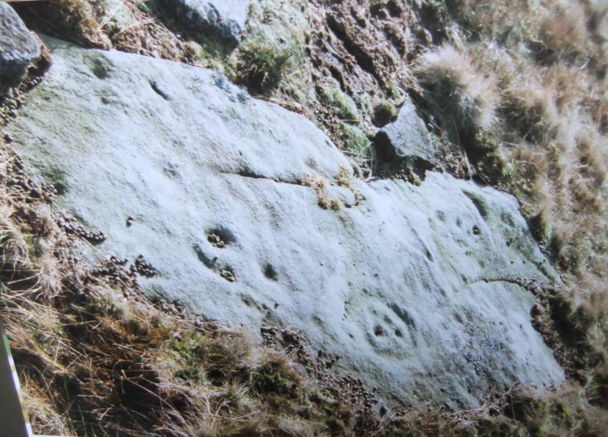
The photograph of the rock below turf (Photo Image 2) was taken during the 1990's soon after the rock was discovered and the fine cups with single rings on the rock were still protected under turf when visited recently. |
| Image 1 ID | 3737 Click image to enlarge |
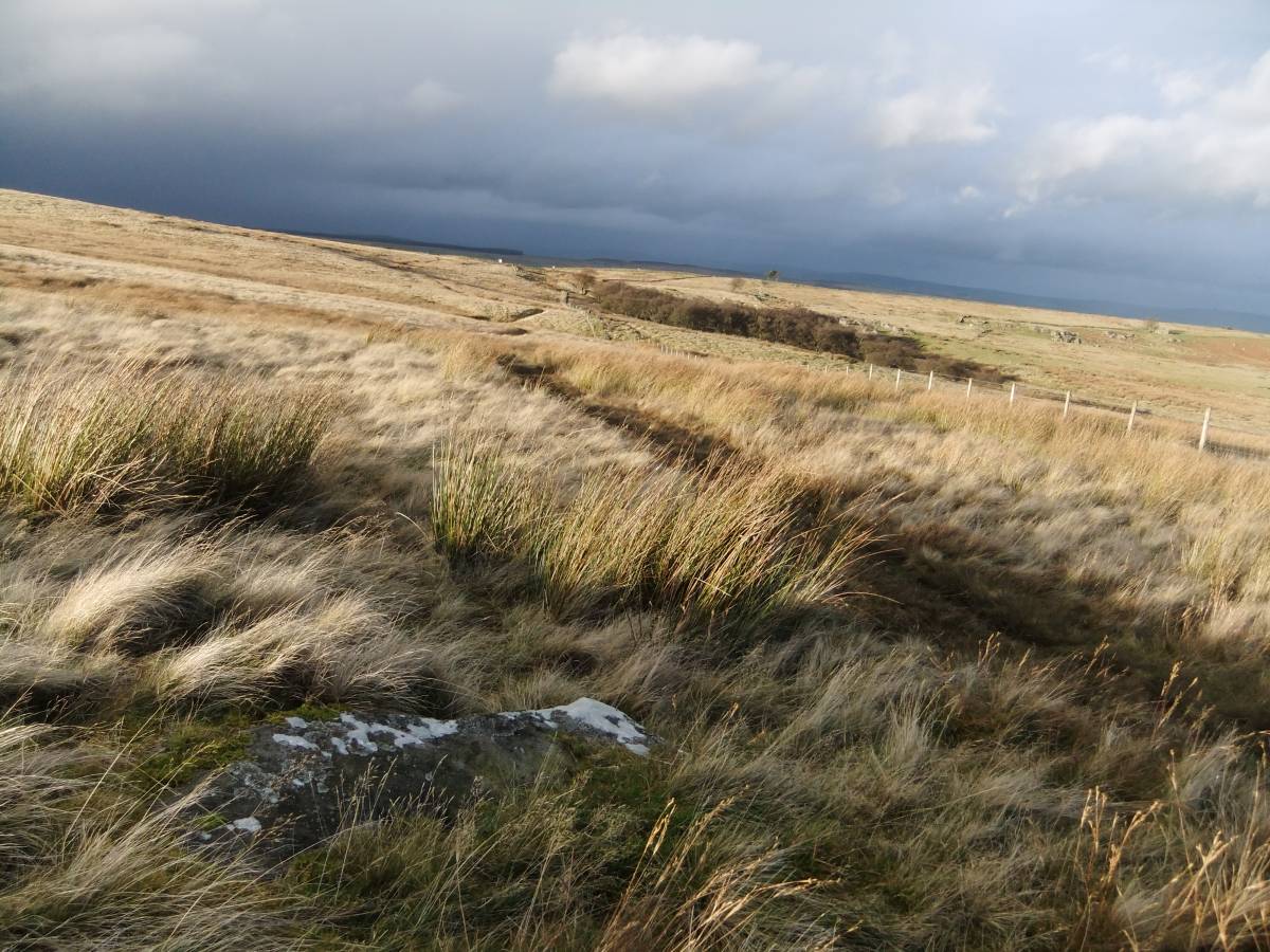
| Image 1 Description | The Pennine Way Bowes Diversion. The small rock part below turf in the foreground is decorated with several fine cup and ring motifs. | 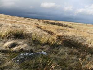 |
| Image 2 ID | 3752 Click image to enlarge |
| Image 2 Description | Photograph taken during the 1990's. For descriptions, photographs and drawings showing the details of this rock and the other cup and ring marked rocks here, see Beckensall and Laurie 1998 pp72-76. | 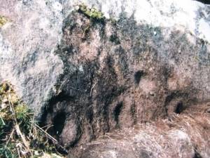 |
| Image 3 ID | 3738 Click image to enlarge |
| Image 3 Description | Photograph taken during the 1990's. This decorated slab is also very close to the Pennine Way. Very weathered but clearly visible when this photo was taken in early 1990's. These carvings now almost invisible although protected under loose stone slabs. | 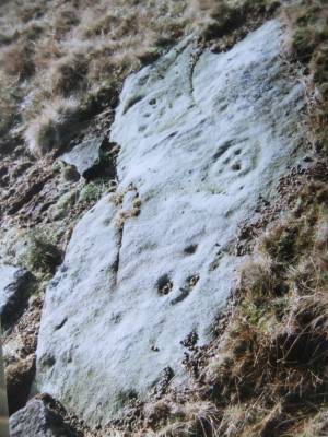 |
| Image 4 ID | 3739 Click image to enlarge |
| Image 4 Description | The second cup marked rock close to the Pennine Way includes a groupd of cups within an enclosing groove. Very weathered, this photo taken in early 1990's. |  |
| Image 5 ID | 3740 Click image to enlarge |
| Image 5 Description | Carvings as these were seen 15 years ago, now almost invisible although protected under loose stone slabs. |  |
| Image 6 ID | 3741 Click image to enlarge |
| Image 6 Description | The same slab as photographed recently. | 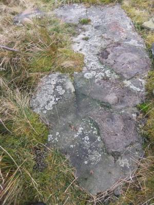 |
| Image 7 ID | 3742 Click image to enlarge |
| Image 7 Description | Carvings now almost invisible although protected under loose stone slabs. | 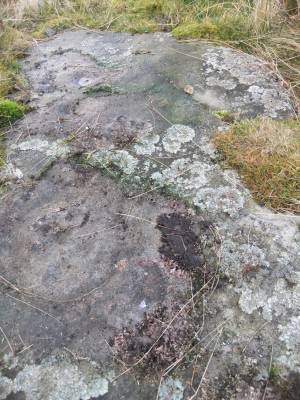 |
| Image 8 ID | 3743 Click image to enlarge |
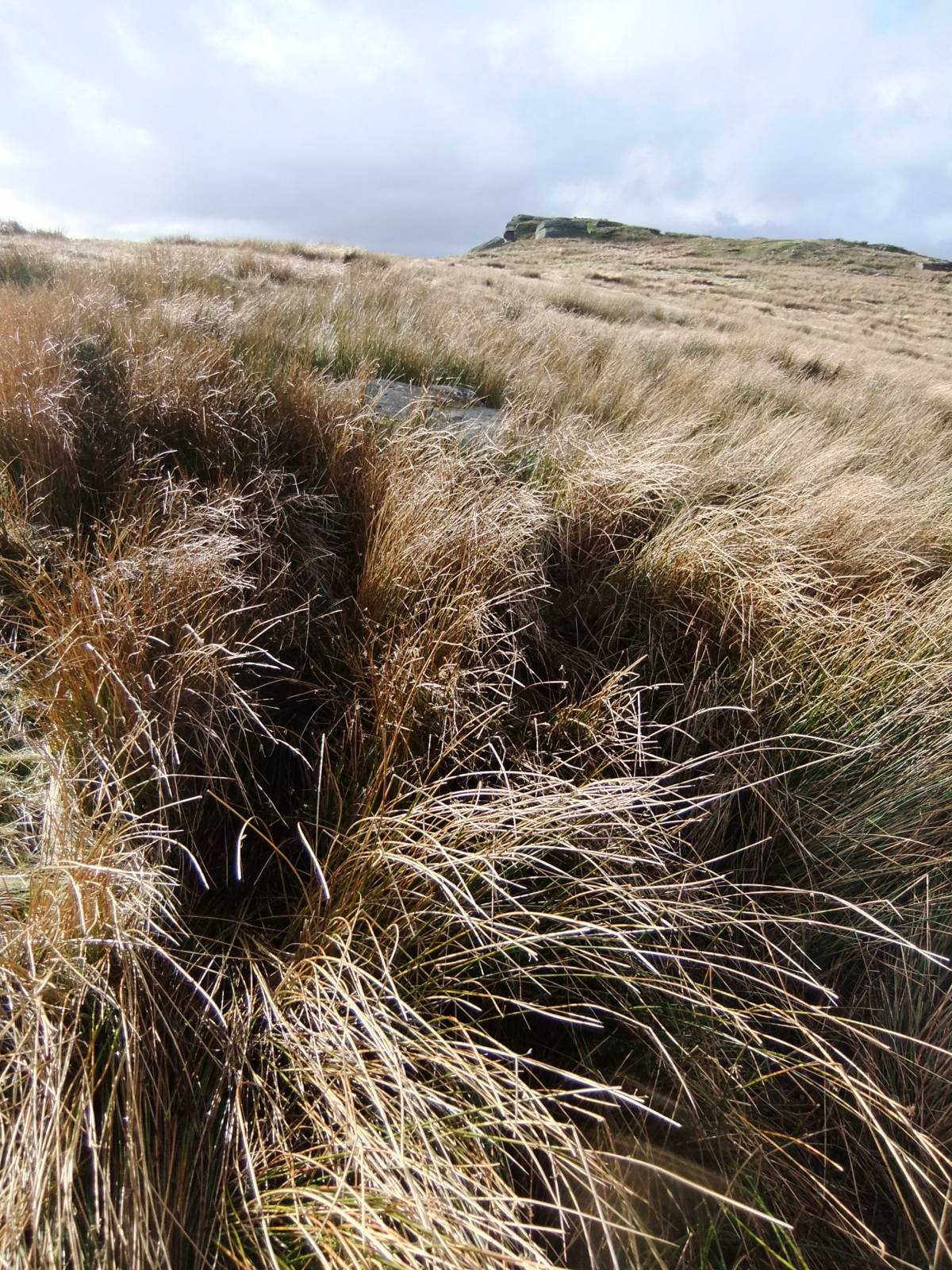
| Image 8 Description | This photograph of the main cup and ring marked rock on Goldsborough Rigg was taken fifteen years ago when sheep density was sufficient to control the growth of rushes (Juncus effusus)'. | 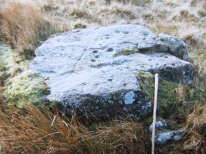 |
| Image 9 ID | 3744 Click image to enlarge |
| Image 9 Description | The same site as photographed recently, completely invisible, hidden under rampant rush growth and driven across by a fourtrack. | 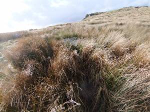 |
| Image 10 ID | 3745 Click image to enlarge |
| Image 10 Description | The same site as photographed recently, completely invisible, hidden under rampant rush growth and driven across by a fourtrack. Perhaps Landowner/Farmers should be briefed on the location of rock carvings. | 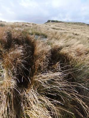 |
| Image 11 ID | 3746 |
| Image 11 Description | | 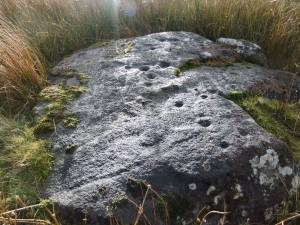 |
| Image 12 ID | 3747 |
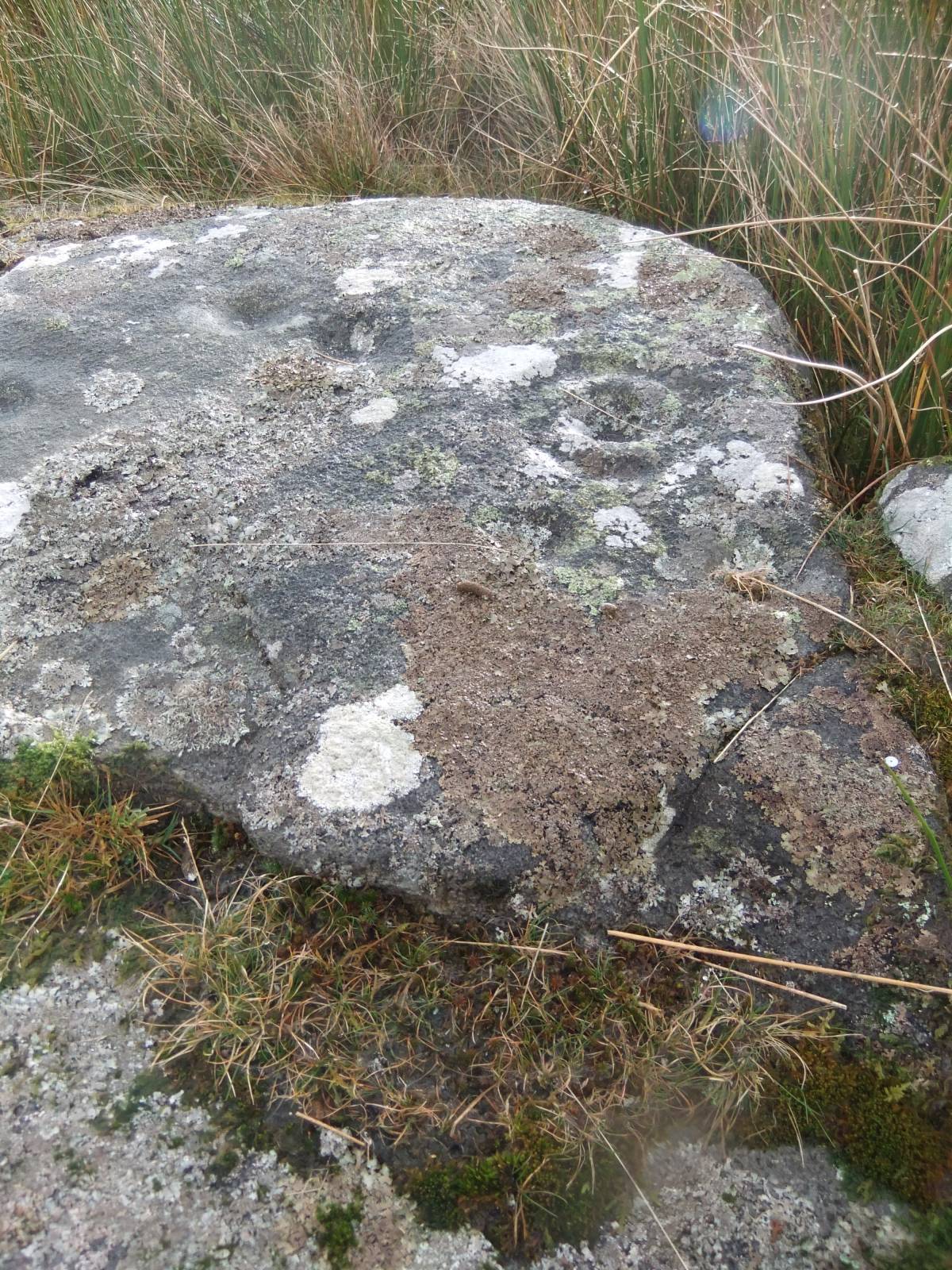
| Image 12 Description | Goldsborough Rigg.The main cup and ring marked rock as photographed recently. | 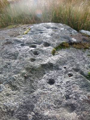 |
| Image 13 ID | 3748 |
| Image 13 Description | Goldsborough Rigg.The main cup and ring marked rock as photographed recently. |  |
| Image 14 ID | 3749 |
| Image 14 Description | Goldsborough Rigg.The main cup and ring marked rock as photographed recently. | 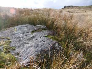 |