|
| *****SWAAG_ID***** | 781 |
| Date Entered | 01/03/2014 |
| Updated on | 02/03/2014 |
| Recorded by | Stephen Eastmead |
| Category | Geophysical Record |
| Record Type | Archaeology |
| SWAAG Site Name | |
| Site Type | |
| Site Name | |
| Site Description | |
| Site Access | Private |
| Record Date | 28/02/2014 |
| Location | Ellerton Priory - west field |
| Civil Parish | Ellerton Abbey |
| Brit. National Grid | SE 0770 9727 |
| Altitude | 180 |
| Geology | |
| Record Name | Ellerton Priory Geophysical Survey Phase 1 |
| Record Description | Ellerton Priory west field geophysical survey phase 1 (interim data) shows the primary data from a gradiometer survey using a Bartington 601-2 instrument.
The survey will be published at a later date and submitted to the Heritage Gateway via OASIS.
Copies of the report will be made available through the Heritage Gateway, the YDNPA HER and by SWAAG.
This survey is taking place in association with the YDNPA and English Heritage. |
| Dimensions | Approximately 4 hectares |
| Geographical area | |
| Species | |
| Scientific Name | |
| Common / Notable Species | |
| Tree and / or Stem Girth | |
| Tree: Position / Form / Status | |
| Tree Site ID | 0 |
| Associated Site SWAAG ID | 0 |
| Additional Notes | |
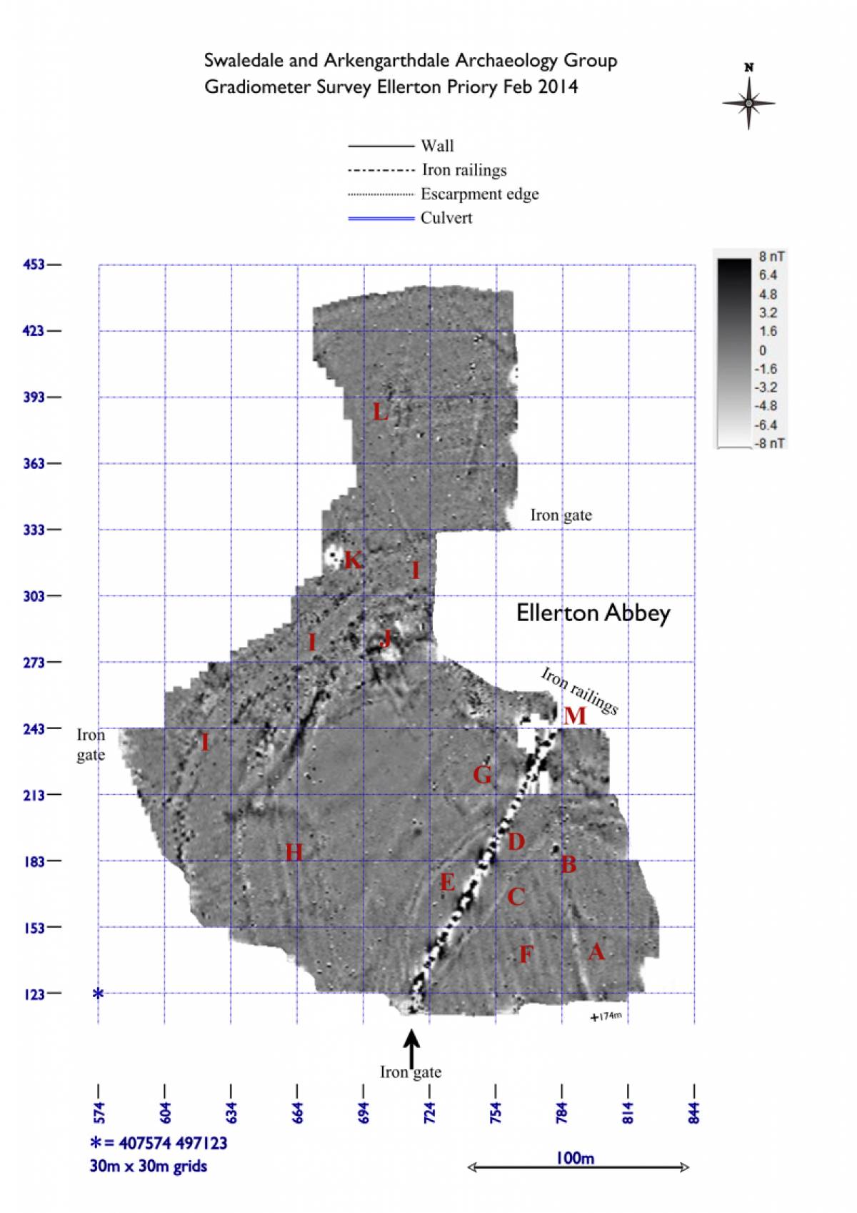
| Image 1 ID | 5144 Click image to enlarge |
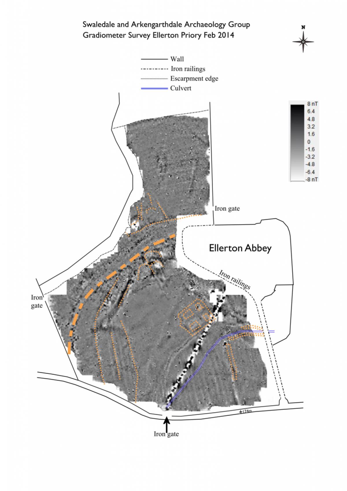
| Image 1 Description | Major Features |  |
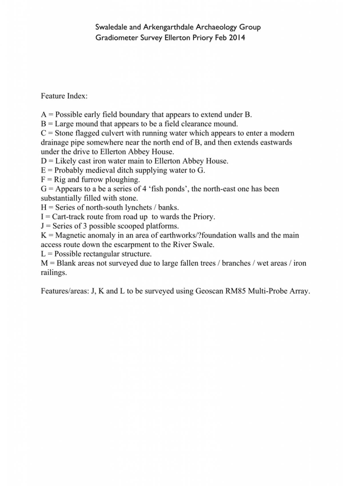
| Image 2 ID | 5143 Click image to enlarge |
| Image 2 Description | Major Features Index |  |
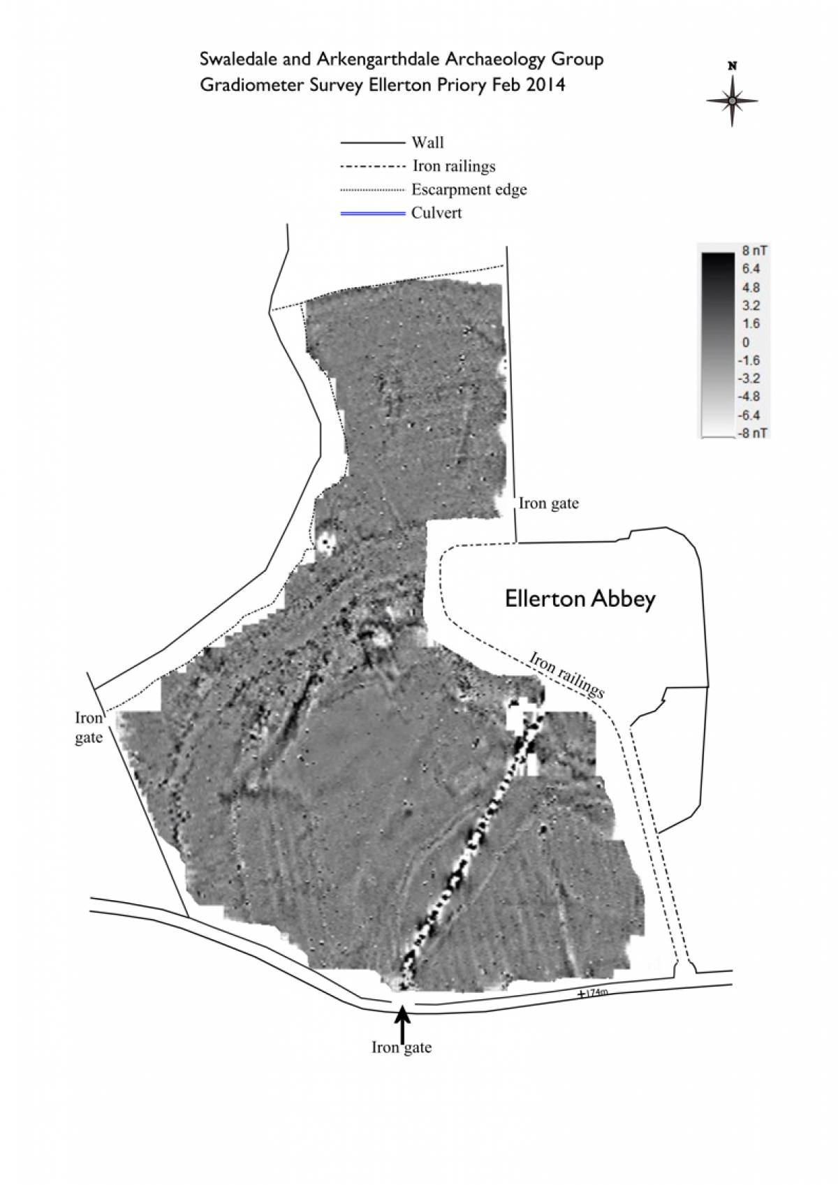
| Image 3 ID | 5145 Click image to enlarge |
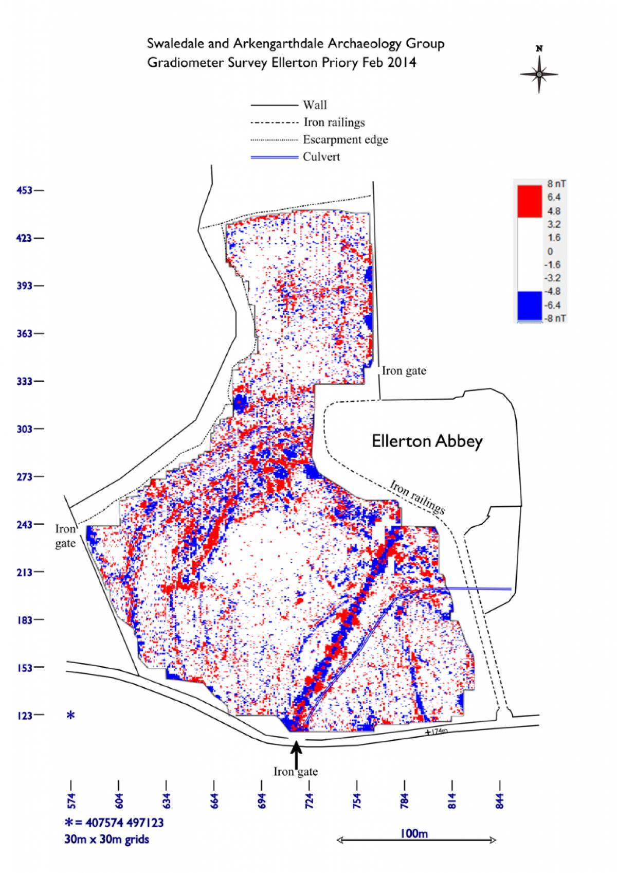
| Image 3 Description | Gradiometer survey | 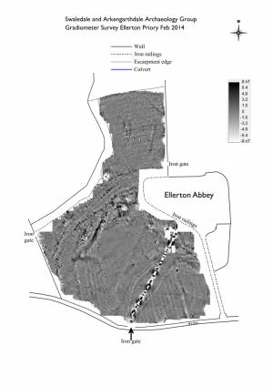 |
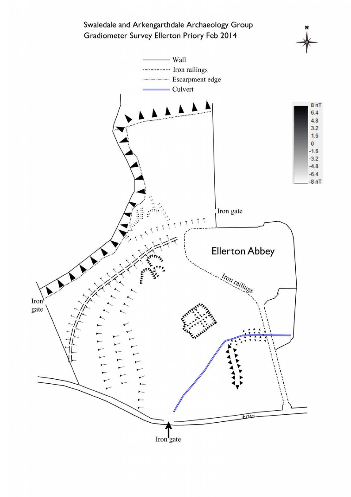
| Image 4 ID | 5146 Click image to enlarge |
| Image 4 Description | GPS Survey | 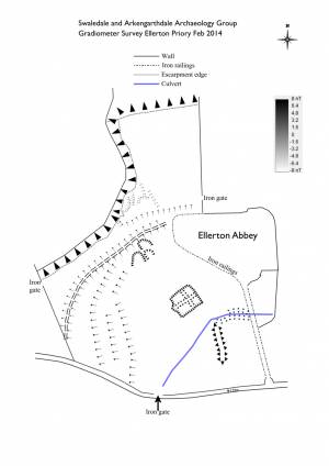 |
| Image 5 ID | 5147 Click image to enlarge |
| Image 5 Description | Gradiometer data with GPS survey overlay |  |
| Image 6 ID | 5148 Click image to enlarge |
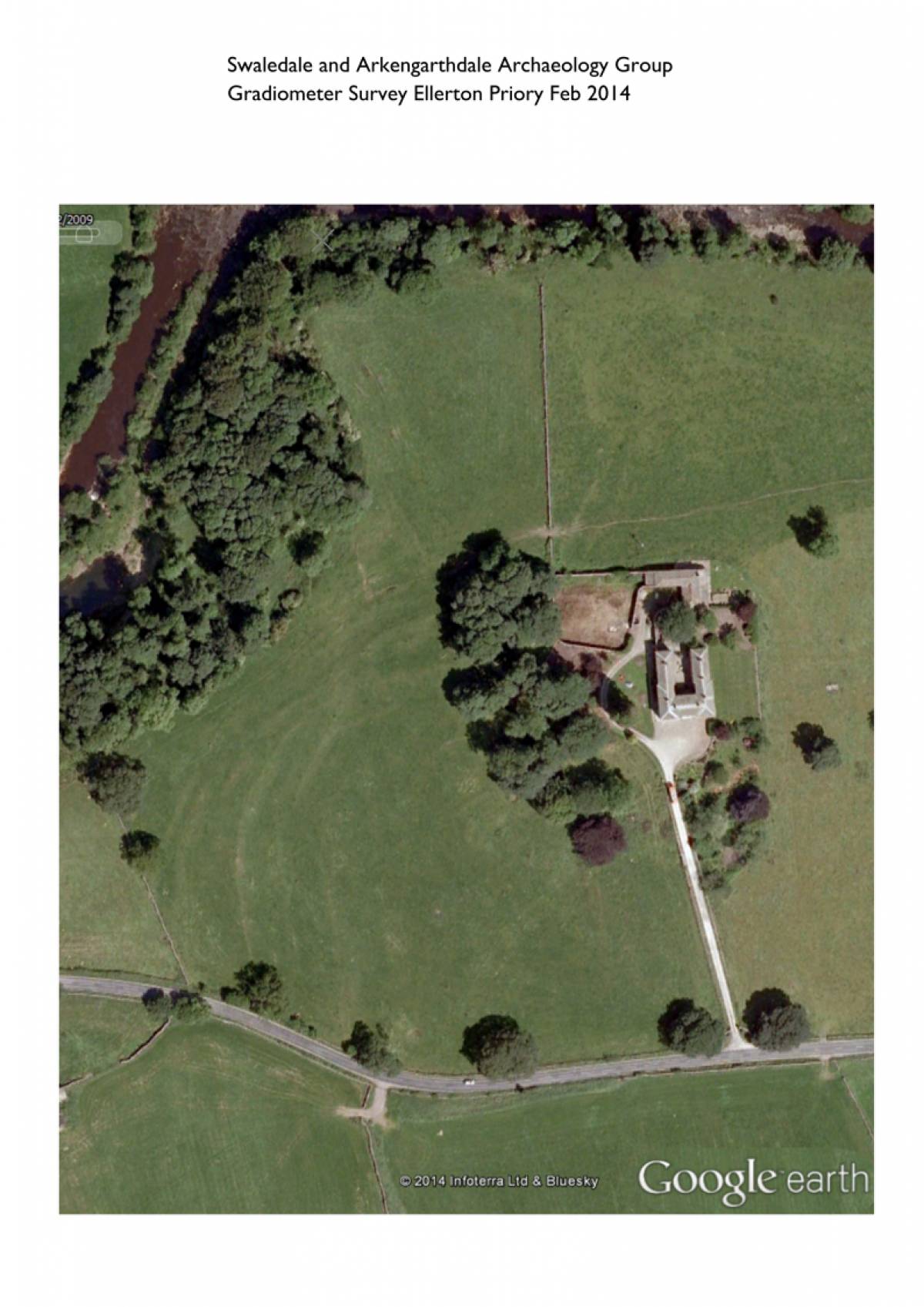
| Image 6 Description | Google Earth view of field | 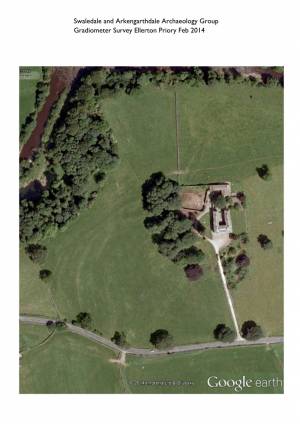 |
| Image 7 ID | 5149 Click image to enlarge |
| Image 7 Description | Google Earth view with gradiometer data overlay | 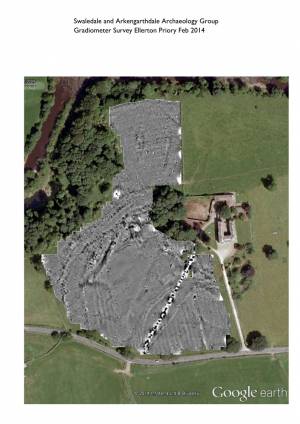 |
| Image 8 ID | 5150 Click image to enlarge |
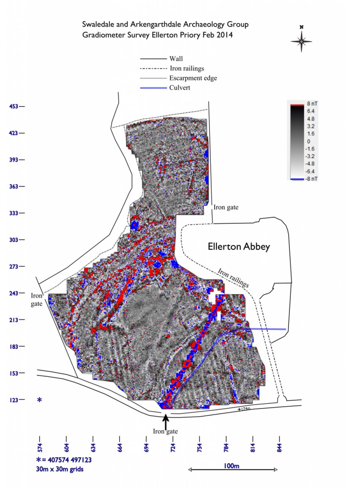
| Image 8 Description | Strong and dipolar magnetic anomalies |  |
| Image 9 ID | 5151 Click image to enlarge |
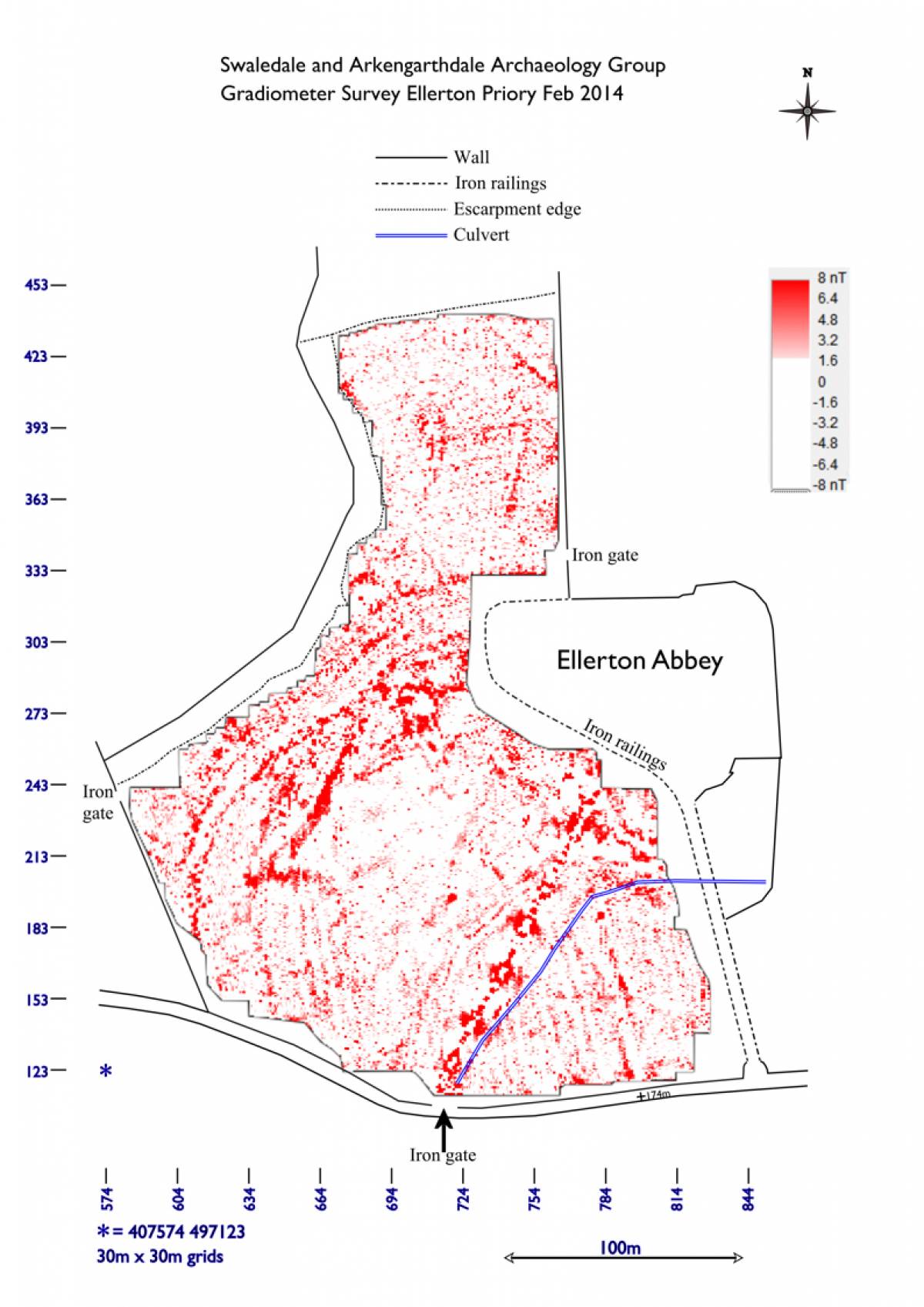
| Image 9 Description | Positive magnetic anomalies | 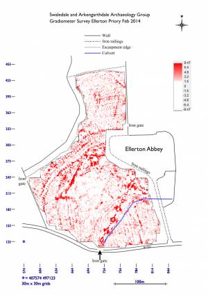 |
| Image 10 ID | 5152 Click image to enlarge |
| Image 10 Description | Negative magnetic anomalies | 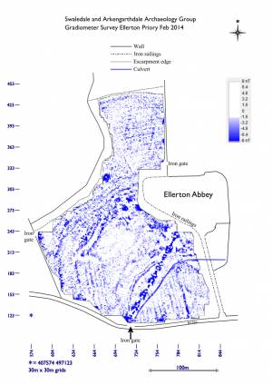 |
| Image 11 ID | 5153 |
| Image 11 Description | Magnetic anomalies | 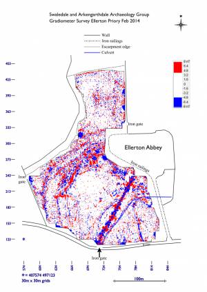 |