|
| *****SWAAG_ID***** | 851 |
| Date Entered | 23/02/2015 |
| Updated on | 23/02/2015 |
| Recorded by | Alan and Judith Mills |
| Category | Mining Related |
| Record Type | Mining |
| SWAAG Site Name | |
| Site Type | |
| Site Name | |
| Site Description | |
| Site Access | Public Access Land |
| Record Date | 23/02/2015 |
| Location | In the mining area to the south of the Grinton - Leyburn road |
| Civil Parish | Grinton |
| Brit. National Grid | SE 05887 95993 |
| Altitude | 1372ft |
| Geology | |
| Record Name | Mining remains on Ellerton Moor |
| Record Description | Our attention was drawn recently to correspondence identifying 'old houses' and an open mine shaft on Ellerton Moor. On investigation the old building is firmly located within a line of shafts running approximately north-south on the Wellington Vein. It is the remains of a 4-cell building with a small walled enclosure to the north, suggesting that part of the building at least might have been domestic. There is a significant amount of clinker and ash in the small heap to the front (north) of the larger of the 4 cells suggesting that it might have been a smithy associated with the mining.
Two pieces of salt-glazed stoneware pottery, greenish-grey glaze, grey fabric, were found in the spoil adjacent to the building, dug up by rabbits. These are probably 18th / 19th century.
There is a large shaft in the location referred to in the correspondence but, as one would expect in an area grazed by sheep, it is no longer open.
The line of shafts in which the building is located is in the mining area which was controlled by the Drax family. The boundary of the Drax land lies a little to the south of building and is indicated by a standing boundary stone, engraved E D, presumed to be Edward Drax (ca.1726 - 1791). |
| Dimensions | |
| Geographical area | |
| Species | |
| Scientific Name | |
| Common / Notable Species | |
| Tree and / or Stem Girth | |
| Tree: Position / Form / Status | |
| Tree Site ID | 0 |
| Associated Site SWAAG ID | 0 |
| Additional Notes | |
| Image 1 ID | 6080 Click image to enlarge |
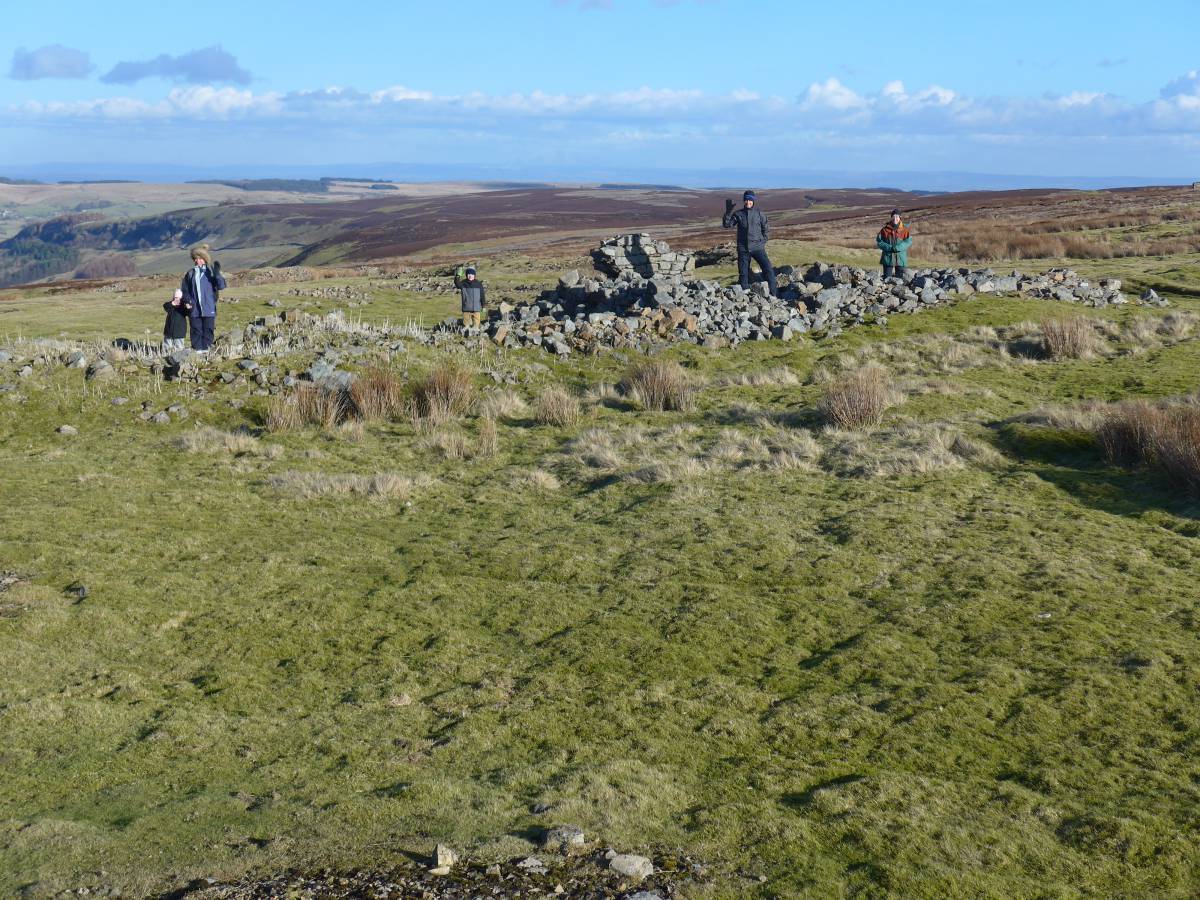
| Image 1 Description | The ruins of the 4-cell building, with one or two people in each cell. The remains of the enclosure wall can be seen beyond the building. The building is located at SE 05887 95993 | 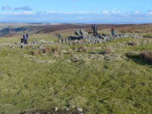 |
| Image 2 ID | 6081 Click image to enlarge |
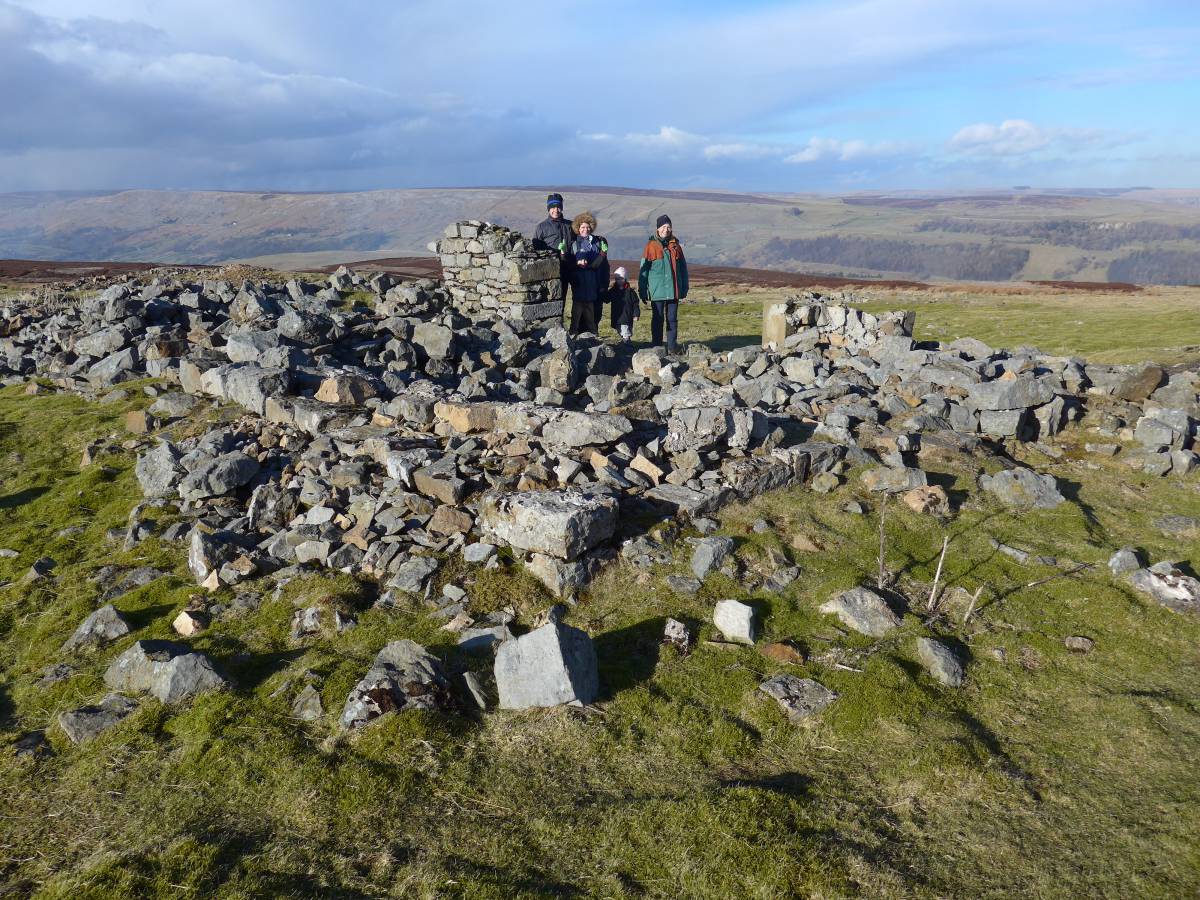
| Image 2 Description | The ruins of the building, looking NW, at what is presumed to have been the smithy in the foreground. | 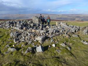 |
| Image 3 ID | 6082 Click image to enlarge |
| Image 3 Description | The ruins of the building, looking south, with the spoil containing the clinker and ash in the foreground. | 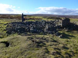 |
| Image 4 ID | 6083 Click image to enlarge |
| Image 4 Description | Standing at SE 05727 95925 looking north to the ruined building on the near horizon. | 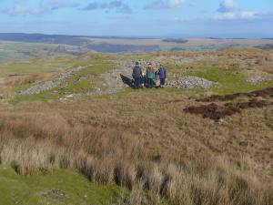 |
| Image 5 ID | 6086 Click image to enlarge |
| Image 5 Description | The boundary stone at SE 05644 95902.
See also SWAAG database entry 390 for more on similar boundary stones. | 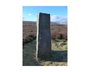 |
| Image 6 ID | 6087 Click image to enlarge |
| Image 6 Description | A close up of the boundary stone. | 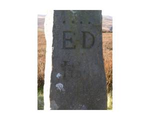 |