|
| *****SWAAG_ID***** | 848 |
| Date Entered | 04/02/2015 |
| Updated on | 05/02/2015 |
| Recorded by | Alan and Judith Mills |
| Category | Photographic Record |
| Record Type | Archaeology |
| SWAAG Site Name | |
| Site Type | |
| Site Name | |
| Site Description | |
| Site Access | Public Access Land |
| Record Date | 04/02/2015 |
| Location | Stang Road, Arkengarthdale |
| Civil Parish | Arkengarthdale |
| Brit. National Grid | NZ 0057 0505 |
| Altitude | 390m |
| Geology | |
| Record Name | The Roman Road over the Stang, Arkengarthdale |
| Record Description | It is thought that the road over the Stang in Arkengarthdale might be on the route of a Roman Road from Bainbridge in Wensleydale to Barnard Castle in Teesdale, and/or the Roman Forts at Bowes and Greta Bridge.
The Roman road is thought to mainly follow the existing route with small divergences. For example, where the current road swings slightly to the north towards Shaw farm it is thought that the Roman road went straight on ie it lies to the south-east of the present road.
This is a record of a brief visit by Alan Mills and Peter Denison-Edson to the Stang Road on 4th February 2015 to see if the route of the Roman road shows up more readily in the lying snow than in the normal rough grass. This was followed by a further visit by Judith and Alan Mills on 5th February.
The photos which follow demonstrate that the existing route does indeed seem to overlay an earlier road with, for example, what is believed to be the Roman agger (the central element of the Roman road see http://www.brrp.bham.ac.uk/construction/construction.html for example) clearly visible to the south-east of Stang Farm.
Other features of interest are also identified.
It will be necessary to re-visit the area later in the year to investigate further.
This record will be updated in due course. |
| Dimensions | |
| Geographical area | |
| Species | |
| Scientific Name | |
| Common / Notable Species | |
| Tree and / or Stem Girth | |
| Tree: Position / Form / Status | |
| Tree Site ID | 0 |
| Associated Site SWAAG ID | 0 |
| Additional Notes | |
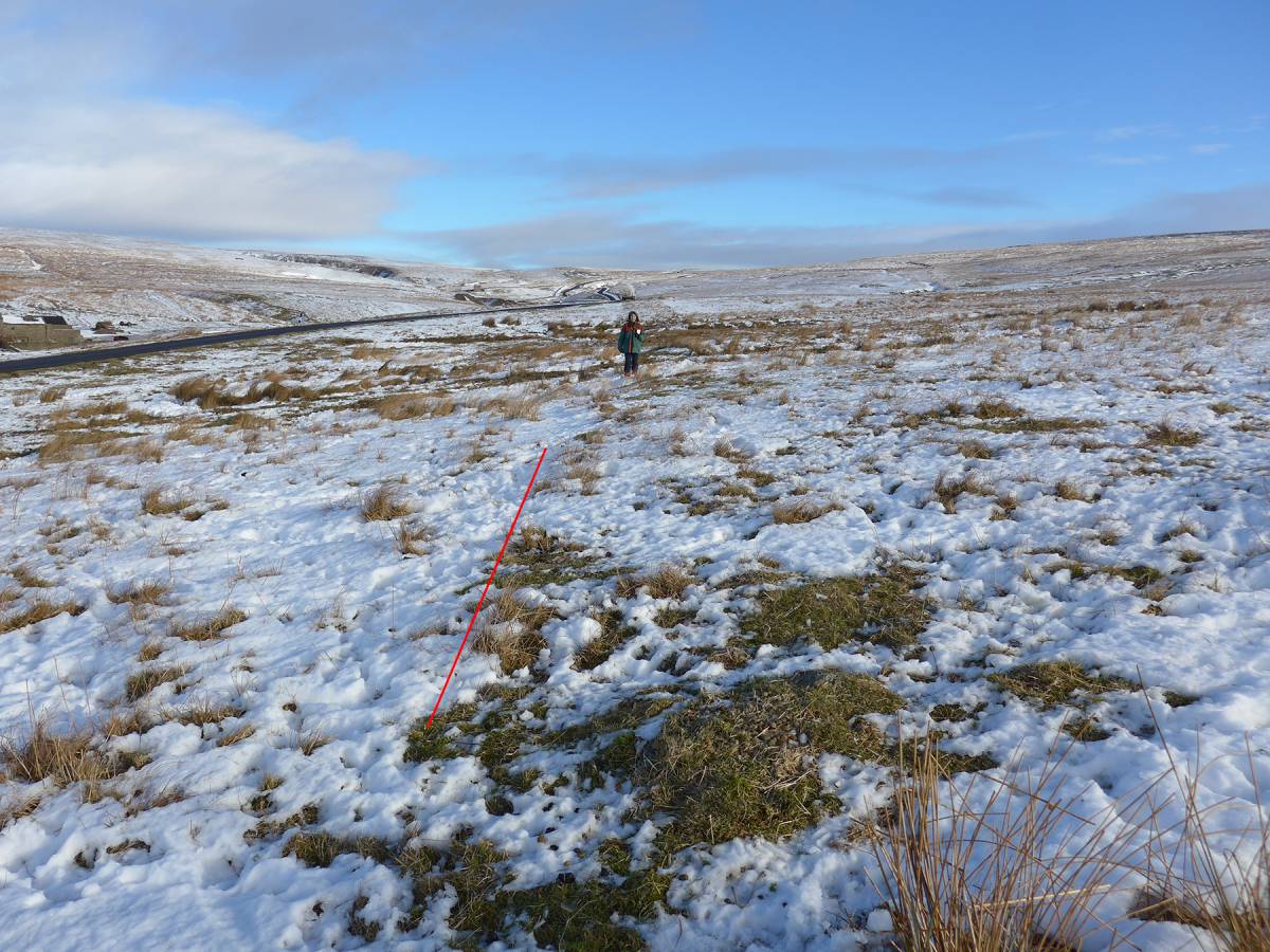
| Image 1 ID | 6053 Click image to enlarge |
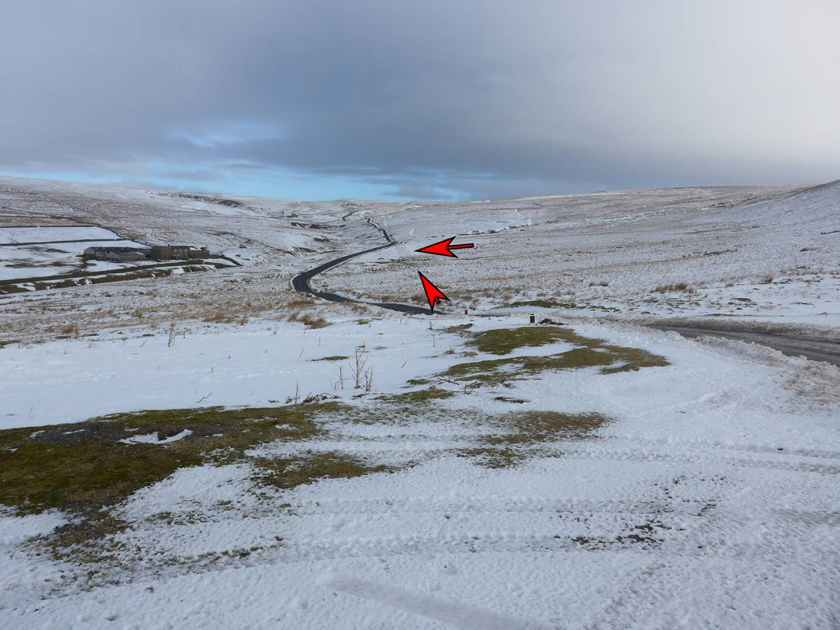
| Image 1 Description | General view of the Stang road from approx NZ 00447 04835 showing Stang Farm to the north-west of the road with the agger to the right, south-east. The agger is clearly visible from the sump at NZ 00571 05045 (1281ft) extending to the north-east to NZ 00604 05100 (1293ft) where it peters out as it approaches the existing road. | 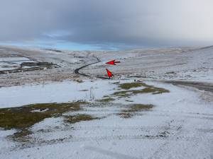 |
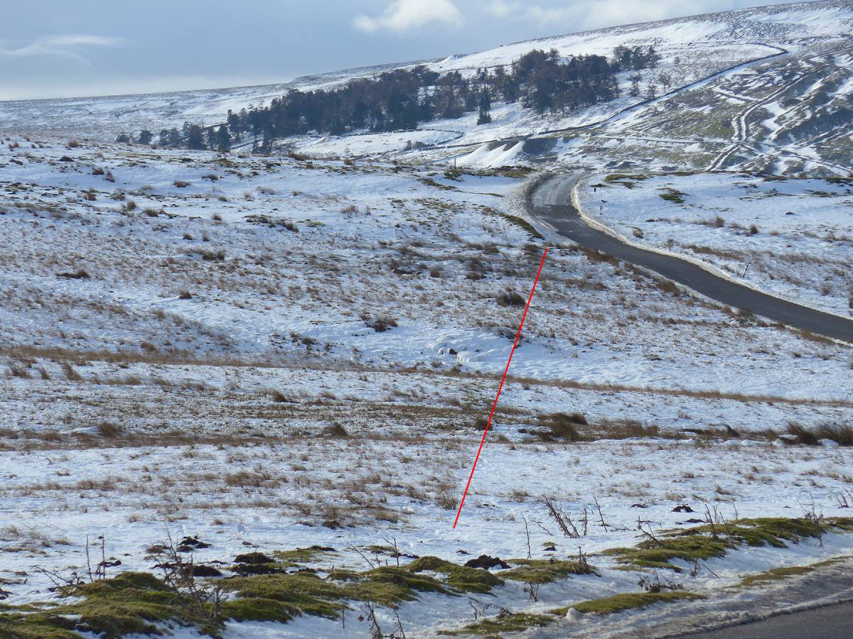
| Image 2 ID | 6054 Click image to enlarge |
| Image 2 Description | Close up of the agger. It is approximately 5m wide. |  |
| Image 3 ID | 6055 Click image to enlarge |
| Image 3 Description | Peter Denison-Edson standing on the agger. | 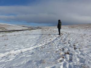 |
| Image 4 ID | 6056 Click image to enlarge |
| Image 4 Description | This low-level view is from the sump at NZ 00571 05045 looking north; the left hand edge of the agger is clearly visible. The sump seems to be a sink hole which is directly on the line of the agger. The line of the agger may be discerned leading to the south west at NZ 00529 04975 where it peters out. See image 8 below. | 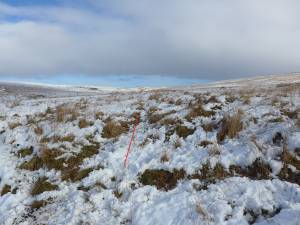 |
| Image 5 ID | 6057 Click image to enlarge |
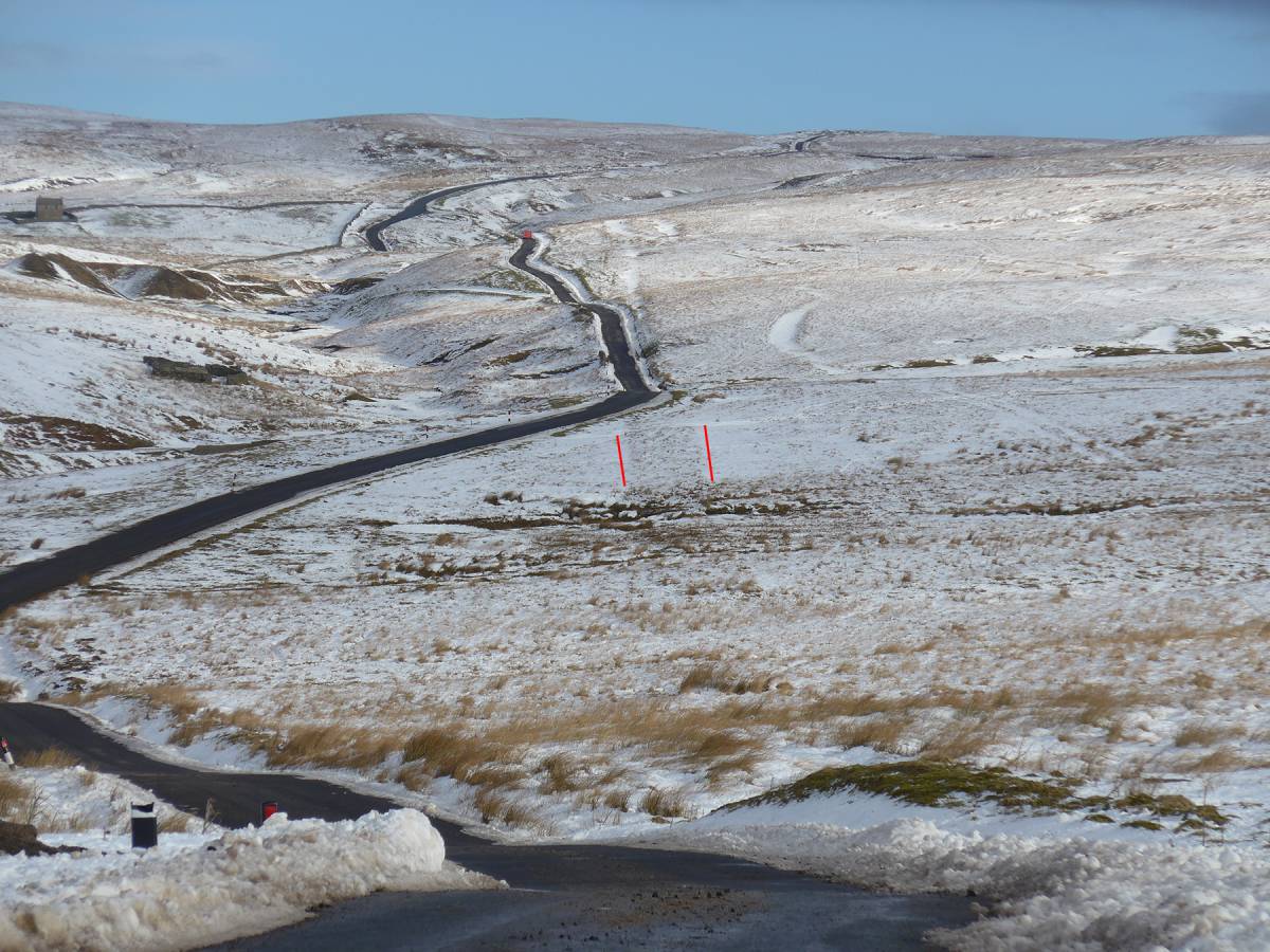
| Image 5 Description | At NZ 01300 06283, a pull-off, looking east to what seems to be another track. This might be associated with mining on Windegg to the south-east. This track is clear running to the south-east but peters out at NZ 01315 06216 (1512ft) although it might continue to the north crossing the brow of a small knoll - see next image. | 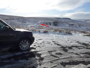 |
| Image 6 ID | 6058 Click image to enlarge |
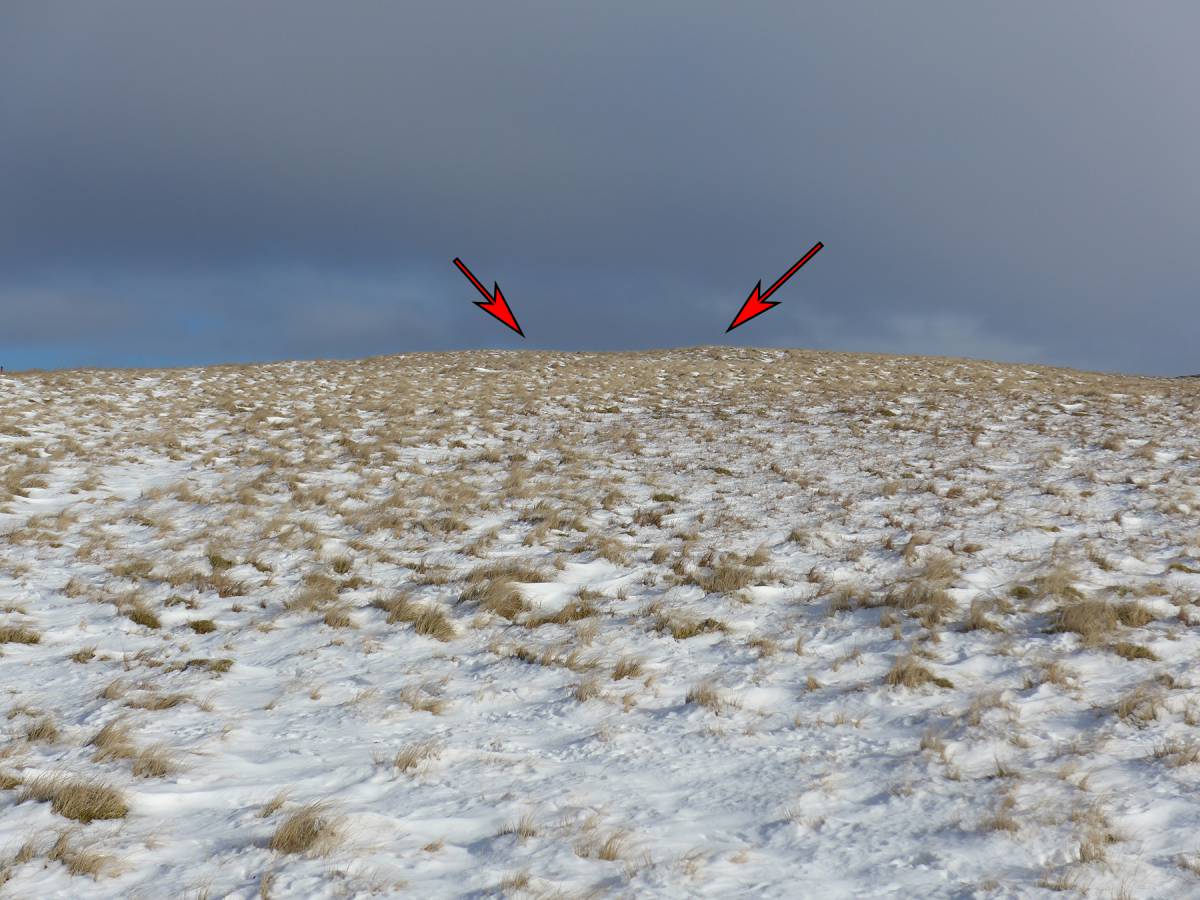
| Image 6 Description | The track referred to above seems to be visible crossing the near horizon. | 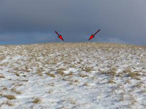 |
| Image 7 ID | 6059 Click image to enlarge |
| Image 7 Description | At Stang Top, NZ 01890 06778(1684ft), there appears to be a hollow way to the south-east of the current road. Is this the route of the Roman road, the possible mining track referred to above or what? Further investigation is required. | 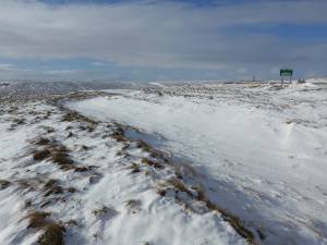 |
| Image 8 ID | 6060 Click image to enlarge |
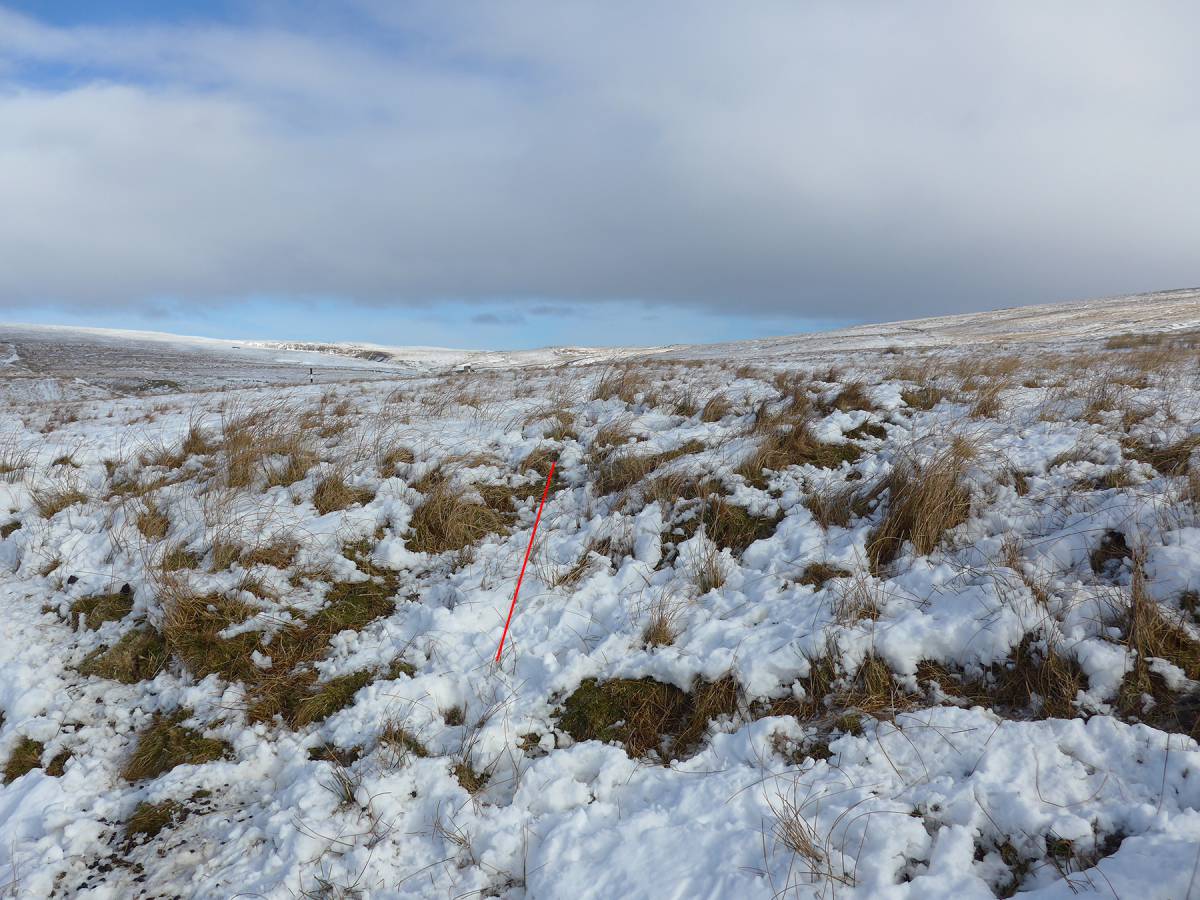
| Image 8 Description | At NZ 00529 04975 where the agger becomes discernible, looking north-east |  |
| Image 9 ID | 6061 Click image to enlarge |
| Image 9 Description | Looking down to the south-west along the line of the agger from where it meets the road. |  |
| Image 10 ID | 6062 Click image to enlarge |
| Image 10 Description | General view of the Stang road from Stang Top. | 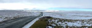 |