|
| *****SWAAG_ID***** | 879 |
| Date Entered | 22/05/2015 |
| Updated on | 22/05/2015 |
| Recorded by | Tim Laurie |
| Category | Unknown |
| Record Type | Archaeology |
| SWAAG Site Name | |
| Site Type | |
| Site Name | |
| Site Description | |
| Site Access | Public Access Land |
| Record Date | 22/05/2015 |
| Location | Carperby Moor. Swinehaw Hill. |
| Civil Parish | Carperby Cum Thoresby |
| Brit. National Grid | SD 97774 91699 |
| Altitude | 466m |
| Geology | The Main Limestone at outcrop. Calcareous grassland with heather on areas of residual blanket peat. |
| Record Name | Carperby Moor, Swinehaw Hill.Three sub-rectangular structures provisionally interpreted as shielings. |
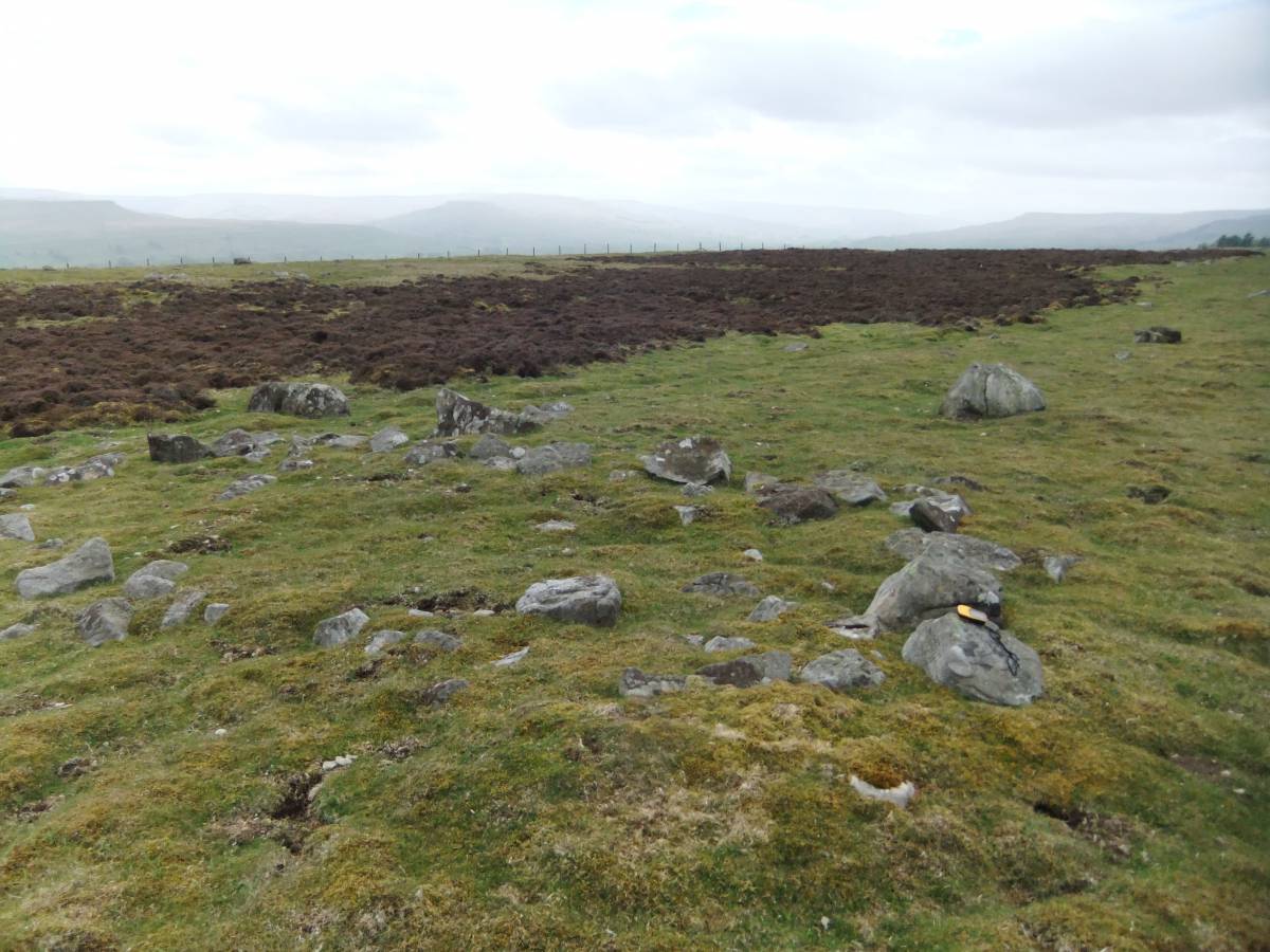
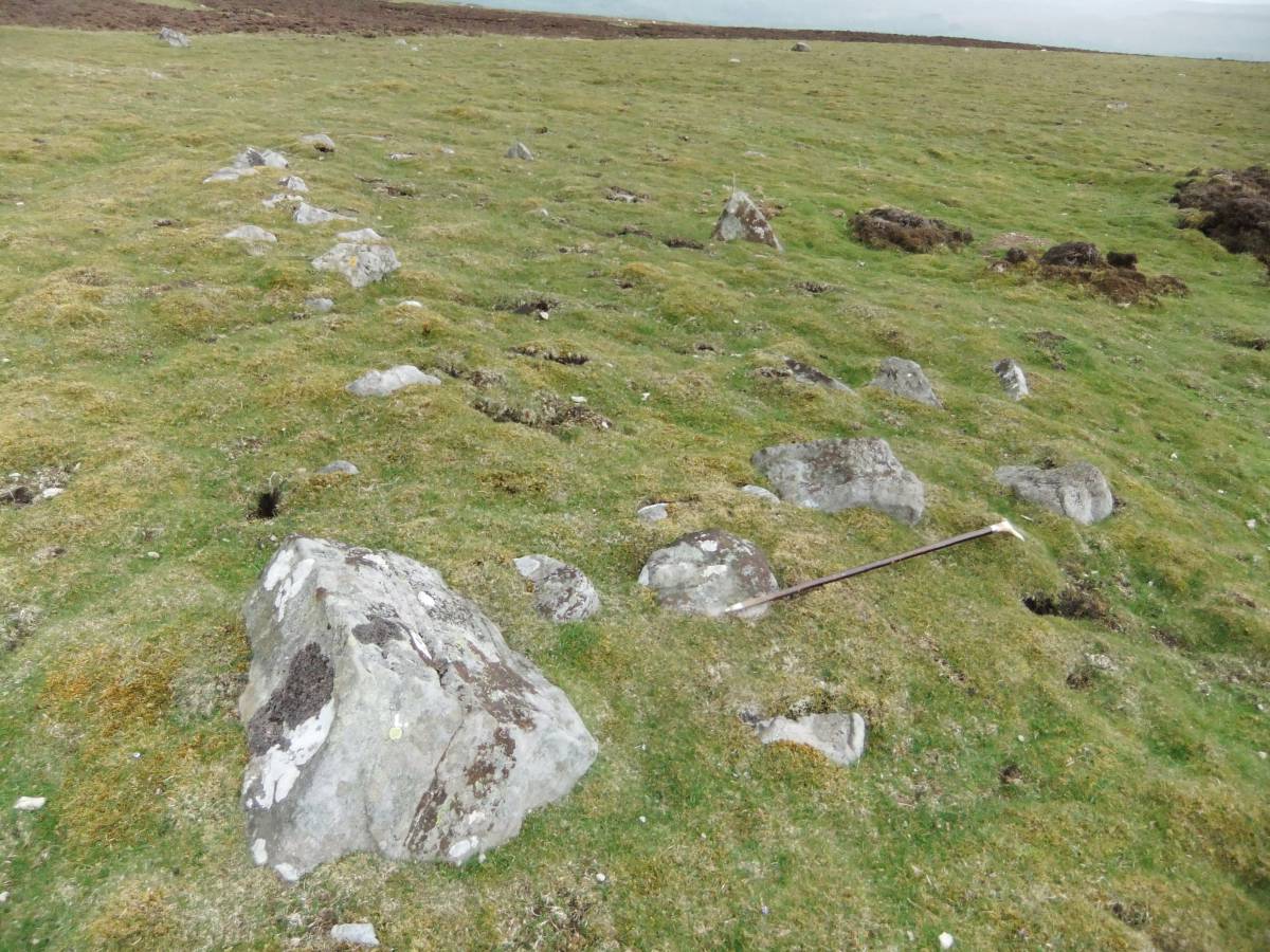
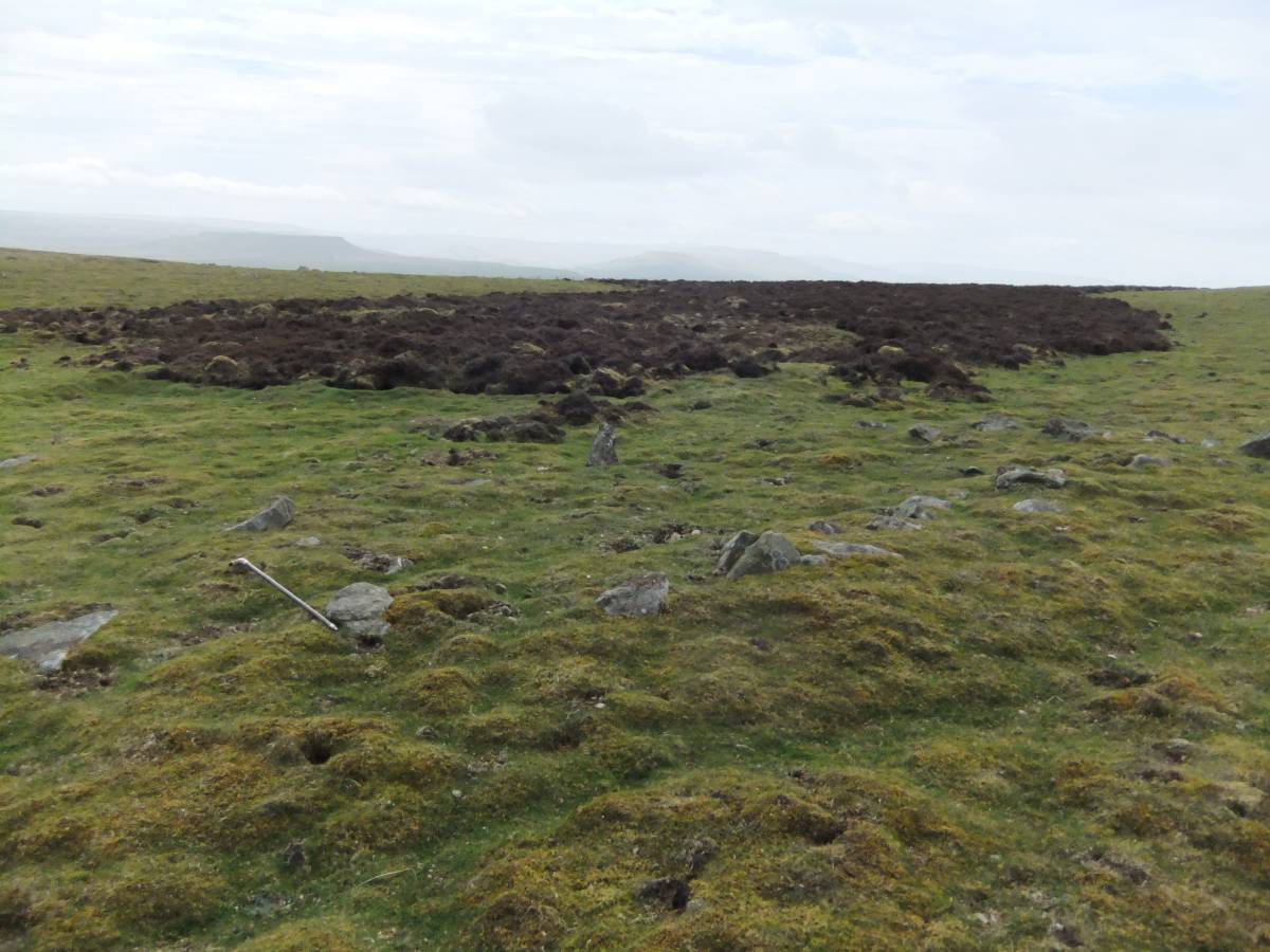
| Record Description | This record will describe three small sub-rectangular stone banked structures averaging 9m*4m but probably with buried stone banks and therefor larger, which, despite the absence of door entrances, are provisionally in the first instance interpreted as small shieling huts. At least one (Structure No 2) and possibly two (No 3) of these 'shielings' may have been adapted from an existing prehistoric ring cairn.
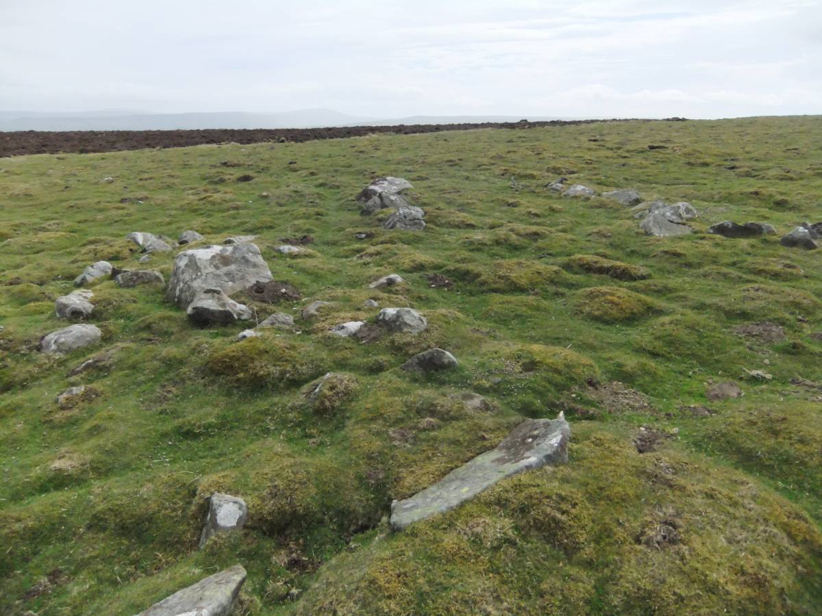
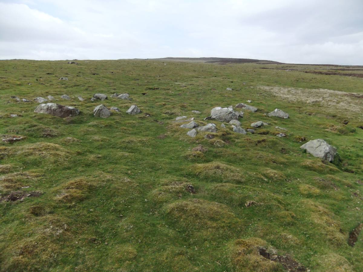
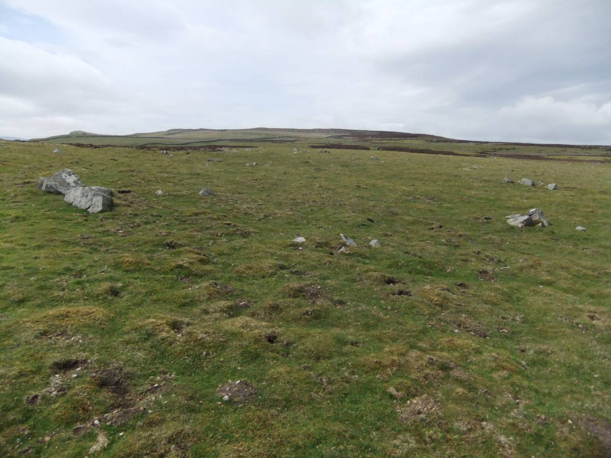
These 'shielings' are located on an area of fine calcareous grassland which would provide excellent summer grazing. In support of the suggestion that these structures are temporary shelters to seasonal pastoralist shepherds (ie transhumant shepherds), the area shows sign of slight improvement or clearance of the pasture in the form of numbers of small grouped rocks, see photo image No below. A more complete survey of this interesting area may provide further insight into the activities represented by these structures.
A fine Barbed and Tanged Arrowpoint was found nearby (See Laurie, T.C. 2003 'Researching the Prehistory Of Wensleydale, Swaledale and Teesdale' in: Yorkshire Arch. Soc. Occasional Paper No 3. pp223-253, Figure 73 No 4. |
| Dimensions | From SD97774 91699 to SD97860 91659 |
| Geographical area | |
| Species | |
| Scientific Name | |
| Common / Notable Species | |
| Tree and / or Stem Girth | |
| Tree: Position / Form / Status | |
| Tree Site ID | 0 |
| Associated Site SWAAG ID | 0 |
| Additional Notes | Whereas the provisional interpretation detailed above of these structures is of shielings, it can be seen from the photos that the structures are very deeply embedded in soil and vegetation and highly consolidated. This does imply great age and an alternative interpretation of these structures would be as prehistoric structured cairns or ring cairns.
The grouped rocks in the area of the rectangular structures may prove to have been arranged to form a circular or sub-circular enclosure.
Several of these may be the remnant of larger rocks broken up for dry stone walling.
This site was recognised during a reconnaissance for the 2015 Swaledale Festival Walk on Carperby Moor. |
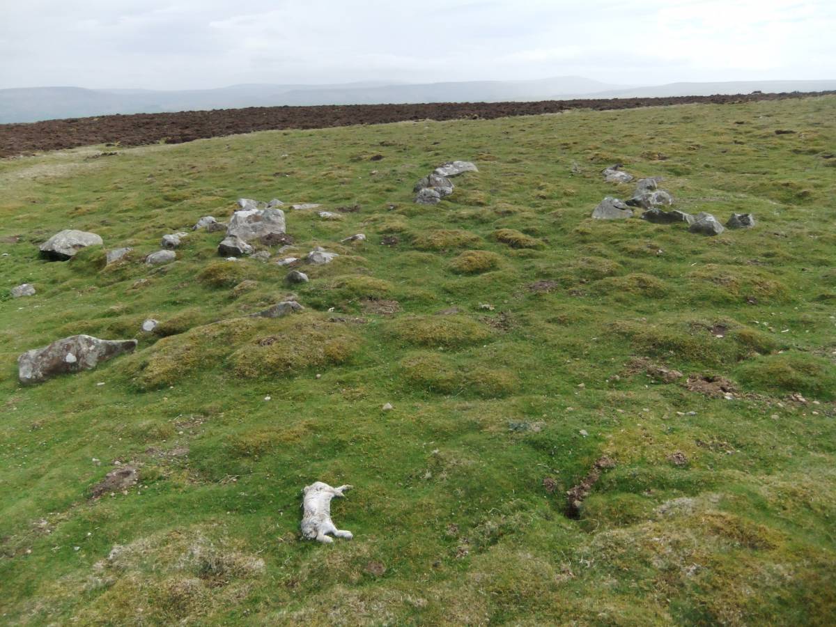
| Image 1 ID | 6235 Click image to enlarge |
| Image 1 Description | Structure No 1 at SD97774 91699 | 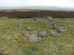 |
| Image 2 ID | 6234 Click image to enlarge |
| Image 2 Description | Structure No 1 at SD97774 91699 |  |
| Image 3 ID | 6233 Click image to enlarge |
| Image 3 Description | Structure No 1 at SD97774 91699 | 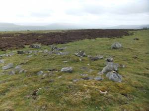 |
| Image 4 ID | 6235 Click image to enlarge |
| Image 4 Description | Structure No 1 at SD97774 91699 | |
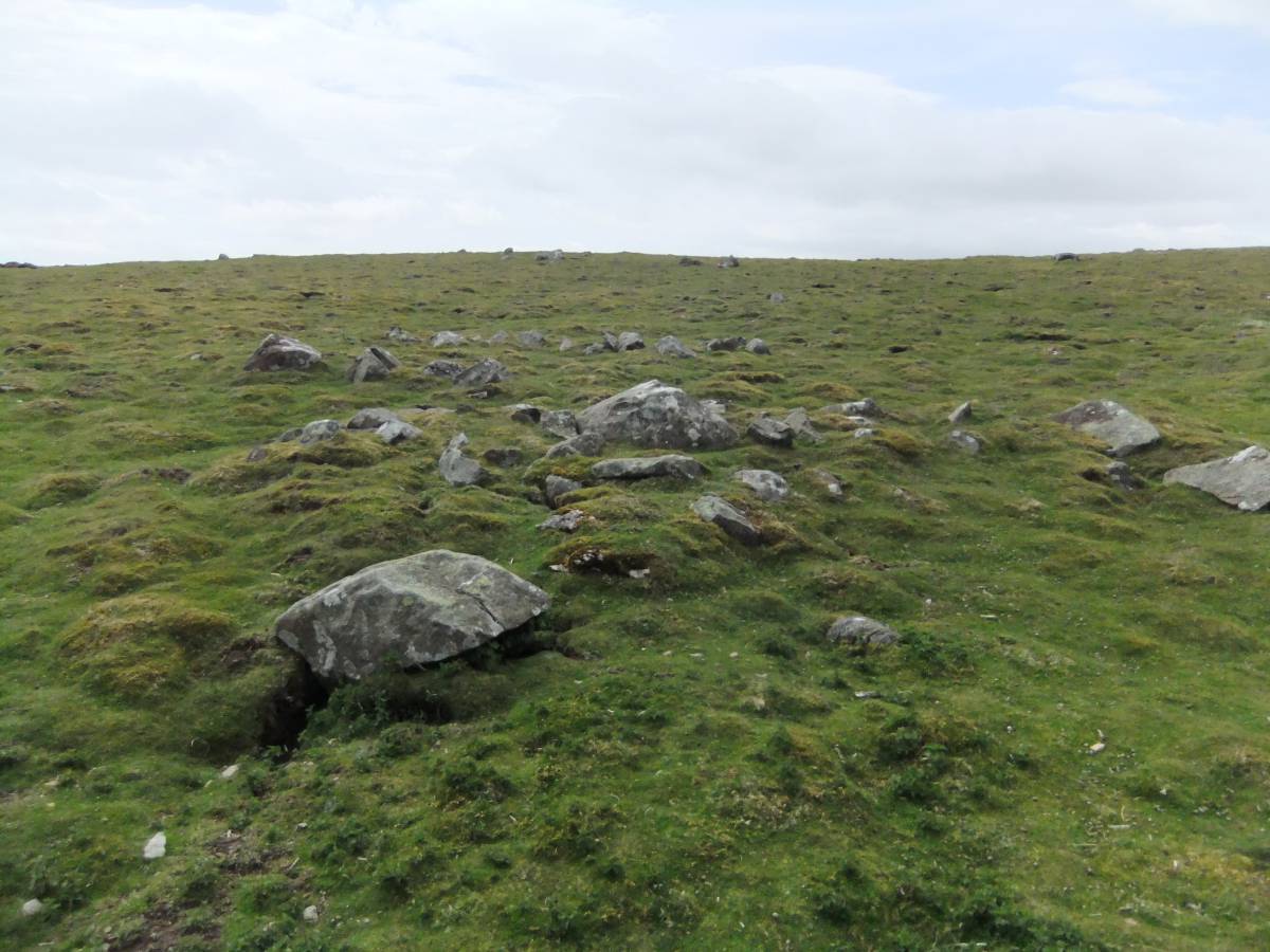
| Image 5 ID | 6236 Click image to enlarge |
| Image 5 Description | Structure No 2 at SD97805 91751 | 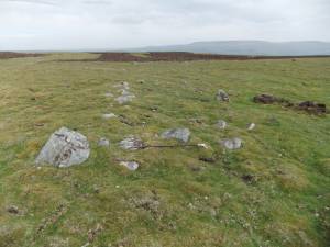 |
| Image 6 ID | 6237 Click image to enlarge |
| Image 6 Description | Structure No 2 at SD97805 91751 |  |
| Image 7 ID | 6238 Click image to enlarge |
| Image 7 Description | Structure No 2 at SD97805 91751 | 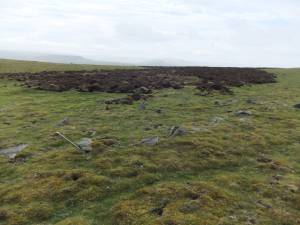 |
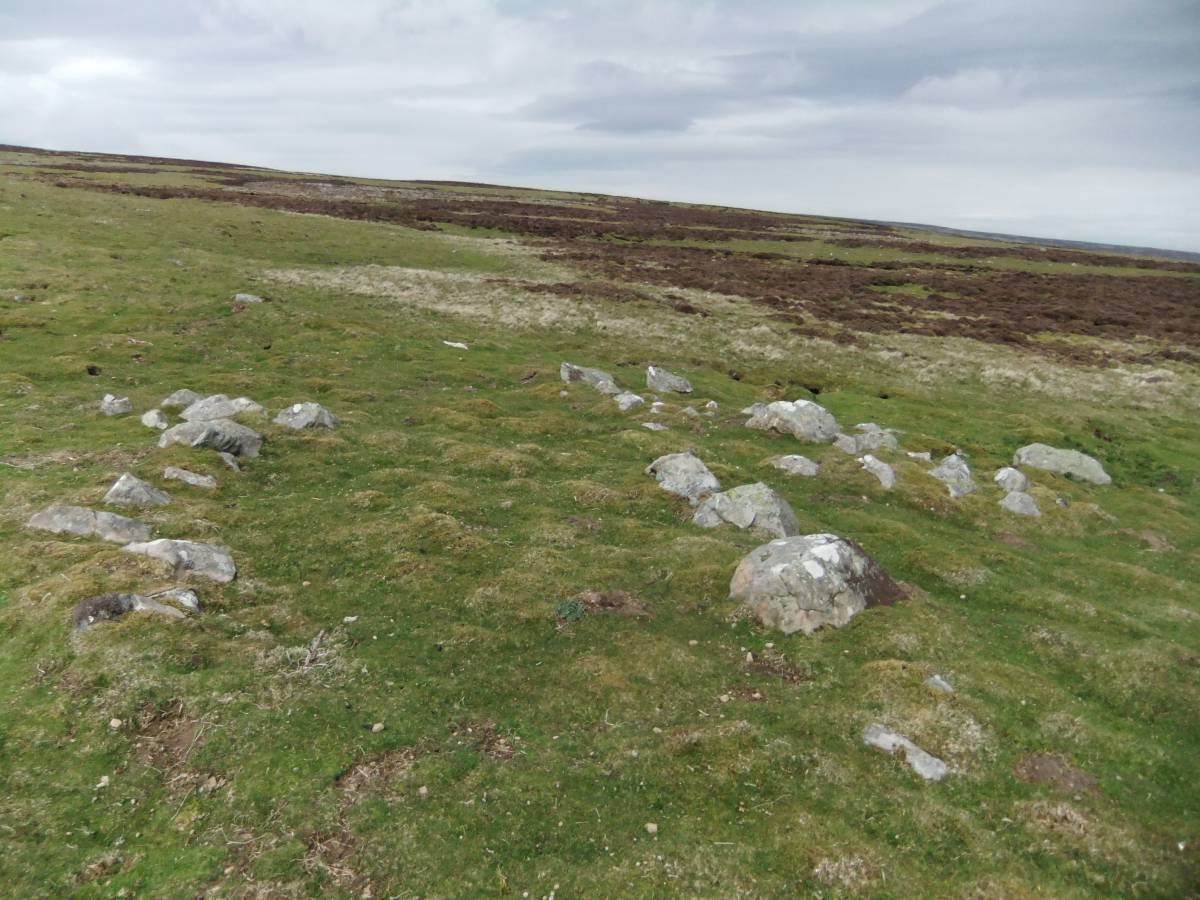
| Image 8 ID | 6240 Click image to enlarge |
| Image 8 Description | Structure and cairn at SD97860 91659 |  |
| Image 9 ID | 6239 Click image to enlarge |
| Image 9 Description | Structure and cairn at SD97860 91659 | 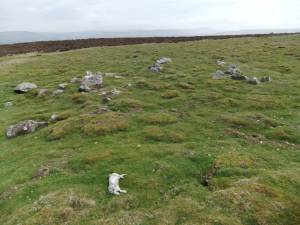 |
| Image 10 ID | 6241 Click image to enlarge |
| Image 10 Description | Structure and cairn at SD97860 91659 | 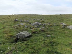 |
| Image 11 ID | 6242 |
| Image 11 Description | Structure and cairn at SD97860 91659 |  |
| Image 12 ID | 6243 |
| Image 12 Description | Structure and cairn at SD97860 91659 |  |
| Image 13 ID | 6244 |
| Image 13 Description | Structure and cairn at SD97860 91659 |  |
| Image 14 ID | 6245 |
| Image 14 Description | Calcareous grassland with heather on relct blanket peat and numbers of small grouped rocks, possibly arranged. | 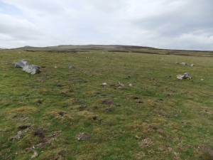 |