|
| *****SWAAG_ID***** | 887 |
| Date Entered | 08/08/2015 |
| Updated on | 08/08/2015 |
| Recorded by | Tim Laurie |
| Category | Mining Related |
| Record Type | Mining |
| SWAAG Site Name | |
| Site Type | |
| Site Name | |
| Site Description | |
| Site Access | Public Access Land |
| Record Date | 29/07/2015 |
| Location | Clints Scar |
| Civil Parish | Marske |
| Brit. National Grid | NZ 0890 0249 |
| Altitude | 213m |
| Geology | The Clints Vein which: '....brings down the Main Limestone on the South side against the Ten fathom Grit on the North side'. For a full description of the geology and mining of this locality, see : K.C. Dunham and A.A. Wilson, British Geological Survey.'Geology of the North Pennine Orefield, Vol.2 Stainmore to Craven, pp 151,2 and Figure 25 North Swaledale Mineral Belt.' |
| Record Name | The Clints Lead Mine |
| Record Description | This Record will provide a brief image of the surface features which survive on the steep fell slopes on the eastern side of Marske Beck opposite Telfit Farm. The entrances to the the Lower and Upper Levels were driven unsuccessfully into the hillside, 'without finding much ore'.Higher up, on the kame terrace below Clints Scar, extensive areas with shallow pits, delves or 'scrins' mark the earliest evidence for lead mining here. These pits exploited the most readily available lead ore from horizontal deposits or flots, close to the surface, by open cast delves.
No dates are known for these early lead mine delves, a challenge for mining archaeologists and historians. |
| Dimensions | |
| Geographical area | |
| Species | |
| Scientific Name | |
| Common / Notable Species | |
| Tree and / or Stem Girth | |
| Tree: Position / Form / Status | |
| Tree Site ID | 0 |
| Associated Site SWAAG ID | 0 |
| Additional Notes | |
| Image 1 ID | 6382 Click image to enlarge |
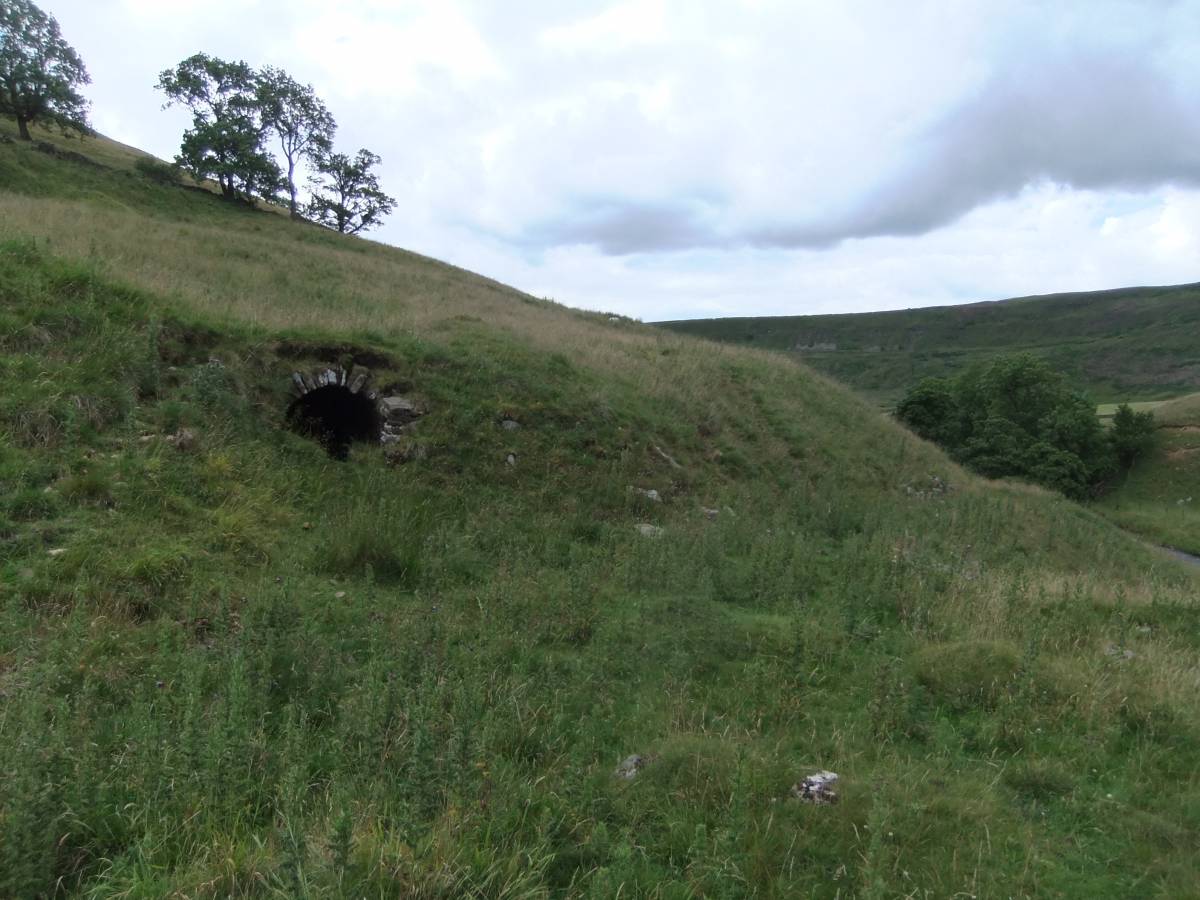
| Image 1 Description | Entrance to the lower level, Clints Mine | 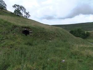 |
| Image 2 ID | 6383 Click image to enlarge |
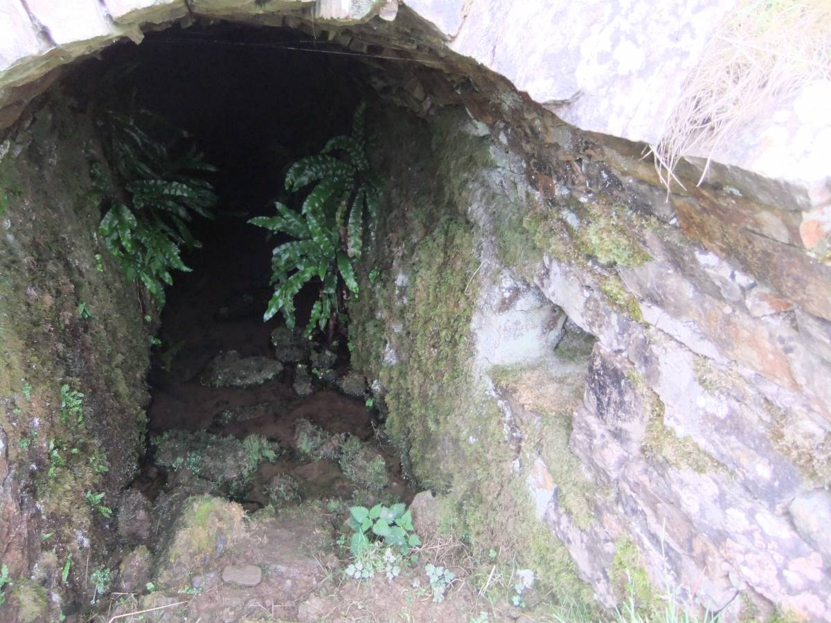
| Image 2 Description | Detail at the entrance to the Lower Level, with fine crop of Harts Tongue Fern. |  |
| Image 3 ID | 6384 Click image to enlarge |
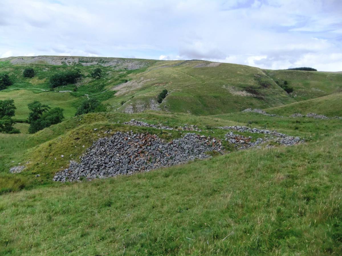
| Image 3 Description | Spoil heaps mark the location of the Upper Level, Clints Lead Mine. Very little vein material in these heaps indicates that the Upper Level level was unsuccessful. |  |
| Image 4 ID | 6386 Click image to enlarge |
| Image 4 Description | Detail of the entrance to the Upper Level | 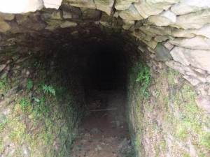 |
| Image 5 ID | 6388 Click image to enlarge |
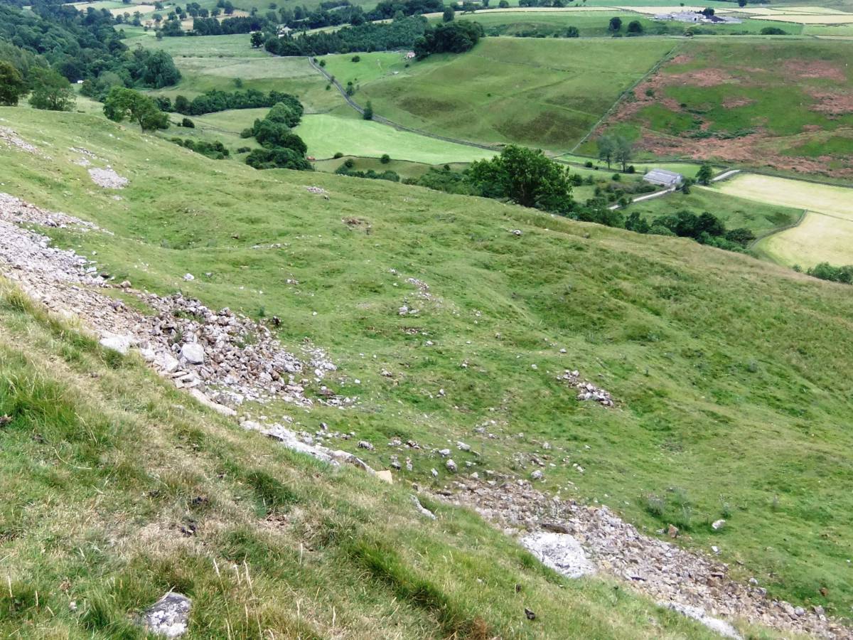
| Image 5 Description | Extensive areas with shallow pits, delves or scrins on the kame terrace below Clints Scar possibly mark the earliest evidence for lead mining here. These pits exploited the most readily available lead ore from horizontal deposits or flots close to the surface by open cast. |  |
| Image 6 ID | 6387 Click image to enlarge |
| Image 6 Description | The lead mining scrins seen from Clints Scar. Musk thistle in foreground. | 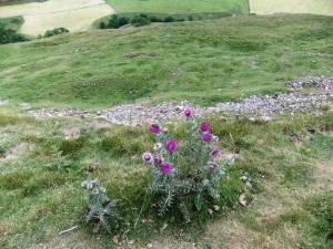 |
| Image 7 ID | 6389 Click image to enlarge |
| Image 7 Description | The lead mining scrins seen from below Clints Scar. The prominent nick in the cliff marks the line of Clints Fault. | 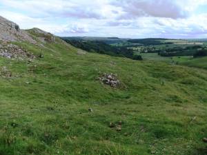 |
| Image 8 ID | 6390 Click image to enlarge |
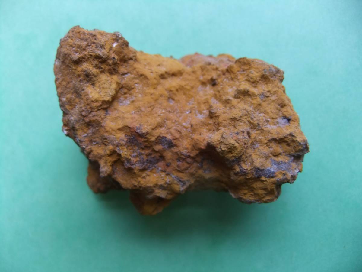
| Image 8 Description | Yellow ochre, a mixture of the iron compound ores limonite and haematite found at Clints Scar. |  |