|
| *****SWAAG_ID***** | 658 |
| Date Entered | 09/12/2012 |
| Updated on | 09/12/2012 |
| Recorded by | Tim Laurie |
| Category | Tree/Shrub Record |
| Record Type | Botanical HER |
| SWAAG Site Name | |
| Site Type | |
| Site Name | |
| Site Description | |
| Site Access | Public Footpath |
| Location | Arkengarthdale. Casle Farm |
| Civil Parish | Reeth |
| Brit. National Grid | NZ 02884 00805 |
| Altitude | 228m |
| Geology | Drift over Middle Limestone |
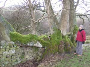
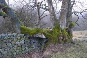
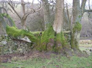
| Record Name | Castle Farm. Relict Hegerow landscapes. Ancient layered ash tree. |
| Record Description | This fine ash tree, some 26'0'' (8.0m) girth, was a laid tree within a managed hedgerow and already old when the dry stone walls which define the present day field boundaries around Castle Farm were built. |
| Dimensions | 26'0'' or 8.0m girth |
| Geographical area | Swaledale North Bank Catchment |
| Species | Ash |
| Scientific Name | |
| Common / Notable Species | |
| Tree and / or Stem Girth | |
| Tree: Position / Form / Status | |
| Tree Site ID | 0 |
| Associated Site SWAAG ID | 0 |
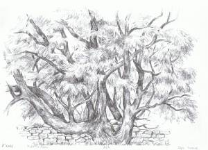
| Additional Notes | This tree is one of the fine specimen trees of the Swaledale Landscape to be drawn by Mrs Jocelyn Campbell. It is imperative that good photographic records are made of the mature ash trees in the Swaledale Landscape which are now under dire threat from the pathogen introduced to Britain rently. |
| Image 1 ID | 3836 Click image to enlarge |
| Image 1 Description | Layered ash tree,with Jocelyn. |  |
| Image 2 ID | 3837 Click image to enlarge |
| Image 2 Description | The Castle Farm Laid Ash. Jocelyn's drawing. |  |
| Image 3 ID | 3838 Click image to enlarge |
| Image 3 Description | The Castle Farm laid Ash, once within a managed hedgerow. |  |
| Image 4 ID | 3835 Click image to enlarge |
| Image 4 Description | The Castle Farm laid Ash, once within a managed hedgerow. Careful observation will reveal the presence of othre relict hedgerow trees, earlier field banks and lynchetted boundaries which denote earlier, medieval or romano british settlements here. |  |


