|
| *****SWAAG_ID***** | 340 |
| Date Entered | 21/11/2011 |
| Updated on | 21/11/2011 |
| Recorded by | Tim Laurie |
| Category | Tree Site Record |
| Record Type | Botanical HER |
| SWAAG Site Name | |
| Site Type | |
| Site Name | |
| Site Description | |
| Site Access | Private |
| Location | Whitsundale. How Edge Scars, Upper Part. |
| Civil Parish | Muker |
| Brit. National Grid | NY 8665 0260 |
| Altitude | 400m |
| Geology | Sandstones (Ten Fathom Grit)and mudstones below the Crow Limestone of Namurian Age exposed in cliffs with strongly calcareous, tufa forming springs approximately 10m above stream level. Very large tufa deposit on undercut cliff above the stream. |
| Record Name | MUK121 Whitsundale Beck.How Edge Scars down to Cop Gill. Aspen and juniper present. |
| Record Description | Type Site B* Upper section of How Edge Scars ravine with tufa cliff and tufa forming springs some 10m above stream level, with:
Betula pubescens, Corylus avellana
Crataegus monogyna
J. communis (?ssp nana). Two large bushes.
P. tremula. Scattered trees on east bank
Prunus padus
Qu. robur, Rosa sp. R. saxatilis
S. aurita, S. caprea, S. caprea ssp sphacelata?,
S. cinerea ssp oleifolia, S. phylicifolia
Sorbus aucuparia
See LR Plant List for full list of Vegetation. |
| Dimensions | See photographs |
| Geographical area | Upper Swaledale |
| Species | |
| Scientific Name | |
| Common / Notable Species | Aspen, scattered trees. Juniper, two bushes.Pedunculate oak which look native on the Upper slopes of the Ravine. If so How Edge Scars is one of just two native oak woods recorded in Upper Swaledale |
| Tree and / or Stem Girth | |
| Tree: Position / Form / Status | |
| Tree Site ID | 0 |
| Associated Site SWAAG ID | 0 |
| Additional Notes | The woodland at How Edge Scars is one of the most interesting and best preserved small native woodlands in Swaledale. Rarely noticed and passed unseen by walkers on the coast to coast path which passes above the Scars. |
| Image 1 ID | 1328 Click image to enlarge |
| Image 1 Description | How Edge Scars from road to Ravenseat | 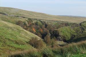 |
| Image 2 ID | 1329 Click image to enlarge |
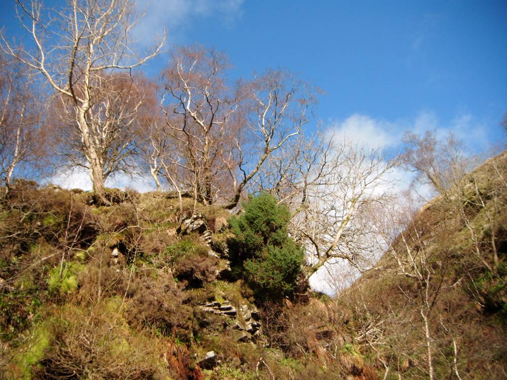
| Image 2 Description | How Edge with aspens. Autumn Colour | 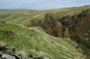 |
| Image 3 ID | 1330 Click image to enlarge |
| Image 3 Description | How Edge with aspens. Autumn Colour | 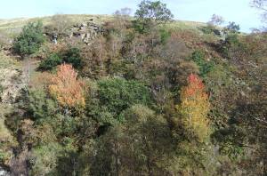 |
| Image 4 ID | 1331 Click image to enlarge |
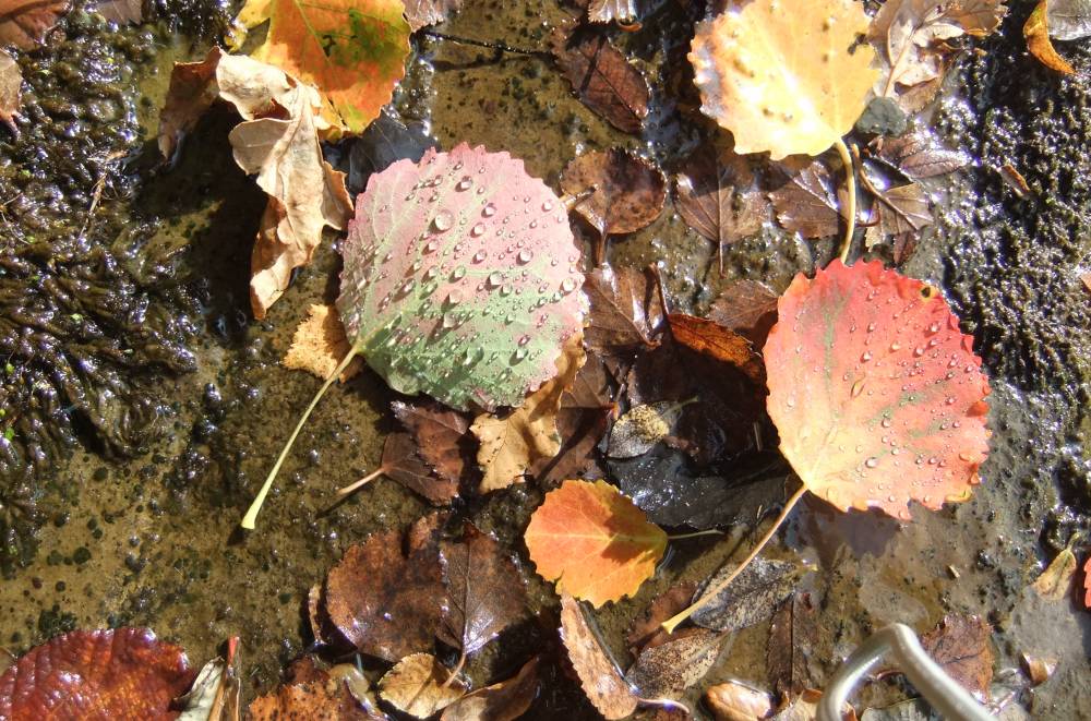
| Image 4 Description | Aspen leaves in stream. |  |
| Image 5 ID | 1332 Click image to enlarge |
| Image 5 Description | How Edge. Juniper, one of two bushes at the top of the ravine. |  |
| Image 6 ID | 1340 Click image to enlarge |
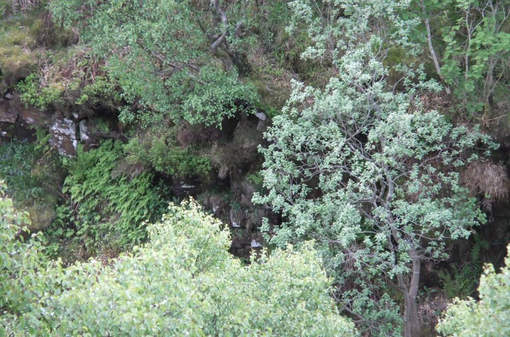
| Image 6 Description | How Edge Scars. Detail of vegetation, west bank at stream level. |  |