|
| *****SWAAG_ID***** | 325 |
| Date Entered | 11/11/2011 |
| Updated on | 25/11/2011 |
| Recorded by | Tim Laurie |
| Category | Mining Related |
| Record Type | Mining |
| SWAAG Site Name | |
| Site Type | |
| Site Name | |
| Site Description | |
| Site Access | Public Access Land |
| Record Date | 02/07/2011 |
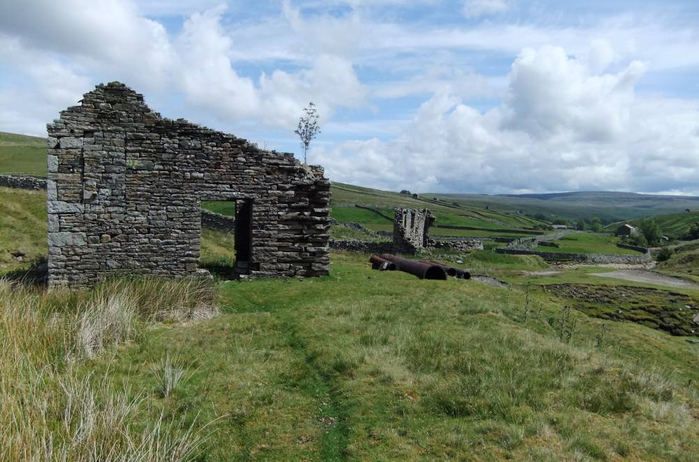
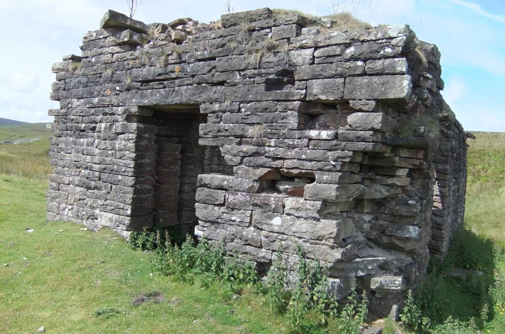
| Location | Great Sleddale. Lane End Mine. |
| Civil Parish | Muker |
| Brit. National Grid | NY 8553 0082 |
| Altitude | 372m |
| Geology | Ten fathom Grit. Mineralised fault. |
| Record Name | MUK001 Great Sleddale. Lane End Mine. |
| Record Description | For a full description of the Lane End Mine and the faulted, mineralised strata here, see BGS Geoloogy of the North Pennine Orefield. Vol 2 Stainmore to Craven,Chapter 9, page 122.
Please see records 108 and 342 as well. |
| Dimensions | See photos |
| Geographical area | |
| Species | |
| Scientific Name | |
| Common / Notable Species | |
| Tree and / or Stem Girth | |
| Tree: Position / Form / Status | |
| Tree Site ID | 0 |
| Associated Site SWAAG ID | 0 |
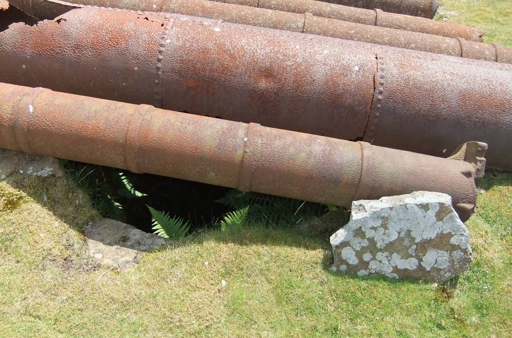
| Additional Notes | The open shaft (45 or 50 fathoms deep by 1801, Raistrick and Jennings 1965)is covered by a number of large diameter cast iron spigot and socket pipes. These pipes may be associated with a 80 bhp steam engine driven pump dewatering system which worked here for ten years from 1828.
Additional Information from Alan Mills:
Arthur Raistrick in "The lead industry of Wensleydale & Swaledale - vol 1" notes, p45, that by 1753 two mines were being opened at High and Low Birkdale; he suggests that the latter was probably Lane End Mine, also known as Loanin End Mine. This mine is described well in Mike Gill's "Swaledale its Mines & Smelt Mills", p32ff. In summary he states that Lane End Mine was leased by Thos. Butson & Co. in 1801 for 21 years at £20pa and 1/6th duty. They sank the New Engine Shaft 50 fathoms, 300ft, deep. This would have reached down to the Main Limestone, or close to. The beds at this level were flooded so the mine was pumped by a waterwheel; however it was not powerful enough and the mine closed in 1815. Henry Jackson and Co. leased the mine in 1829 and installed an 80hp engine.
At the present time the open shaft is covered by a number of large diameter cast iron spigot and socket pipes. These pipes may be associated with this engine driven pump dewatering system which worked here for ten years. The mine was probably too wet, for Jackson & Co. gave it up in 1839. It does not seem to have been worked since.
Note that additional pictures may be found in record 108. |
| Image 1 ID | 1204 Click image to enlarge |
| Image 1 Description | Lane End Mine | 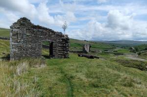 |
| Image 2 ID | 1205 Click image to enlarge |
| Image 2 Description | | 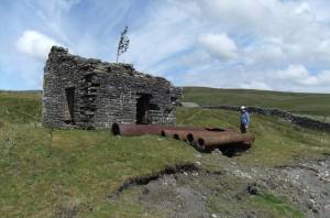 |
| Image 3 ID | 1206 Click image to enlarge |
| Image 3 Description | | 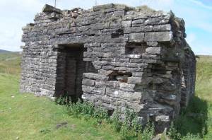 |
| Image 4 ID | 1207 Click image to enlarge |
| Image 4 Description | | 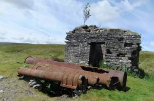 |
| Image 5 ID | 1208 Click image to enlarge |
| Image 5 Description | | 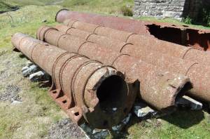 |
| Image 6 ID | 1209 Click image to enlarge |
| Image 6 Description | | 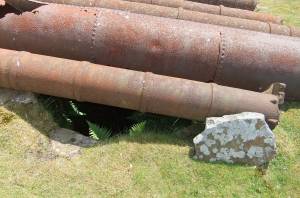 |
| Image 7 ID | 1210 Click image to enlarge |
| Image 7 Description | | 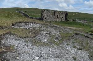 |
| Image 8 ID | 1211 Click image to enlarge |
| Image 8 Description | | 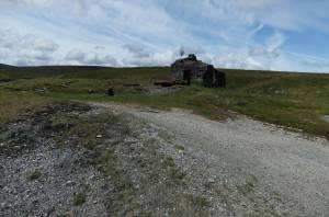 |