|
| *****SWAAG_ID***** | 629 |
| Date Entered | 28/10/2012 |
| Updated on | 28/10/2012 |
| Recorded by | Tim Laurie |
| Category | Tree Site Record |
| Record Type | Botanical HER |
| SWAAG Site Name | |
| Site Type | |
| Site Name | |
| Site Description | |
| Site Access | Private |
| Location | Whitfield Scar (as seen from Askrigg Pasture) |
| Civil Parish | Askrigg |
| Brit. National Grid | SD 927 926 |
| Altitude | 440m |
| Geology | Sheer south facing Scar or cliff formed by the Underset Limestone |
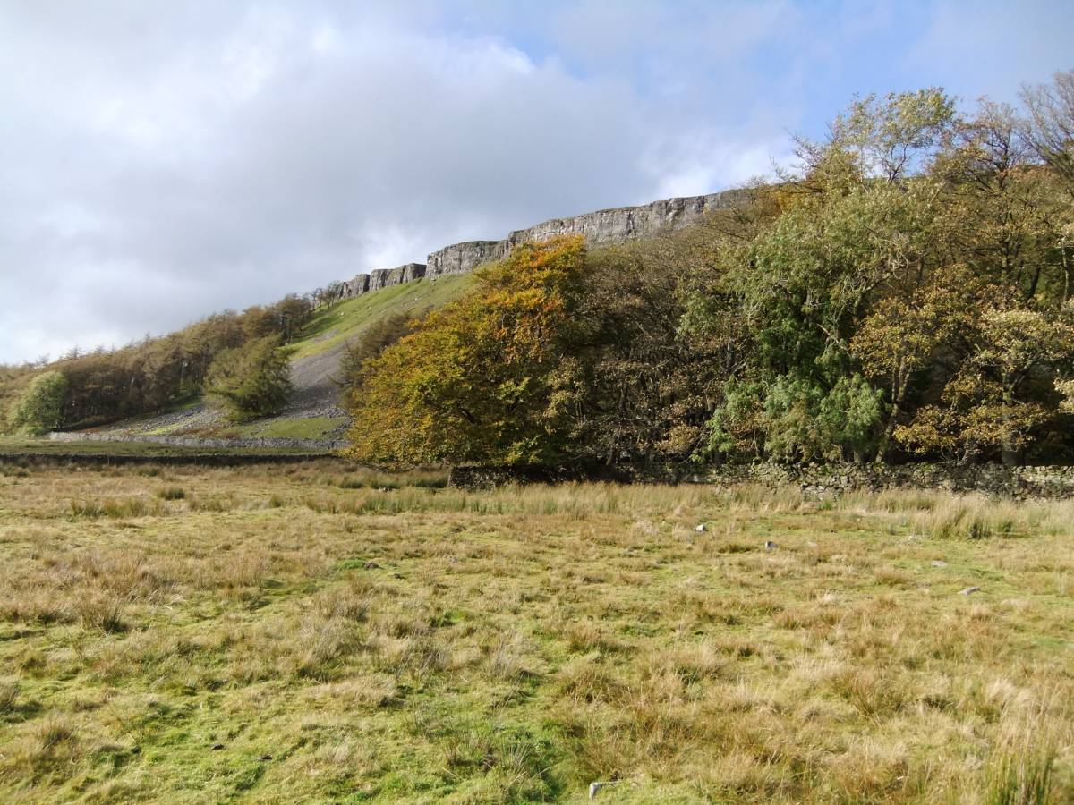
| Record Name | Species poor, depleted native woodland on and below Whitfield Scar with mature landscaping plantations. |
| Record Description | This Tree Site Record is intended to provide a comparison and contrasting record from Wensleydale to the species rich cliff woodlands of both Upper and Lower Swaledale. However, the limestone scars of Mid Swaledale are very similar in that the high limestone scars or cliffs located between Reeth and Muker, including the high scars at Winterings Edge above Gunnerside Gill are similar being also virtually barren of trees, supporting only depleted native woodland.
The very few trees on Whitfield Scar are all small rowans which can only be detected by telescopic lens. However the surviving presence of one ancient rowan in a sheepfold below the Scar points to the one-time existence of native woodland here.
The Plantations here are very fine and contribute greatly to the Wensleydale Landscape. Unlike the planted larches below Hooker Mill Scar on Kisdon Side in Swaledale,which have colonised the nearby cliffs, the plantation larches have not self seeded and have not colonised Whitfield Scar. Probably for the reason that Whitfield Scar may be accessible to adventurous and starving rabbits. |
| Dimensions | |
| Geographical area | |
| Species | |
| Scientific Name | |
| Common / Notable Species | |
| Tree and / or Stem Girth | |
| Tree: Position / Form / Status | |
| Tree Site ID | 0 |
| Associated Site SWAAG ID | 0 |
| Additional Notes | |
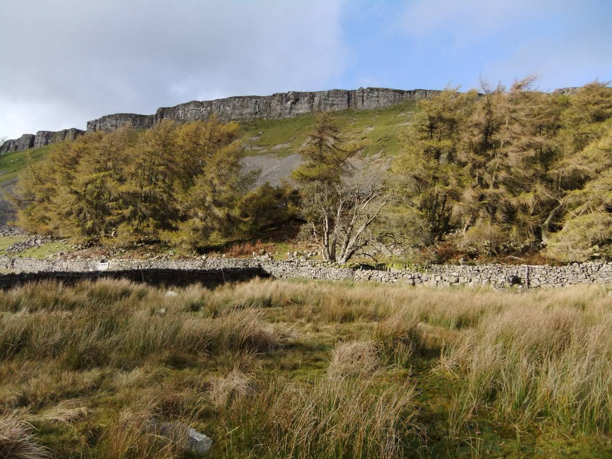
| Image 1 ID | 3518 Click image to enlarge |
| Image 1 Description | Whitfield Scar and plantations below. | 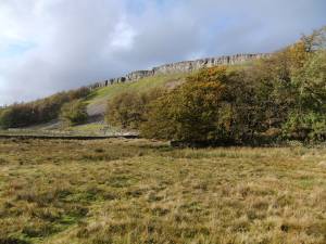 |
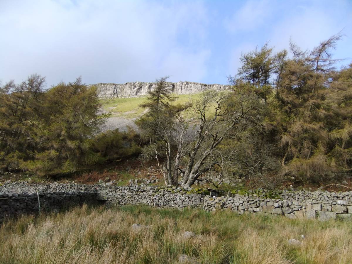
| Image 2 ID | 3519 Click image to enlarge |
| Image 2 Description | Whitfield Scar with planted larches and ancient native rowan. | 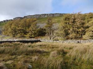 |
| Image 3 ID | 3520 Click image to enlarge |
| Image 3 Description | Whitfield Scar, detail of larches and rowan. |  |
| Image 4 ID | 3521 Click image to enlarge |
| Image 4 Description | Whitfield Scar. Small rowan at top edge of the cliff. | 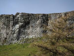 |
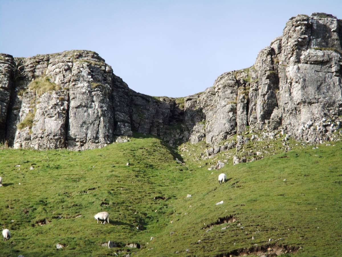
| Image 5 ID | 3522 Click image to enlarge |
| Image 5 Description | Whitfield Scar | 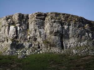 |
| Image 6 ID | 3523 Click image to enlarge |
| Image 6 Description | Whitfield Scar |  |
| Image 7 ID | 3524 Click image to enlarge |
| Image 7 Description | | 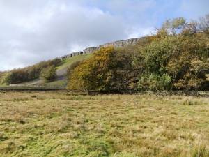 |
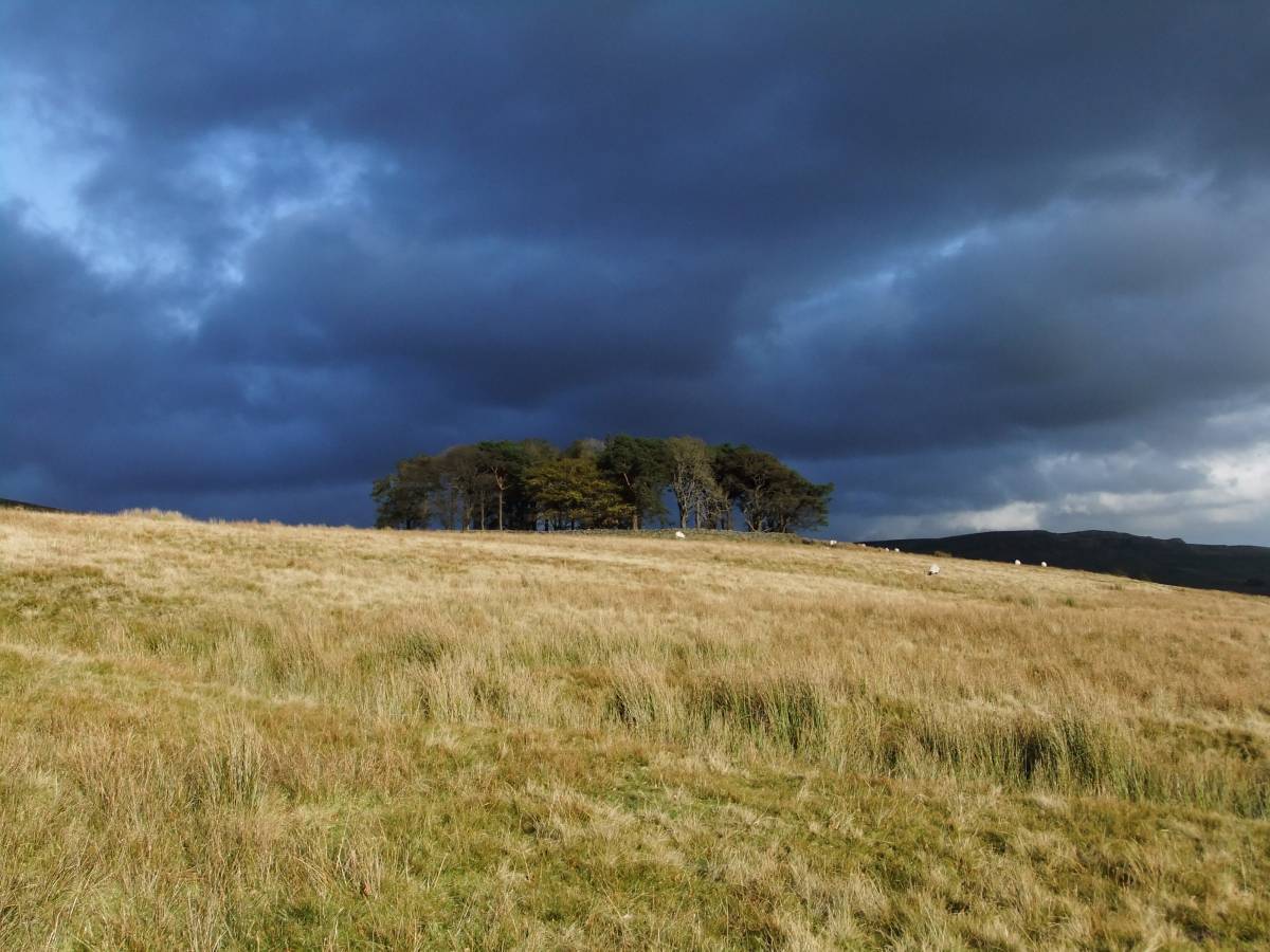
| Image 8 ID | 3526 Click image to enlarge |
| Image 8 Description | Plantation on Askrigg Pasture. |  |