|
| *****SWAAG_ID***** | 646 |
| Date Entered | 25/11/2012 |
| Updated on | 25/11/2012 |
| Recorded by | Tim Laurie |
| Category | Ring Cairns |
| Record Type | Archaeology |
| SWAAG Site Name | |
| Site Type | |
| Site Name | |
| Site Description | |
| Site Access | Public Access Land |
| Record Date | 23/11/2012 |
| Location | Cotherstone Moor. Goldsborough. Summit. |
| Civil Parish | Cotherstone |
| Brit. National Grid | NY 95472 17687 |
| Altitude | 387m |
| Geology | Namurian sandstone capped isolated hill. |
| Record Name | Ring cairn on summit of Goldsborough Hill. Cotherstone and the effects on the moorland vegetation of reduction of sheep. |
| Record Description | This embanked stone faced ring work some 11m diameter overall is interpreted here as a probable ring cairn and is defined by a circular stone dump earthfast bank with occasional unworked facing stones on both inner and outer faces. The Late Dennis Coggins first recorded this ring cairn during fieldwork in the early 1990's leading to the discovery of the grouped rock art sites on Goldsborough and subsequently those at West Loups Farm, see Laurie, T.C. 1992. 'The Archaeology of West Loups' in Catterick and Feldom Conservation Group Monograph Project '92: 'Battle Hill Ranges and Red Scar' pp 5-7 and Figure 1 (attached) and Beckensall and Laurie 1998 'Prehistoric Rock Art of Co. Durham, Wensleydale and Swaledale.' Durham County Books.
This ring cairn, as it is supposed to be, is one of very few similar ringworks not to have been excavated. The majority of these monuments also termed enclosed cremation cemetaries have been investigated by archaeologists, finds from these ringworks typically include cremation burials contained within collared urns, pygmy incense cups and date from the Neolithic through to the Middle Bronze Age.
The rock art sites recorded in this area are likely to predate the ring cairn, but do reflect the seasonal activity of Bronze Age and Neolithic transhumant pastoral family groups in this area.
Two of the most comprehensively excavated and published examples of ring cairns in the NW and NE of England include:
1. The multi period ringwork comprising double concentric ring timber post circle with overlying stone embanked ring cairn at Oddendale , near Shap excavated by Percival Turnbull and Deborah Walsh (Turnbull and Walsh 1997. ' A prehistoric Ritual Sequence at Oddendale, Near Shap.' Trans. Cumberland and Westmoreland A. & A. Soc Vol XCV11, 1997. pp11-44.
2. The ring cairn with standing stone, other ringworks and cairnfield at Danby Rigg on the NYM excavated by Prof. A.F. Harding et al. 1994. ( Harding, A.F. et al. 1994. Archaeol. Journal 151 (1994), 16-97.) |
| Dimensions | 11m diameter overall |
| Geographical area | |
| Species | |
| Scientific Name | |
| Common / Notable Species | |
| Tree and / or Stem Girth | |
| Tree: Position / Form / Status | |
| Tree Site ID | 0 |
| Associated Site SWAAG ID | 0 |
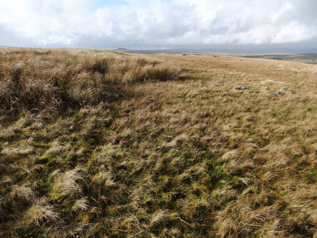
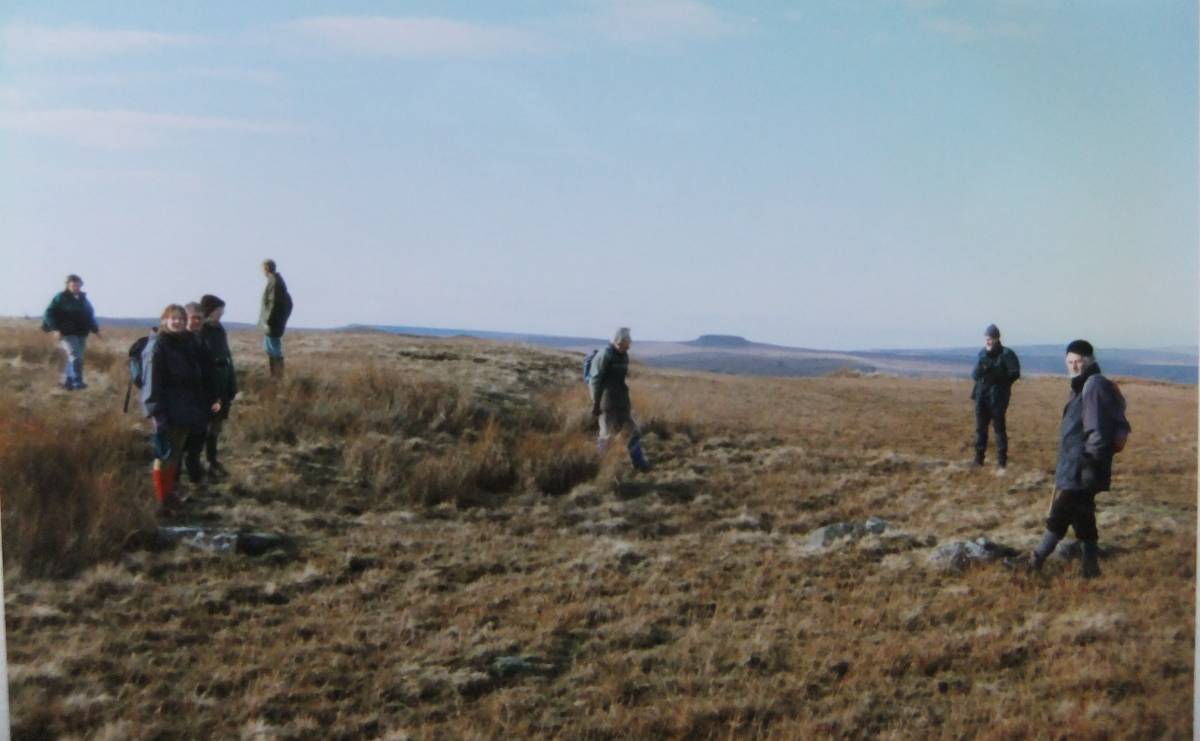
| Additional Notes | Finally, attention is drawn to the fact that the moorland vegetaion on the summit of Goldsborough is today very different to that which was present when my earlier photo was taken during the 1990's. The stone bank of the ring cairn is clearly visible on the earlier photo which was taken during a field walk lead by me to Cotherstone Moor by members of a University of Leeds Extra Mural Class in the early 1990's. The ring bank is today very difficult to recognise as the moorland vegetation and the soft rushes are much more rampant and luxuriant following reduction in sheep headage and in the reduction of grazing the moor. |
| Image 1 ID | 3734 Click image to enlarge |
| Image 1 Description | The ring cairn on the summit of Goldsborough photographed on 23 November 2012. |  |
| Image 2 ID | 3735 Click image to enlarge |
| Image 2 Description | The same ring cairn photographed during a field walk at the same time of year during the 1990's |  |