|
| *****SWAAG_ID***** | 637 |
| Date Entered | 06/11/2012 |
| Updated on | 06/11/2012 |
| Recorded by | Tim Laurie |
| Category | Settlement |
| Record Type | Archaeology |
| SWAAG Site Name | |
| Site Type | |
| Site Name | |
| Site Description | |
| Site Access | Public Footpath |
| Record Date | 04/11/2012 |
| Location | Upper Teesdale. Bracken Rigg |
| Civil Parish | Forest and Frith |
| Brit. National Grid | NY 882 282 |
| Altitude | 381m |
| Geology | Morainic ridge. |
| Record Name | Unenclosed round house settlement at Bracken Rigg, Upper Teesdale and the dating of unenclosed settlements in Swaledale. |
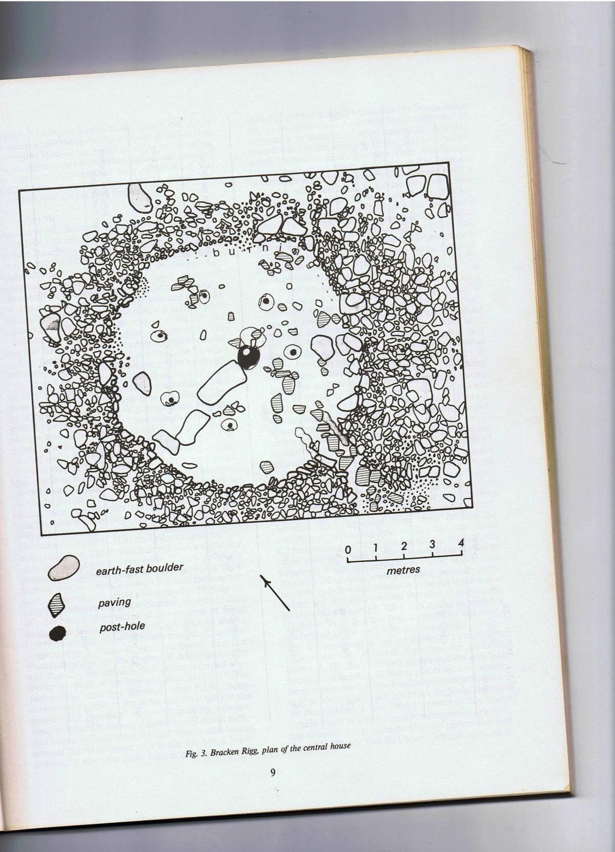
| Record Description | This settlement consists of an 8m diameter round house within two small paddock like fields located on the summit of a morainic ridge on the southern side of the River Tees and has been radiocarbon dated to the Middle Bronze Age (Coggins and Fairless, 1984.)
This settlement is probably the closest dated analogue and reference for the rather few unenclosed round house settlements located in Swaledale and on the Swale-Tees/Greta Uplands.
Some settlements which can be considered as of similar morphology and date as that at Bracken Rigg are listed below:
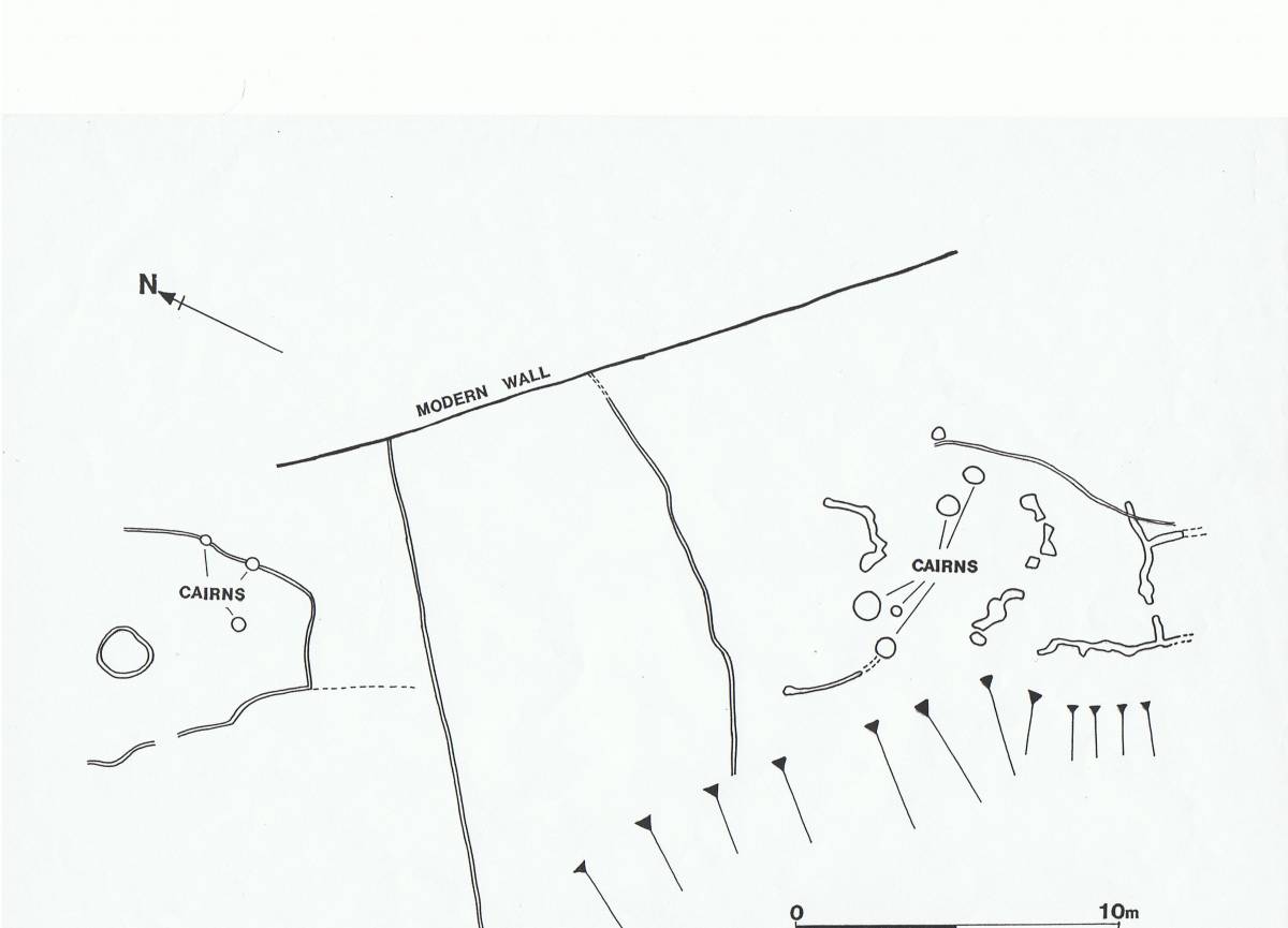
1. Three Settlements on Fremington Edge. Site 1. the Radio Mast Site. See site Plan TCL Survey unpublished. Image no 7 below.
More to follow. |
| Dimensions | |
| Geographical area | |
| Species | |
| Scientific Name | |
| Common / Notable Species | |
| Tree and / or Stem Girth | |
| Tree: Position / Form / Status | |
| Tree Site ID | 0 |
| Associated Site SWAAG ID | 0 |
| Additional Notes | |
| Image 1 ID | 3642 Click image to enlarge |
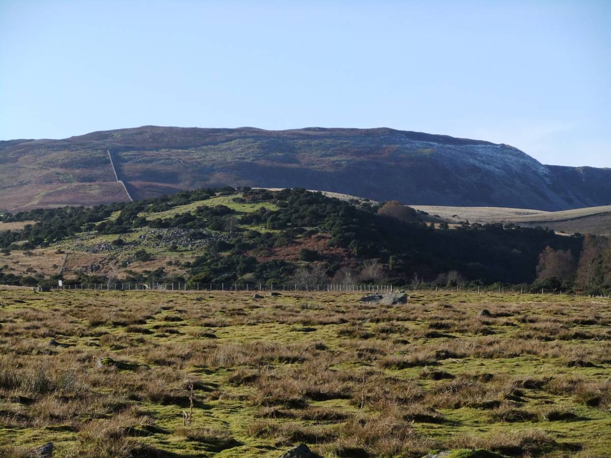
| Image 1 Description | Bracken Rig from pasture Foot, in mid distance. The settlement is on the summit. |  |
| Image 2 ID | 3643 Click image to enlarge |
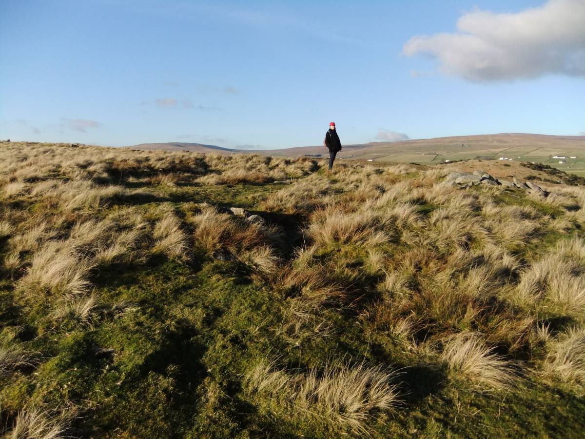
| Image 2 Description | The round house. | 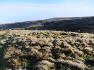 |
| Image 3 ID | 3644 Click image to enlarge |
| Image 3 Description | The round house. | 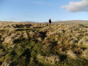 |
| Image 4 ID | 3646 Click image to enlarge |
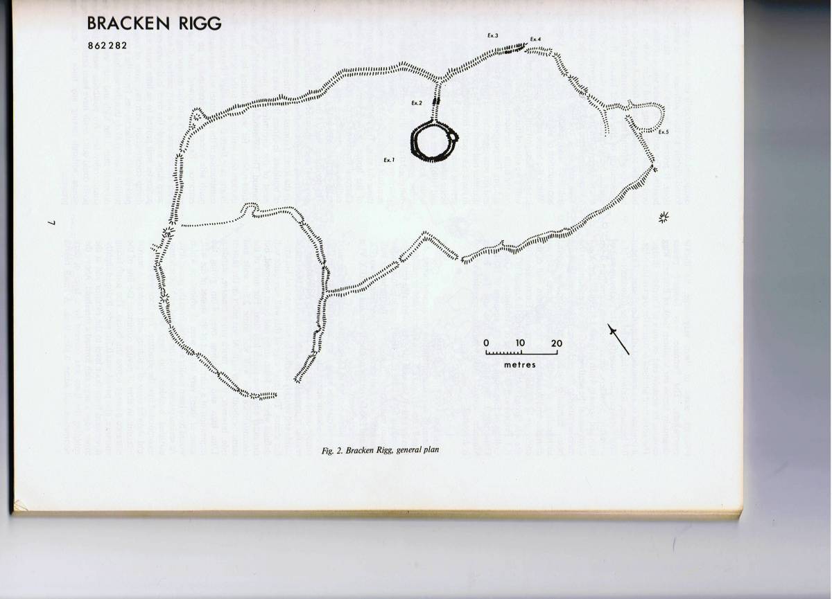
| Image 4 Description | Site Plan. Coggins and Fairless 1984.The Bronze Age Settlement Site of Bracken Rigg. Upper Teesdale. The Durham Archaeologicale Journal 1. pp5-21. Figure 2 | 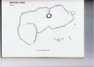 |
| Image 5 ID | 3647 Click image to enlarge |
| Image 5 Description | The round house after excavation. Coggins and Fairless 1984. Figure 3 |  |
| Image 6 ID | 3648 Click image to enlarge |
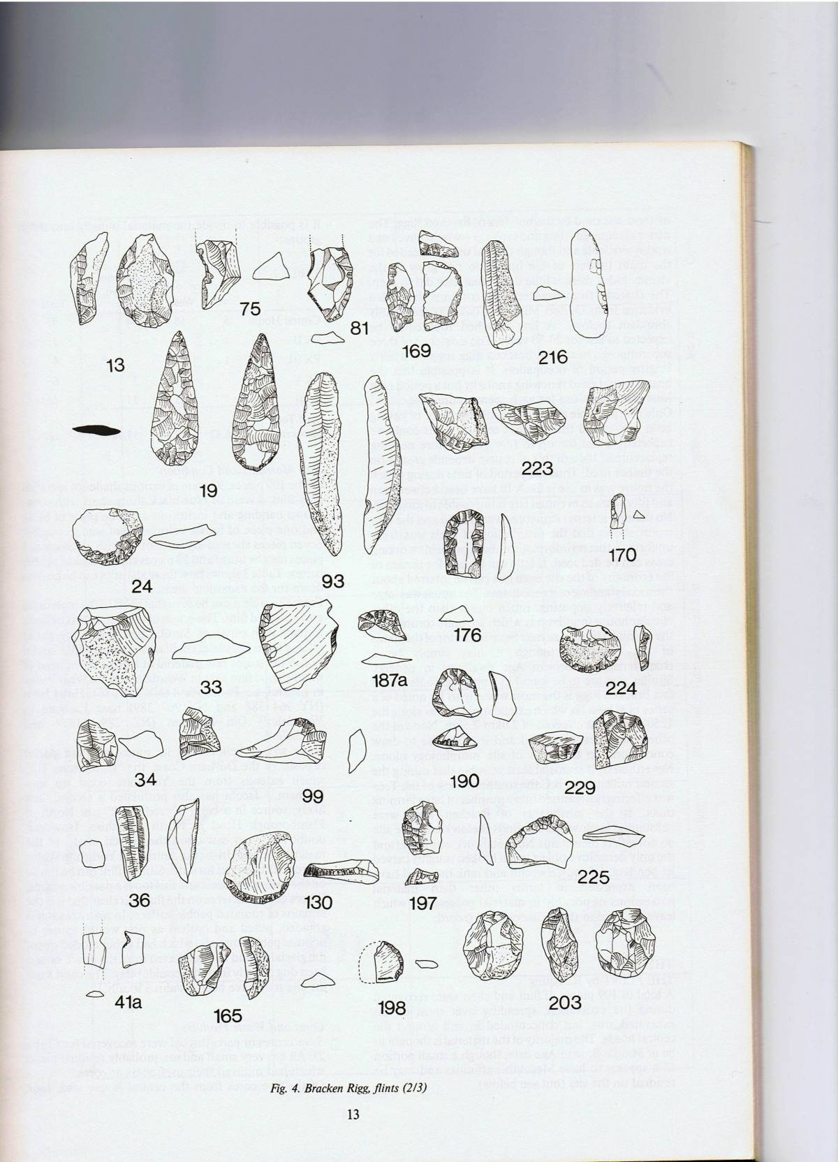
| Image 6 Description | Lithic finds from the round house excavations, some possibly residual. | 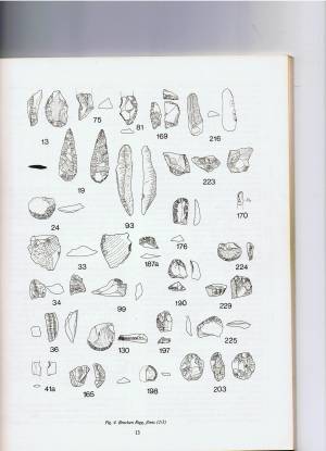 |
| Image 7 ID | 3649 Click image to enlarge |
| Image 7 Description | Unenclosed settlement on Fremington Edge, Swaledale. Site plan for comparative purposes. | 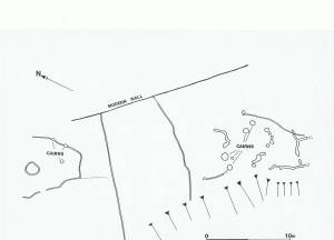 |