|
| *****SWAAG_ID***** | 135 |
| Date Entered | 19/02/2011 |
| Updated on | 19/02/2011 |
| Recorded by | Tim Laurie |
| Category | Mining Related |
| Record Type | Archaeology |
| SWAAG Site Name | |
| Site Type | |
| Site Name | |
| Site Description | |
| Site Access | Public Access Land |
| Record Date | 20/05/2008 |
| Location | Marske CP. Forty Acres Allotment. |
| Civil Parish | Not known |
| Brit. National Grid | NZ 07151 00867 |
| Altitude | 330m |
| Geology | Earthfast erratic boulder of fell sandstone. |
| Record Name | Marske CP. Forty Acres Allotment. Lower of two cross marked rocks at this location. |
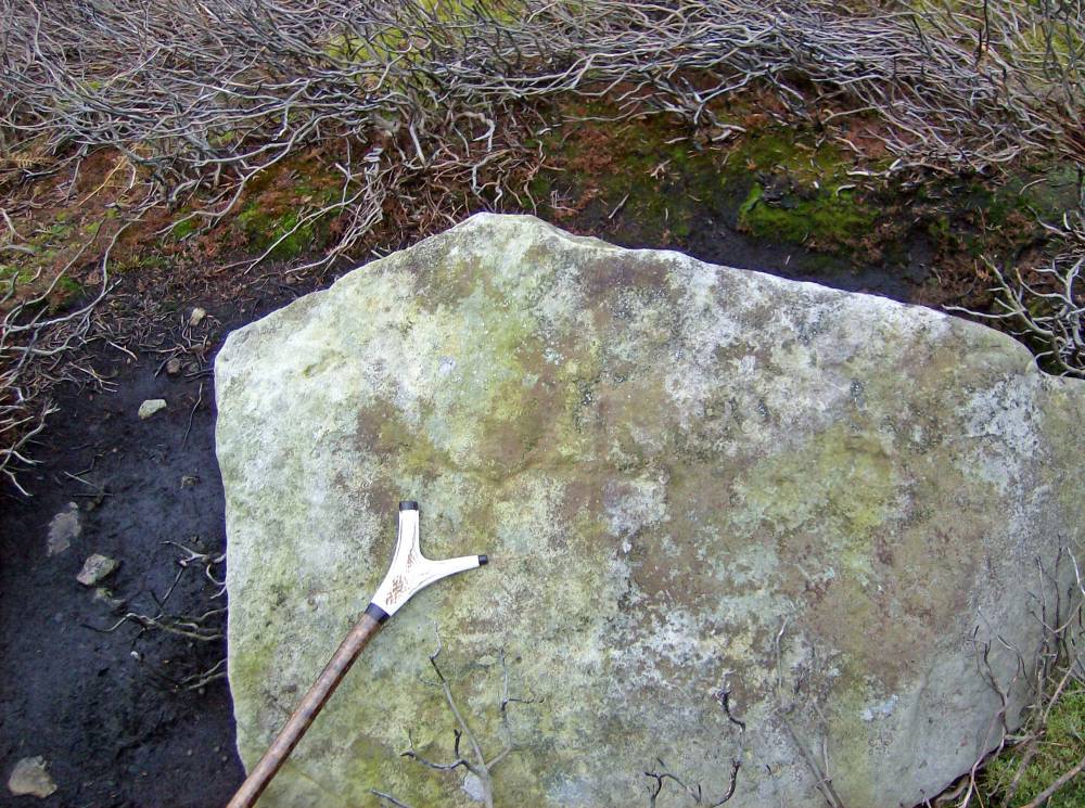
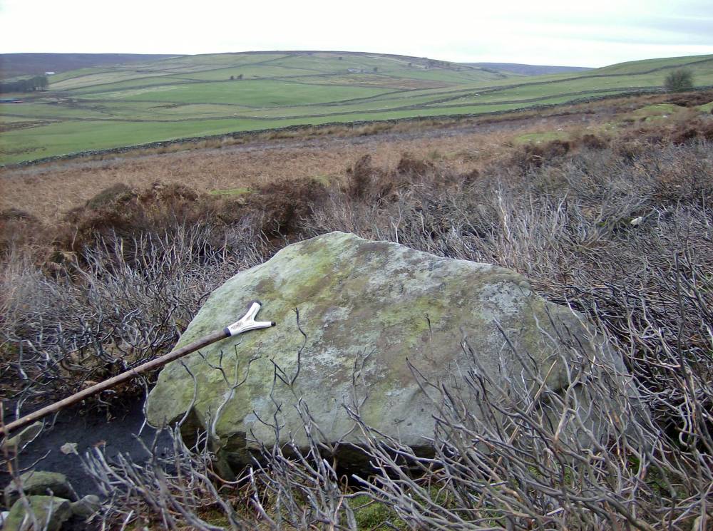
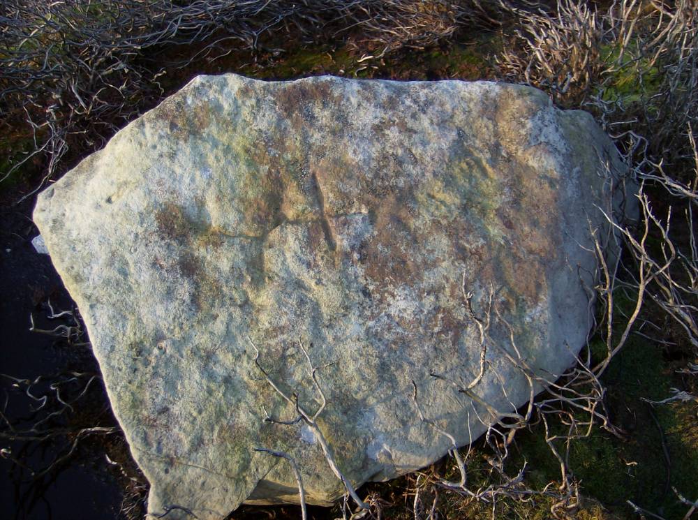
| Record Description | Incised cross of Maltese type with equal arms 200mm *200mm.
Lower of two such crosses incised on rocks at this location on the West Facing slopes of Cock How overlooking Stelling and Dales Beck close to the Parish Boundary with Marrick approximately 200m to the east of Helwith Road or Green Lane.
Located on the upper, south westerly facing heather covered slopes of Cock How overlooking the Helwith Road or Green Lane.
The Upper of these two Crosses is made on a sandstone boulder some 170m to the north and to the north and higher up the slope.This second cross is much more deeply incised and different style and much more prominent.
In view of the fact that these two cross marked rocks are 170m apart on a hill slope with evidence in the form of shallow delves either for lead mine prospection if not for actual mining and that there are apparently no other similar marked rocks to prove a boundary in association. |
| Dimensions | |
| Geographical area | |
| Species | |
| Scientific Name | |
| Common / Notable Species | |
| Tree and / or Stem Girth | |
| Tree: Position / Form / Status | |
| Tree Site ID | 0 |
| Associated Site SWAAG ID | 0 |
| Additional Notes | The alternative possibility that these cross marked rocks are boundary stones relating to a Knights Templar Preceptory in the area is intriguing.
However in view of the presence of lead mining activity in their immediate vicinity, they are more likely to be Mere Stones which related to Mining Ground which belonged to Marrick Priory. |
| Image 1 ID | 315 Click image to enlarge |
| Image 1 Description | Forty Acres Allotment. Lower of two cross marked rocks. Detail. | 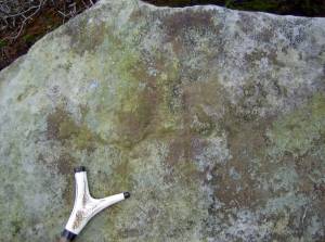 |
| Image 2 ID | 316 Click image to enlarge |
| Image 2 Description | Forty Acres Allotment. Lower of two cross marked rocks. | 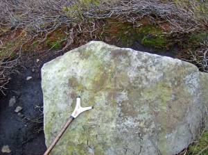 |
| Image 3 ID | 317 Click image to enlarge |
| Image 3 Description | Forty Acres Allotment. Lower of two cross marked rocks. | 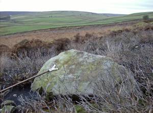 |
| Image 4 ID | 318 Click image to enlarge |
| Image 4 Description | Forty Acres Allotment. Lower of two cross marked rocks. |  |