|
| *****SWAAG_ID***** | 140 |
| Date Entered | 22/02/2011 |
| Updated on | 22/02/2011 |
| Recorded by | Tim Laurie |
| Category | Burnt Mound |
| Record Type | Archaeology |
| SWAAG Site Name | |
| Site Type | |
| Site Name | |
| Site Description | |
| Site Access | Private |
| Record Date | 01/01/2005 |
| Location | Wensleydale. West Burton CP. Morpeth Gate. Nancy Nick Pastures. |
| Civil Parish | Not known |
| Brit. National Grid | SE 0266 8738 |
| Altitude | 240m |
| Geology | Spring line below Middle Limestone Series. |
| Record Name | Morpeth Gate Pasture.Four burnt mounds, Sites 1-4, below Nancy Nick Woods. |
| Record Description | Site 1,the uppermost of the four burnt mounds located on the banks of a diverted watercourse,is large and best recognised by careful examination of the photograph as it is not easily seen and is not prominent since for the most part this site is buried below hillwash colluvium. All four sites recorded here are located on the banks of a diverted or piped watercourse which originates at a spring rising below Nancy Nick Wood.Of particular interest here is the presence of a levelled platform located just below the spring rise. which is likely to be associated with burnt mound, Site 1. See photos.
Site 2 is a large burnt mound, again buried and not prominent.
Site 3 is clearly visible and the most prominent of four burnt mounds by the old watercourse at this location. The stream has been staightened where passing Site 3 and the burnt mound is somewhat slighted.
Site 4 is the lowest of the four burnt mounds and this site is visible on the south bank of the watercourse close to the lower field wall, see photo.
SE 0266 8738centre. |
| Dimensions | All four sites are large but difficult to define as they are either buried below colluvium or slighted when the stream was canalised. |
| Geographical area | |
| Species | |
| Scientific Name | |
| Common / Notable Species | |
| Tree and / or Stem Girth | |
| Tree: Position / Form / Status | |
| Tree Site ID | 0 |
| Associated Site SWAAG ID | 0 |
| Additional Notes | |
| Image 1 ID | 342 Click image to enlarge |
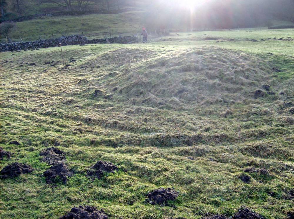
| Image 1 Description | West Burton CP. Morpeth gate Pasture. Four Burnt Mounds below Nancy Nick Wood. Site 2 barely visible in foreground and Site 3 , centre. | 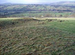 |
| Image 2 ID | 343 Click image to enlarge |
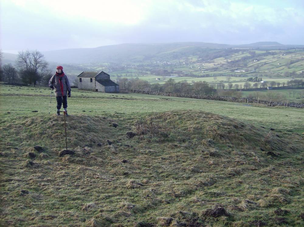
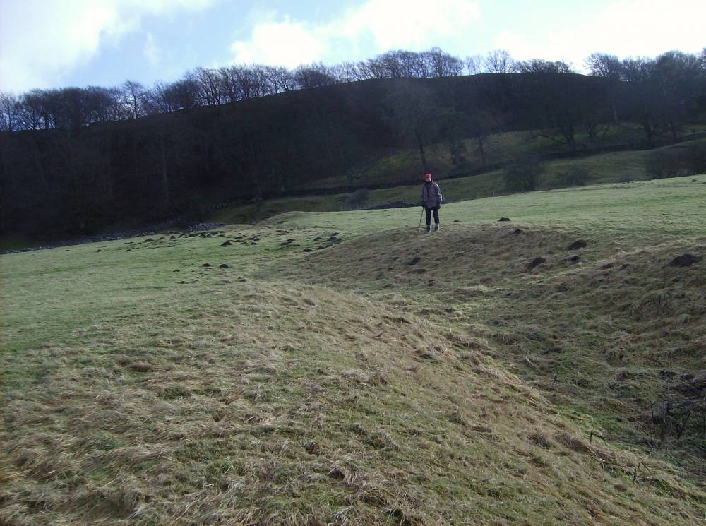
| Image 2 Description | West Burton CP. Four Burnt Mounds below Nancy Nick Wood. Site 3. | 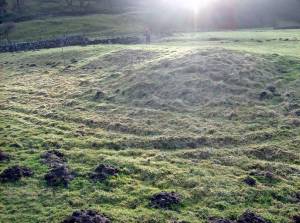 |
| Image 3 ID | 344 Click image to enlarge |
| Image 3 Description | West Burton CP. Four Burnt Mounds below Nancy Nick Wood. Site 3. | 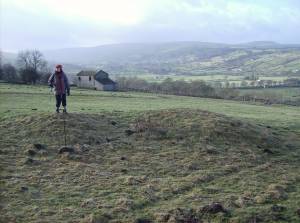 |
| Image 4 ID | 345 Click image to enlarge |
| Image 4 Description | The platform at the spring rise. | 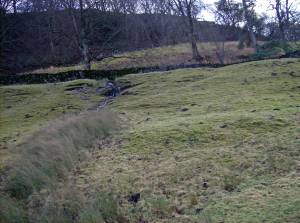 |
| Image 5 ID | 346 Click image to enlarge |
| Image 5 Description | West Burton CP. Four Burnt Mounds below Nancy Nick Wood. Site 1 and platform at spring rise. | 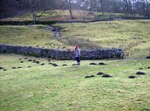 |
| Image 6 ID | 347 Click image to enlarge |
| Image 6 Description | West Burton CP. Four burnt mounds below Nancy Nick Wood. Site 4 view towards Site 3 in centre of pasture. | 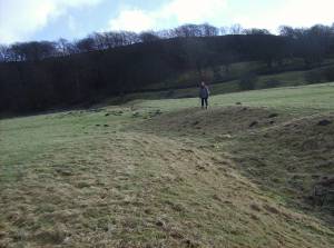 |