|
| *****SWAAG_ID***** | 150 |
| Date Entered | 05/03/2011 |
| Updated on | 05/03/2011 |
| Recorded by | Tim Laurie |
| Category | Ring Cairns |
| Record Type | Archaeology |
| SWAAG Site Name | |
| Site Type | |
| Site Name | |
| Site Description | |
| Site Access | Public Access Land |
| Record Date | 01/01/2005 |
| Location | Harkerside Moor. Harker Mires. |
| Civil Parish | Grinton |
| Brit. National Grid | SE 035 976 |
| Altitude | 340m |
| Geology | Lateral moraine and spring line draining into shallow mire over Middle Limestone series. |
| Record Name | Cairnfield type settlement complex centred on the Harker Mires Ring Cairn |
| Record Description | Bronze Age settlement landscape which extends across the moorland slopes west of Grinton Gill and below High Harker Hill but centred on the fine ring cairn at Harker Mires (this Ring Cairn is shown on the 1:25000 Scale Os Map as a Hut Circle) comprising well preserved and largely undisturbed ring cairn, cairnfield, six burnt mounds,an extensive field system with irregular shaped paddock like fields and structures which may represent an unenclosed settlement. The extensive coaxial field system runs downslope and is probably late Bronze age in origin. Later field banks associated with settlements located at lower elevation in the pastures east of Plaintree farm run upslope and abut this field system above Dykes House.
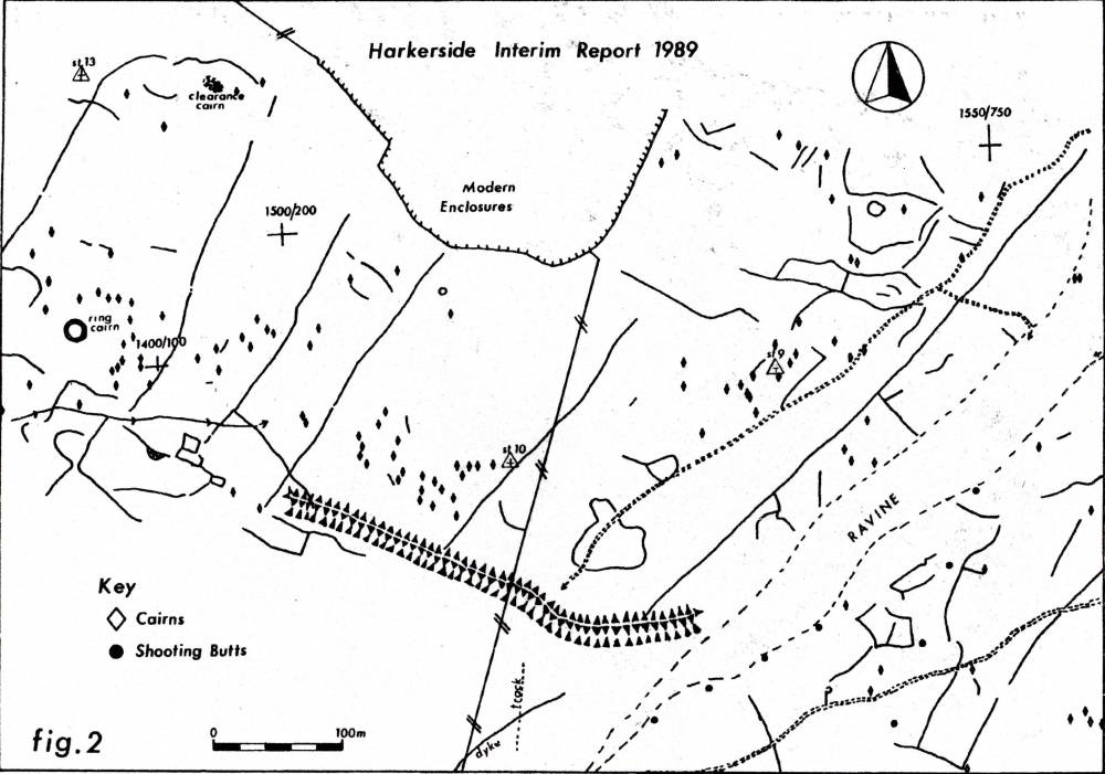
For details of this Bronze Age Cairnfield Landscape see Laurie,T.C 1985. In: Spratt, D and Burgess, C. Eds. ' Upland Settlement in Britain. The Second Millenium B.C. and after. Ch. 8, Figure 8.4., Fleming and Laurie, 1989: SWALB Interim Report 1989, Figure 2 and Laurie,T.C. with Mahaffy N.W. and White R.F.'Coaxial field systems in Swaledale, a reassessment following recent fieldwork. Figure 8.4 and Plates 4 and 5.' Forthcoming.
SE 035 976 (Centre) |
| Dimensions | See surveys, Laurie 1985 Figure 8.4 and SWALB Interim Rpt 1989 Figure 2. |
| Geographical area | |
| Species | |
| Scientific Name | |
| Common / Notable Species | |
| Tree and / or Stem Girth | |
| Tree: Position / Form / Status | |
| Tree Site ID | 0 |
| Associated Site SWAAG ID | 0 |
| Additional Notes | This record emphasises the fact that the totality of this high elevation landscape is more important than the sum of its parts and Harker Mires could provide an open air laboratory for future research into the earliest permanent settlement of Swaledale.
The Swaledale Ancient Land Boundaries Project Plan must be considered indicative, provisional and is currently under review. Many features, including the burnt mounds are not shown on this plan as they were not recognised being under deep heather at the time of the original survey.
The fact that later field banks abut and respect the field boundaries running downslope from the high ground at Harker Mires confirms that the Bronze Age fields were still visible, possibly in continued use as mature hedges, with hedgerow trees.
|
| Image 5 ID | 257 Click image to enlarge |
| Image 5 Description | The Harker Mires Settlement Landscape. | 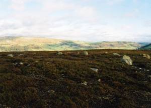 |
| Image 6 ID | 258 Click image to enlarge |
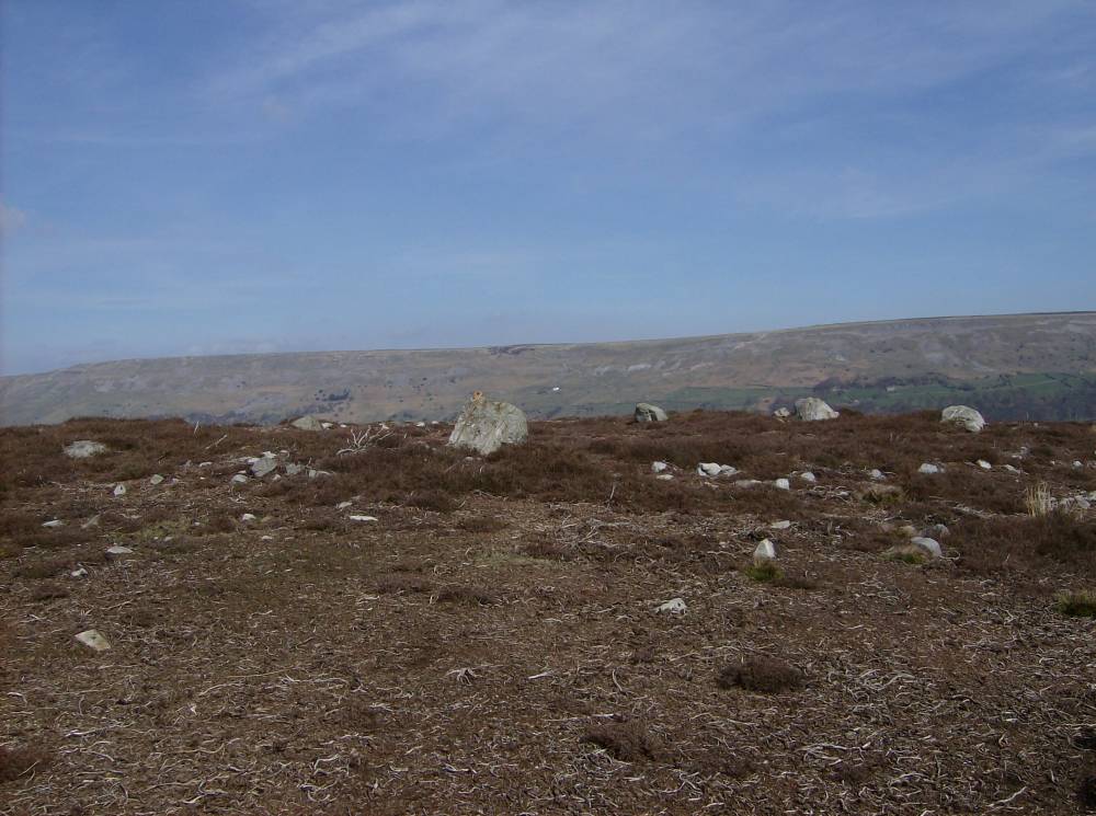
| Image 6 Description | The Harker Mires Ring Cairn forms the focus for a large Bronze Age cairnfield type settlement complex. | 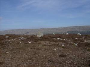 |
| Image 7 ID | 391 Click image to enlarge |
| Image 7 Description | Harker Mires Ring Cairn and Cairnfield settlement complex. | 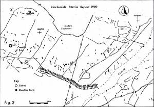 |