|
| *****SWAAG_ID***** | 49 |
| Date Entered | 11/01/2011 |
| Updated on | 05/01/2012 |
| Recorded by | Stephen Eastmead (admin) |
| Category | Mining Related |
| Record Type | Mining |
| SWAAG Site Name | |
| Site Type | |
| Site Name | |
| Site Description | |
| Site Access | Public Footpath |
| Record Date | 08/08/2010 |
| Location | Booze Wood Level - Langthwaite |
| Civil Parish | Arkengarthdale |
| Brit. National Grid | NZ 01426 01984 |
| Altitude | 254m |
| Geology | |
| Record Name | Booze Wood Level - Langthwaite |
| Record Description | Booze Wood Level - Langthwaite
Copyright all images: 2010 Chris Twigg. Images taken 08-08-2010.
Further information from Alan Mills:
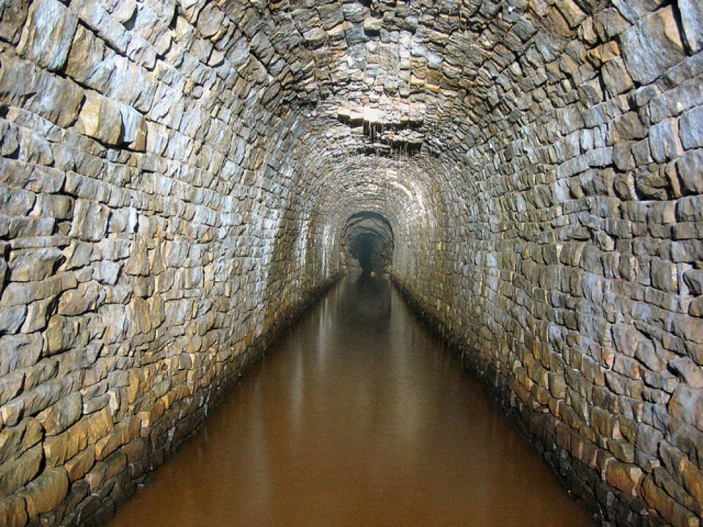
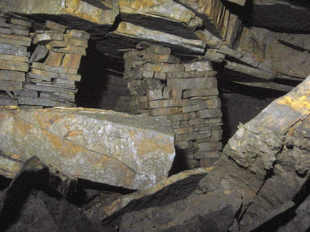
Booze Wood Level is a 19th C lead mine, later used as an underground quarry for building stone, mainly flagstone. It is said that the houses on Bridge Terrace, Reeth were roofed with flag from this source.
Jaques & Company started work on the level soon after 1863. It was driven almost due North, intended to try the Booze (Fell End) vein in the Fourth (Five Yard) Limestone. Progress was slow; by 1869 the level had only been driven ca. 320m.The Arkengarthdale Lead Mining Company was formed in 1870 and continued work on the level. The Booze vein was first cut in 1872 with the first ore being raised in September that year. It seems that the mine was not as productive as hoped. The limited data available shows an annual average of only 67 tons of ore over a 12 year period in the 1870's and 1880's compared with 145 tons/yr from Danby Level and 966 tons/yr from Faggergill.
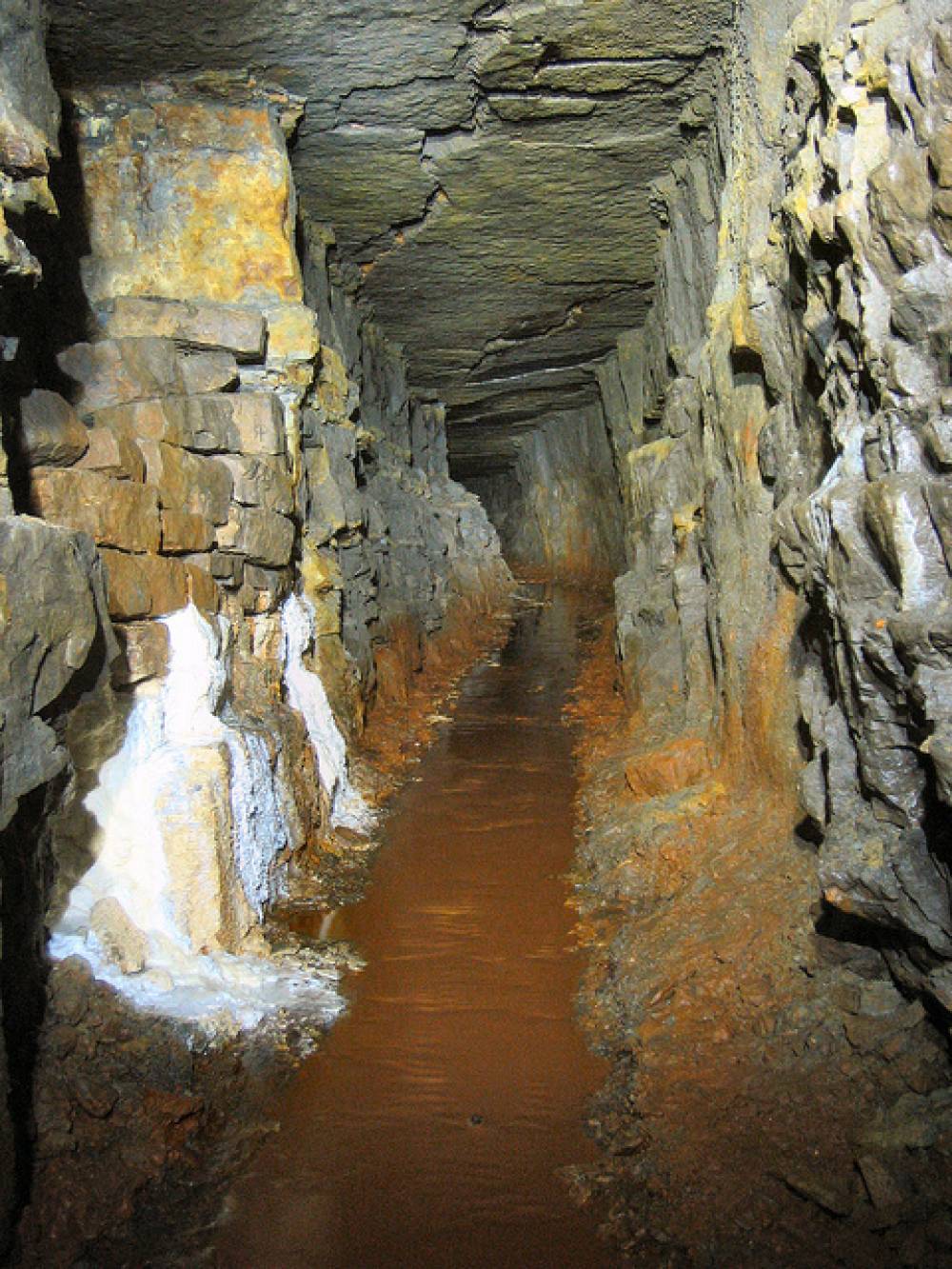
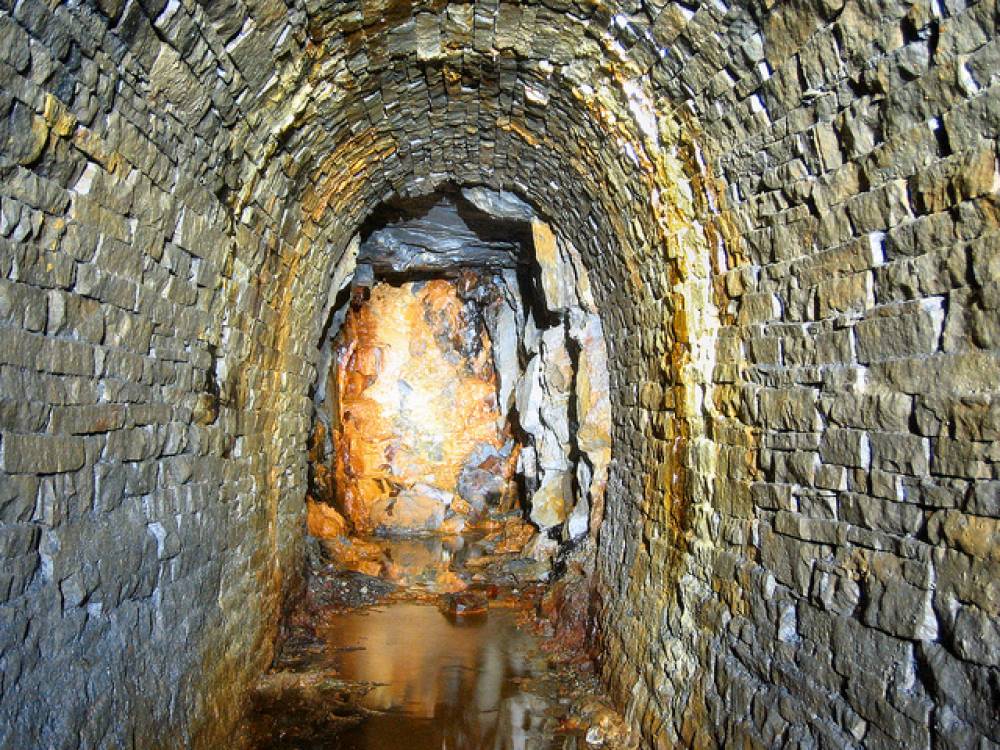
The air in Booze Wood Level was, and still is, poor. At an unknown date, an airshaft was sunk from the hamlet of Booze. This is located at NZ 01456 02457 at an altitude of ca. 323m, suggesting a depth of ca.70m. All that remains on the surface is a large depression, ca. 4m across, on the left ca. 40m before the entrance to Town Farm, Booze.
For further information see
(1) British Mining No.73 Memoirs 2003; p112ff, An Initial Survey of Booze Wood Level, July 2003, Alan Mills. (2)
British Mining No.53 "The Arkengarthdale Mines", L.O.Tyson. (3)
"Swaledale - its mines & smelt mills", Mike Gill.
Images 11 -16 copyright Alan Mills 2003 |
| Dimensions | |
| Geographical area | |
| Species | |
| Scientific Name | |
| Common / Notable Species | |
| Tree and / or Stem Girth | |
| Tree: Position / Form / Status | |
| Tree Site ID | 0 |
| Associated Site SWAAG ID | 0 |
| Additional Notes | |
| Image 1 ID | 79 Click image to enlarge |
| Image 1 Description | Image 1 of 10 | 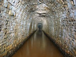 |
| Image 2 ID | 80 Click image to enlarge |
| Image 2 Description | Image 2 of 10 |  |
| Image 3 ID | 81 Click image to enlarge |
| Image 3 Description | Image 3 of 10 | 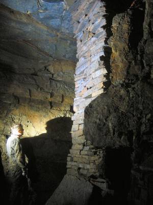 |
| Image 4 ID | 82 Click image to enlarge |
| Image 4 Description | Image 4 of 10 | 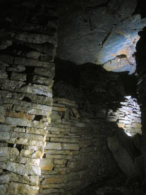 |
| Image 5 ID | 83 Click image to enlarge |
| Image 5 Description | Image 5 of 10 | 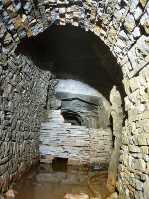 |
| Image 6 ID | 84 Click image to enlarge |
| Image 6 Description | Image 6 of 10 |  |
| Image 7 ID | 85 Click image to enlarge |
| Image 7 Description | Image 7 of 10 | 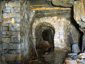 |
| Image 8 ID | 86 Click image to enlarge |
| Image 8 Description | Image 8 of 10 | 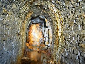 |
| Image 9 ID | 87 Click image to enlarge |
| Image 9 Description | Image 9 of 10 | 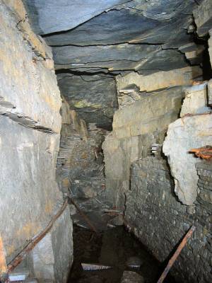 |
| Image 10 ID | 88 Click image to enlarge |
| Image 10 Description | Image 10 of 10 | 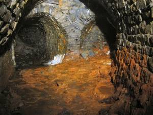 |
| Image 11 ID | 717 |
| Image 11 Description | Plan of 2003 survey of Booze Wood Level over OS 1912 map showing presumed line of Booze vein | 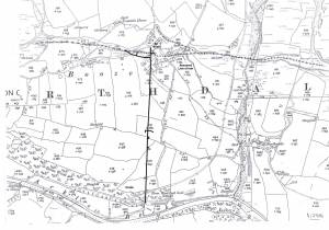 |
| Image 12 ID | 718 |
| Image 12 Description | Iron pegs (old jumpers?) holding up rail which in turn supports half-arching | 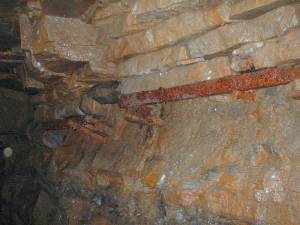 |
| Image 13 ID | 719 |
| Image 13 Description | Base of airshaft | 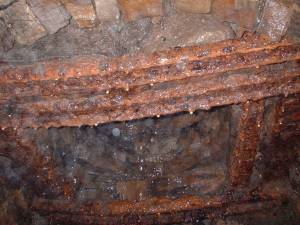 |
| Image 14 ID | 720 |
| Image 14 Description | Looking up the airshaft | 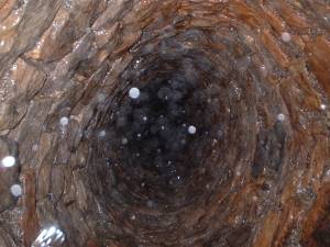 |
| Image 15 ID | 722 |
| Image 15 Description | In the main stone workings, approx 220m in-bye, block supported on iron bar | 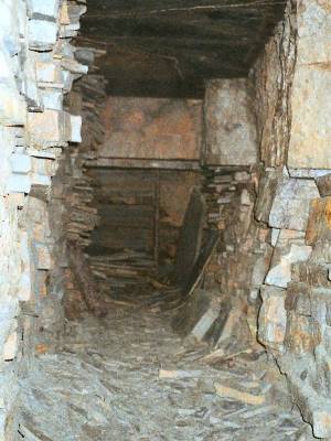 |
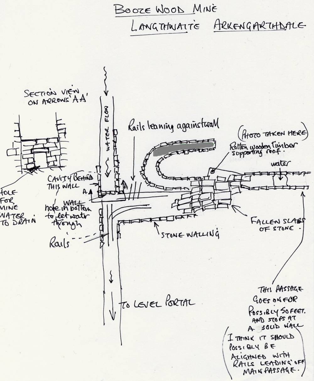
| Image 16 ID | 716 |
| Image 16 Description | Sketch plan by Malcolm Needham, 2003, of main stone workings, approx 220m in-bye to East | 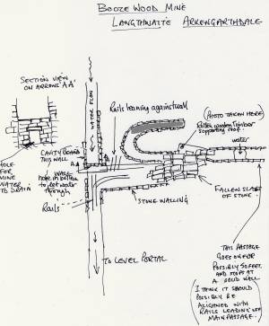 |