|
| *****SWAAG_ID***** | 63 |
| Date Entered | 12/01/2011 |
| Updated on | 17/12/2011 |
| Recorded by | Tim Laurie |
| Category | Burnt Mound |
| Record Type | Archaeology |
| SWAAG Site Name | |
| Site Type | |
| Site Name | |
| Site Description | |
| Site Access | Public Access Land |
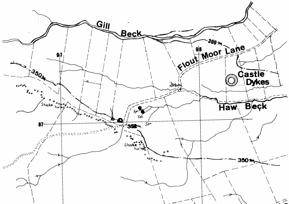
| Location | Flout Moor Lane, Haw Beck Springs |
| Civil Parish | Thoralby |
| Brit. National Grid | SD 976 871 |
| Altitude | 335m |
| Geology | Spring rise below Five Yard Limestone. |
| Record Name | Flout Moor lane. Two large Burnt Mounds at spring head 800m west of Castle Dikes Henge. |
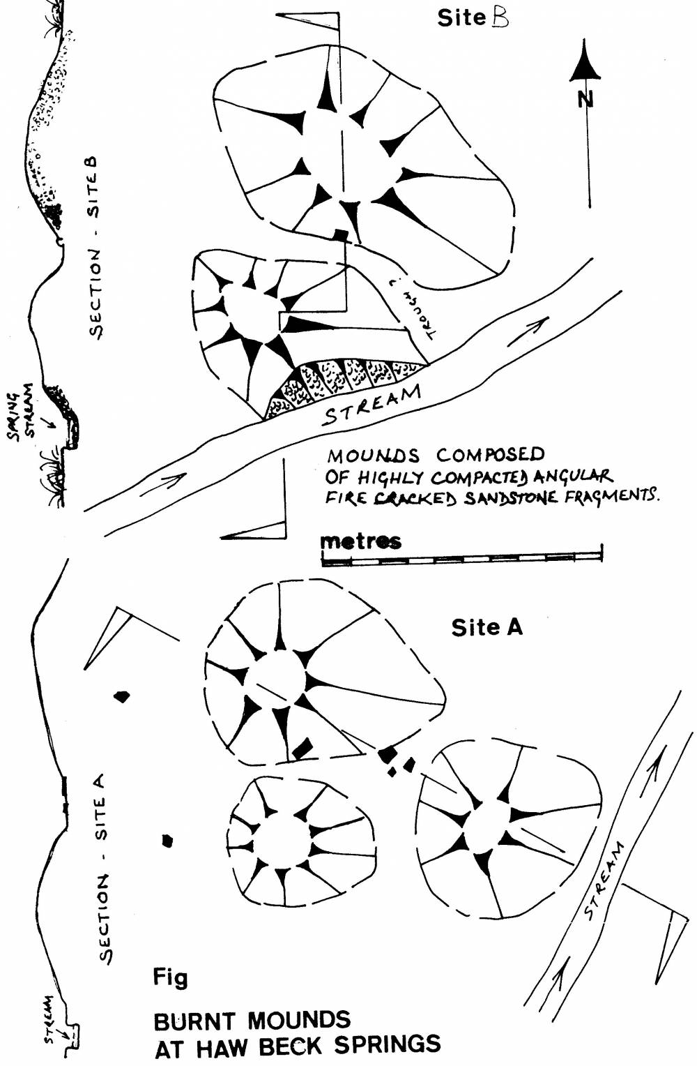
| Record Description | See Location Plan and Ste Plans (Laurie 2004, Figure 8.3 and attached.
Two Burnt Mounds in rough pasture immediately to the east of Flout Moor Lane: These two burnt mounds are situated at Haw Beck Springs on rising ground which overlooks Castle Dykes henge which is visible from the burnt mounds just 800m to the East. Settlement and field system 200m to the east in pasture on the eastern side of Flout Moor Lane. Both these burnt mounds at Haw Beck Springs are of large and are undisturbed. See Site plan.
*Indicative Dimensions.
Size: Small <6m, Medium 6m-9m, Large 10m-15m, Extra large >15m.
Height: Low <0.5m, Average 0.5-1.0m, High >1.0m.
SD 976 871Centre |
| Dimensions | Large, high.* |
| Geographical area | |
| Species | |
| Scientific Name | |
| Common / Notable Species | |
| Tree and / or Stem Girth | |
| Tree: Position / Form / Status | |
| Tree Site ID | 0 |
| Associated Site SWAAG ID | 0 |
| Additional Notes | These two substantial burnt mounds, together with the unenclosed platform settlement and field system located in pasture immediately west of Flout Moor Lane in view of the juxtaposition of these burnt mounds which are potentially of late Neolithic Age, with Castle Dikes henge which is visible from the Burnt Mounds just 1km to the east.
|
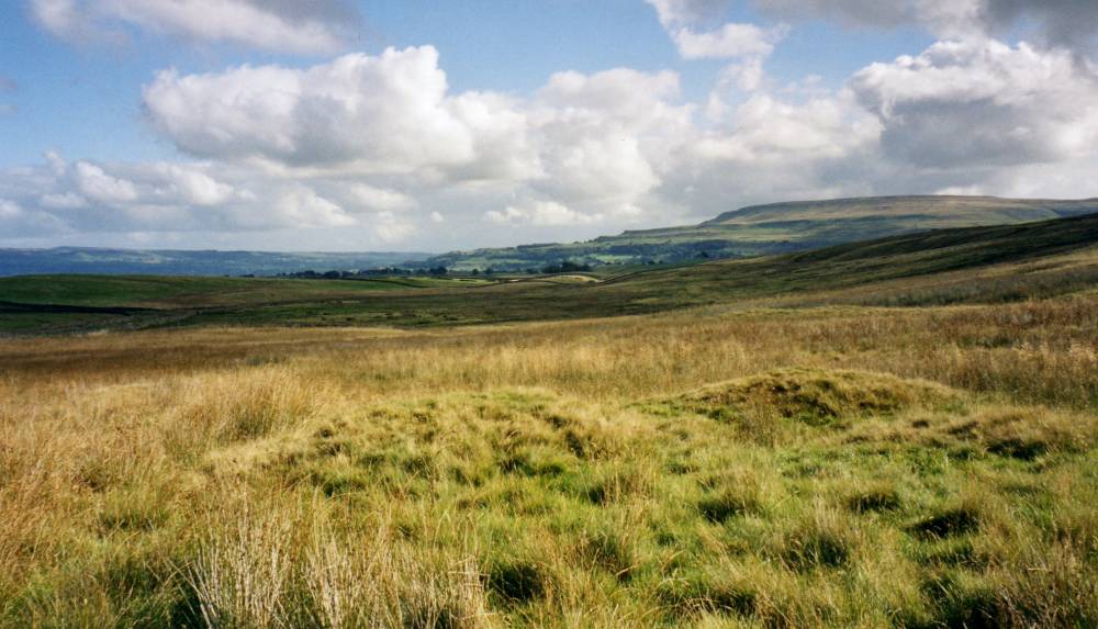
| Image 1 ID | 253 Click image to enlarge |
| Image 1 Description | One of the two large burnt mounds at Haw Beck Springs | 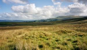 |
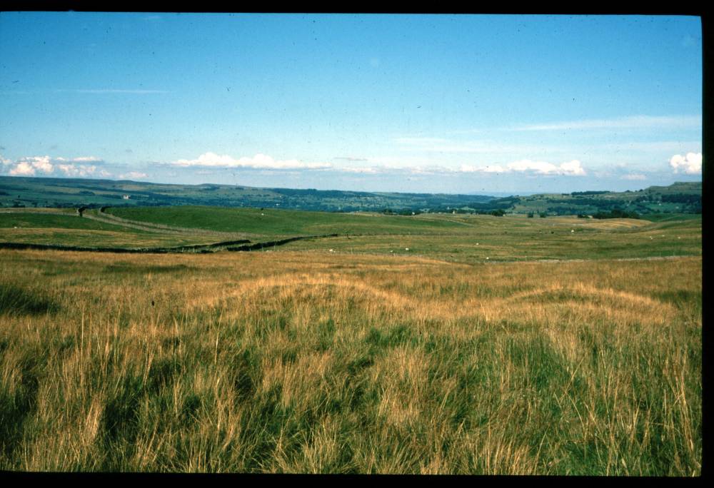
| Image 2 ID | 1759 Click image to enlarge |
| Image 2 Description | | 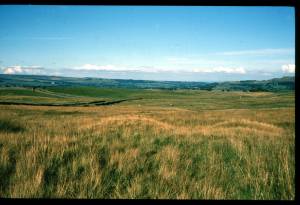 |
| Image 3 ID | 1755 Click image to enlarge |
| Image 3 Description | Location Plan. Prehistoric Sites on Flout Moor. | 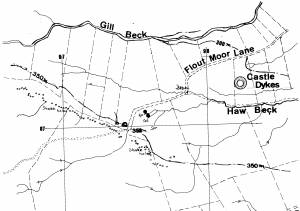 |
| Image 4 ID | 1756 Click image to enlarge |
| Image 4 Description | Flout Moor Springs. Two Burnt Mounds. Site Plan. | 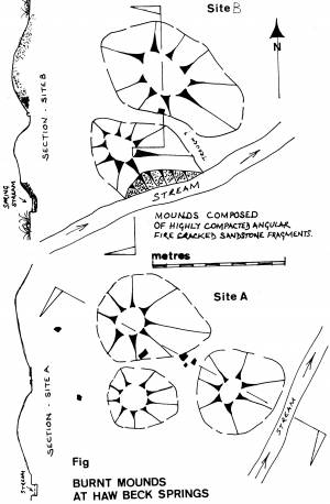 |
| Image 5 ID | 1757 Click image to enlarge |
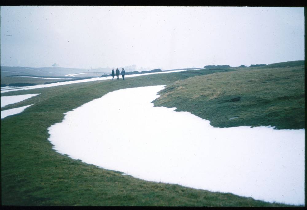
| Image 5 Description | Castle Dikes Henge in winter. |  |
| Image 6 ID | 1758 Click image to enlarge |
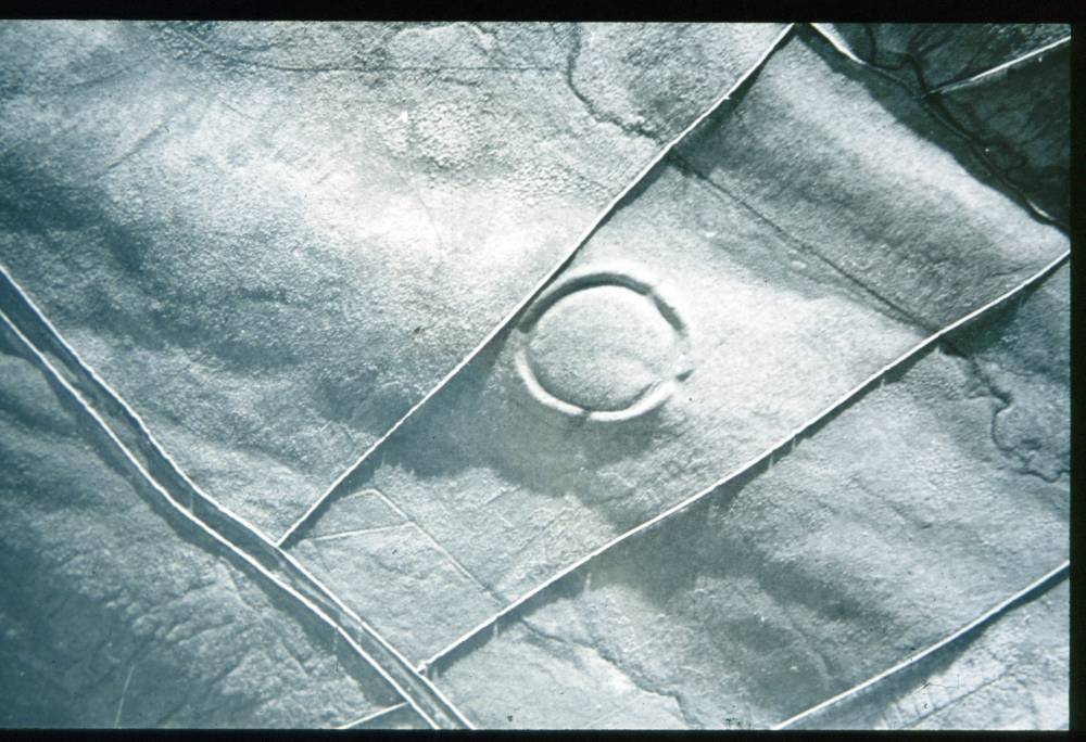
| Image 6 Description | Castle Dikes Henge. A.P. K. St. Joseph |  |