|
| *****SWAAG_ID***** | 56 |
| Date Entered | 11/01/2011 |
| Updated on | 14/12/2011 |
| Recorded by | Tim Laurie |
| Category | Burnt Mound |
| Record Type | Archaeology |
| SWAAG Site Name | |
| Site Type | |
| Site Name | |
| Site Description | |
| Site Access | Private |
| Location | Low Wanless Springs |
| Civil Parish | West Witton |
| Brit. National Grid | SE 0672 8905 |
| Altitude | 130m |
| Geology | At spring rising in area of sands and gravels on the flood plain of the Ure |
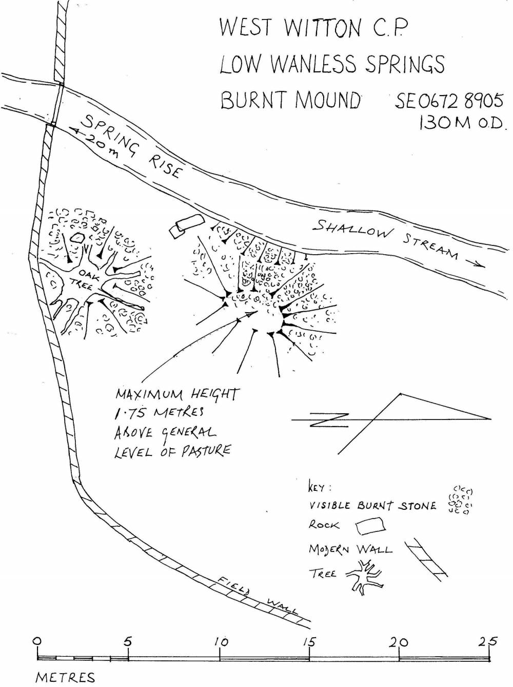
| Record Name | West Witton CP.Low Wanless Springs. Burnt Mound at the low elevation of 130m |
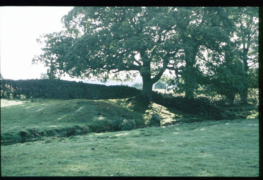
| Record Description | This undisturbed burnt mound is large, prominent and of great interest being located just above the floodplain of the River Ure, this Burnt Mound is at an exceptionally low elevation.
Lithic finds further west in molehills (to be recorded seperately) and a possible barrow located on a drumlin upstream on the opposite side of the Ure indicate that there is evidence for prehistoric activity close to the river.
A mature oak tree grows on this mound. |
| Dimensions | |
| Geographical area | |
| Species | |
| Scientific Name | |
| Common / Notable Species | |
| Tree and / or Stem Girth | |
| Tree: Position / Form / Status | |
| Tree Site ID | 0 |
| Associated Site SWAAG ID | 0 |
| Additional Notes | Dimensions.
Size: Small <6m, Medium 6m-9m, Large 10m-15m, Extra large >15m.
Height: Low <0.5m, Average 0.5-1.0m, High >1.0m. |
| Image 1 ID | 362 Click image to enlarge |
| Image 1 Description | Low Wanless Springs. Burnt Mound with oak tree. | 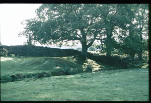 |
| Image 2 ID | 363 Click image to enlarge |
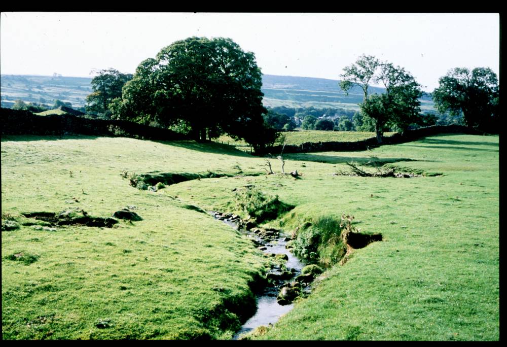
| Image 2 Description | Low Wanless Springs. Burnt mound location. |  |
| Image 3 ID | 1698 Click image to enlarge |
| Image 3 Description | Low Wanless Springs. Burnt Mound Plan. | 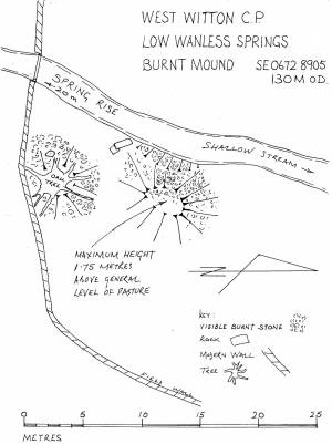 |